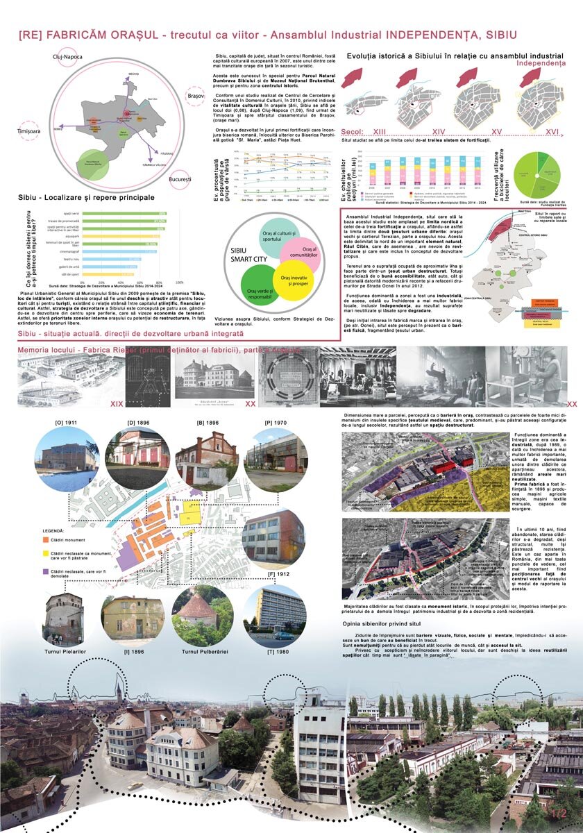
[RE]Making the city - the past as future - Independența Industrial Complex, Sibiu
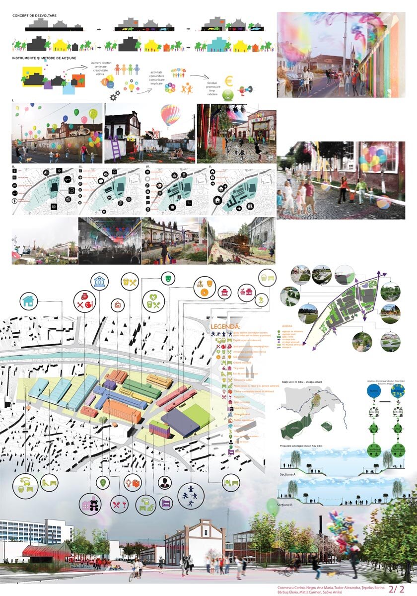
Sibiu - current situation. Integrated urban development directions
Sibiu, the county capital, located in the center of Romania, former European Capital of Culture in 2007, is one of the most visited cities in the country during the tourist season.
It is known in particular for the Dumbrava Sibiului Nature Park and the Brukenthal National Museum, as well as for the historic center.
According to a study conducted by the Center for Cultural Research and Consultancy in 2010 on the cultural vitality index in the country's cities, Sibiu is in second place (0.88), after Cluj-Napoca (1.09), followed by Timișoara and, towards the end of the ranking, Brasov (large cities).
The 2009 General Urban Plan of the Municipality of Sibiu is based on the premise "Sibiu, a meeting place", according to which the city must be open and attractive for both residents and tourists, with a close relationship between scientific, financial and cultural capital. Sibiu's development strategy is conceived along four axes, with development from the center to the periphery, aimed at saving land. Thus, priority is given to the inner areas of the city with potential for restructuring, rather than expansion on vacant land.
Memory of place - Rieger factory (first owner of the factory), part of the city
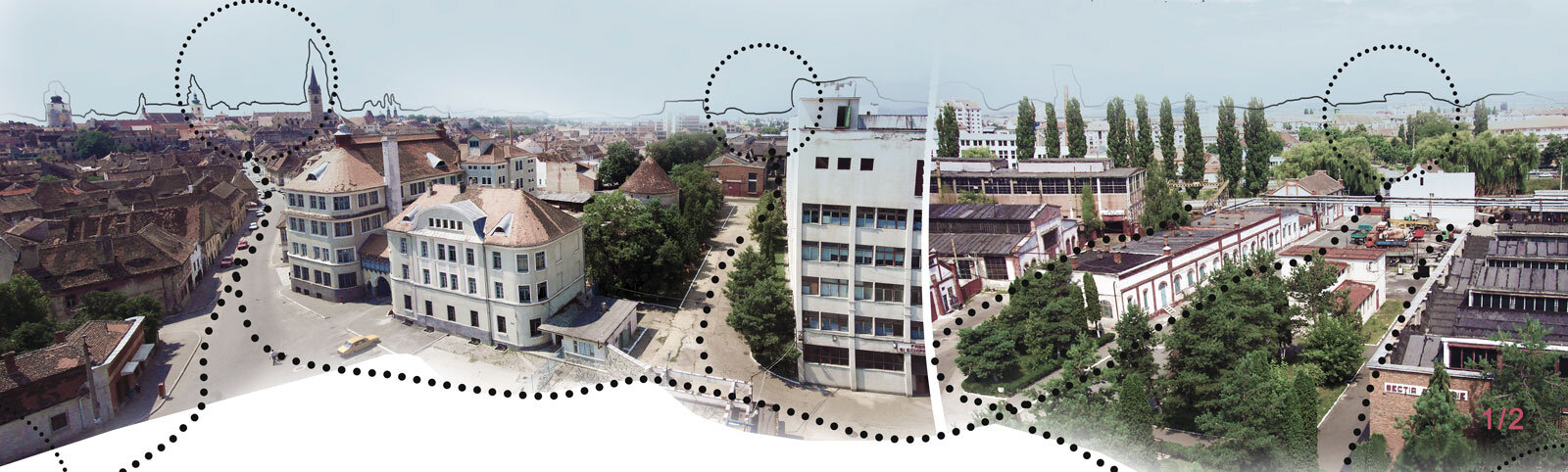
The Independence Industrial Complex, the site on which this study is based, is located on the northern boundary of the third fortification of the city, thus on the boundary between two different urban fabrics: the old city and the Terezian district, part of the new city. It is bounded to the north by an important natural feature, the Cibin river, which is also in need of revitalization and is included in the proposed development concept.
The site has an occupied area of approximately 9 ha and is part of a destructured urban fabric. However, it benefits from good accessibility, both vehicular and pedestrian, due to the recent modernization and road resurfacing of Ocnei Street in 2012.
The dominant function of the area has been industrial, so with the closure of several local factories, including Independence, this has resulted in large areas of land being unused and left to decay.
Although originally the factory entrance also marked the entrance to the city (on Ocnei Street), the site is now perceived as a physical barrier, fragmenting the urban fabric. The large size of the plot, perceived as a barrier to the city, contrasts with the very small plots in the very small islands specific to the medieval fabric, which predominantly kept the same configuration over the centuries, resulting in a destructured space. The dominant function of the whole area was industrial. After 1989, with the closure of several important factories, followed by the demolition of some of their buildings, large areas were left unused.
The first factory was established in 1896 and produced simple agricultural machinery, hand-operated textile machinery, drain covers. (...)
Read the full text in issue 6 / 2015 of Arhitectura magazine