Alluvium
In the beginning was Halmyris
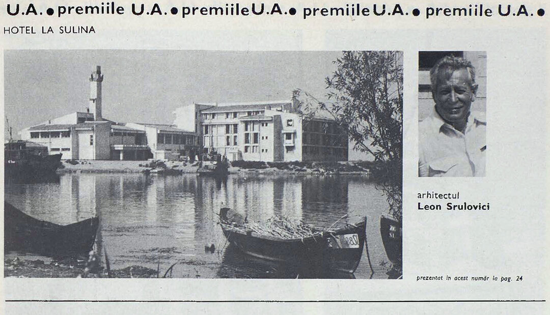
--15098-xl.jpg)
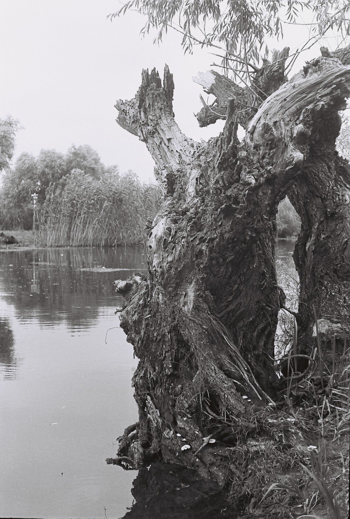
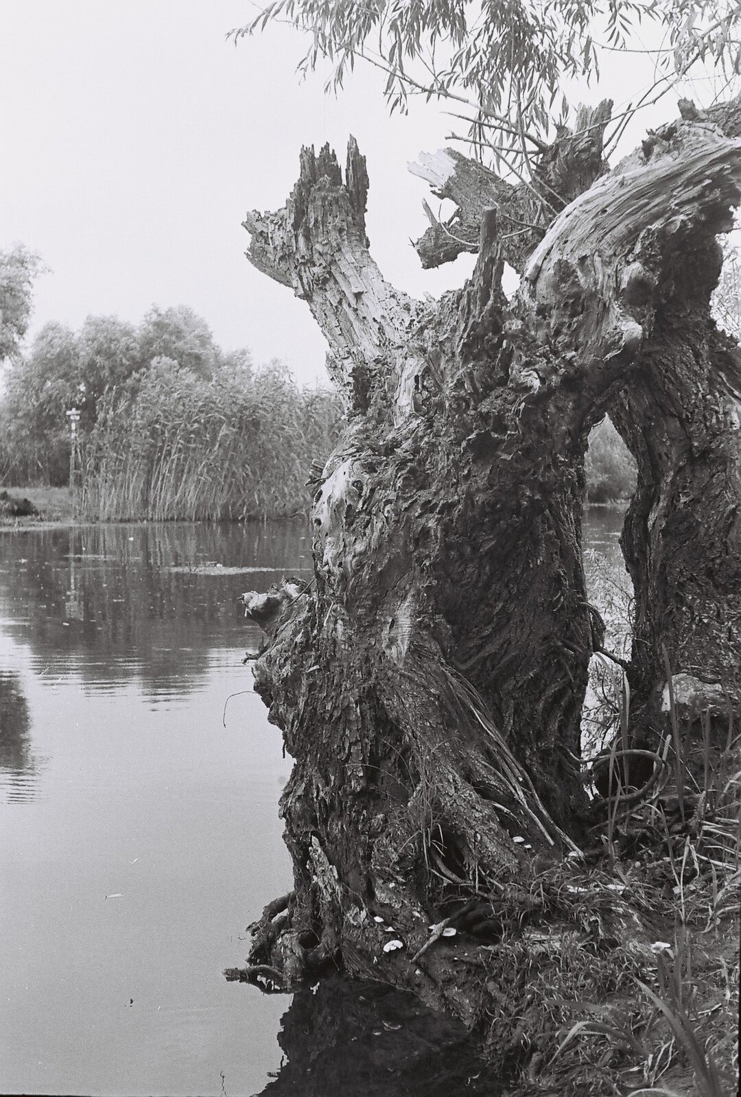
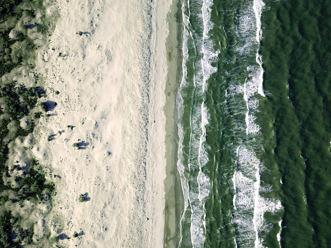
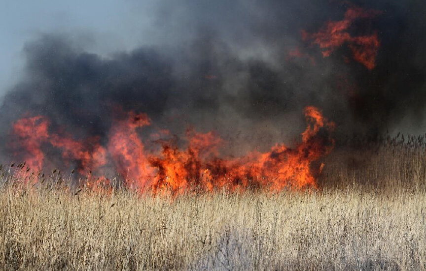
Seen from a boat, the Delta looks as if it's been lying between the mouths of the Danube for ages. When you admire the old willows on Heracles or the centuries-old oaks in the Letea Forest, it's hard to believe that it's much younger than we think. And yet, Burebista or Decebal, for example, would not have enjoyed the privilege of the same views in their time, when the Delta looked very different. One can only suspect that a long time ago, around the time when the flea with ninety-nine gooses on one foot was being shod, the Black Sea, then a huge lake, met the Danube a long way from today's Delta, somewhere between Calarasi and Giurgiu, Dobrogea being a vast island. As the climate cooled and more and more water was trapped in the ice crust that covered half of the northern hemisphere, the retreating sea forced the river to move north and east. According to this theory, the Carasu Valley, through which the Danube-Black Sea Canal passes today, is nothing more than an ancient route where the river flowed into the sea.
Ever since it was created thousands of years ago, the Danube Delta has been living according to a different calendar, from which summer, fall, winter and spring are missing, at least in the form we are used to. The explanation is far from scholarly. A specific microclimate, atmospheric currents with their own particular evolution, a salty sea or plenty of water with a thermal inertia to match - all good words to put in the textbook. In fact, it's the Danube that sets the rhythm of the Delta, so the seasons here are strictly linked to... water.
We used to call only the area downstream from Tulcea "Deltă", without caring for a second about what happens up the river. But what have the carp at the mouth of the Danube got to do with the trout in the Black Forest?! We've seen that the river travels a goodly distance and myriad different landforms before plunging into the sea. It passes over at least two major mountain ranges and crosses two thirsty plains, collecting the waters of some 120 rivers over an area four times the size of the whole of Romania. As a result, the river's lower plain and delta are sometimes flooded by a raging Danube, even though it hasn't rained here for months.
The Danube owes its birth to the mountains, more specifically to the snow and glaciers on the high peaks of the Alps. The eternal ice keeps the river's flow to a minimum by melting it, and thus provides permanent springs. Naturally, the maximum flow in the upper reaches of the river is in late spring, when the sun melts the snow on the Alpine ridges.
Incidentally, the Danube did not once flow where it does today. Its sources have always been close to those of the Rhine, but the limestone of the Alps, a rock easily shaped by water, and the favorable slope on the Rhine's side have caused it to "steal" over time from the Danube's original tributaries, often by underground routes. Because of this, the Danube's sources are constantly moving eastwards. It is now known with certainty that the upper reaches of the river will disappear over time (we are, of course, talking about geological periods), with the Alpine tributaries almost entirely redirecting towards the Rhine. Until then, we can only note that in dry years, the Danube does not have a high enough flow to compensate for the loss of the underground network. The young river literally enters the ground for a variable distance.
Perhaps if the sea had started right at the foot of the Alps, the Danube would have been a beautiful, crystal-clear, rushing mountain river, with increases in flow towards spring, when it would swell a little in feathers as the snow melted, or towards fall, when the rains came. No matter how dry the summer, the flow would not have dropped dramatically, because the accelerated rate of glacier melt due to the summer heat would have compensated for evaporation and lack of precipitation.
But that's not the case because the sea is far away.
Before we go for a walk in the Delta's sandstone, you should know that the 'Danube Delta' is not quite the same as the 'Danube Delta Biosphere Reserve' (DBRD), as it is officially called. The Delta itself, with its lands and waters, its birds and animals, cannot be separated from the sea from which it was born thousands of years ago, nor from the great lagoon complex to the south. This is why the RBDD includes, in addition to the Delta proper, several distinct entities, stretching over just over 5,800km2, from Capul Midia in the south to Brațul Chilia in the north, from Sulina and the Black Sea in the east to Cotul Pisicii (near Galati) in the west.
Of course, the Delta proper occupies the largest part of the reserve, with its 3,510km2 on our territory, the rest up to 4,178km2 belonging to Ukraine. To this is added the Razim-Sinoie complex, with 1,145km2, of which only 282km2 of dry land, the portion of the Danube bed between Mm 43 and Mm 74 (from the fork of the Chilia Arm to Cotul Pisicii) together with the entire floodplain between Tulcea and Isaccea (Somova-Parcheș area), in total 115km2, and Lake Sărăturii - Murighiol, located in the south-western part of the reserve. More than one-sixth of the reserve, or 1 030km2, is occupied by the adjacent part of the Black Sea up to the isobath (the line joining points at the same depth) of 20 m. So, by extension, you can say that you are 'in the Delta' anywhere in this vast territory on either side of the 45°N parallel, which runs halfway between the North Pole and the Equator.
As a low-lying plain located in a flood-prone region, the land area, especially in the Delta proper, varies according to the level of the Danube. In fact, less than one seventh of the entire area of the reserve is dry, and during historical floods (most recently in 2006 and 2010) only about 14,000 hectares, or 140km2, would remain uncovered by water! It is therefore quite possible that, if we wanted to go camping in the Delta in spring, we wouldn't find much to camp on.
For those who have seen the Delta at least once in their lives, these figures seem an aberration. Aren't all the lakes surrounded by thick reeds and impenetrable shores, sometimes even stuffed with large willows all around? Aren't most of the canals, channels, and jams cut through solid walls of vegetation? Perfectly true, except that what we often see around the lakes, oxbow lakes and privaludes of the Delta is less about land and more about... water.
The Chilia is the largest, longest and deepest of the Danube's arms, carrying more than half of all the water collected by the river. It is also the youngest of the Danube's branches, so its riverbed has not yet experienced the "benefits" of silting like the other Danube branches. Less than two centuries ago, Chilia carried 75% of the Danube's water to the sea. No wonder then that Lycostoma ('Wolf's Mouth'), as it was called in the Middle Ages, was for centuries the main and most disputed mouth of the Danube.
After the Danube Commission - about which more later - decided to develop the Sulina Arm for navigation, the importance of the northern arm progressively declined, in parallel with its flow. This is also the reason why the figures on the division of the total flow of the Danube into the four large arms differ so much from one bibliographical source to another.
The Chilia branch has something that makes it unique among the Danube branches: it has its own "deltas", three in number. Downstream from Pardina, it splits for the first time into a cluster of smaller arms, which enclose within themselves several cloves, some of them quite small. It is the first secondary delta that Chilia formed at the beginning of the Delta. These arms, considered in Antipa's time as the old whites of the Chilia Arm that were left behind by the progressive migration of the Chilia Arm to the north, join at Chilia Veche and continue for more than ten kilometers. At Periprava, the Chilia becomes a single riverbed, and at the Ukrainian village of Vâlcov (derived from the Slavic word for wolf) it splits into several secondary branches, forming what is today called the Chilia [secondary] Delta, which is located entirely in Ukraine.
It also has some unique characteristics. It is the straightest of the Danube branches. Paradoxically, although it is the smallest in terms of flow, it is also the branch with the greatest potential for growth. And that's because the Sulina Arm is, in every sense of the word, an... artificial channel! Let me explain...
Today's Sulina is entirely a creation of Europe, perhaps more than any other corner of the country. More than a century and a half ago, the Western powers sought to increase their power over this part of the continent by extending their influence over the mouths of the Danube at the expense of the Tsarist and Ottoman Empires. The 1856 Treaty of Paris established the French-inspired European Danube Commission with the stated mission of improving and monitoring navigation on the river. At the time of the EDC, Sulina was little more than a poor saha, a shallow and partially silted-up arm of the Danube. Before the dredging, it is estimated that only five percent of the river's water flowed to the sea! Extensive dredging works were therefore started. Initially, the mouth of the inlet was drained. Then its depth was gradually increased upstream. The large meanders - some of which still exist today, forming what is known as the "Great M of the Sulina" - were short-circuited by a canal inaugurated in 1894, cut directly through one of the largest canyons of the Delta at the time. The two halves of the lake are none other than today's Obretinu Mare and Obretinu Mic gorges. As a result of these works, the length of the inlet was shortened by a third, from 92 to just over 62 km, with the flow gradually increasing to four times its original value.
From a navigational point of view, serious problems arise where the branch flows into the sea, as the current slackens abruptly and silt begins to settle, forming alluvial shoals. They are, in fact, the famous Sulina bar. To remove the mouth of the Danube from the influence of the coastal currents, the Sulina arm, now 64 km long, was extended into the sea with solid breakwaters, which enclose a very deep channel (11 m). The channel extends far out to sea (8 km today), with a narrow dyke separating the muddy fresh water of the river from the clearer, salty sea water.
Sfântu Gheorghe is the oldest of the Danube inlets. The Danube once passed through here, when the Delta didn't even exist, at least not in its present form. The southernmost main branch has had a tumultuous existence, with periods of rising, alternating with falling and then rising again. As such, the Sfântu Gheorghe has two distinct reaches: the initial two thirds of the bed are irregular, meandering. To the keen eye, this is where the arm shows its true age: the banks are high, solid, with innumerable sills, shaded by falconitic forests.
Sfântu Gheorghe has several meanders (some say 8, others 10). In the 1980s, some of the meanders were short-circuited to improve access for ships. When the work was completed in 1985, the six rectified areas each gave rise to an island. The largest one, formed by short-circuiting the Murighiol meander, was converted into a fish farm. Those who navigate Sfântu Gheorghe in their own boat should be aware that from the origin of the branch, at the Sfântu Gheorghe Ceatalul, they have to travel about 109 kilometers to the sea, if they follow the old course of the branch, or only 70 kilometers if they follow the "New Danube". For orientation, the dredged canals pass to the right of the first five islands and to the left of the last and smallest.
Sfântu Gheorghe is basically everything that Sulina is not. While the northernmost arm has been transformed into an artificial channel, where the watchword is uniformity, Sfântu Gheorghe retains its natural, picturesque air almost untouched. Its irregularity, be it in the form of islands, meanders, steep cliffs, sinkholes (the maximum depth reaches -26 m) or extensive alluvial beaches, or entire forests swept by the current, makes it a haven for fish and, by extension, a destination for fishermen.
If the Danube and its arms are the great arteries of the Delta, the "blood" of this circulatory system could not reach everywhere without smaller capillaries to carry the vital fluid to the most hidden nooks and crannies. Well, the Delta's capillary system is made up of the plethora of canals, channels, sluices, channels and so on, which link all the waters of the Danube Delta into a huge network.
To give you an idea of just how vast this network is, I have to tell you that all the canals, sluices and channels in the Delta together make up a length of... 3,600 kilometers! In other words, almost nine times the length of the river, with its four branches, in the Reserve! Or, in other words, almost a third more than the entire length of the river, from its source to its mouth! Of course, not all these waters are rheologically functional today. As with any not very young organism, some have clogged with silt. Others have been clogged by man's careless hand. A few, quite a few, are still dredged here and there to save certain areas of the Delta from drying up.
The secondary hydrographic network in the Danube Delta contains three main types of water. The slackwaters are old, clogged secondary branches of the Danube. Gârlele are also natural watercourses, in fact smaller bracklets. In contrast to the channels, the canals are man-made. This classification has lost its absolute character, however, and over the years development, clearance and partial dredging works have been carried out almost everywhere in the Danube Delta.
The first artificially cut channels in the Delta are only a century old. At the beginning of the 1900s, the increased salinization of the Razimului due to the clogging of its links with the Danube resulted in the collapse of carp and mackerel production in the lagoon. Afraid of the negative economic consequences, the authorities of the time decided to dredge channels at least 2 meters deep from Sfântu Gheorghe to the northern end of the Razimu. The King Carol I Canal, today's Dunavăț Canal, was inaugurated in 1906. One year later there was an almost six-fold increase in fish catches in Razim!
The process continued and between 1911 and 1914 the King Ferdinand Canal, today's Dranov Canal, was cut. Enthusiastic about the effects on the fishery, the managers of the time set to work. This was soon followed by the Elisabeta I canal (Babadag), the Razim canal, then called the Pârlita-Roșculeț (Tătaru - today's ring canal), the King Charles II canal (Litcov), the Voievodul Mihai canal (Crasnicol). In fact, many of these channels were cut on the route of older channels, which were straightened and dredged. Other channels, which connected the Sulina Arm with the neighboring marshes, were remorselessly plugged in order to increase the water flow in the large navigable channel.
The ruthless cutting of canals reached a fever pitch unheard of in the sixth and seventh decades of the last century. The great scientific development of the Delta involved making the most of all available resources. Hundreds of kilometers of canals allowed easy access for boats, fishermen and reed harvesting machines to the heart of the most remote gorges. Others were designed to sanitize entire regions of the Delta, encircling various agricultural or fish farming developments: Stipoc, Pardina, Pardina-Ocolitor. In fact, nowhere has the process of destruction reached greater heights than in the Pardina area, the largest agricultural development in the Delta.
Several canals have been cut to facilitate access for small transport vessels to the most remote parts of the Delta or even to exploit mineral resources (Caraorman canal, opened in the early 1980s). A canal from Chilia (km 112) to Șontea-Sireasa had already been cut in Antipa's time. It was subsequently closed at one end, its role being taken over by an incomparably larger canal, designed to short-circuit the entire original stretch of the Chilia Arm - the Mila 35 canal, which still today joins the Tulcea Arm with the Chilia Arm, upstream of Pardina. And there are plenty more examples...
In those troubled times, no one questioned whether it was right to grow the Delta to the liking of the heart. Today, it is estimated that less than 300 kilometers of the theoretical 3,600 kilometers of the secondary hydrographic network are natural channels! The result? Economically - excellent. At least in the beginning, the quantities of fish and reeds harvested from the gorges increased exponentially. Ecological - initially beneficial, as the new canals brought with them fresh water and nutrients. Very quickly, however, the side-effects made their presence felt: along the newly opened waterways, impressive quantities of silt flowed into the canals, suffocating them (Fortuna through the Crânjală canal, now closed, Uzlina through the channel of the same name, Iacub through the Caraorman canal). The volume of lakes in the Delta has collapsed in just half a century!
The Delta's canyons, although numerous (today there are almost 500 of them larger than one hectare, but a century ago there were about 700!!!), occupy less than a tenth of the surface area of the Delta. They have little to do with the lowland lakes so familiar to our fishermen. The prototypical pond with firm banks, even if sometimes difficult to access, is rarely found in the Danube Delta. As a rule, the Delta's lakes were formed by filling with water the depressions between the river's inlets, channels and slacks. Through the natural process of silting up and ageing of the Delta, the flooded surface has fragmented, giving rise to a number of canyons. Over time they have come to be separated either by grunds, if the region is older, or only by a barrier beach, as in the young part of the Delta.
In the first case, we are talking about self-sufficient lakes with solid shores, formed by real grindstones. Fragmentation is intense - a multitude of small, shallow lakes. The flora and fauna can vary significantly from one gorge to the next, each with its own characteristic features. They are semi-open ecosystems, largely influenced by the rhythms of the river, but able to set their own 'rules of functioning'. An event in one canyon does not necessarily affect the others. This is the case of the small lakes in the west of the Delta, situated between the Mila 35 canal, Șontea, Păpădia and the Sulina Arm.
In the second case, the flat is only a shallow barrier under which the water flows almost freely. This is a false shore, which fragments a single large body of water into several smaller subdivisions. Fish can pass unhindered under the floating reeds, from one reed bed to another, so the flora and fauna are almost identical, even if the sites appear to be different. In a flooded depression like this, a unique, open ecosystem emerges. External factors acting on a particular area usually have a major influence on the rest of the lake complex. Corciovata - Căzănele - Trei Iezere - Bogdaproste, Miazăzi - Lungu - Matița, Uzlina - Isac - Isăcel, Puiu - Lumina - Vătafu are just a few examples.
Whatever the location, the general characteristic of deltaic lakes is their relatively shallow depth. With a few notable exceptions, it rarely exceeds 1.5 meters. The maximum value is reached in Belciug (7 m), Erenciuc (2.5 m, but here the silting was accelerated by the cutting of the homonymous channel), Lumina (2.5-3 m at an average depth). Belciug and Erenciuc are meandering lakes, i.e. former Danube whites, now clogged. The Lumina occupies the center of the vast depression between the Caraorman, Sărăturile and Letea gorges.