Alluvium
I am trying to tell you, in a nutshell, the story of a special land, of a city that can only be reached by water and where, for almost a century, from the mid-19th century to the first part of the 20th century, a prestigious international institution - the European Danube Commission - was active. The town of Sulina is, in fact, its creation.
The geographical location of Sulina is first mentioned in 950 AD, in the Byzantine Emperor Constantine VII Porphyrogenetus' De administrando imperio. At that time the Danube Gorges were part of the Byzantine Empire. In the following centuries, as Byzantine power in the region weakened, the position of Genoese and Venetian merchants strengthened. In the 14th century, Sulina became a Genoese scaffold until the Ottoman Empire occupied the territory at the end of the 15th century. It remained under Ottoman rule for almost four and a half centuries. Gura Sulina and the old settlement are inscribed in cartographic documents dating back to the 14th century. XIV-XVII and in the old writings of travelers under the names Selinas, Saline, Solina, Seline, Sunja, Sunne, Soulineh.
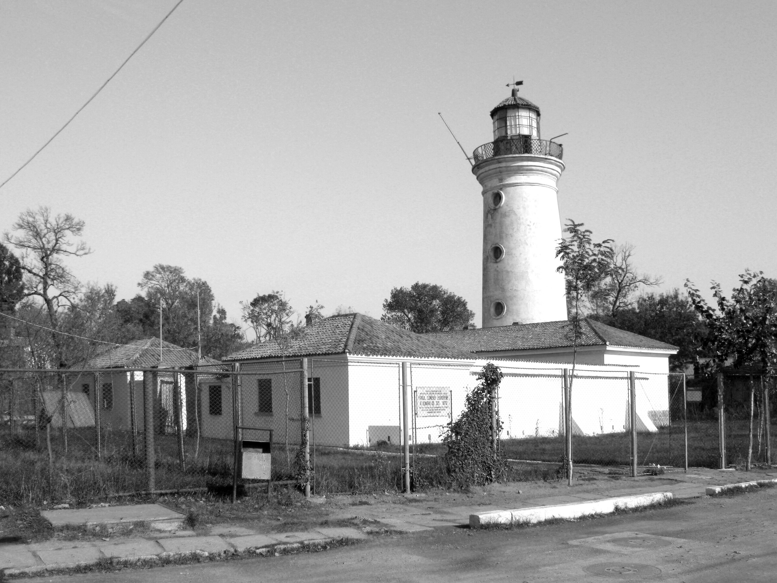
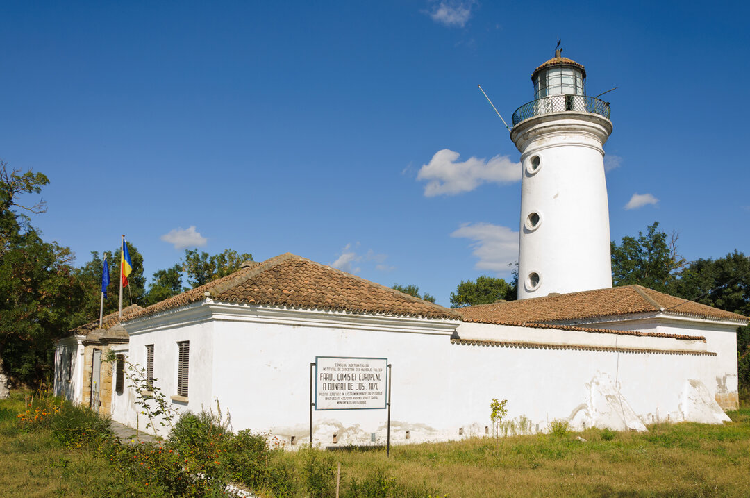
In the 18th century, the Turks built a redoubt on the left bank of the Danube. In 1802, Beshir Aga Aga built a lighthouse on the right bank of the Danube, at the Danube's mouth. This lighthouse was modernized by the European Commission of the Danube in 1870 and is today known as the Lighthouse of the European Commission of the Danube, becoming one of the city's emblematic historical monuments. The settlement is described by the Dutch navigator Georg Lauterer1, who landed in Sulina in 1782:
"Sulina, in Turkish Sunja, is a small town, situated right on the Black Sea, at the far end of the third and only navigable arm of the Danube; at the extremity of the right bank of the Danube is a lighthouse, about 50 feet high, in which 10 large lamps burn at night, to the assistance of navigators; farther inland is a coffee-house. On the other side, on the left bank, is an old wooden redoubt, a wooden mosque, a house for the commander, in front of which are installed 7 six-oared metal cannons, without aft, 11 cafes with shops, where passing ships can buy all their necessary food. (...) And as the strong winds from the north-east are wont to raise here on the Danube waves passing 2 feet, the land on which the houses are built in Sulina is raised about 4 feet above the water, which is at its lowest level.
... As soon as you pass the mouth of Sulina, there is in the sea a shallower passage (n.n.: Bara), where the water scarcely reaches 11 feet, for which there is at hand in Sulina a vessel called in Turkish bairactar, which draws or takes out (of the harbor) all ships; for this and for the lighthouse one pays 4.5 to 6 piastres, according to the size of the ship.... At Sulina, the width of the Danube is 105 fathoms and the depth 5 fathoms. From Galati to here you can get 35 watches or 23 German miles, and the journey can be made in good weather in three days. (....)... During my stay in Sulina, I had the opportunity to count all the ships that passed that way, and to learn that in the space of 40 days 62 ships left and 43 entered"2.
Ottoman domination of the Danube Gorges came to an end in 1829, following the Peace Treaty of Adrianople. The Delta was then under Russian rule until 1856. To promote the development of trade through the port of Odessa, the Russian authorities, although committed to ensuring navigability at the Sulina Gorge, allowed the Sulina Arm to silt up and raise the level of the silt bar that formed on the bottom of the Danube at the mouth of the Danube into the Black Sea, known as the Sulina Bar.
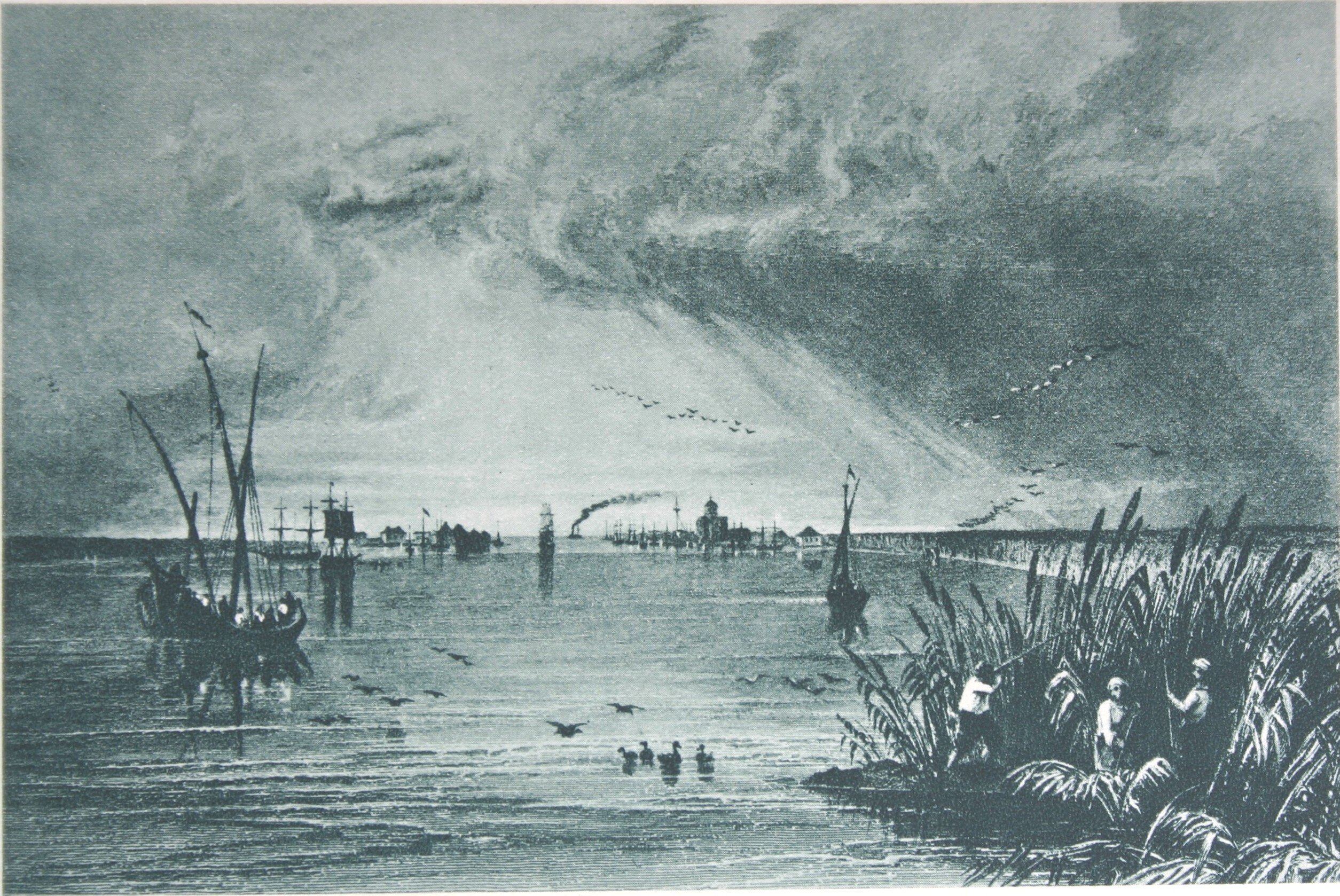
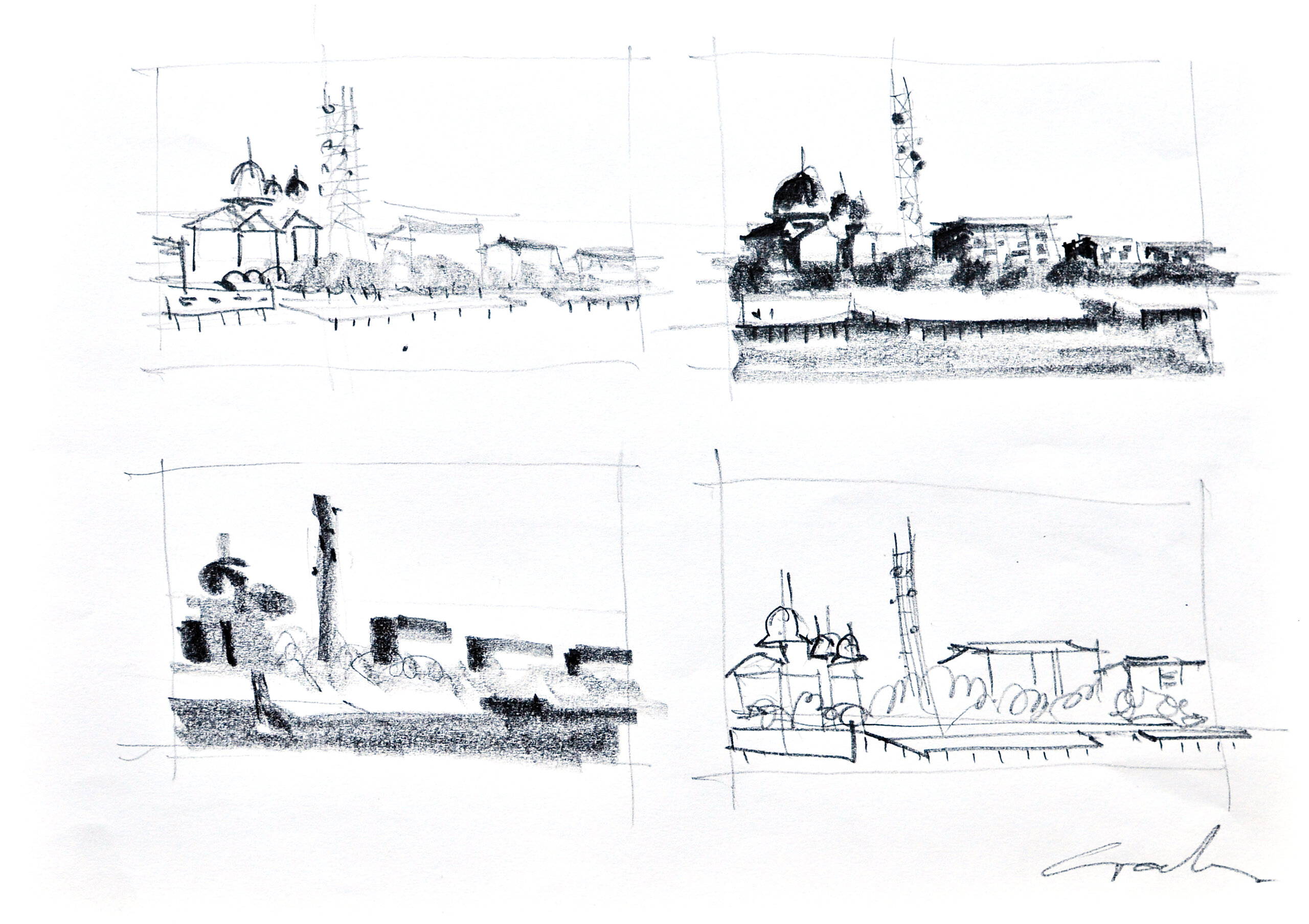
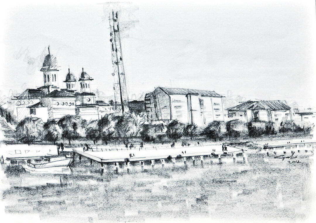
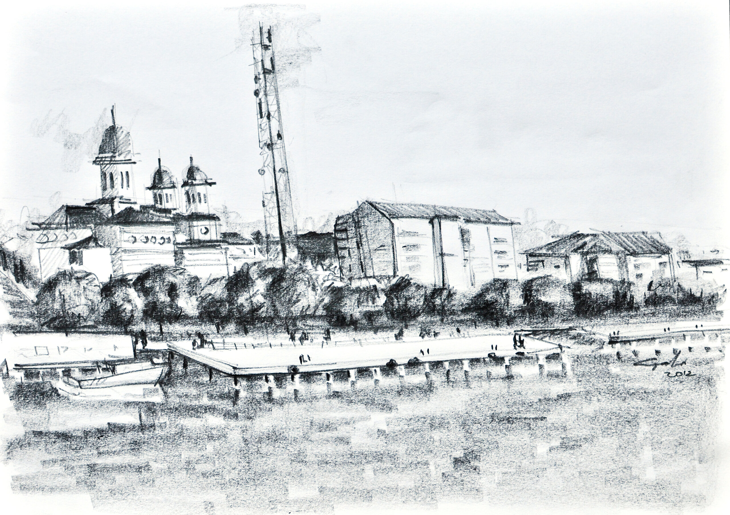
The Russians reinforced the Turkish fortifications on the left bank of the Danube and built a quarantine station here in 1836. On the right bank of the Danube, in the center of the settlement of Sulina, on a plot of firm land, set back from the Danube, they built an imposing church, now disappeared, whose altar is marked by a monument located in the courtyard of the present Old Orthodox Church of St. Nicholas in Sulina. Its striking silhouette, together with that of the old Ottoman lighthouse erected in 1802, also on the right bank, marks the silhouette of Sulina in old engravings from the first half of the 19th century.
After the Peace of Adrianople, the Greeks began to emigrate, many of them settling in the port cities on the Danube and the Black Sea. This was the time of the massive influx of Greeks to Sulina, an ethnic group that soon became the majority. Dark clouds appear in the sky over Sulina. The Crimean War begins. Between 1853 and 1856, heavy fighting breaks out at the mouth of the Danube. In 1854, on July 17, Sulina was bombarded and set on fire by the English Vice Admiral Parker, who was avenging the death of his son, killed in the war by Greek volunteers from the Russian army3. This moment is illustrated in the war reports in the Leipzig-based publication "Illustrirte Zeitung".
The Peace Treaty of Paris of March 1856 returned the Danube Gorges to Turkish rule. The European Commission for the Danube was also set up at the same time. Its main tasks were to regulate free movement on the Danube and ensure navigability at the mouths of the Danube. As early as the beginning of the 19th century, the great European powers, meeting at the Vienna Peace Congress in 1815, had legislated the principle of free navigation on international waterways. As water transport was much cheaper than land transport, large-scale construction projects had been launched to convert waterways into transport corridors. However, it was not until 40 years later, at the Paris Peace Congress in 1856, that this principle could be imposed on the maritime Danube, when the European Danube Commission was set up, with its headquarters in Galati and Sulina. It was set up as a provisional body with a two-year mandate, made up of representatives of the major European powers, and remained in Romania until 1938, when its main tasks were taken over by the Romanian state.
Ed.Engelhardt4, who visited Sulina in 1853, before the establishment of the EDC. The settlement is described as having about 1,000 inhabitants, mostly Ionians, Greeks and Maltese, who practiced a form of piracy, "helping" ships to pass over the Bara Sulina in order to continue their voyage:
"A few shacks of planks or simple reed huts erected on the beach served as shelter for adventurers whose art consisted in plundering in a grand and merciless manner the unfortunate captains who were obliged, in view of the obstacles they had to encounter at this point, to resort to their offices. (...)
The robbery was organized and, compared to the disorganization which followed the first hostilities on the Danube, it was practiced without punishment by anyone. The compulsory use of partial unloading at the crossing of the bar made the practices of these daring pirates much easier. Their barges were generally double-bottomed, into which most of the grain taken for a moment from the sea-casks drained, and they only returned the surplus if they were unable to escape the vigilance of the ship's captains. This explains how several windmills, traces of which can still be seen today, were in full activity at the mouth of the Danube, at a hidden point of the coast, at the end of the reeds"5.
The European Danube Commission - EDC was made up of representatives of the major European powers: England, France, Austria, Austria, Prussia, Germany, Italy, Sardinia, Russia, Turkey and Italy. Its tasks were legislative, judicial, administrative and technical. It drafted navigation and river police regulations in the maritime Danube sector, judged all infringements of navigation regulations, established and collected navigation fees, administered the Sulina Port and carried out studies and works for the development of navigation on the Sulina Arm.
The CED's activity was carried out within the following departments:
The General Secretariat, established in 1856, based in Galati, which, among other things, comprised the CED's registry, library and archives;
The General Accounting Office, established in 1856, operating in both Galați and Sulina;
The Navigation House, established in 1859 in Sulina, which was responsible for the collection of navigation and sanitary taxes and fines imposed by the Sulina Port Captaincy and the Navigation Inspectorate;
The Technical Service, established in 1856 in Sulina, which owned the workshops and ship repair yards in Sulina, three stone quarries in Tulcea and one in Isaccea, and was responsible for drawing up projects and carrying out improvement works at the mouths of the Danube, maintaining the navigational state, installing and maintaining lighthouses, buoys, fog signals, and building, maintaining and repairing the CED buildings;
Navigation Inspection, established in 1861;
Sulina Port Captaincy, established in 1857, which was responsible, among other things, for pilotage at the entrance to the river, the rescue of ships in distress, the operation of lighthouses and fog signals at Sulina, St. Gheorghe and Snakes Island;
The Hospital Service, created in 1857 in Sulina, which established the Central Hospital and the Infectious Diseases Hospital in Sulina.
Thus, the operational services of the CED have operated in Sulina since 1856.
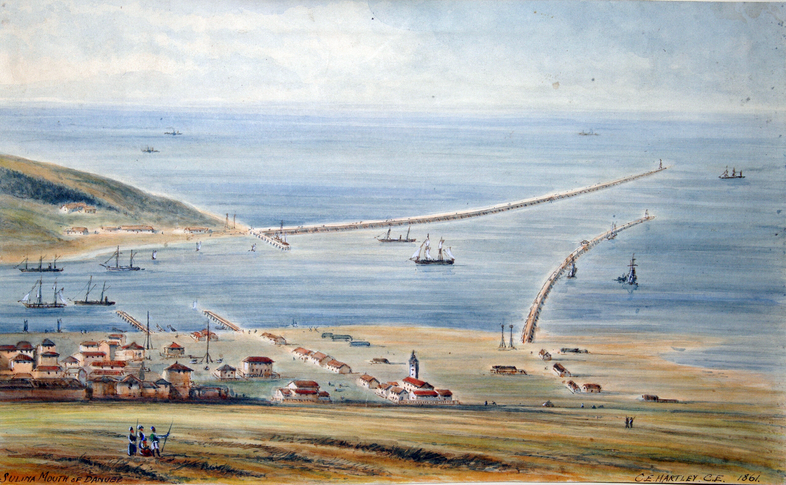
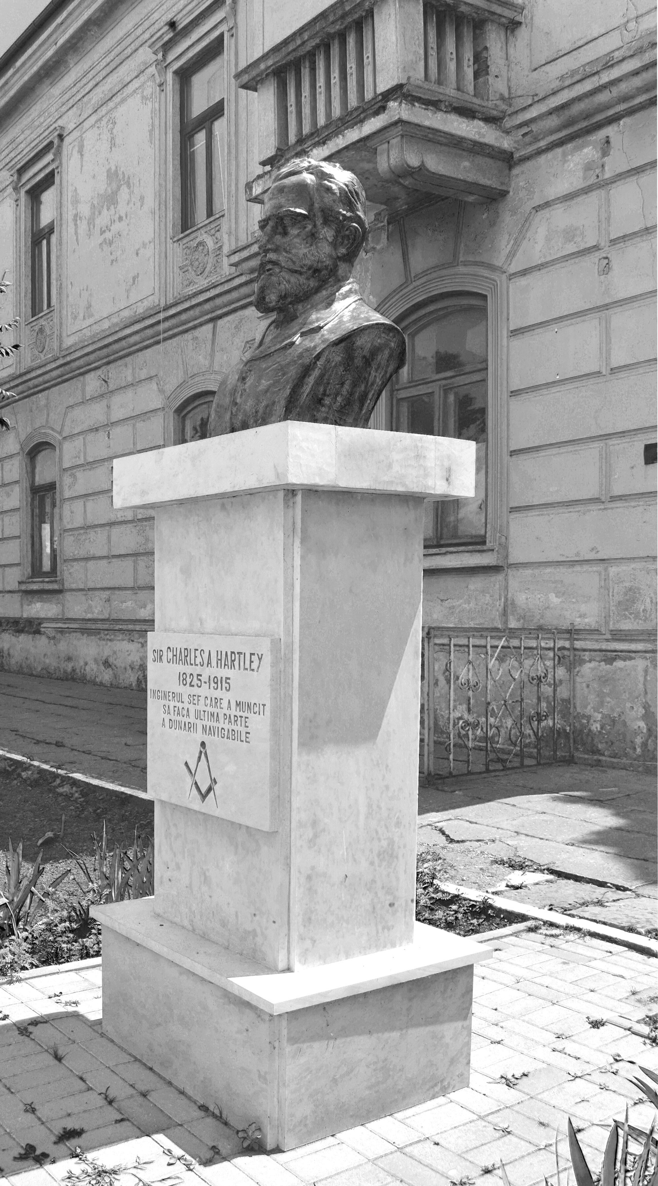
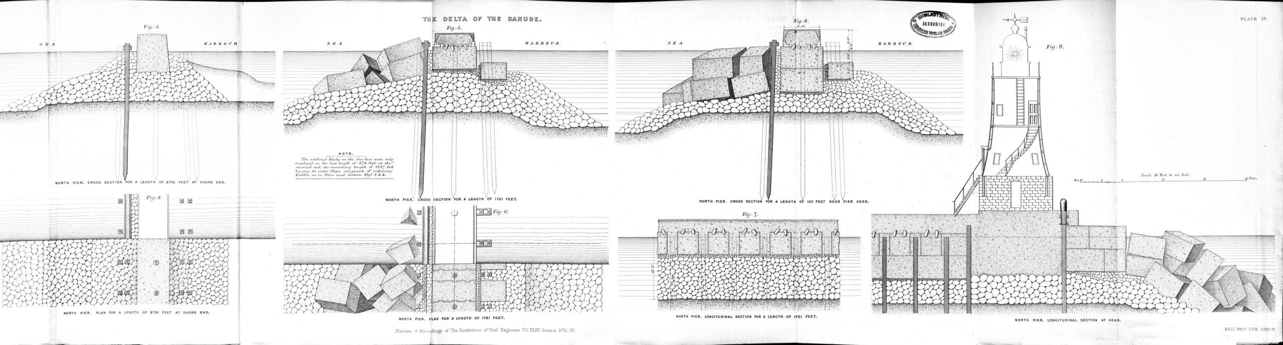
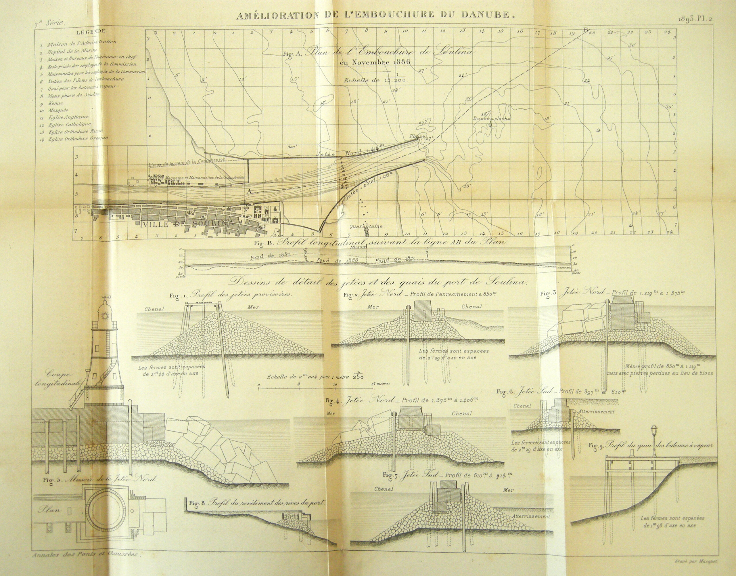
The following year, work began on improving navigability at the mouths of the Danube and on the maritime Danube from Brăila to the Black Sea. After extensive studies, the Sulina branch was chosen, over the Sfântu Gheorghe and Chilia branches, to be transformed into the main navigable river artery. Although much longer, its choice was also due to its average depth, which was greater than that of the other two branches. Until 1902, the CED carried out, according to the projects of the English engineer Charles Hartley6, extensive works for the development and regularization of the Sulina Arm. Although he was only CED's chief engineer until 1872, he continued to supervise the Commission's technical work until 1902. The chief engineers who succeeded him only implemented the projects of this genius engineer.
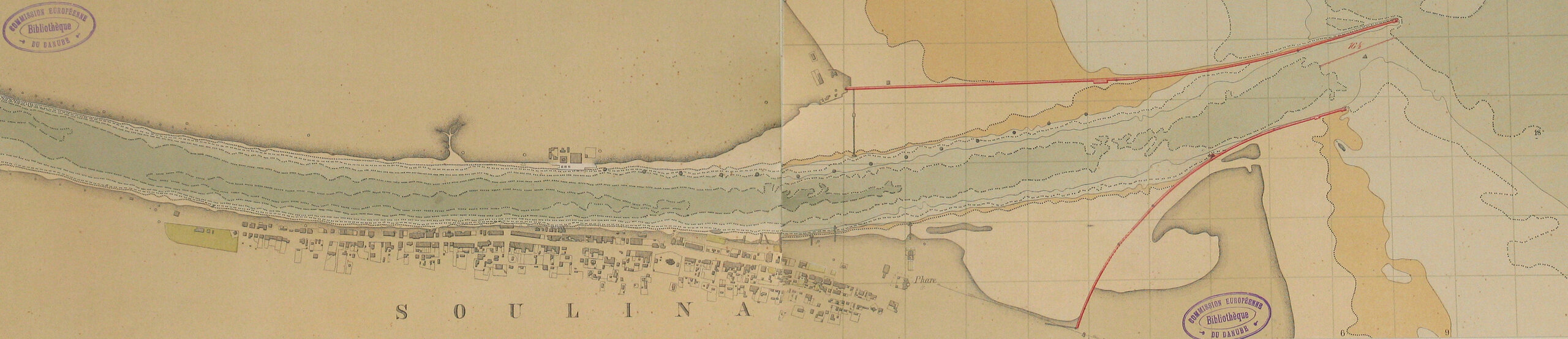
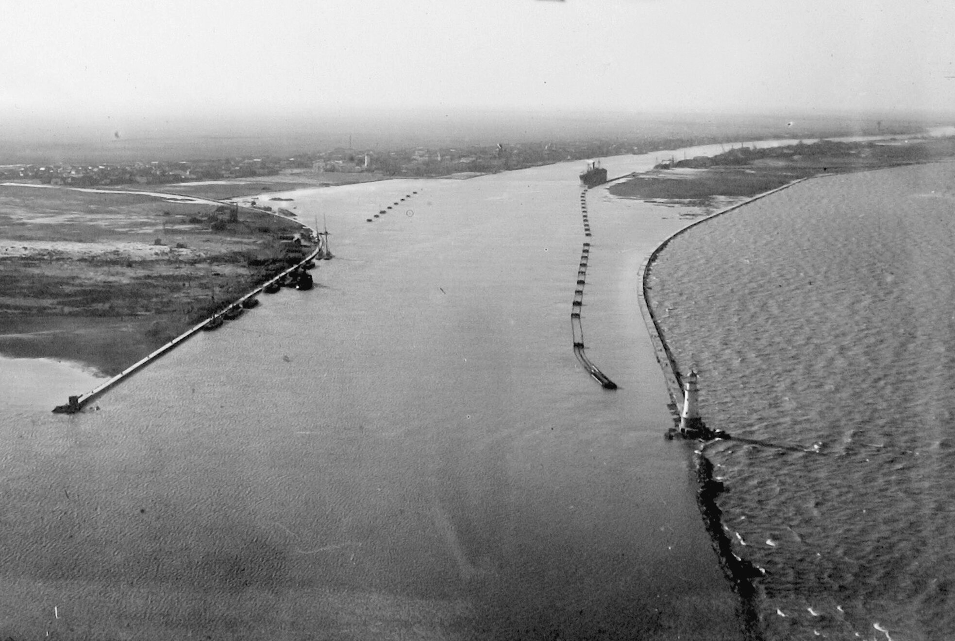
As a result of these works, the Sulina Arm was regularized and transformed into a navigable channel, from Tulcea to the sea, by diking, dredging and removing all bends. Major "cuts" are made, including those of the "Big M" loops, reducing the length of the Sulina Arm by more than 20 km.
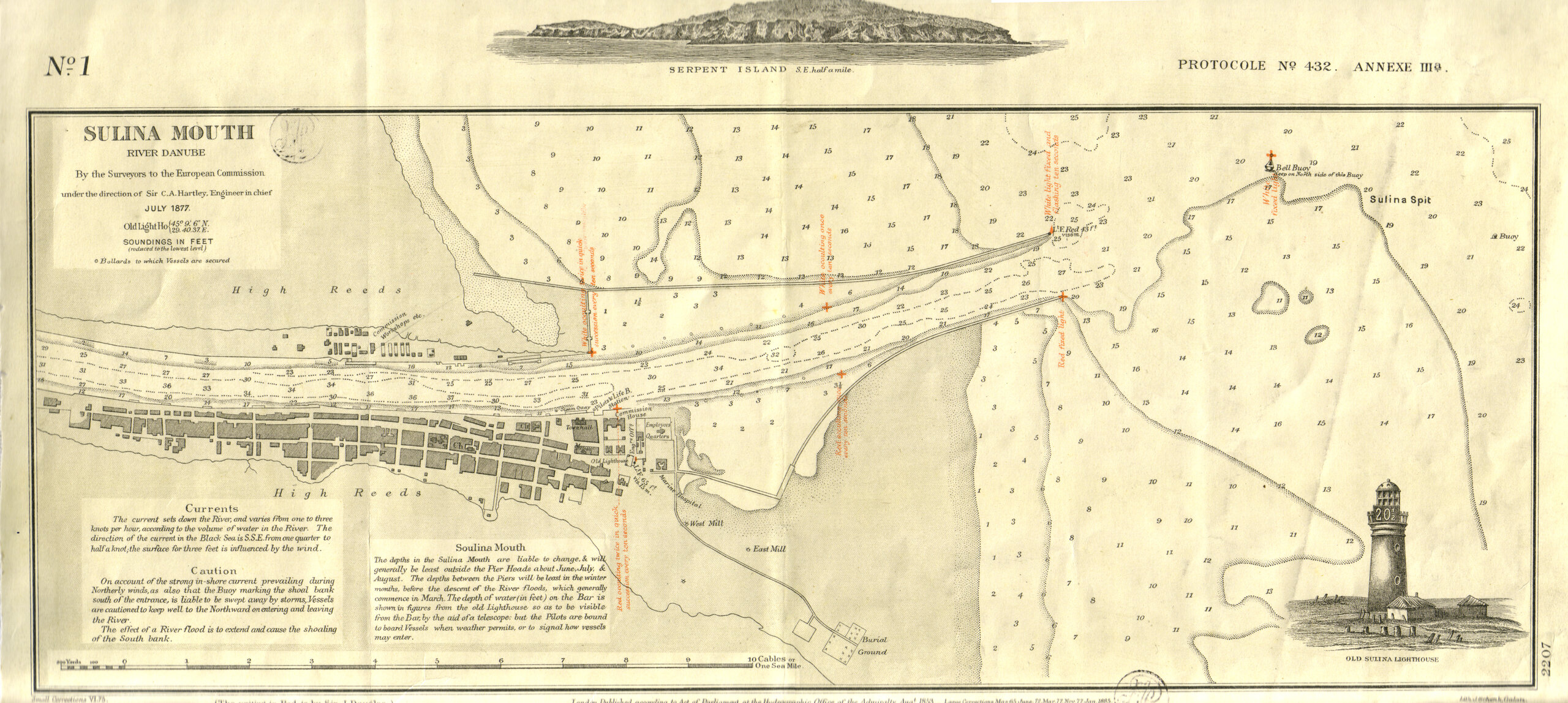
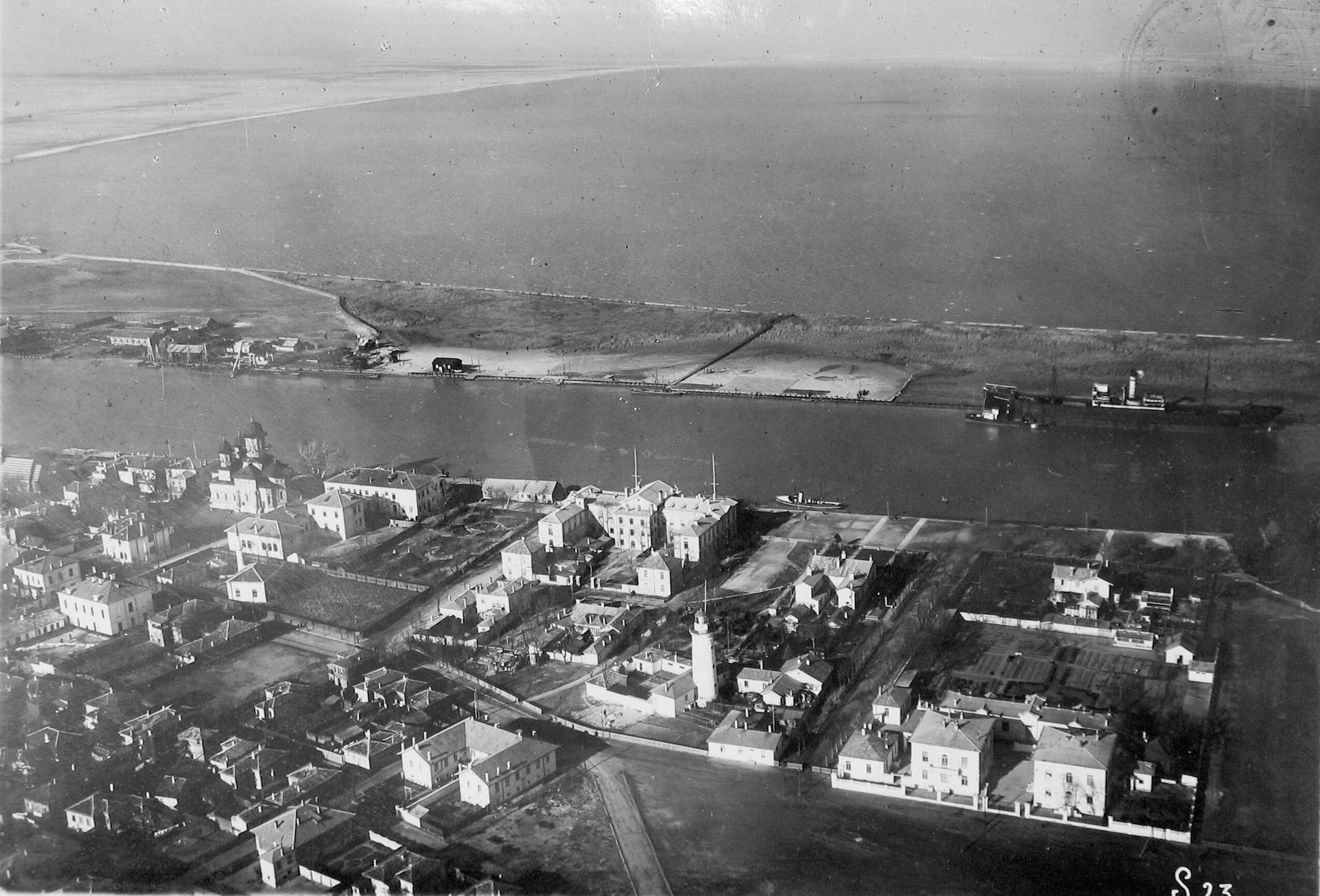
In Sulina the embankments are dyked and the great breakwaters are drawn and built, which advance for kilometers in the sea, ensuring, by shape and direction, the navigability of the Sulina Gorge, by naturally cleaning the Sulina Bar, using the directed flow of the Danube waters. After 1902, when Charles Hartley left Sulina, the engineers who followed him did nothing more than to extend the northern and southern breakwaters eastwards, towards the open sea, maintaining the trajectories traced by Hartley.
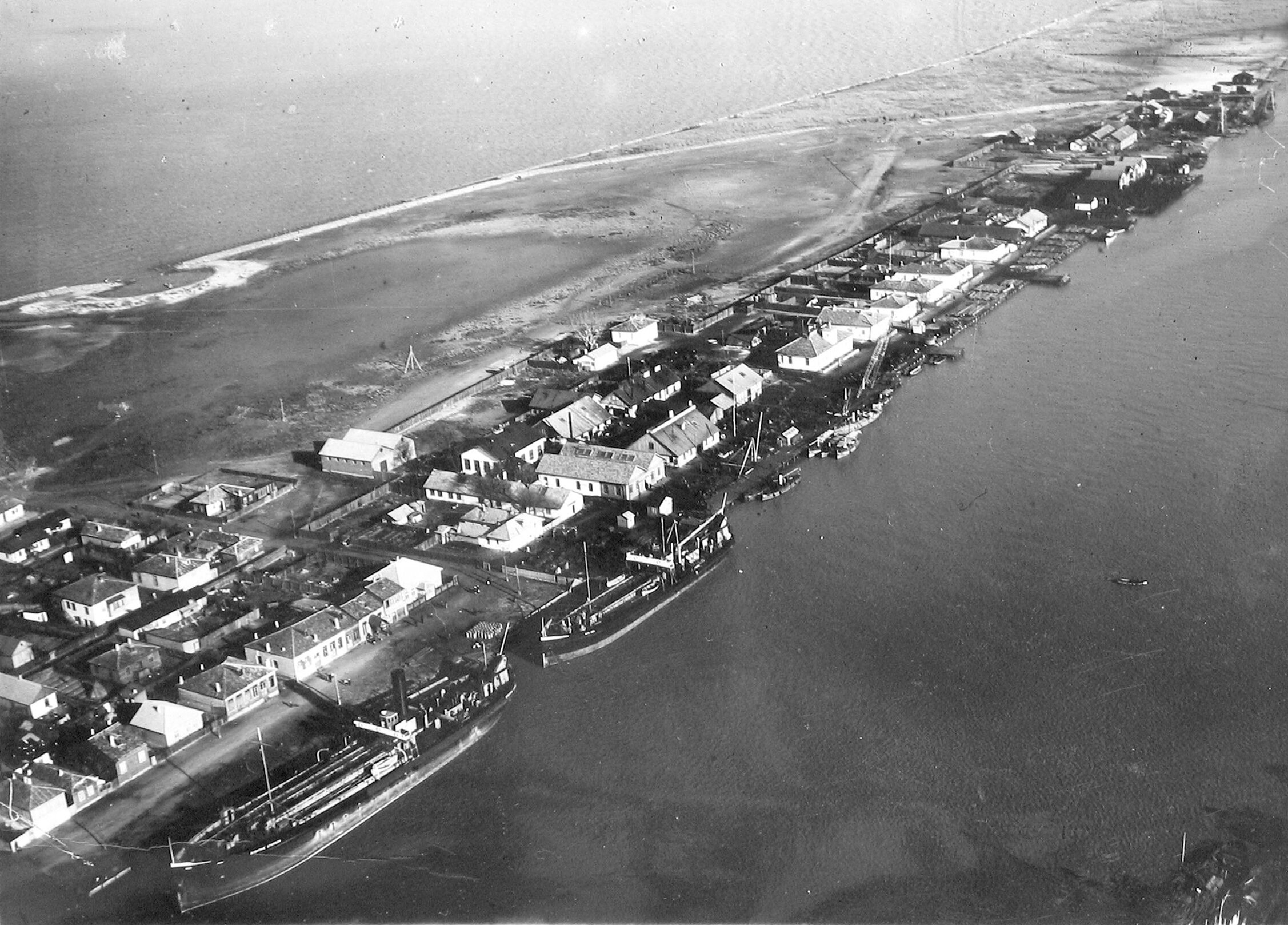
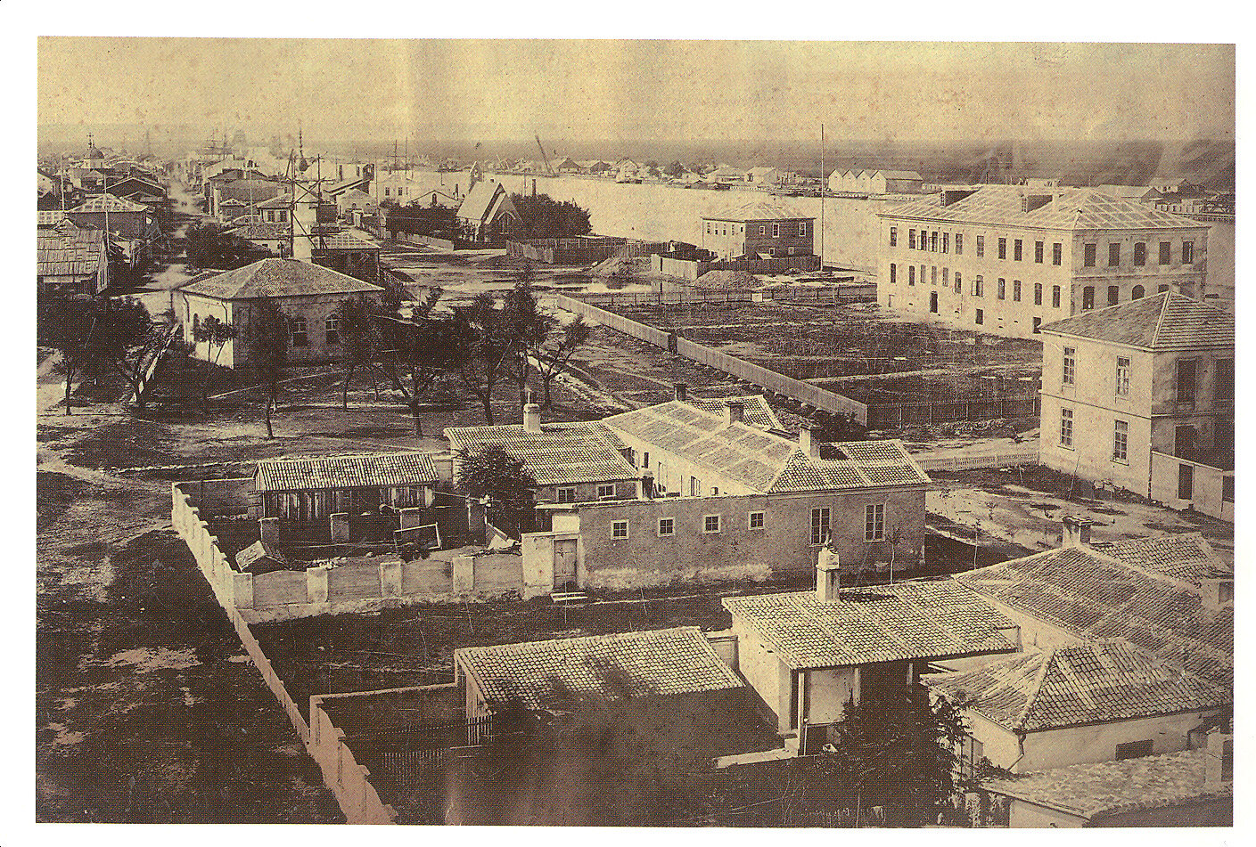
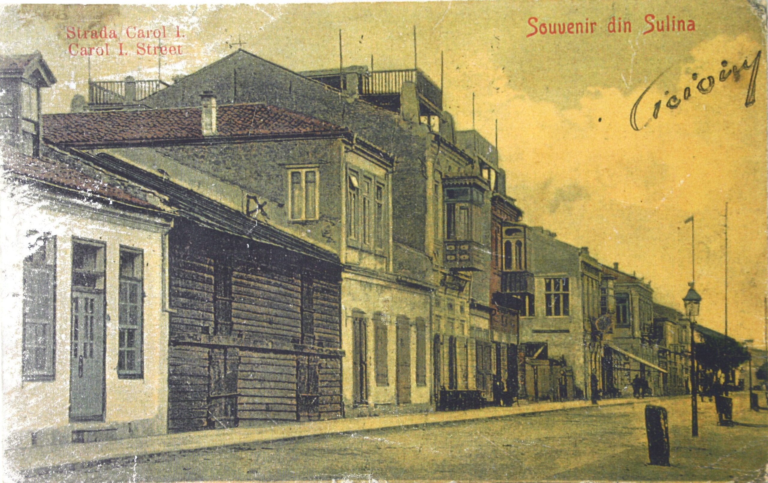
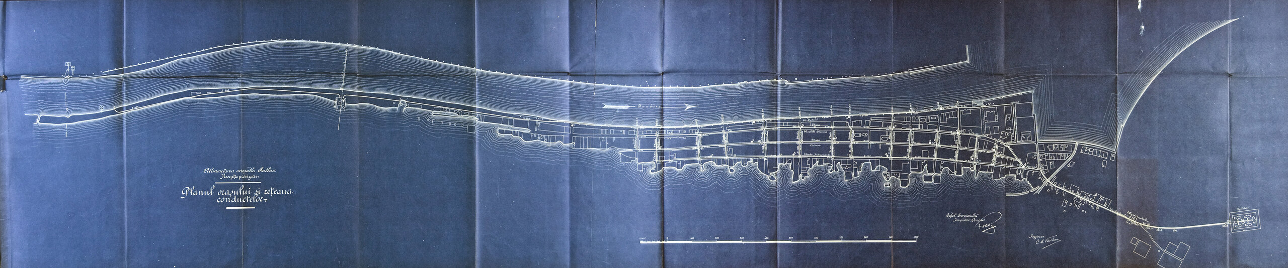
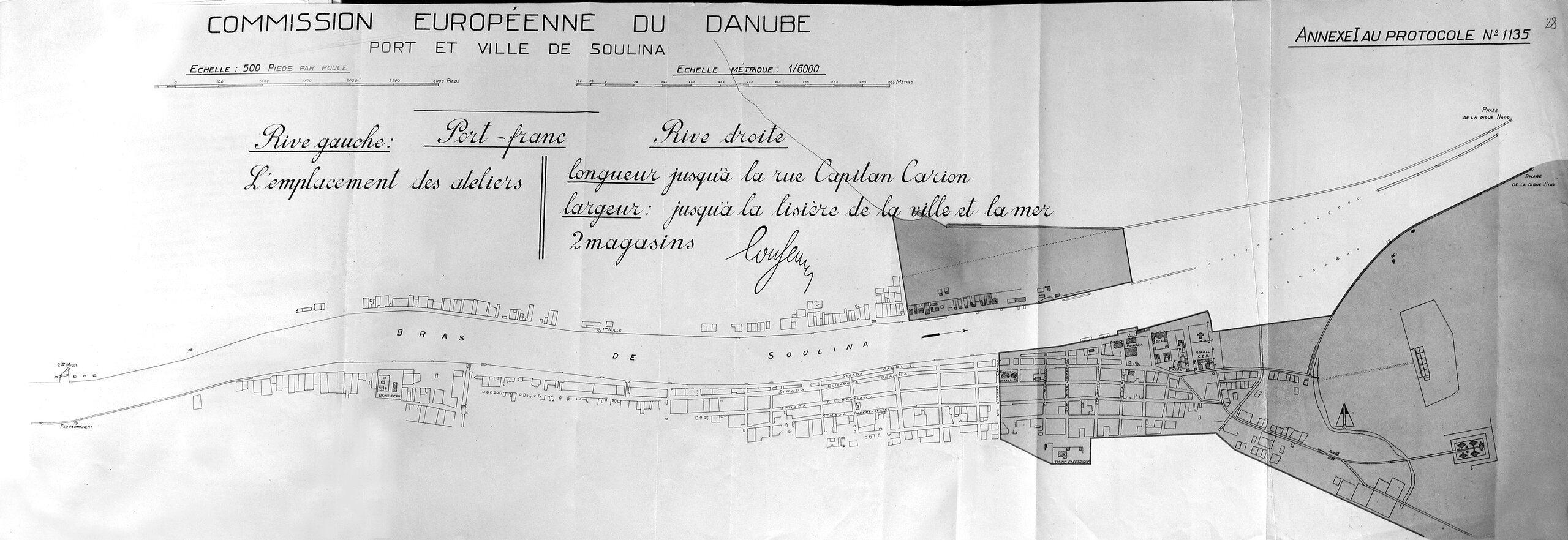
The installation of the CED in Sulina led to the rapid development and modernization of the town. Since 1857, there has been intense building activity, strongly supported by subsidies from the CED. In order to extend the solid ground on the right bank, suitable for building, the land was progressively drained by draining the marshes and spreading ballast brought by ships entering the Sulina Arm. To protect against flooding, large quantities of silt extracted from the river by suction dredgers are deposited on the banks. The town was laid out on a pre-established plan, consisting of a network of streets parallel to the Danube arm, numbered with Roman numerals, linked by short perpendicular streets, starting from the quays and ending south of the town in the marshes.
The main streets are covered with gravel. Street II, which runs parallel to the quay, is turned into a roadway by being paved with macadam. By 1880, streets III and IV are also laid and filled with earth and ballast.
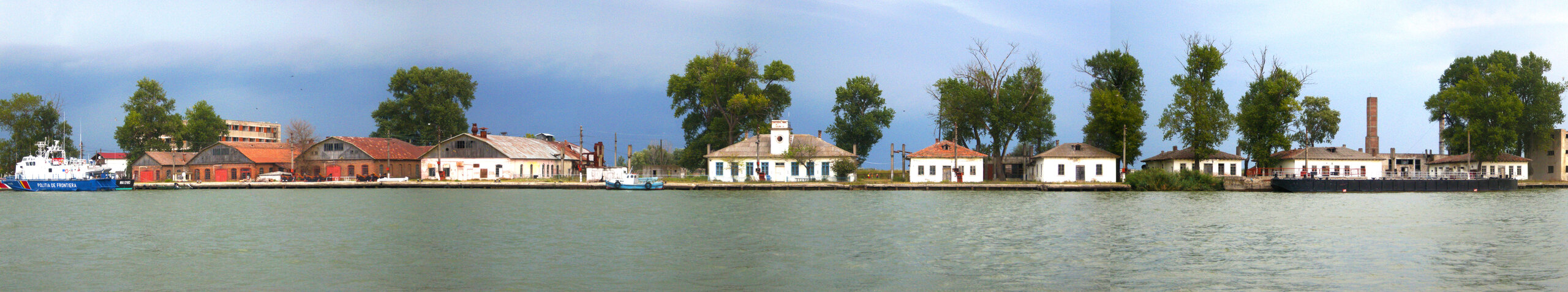
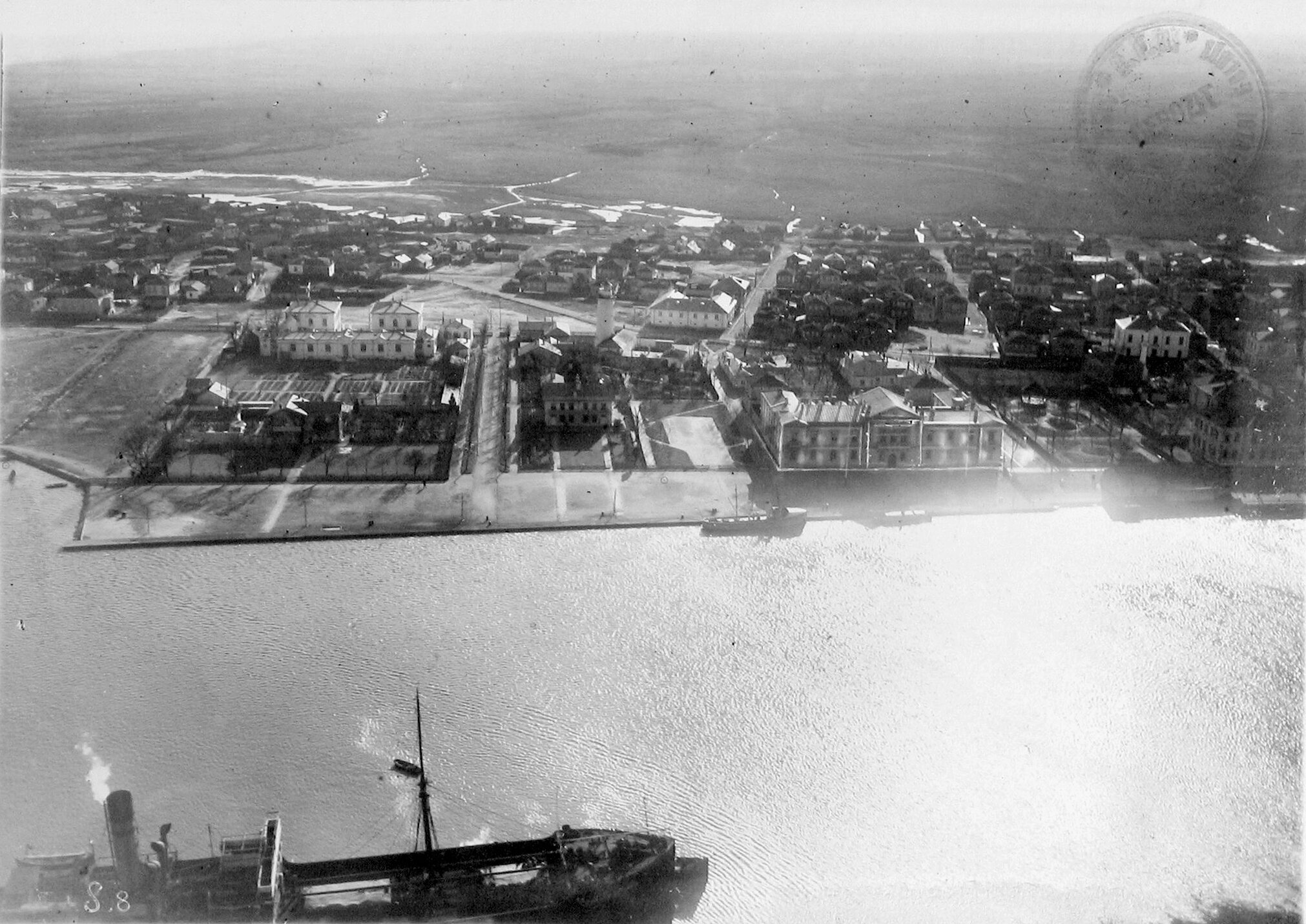
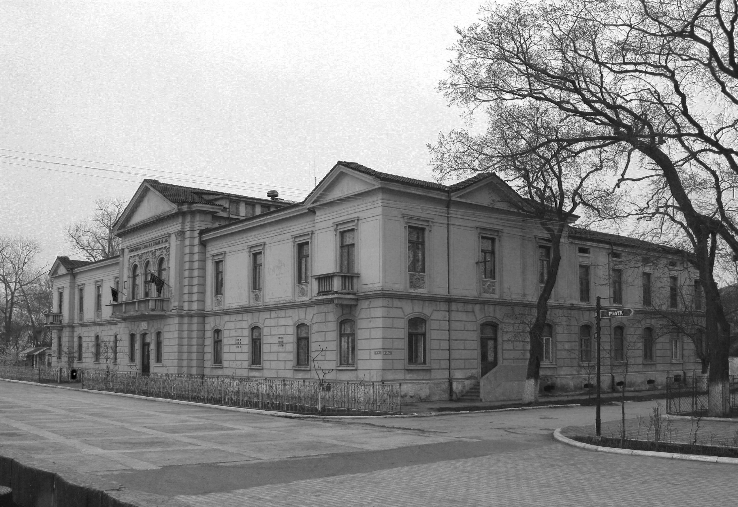
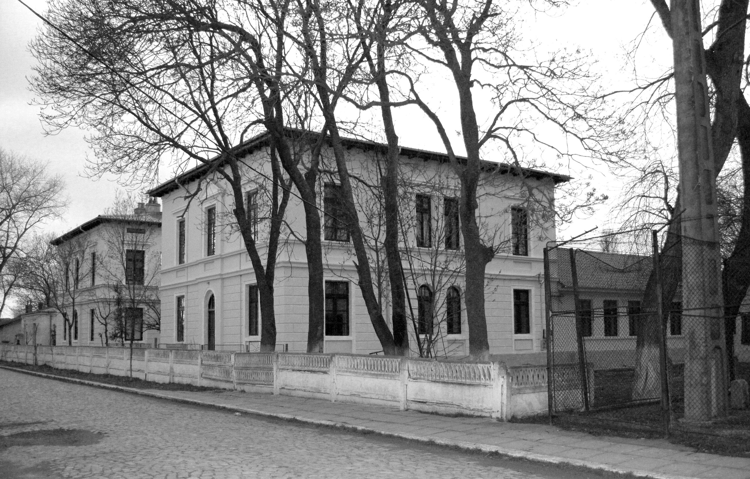
The newerstretchesofland, located at the eastern end of the old settlement, on the right bank of the Sulina Arm, were also cleared and transformed into an elegant district, consisting of a group of buildings that ensured the organized functioning of the CED as a legislative, judicial, administrative and technical entity. The CED district includes buildings erected between 1856-1877: the CED Palace, with its main facade facing the Danube, aligned with the I Street and with a pontoon area for mooring, the headquarters of the CED Technical Service and the home of the CED Chief Engineer, the CED Central Hospital and a group of residential buildings for the commission's senior officials. The old lighthouse, erected by the Ottomans in 1802 and rebuilt and modernized by the CED in 1870, is also located in this district. The whole complex, partially enclosed in the form of an enclosure, reflects a quasi-independent functioning, the grounds being structured in an academic order, encompassing ample green, sports and detention areas.
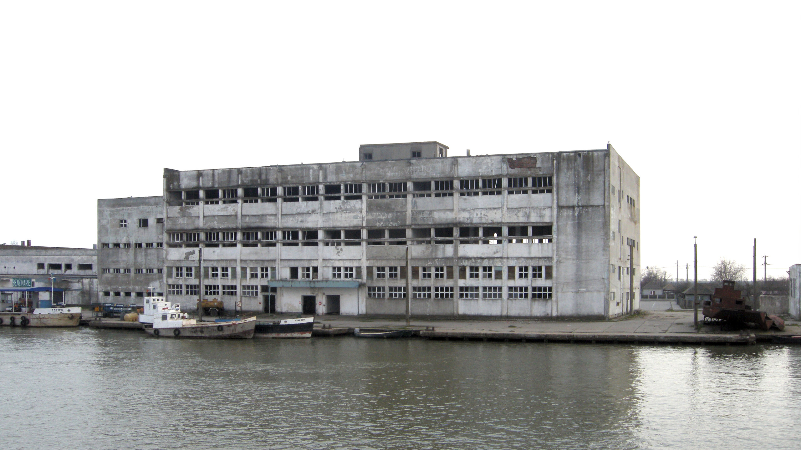
During the same period, the commission builds on the left bank of the Sulina Arm a vast complex of ship repair and maintenance workshops, offices and residential buildings, known as the CED Workshops.
Thanks to the advantages offered by the CED, Sulina is becoming populated. The influx of immigrants increases. To the indigenous population of Greeks, Romanians, Russians and Turks were added Armenians, Jews, Kosovans, Kosovans and Montenegrins, as well as CED officials, employees of diplomatic representations and shipping agencies in European countries, port workers and workers from CED's shipyards. The multi-ethnic and multicultural mosaic, inspired by the writer Jean Bart's "Europolis", is taking shape. The city blossoms. Diplomatic representations and agencies of major shipping companies open. In 1870 Sulina was granted the status of a free port by the Turkish authorities.
In 1863, in the center of Sulina, on the land consolidated by the CED, between 2nd and 3rd Streets, the Italian community, mainly made up of Dalmatian and Venetian sailors and merchants, built the Catholic Church of St. Nicholas in the center of Sulina. Between 1866 and 1868, the old Greek, Romanian and Russian communities built the Greek and the Russian-Roman churches (the old Orthodox church, which at that time served in Russian and Romanian) on adjoining plots of land, both of which were dedicated to St Nicholas, the latter being built on the site of the old Russian church, which had been burned down in July 1854 during the Crimean War. In 1869, the Anglican church was built on I Street at the quay near the CED district, which was destroyed in the bombings of the Second World War. In 1870, a mosque was built, but it was demolished in the 1950s due to war damage. For the construction of all these places of worship, and later for their maintenance and repair, the CED grants subsidies.
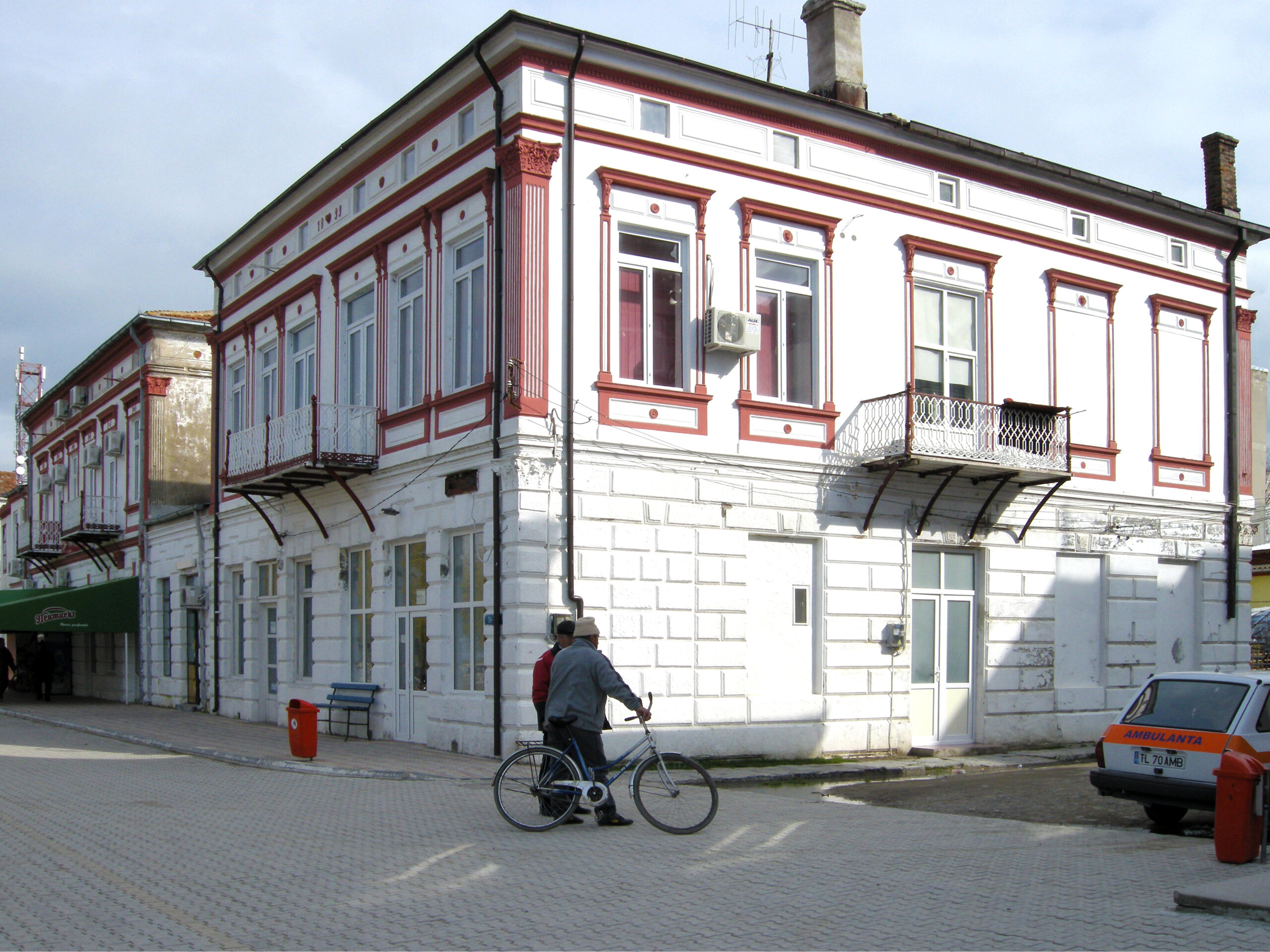
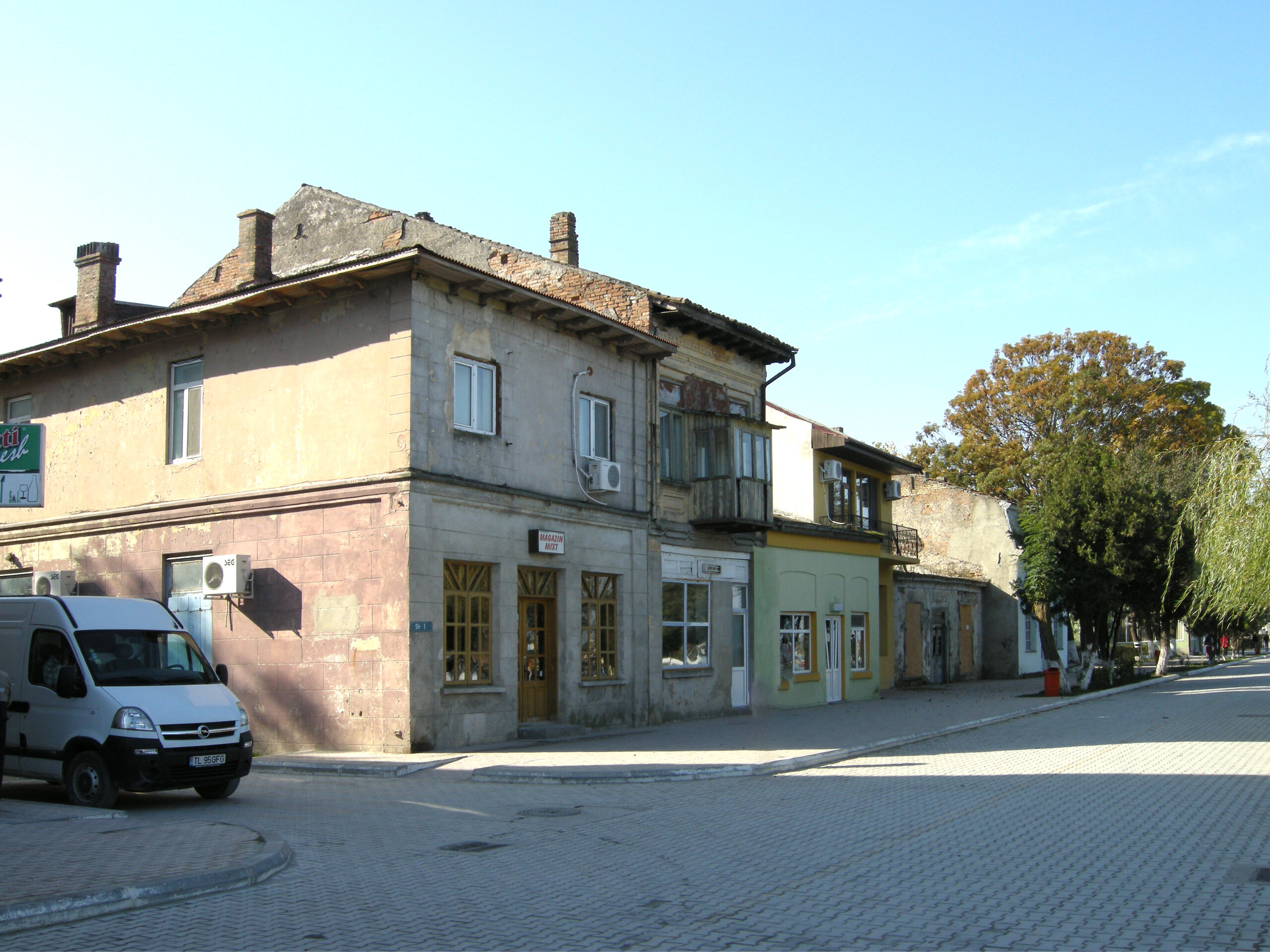
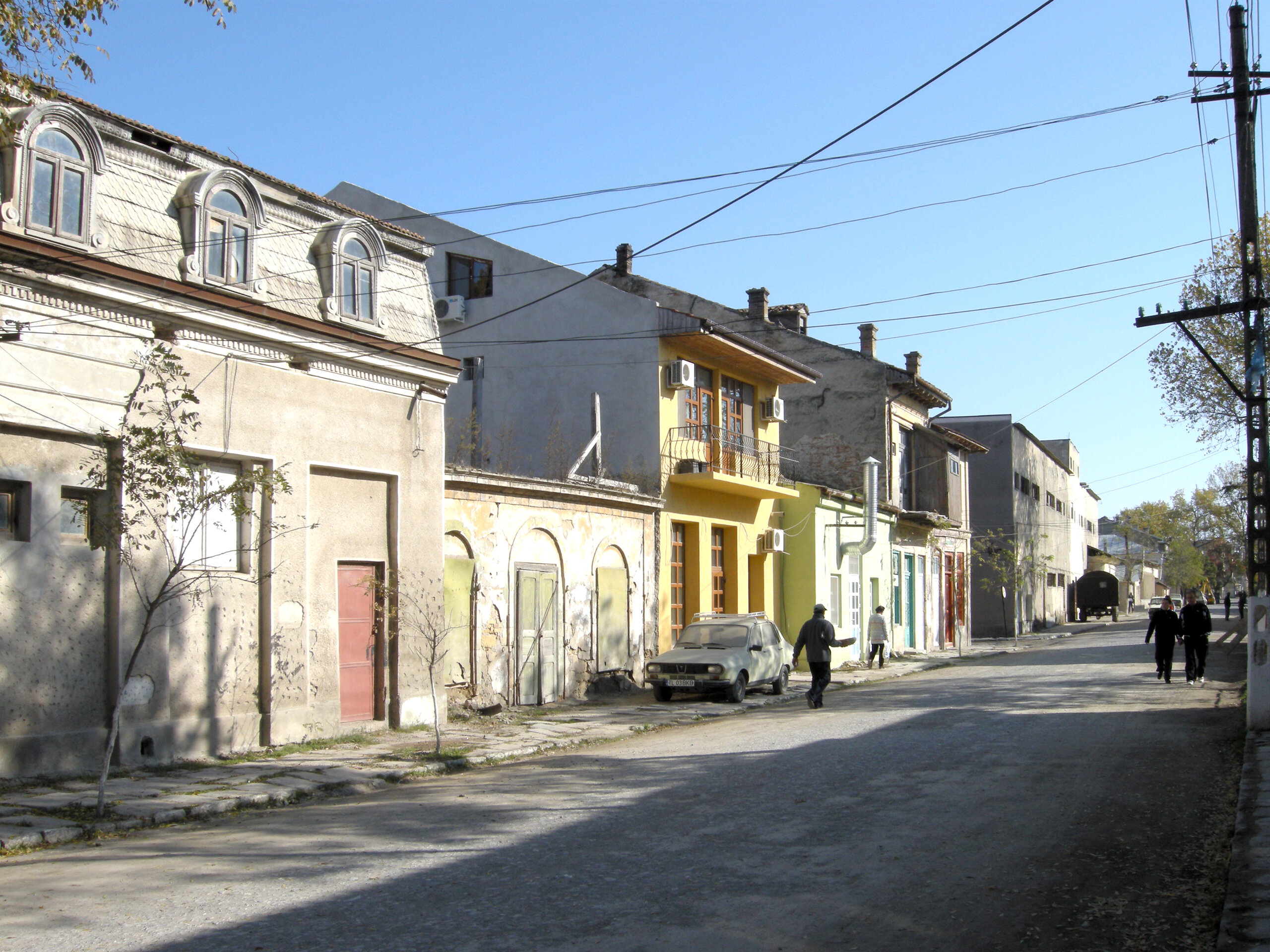
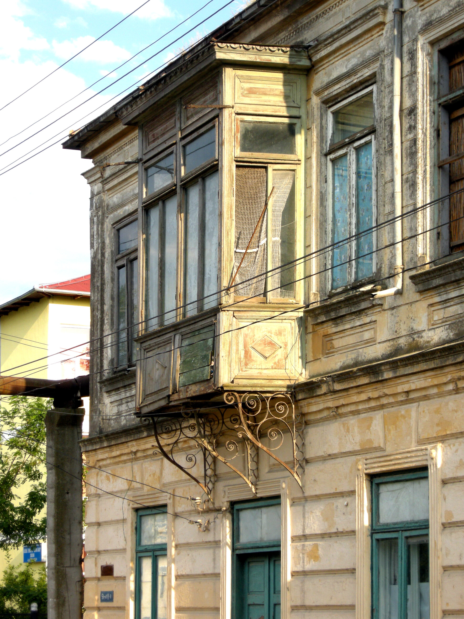
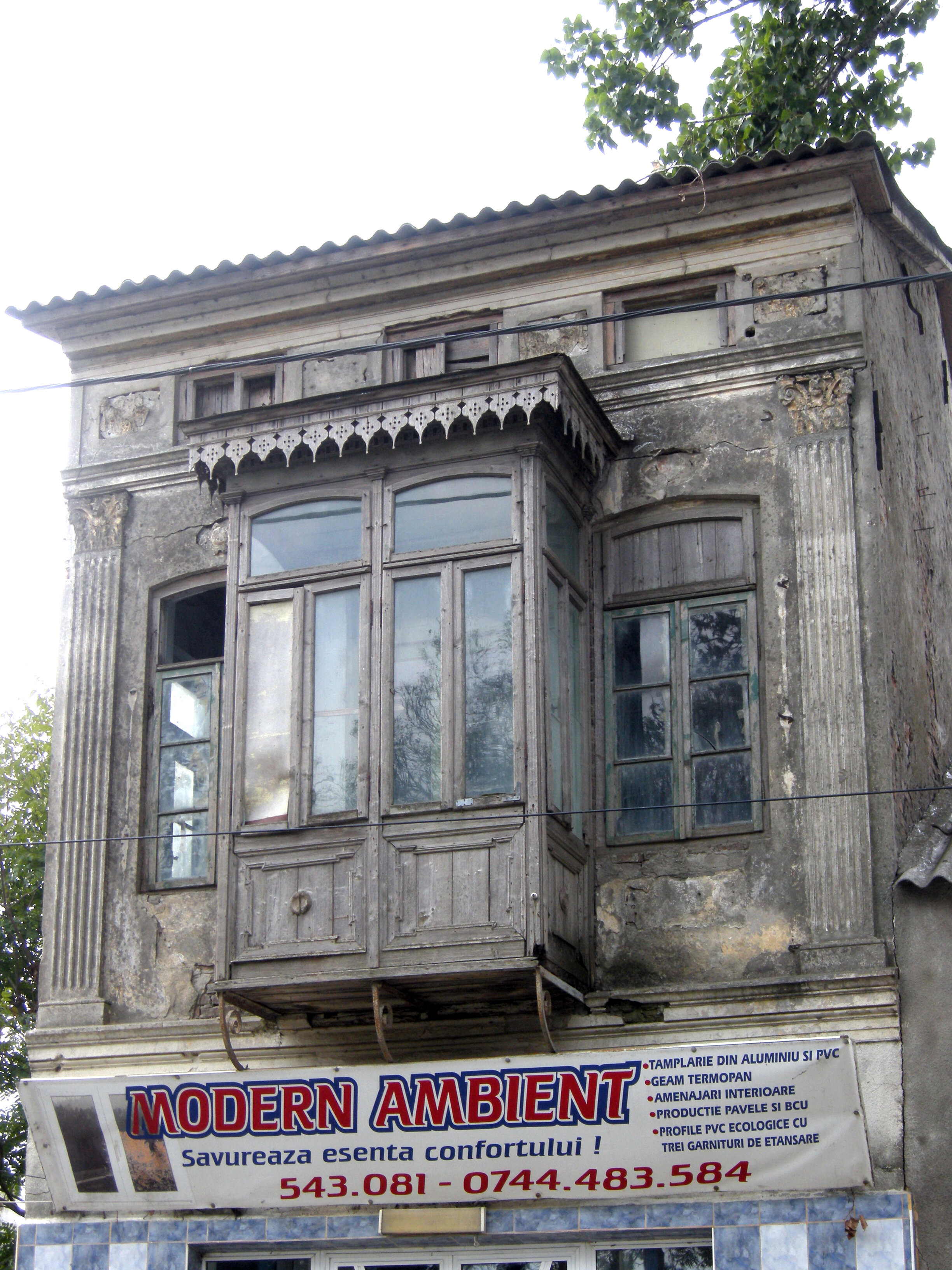
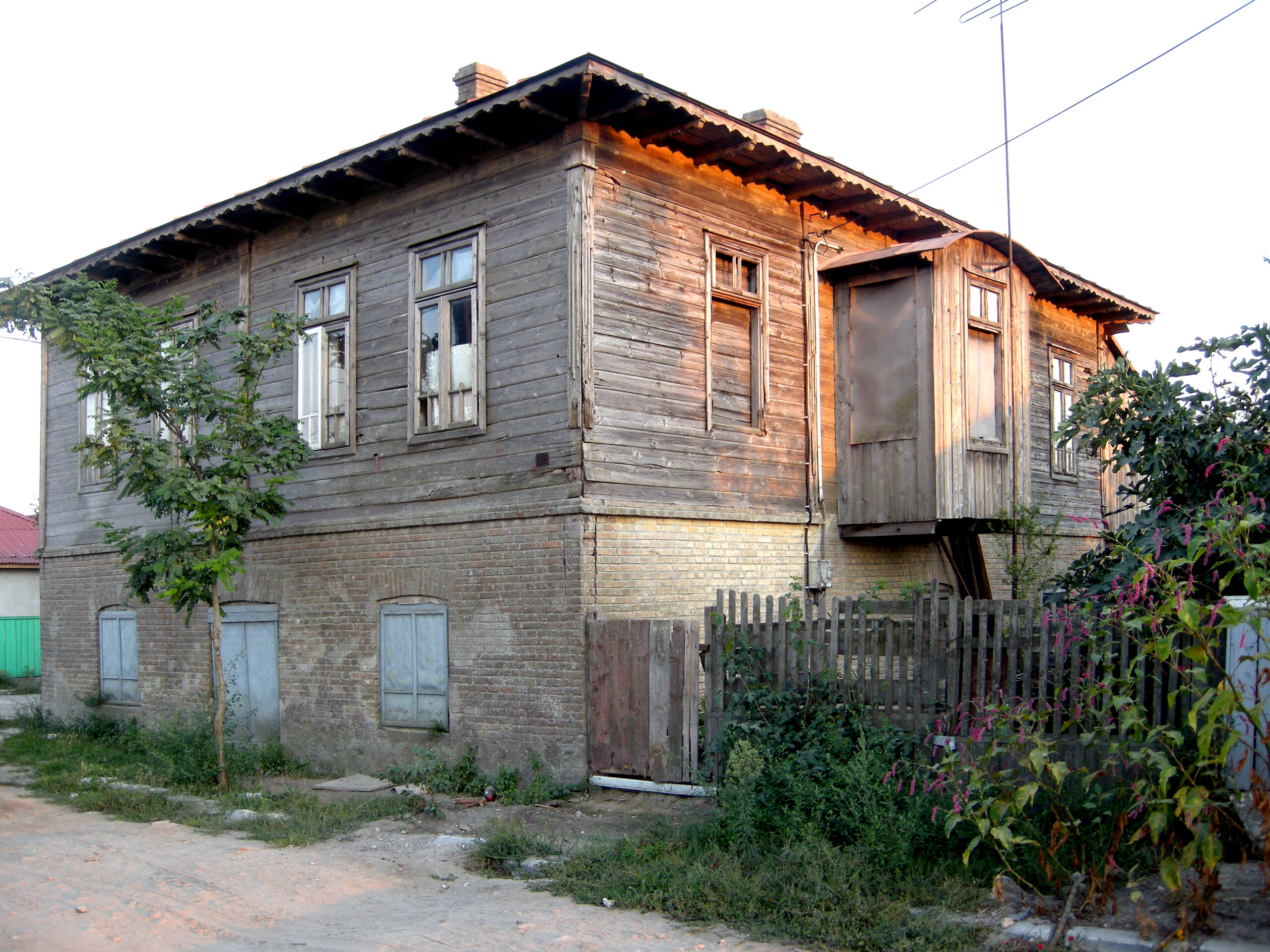
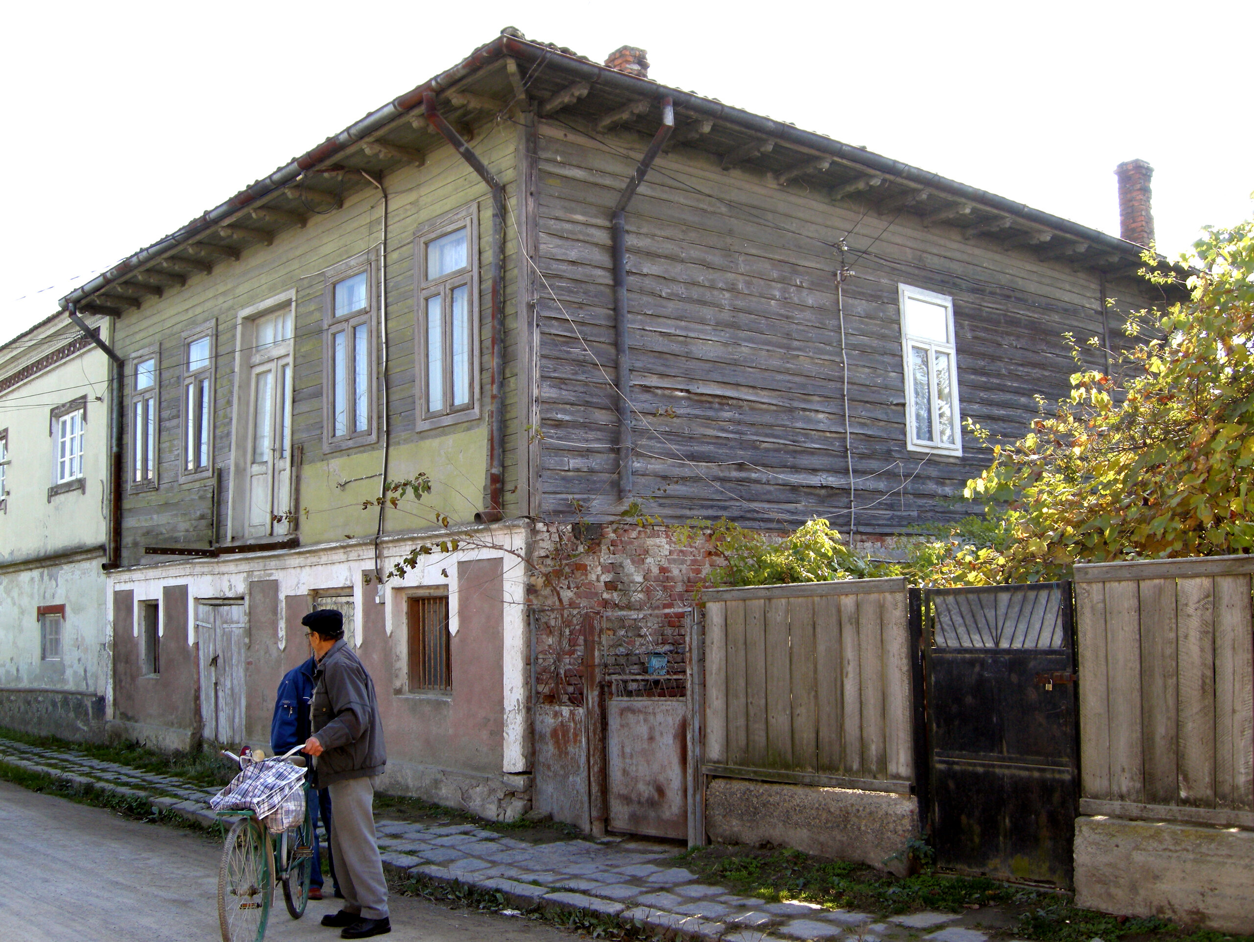
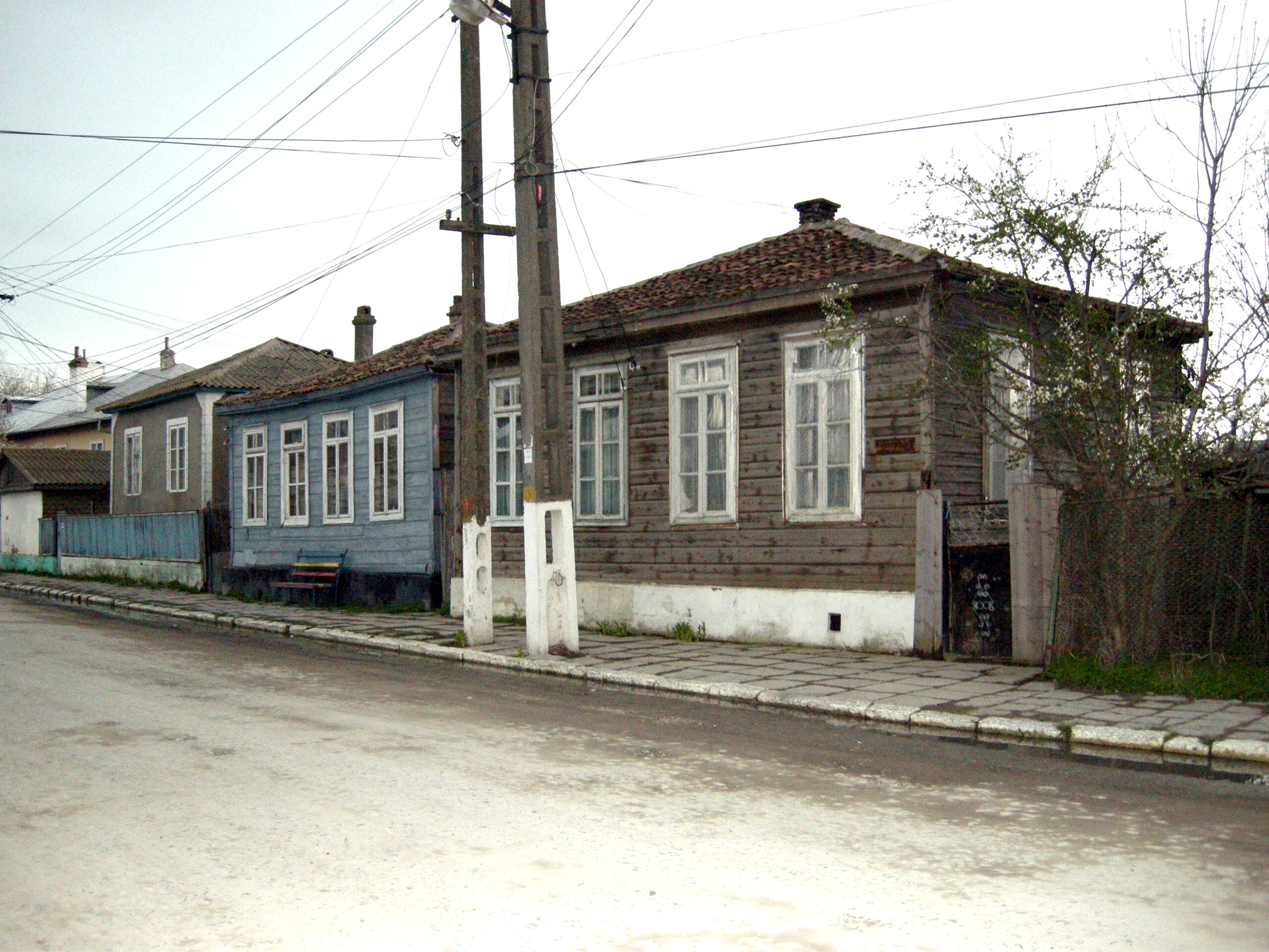
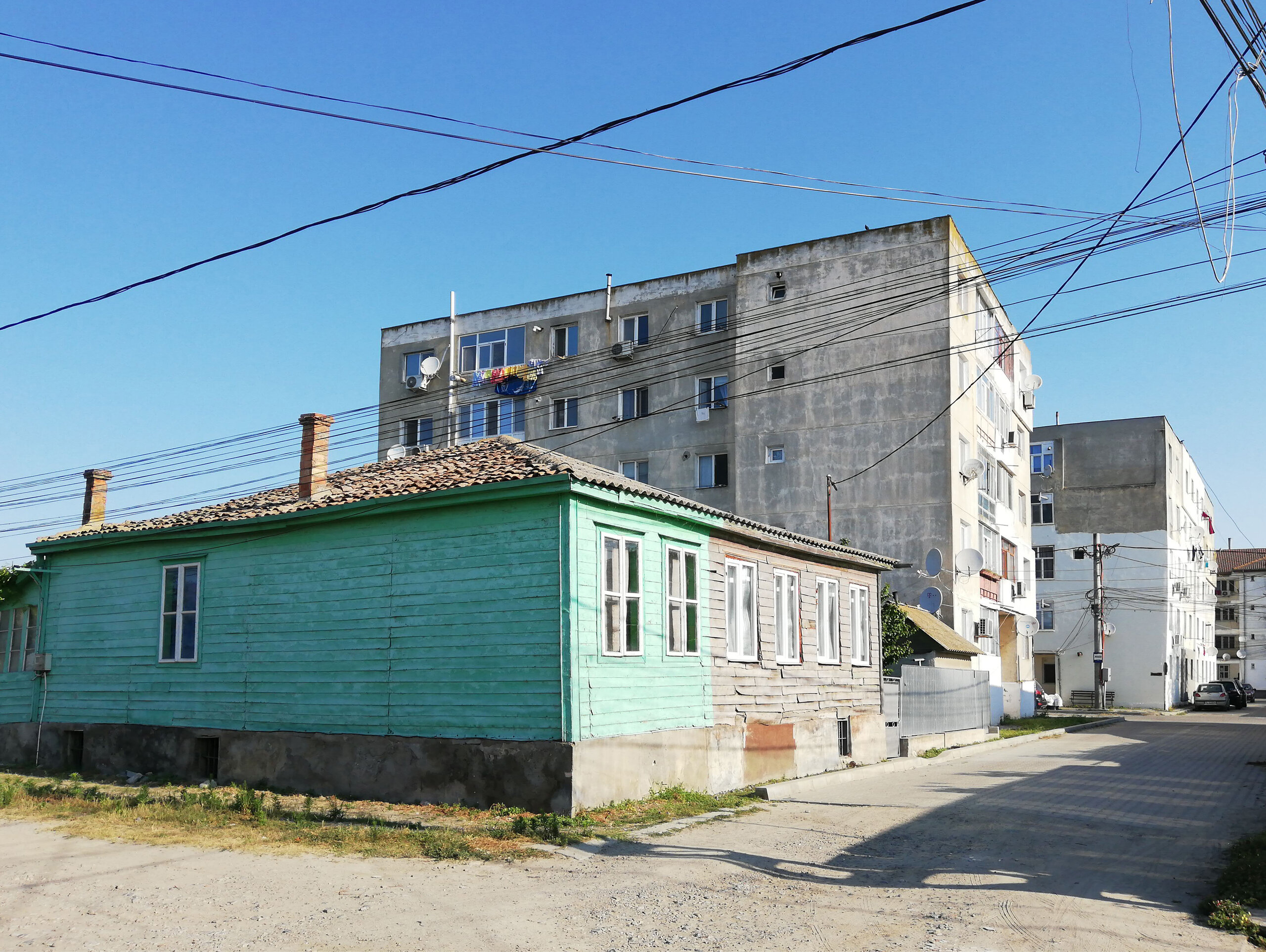
From this time until the beginning of the 20th century, Sulina was the site of a valuable and unique collection of buildings, including residential buildings with shops on the ground floor, oriental-style houses in caplama, with sacnazios and colonial villas belonging to CED officials.
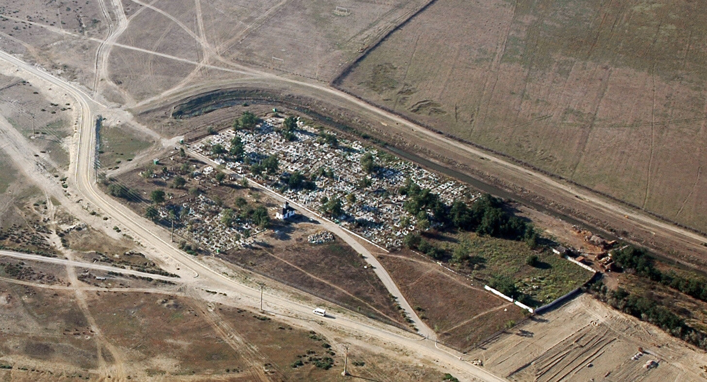
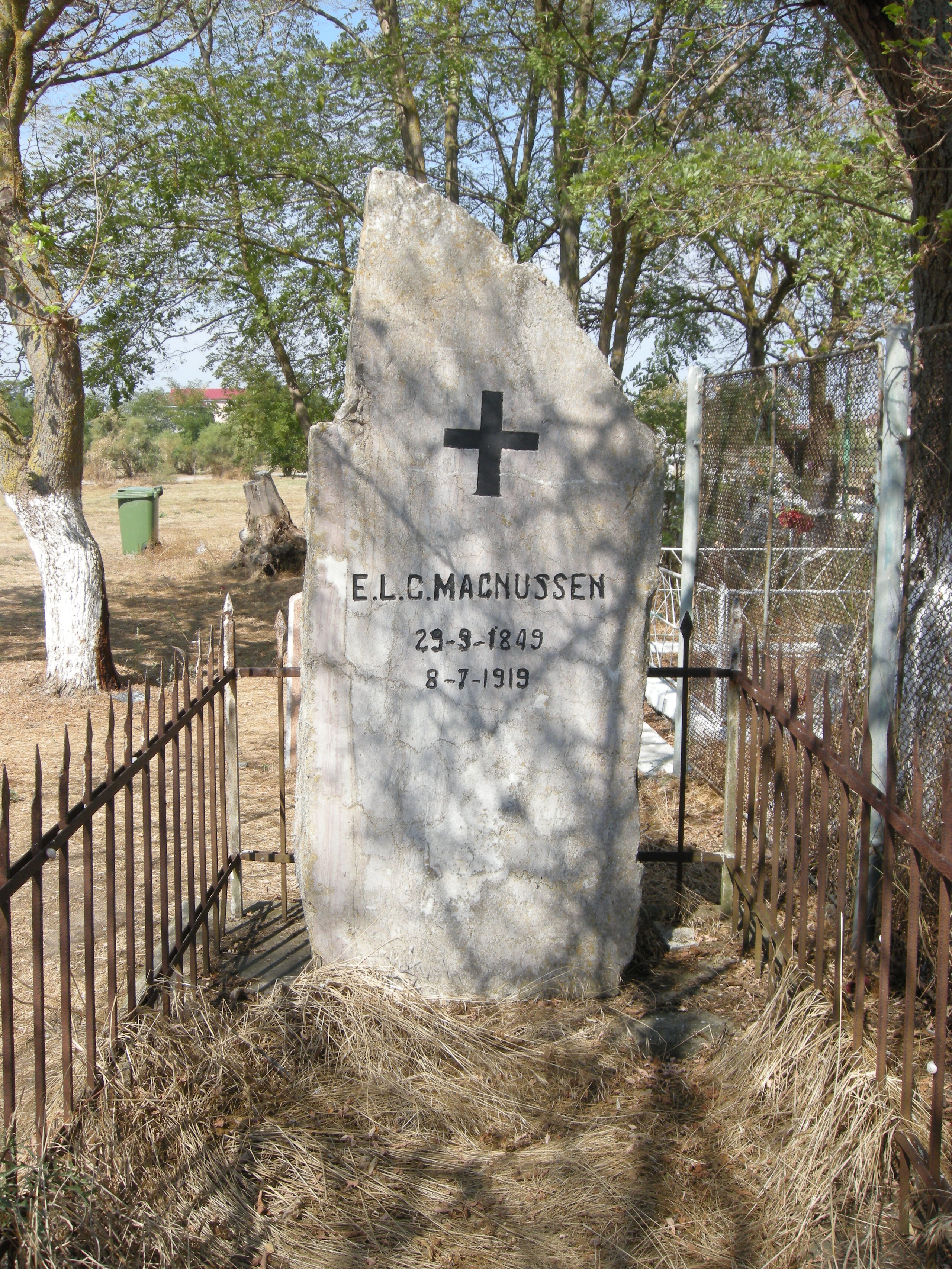
In 1864, the CED cemetery - Catholic, Protestant and Orthodox - was laid out on the sandy beach, towards the sea, on the site of the old cemetery of thesettlement. In 1871, a Muslim cemetery was opened next to the cemetery, and at the end of the 19th century a Jewish cemetery. In the first decades of the 20th century, the large Lipovan community, newly settled in Sulina, opened its own cemetery. In the CED cemetery in Sulina, along with other prominent people, is buried the Dane Magnussen7, chief engineer of the CED from 1907-1919.
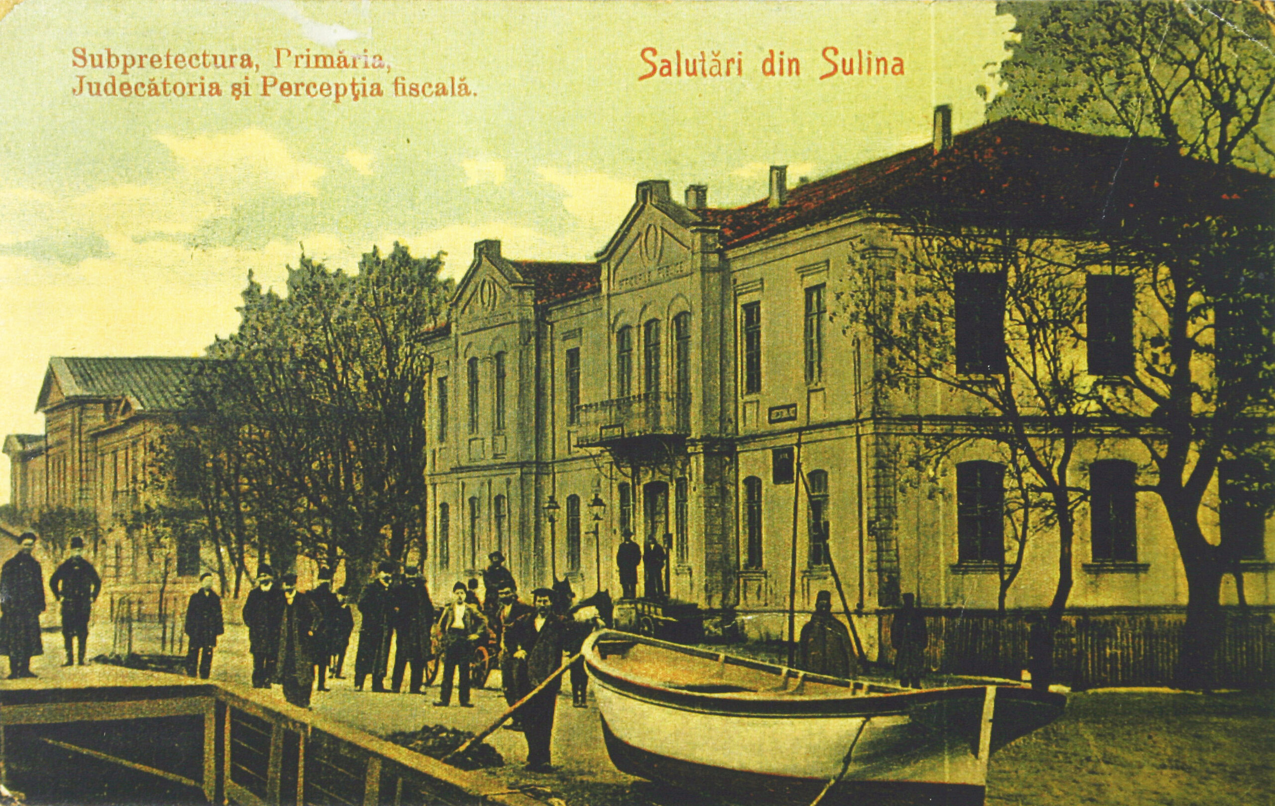
Sulina again became a battleground in the Russo-Turkish War of 1877-1878, and suffered extensive destruction. The San Stefano peace preliminaries, signed by Russia and Turkey in February 1878, confirm the prerogatives of the EDC, thus preserving the city's prosperity. Following the Treaty of Berlin in July 1878, Sulina becomes Romanian territory and Romania becomes a member of the EDC. On 18 November 1878, the "Regulation for the administrative organization of Dobrogea" established the counties of Tulcea and Constanța. The Sulina Plasa is established in Tulcea County, which includes Caraorman, Satu Nou, Sfiștofca, Sf. Gheorghe, Insula Șerpilor and Sulina - the residence of the sub-prefecture. In Sulina are built administrative seats for the new Romanian authorities: town hall, prefecture, court, tax office, customs, police. At the first Romanian census in 1880, Sulina had 2 875 inhabitants, excluding the "floating inhabitants": 1 653 Greeks, 150 Romanians, 155 Russians, 250 Turks and 15 Lipovans.
It is worthmentioning an event that was to influence the fate of Sulina. In 1860, the Constanta - Cernavodă railroad was put into service and, together with Dobrogea, was incorporated into Romanian territory on October 20, 18788. It was at this time that rail transport began to compete strongly with water transport, favoring the development of the Port of Constanta to the detriment of Sulina. However, the CED continues the extensive dyking works to ensure navigability at Gura Sulina, initiated by Charles Hartley.
The town continues to develop. In 1883, the Greek school is built in the Greek churchyard. In 1892 an Armenian church was built, now gone. A year later, the CED built a pavilion hospital for infectious diseases on the beach outside the town. In 1895, the British Seamen's Institute, later known as the Naval Military Circle, was established on I Street, on the quayside, next to the Anglican Church, in the old Turkish barracks building, with CED subsidies.
In 1894, King Carol I visited Sulina on the occasion of the inauguration of the newest section of the Sulina Canal, obtained by cutting the second loop, downstream, of the "Big M". This major moment in the CED's activity was marked by the erection of the obelisk at Mile 18, near the village of Crișan. In 1895, Sulina had a population of 4,500 (2,400 Greeks, 450 Romanians, 450 Russians, 450 Russians, 115 Armenians, 200 Turks, 230 Jews, 230 Jews, 60 Bulgarians, 350 Germans), with 2,000 "flotanti" (floating inhabitants). At the end of the 19th century, the CED built the lighthouses on the northern and southern breakwaters.
The Camberi Hotel, the town's emblematic building, is built on the quays.
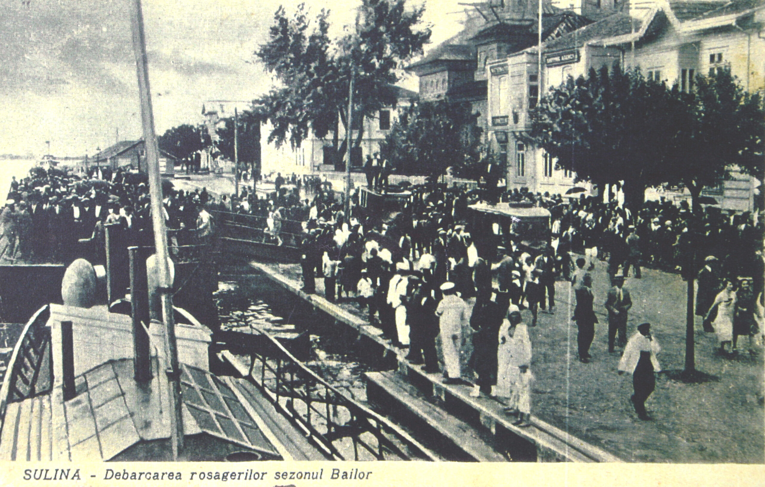
The establishment of the "National House" promotes seaside and holiday tourism. The beach is laid out. Children's camps are organized.
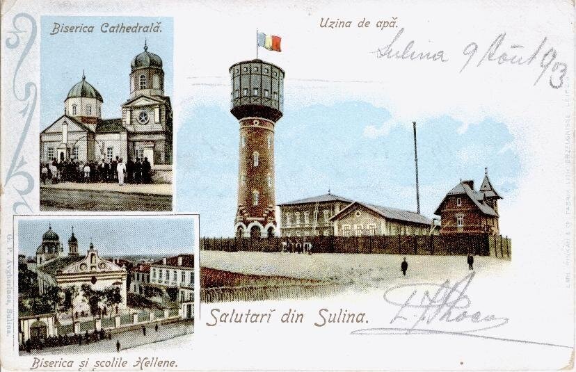
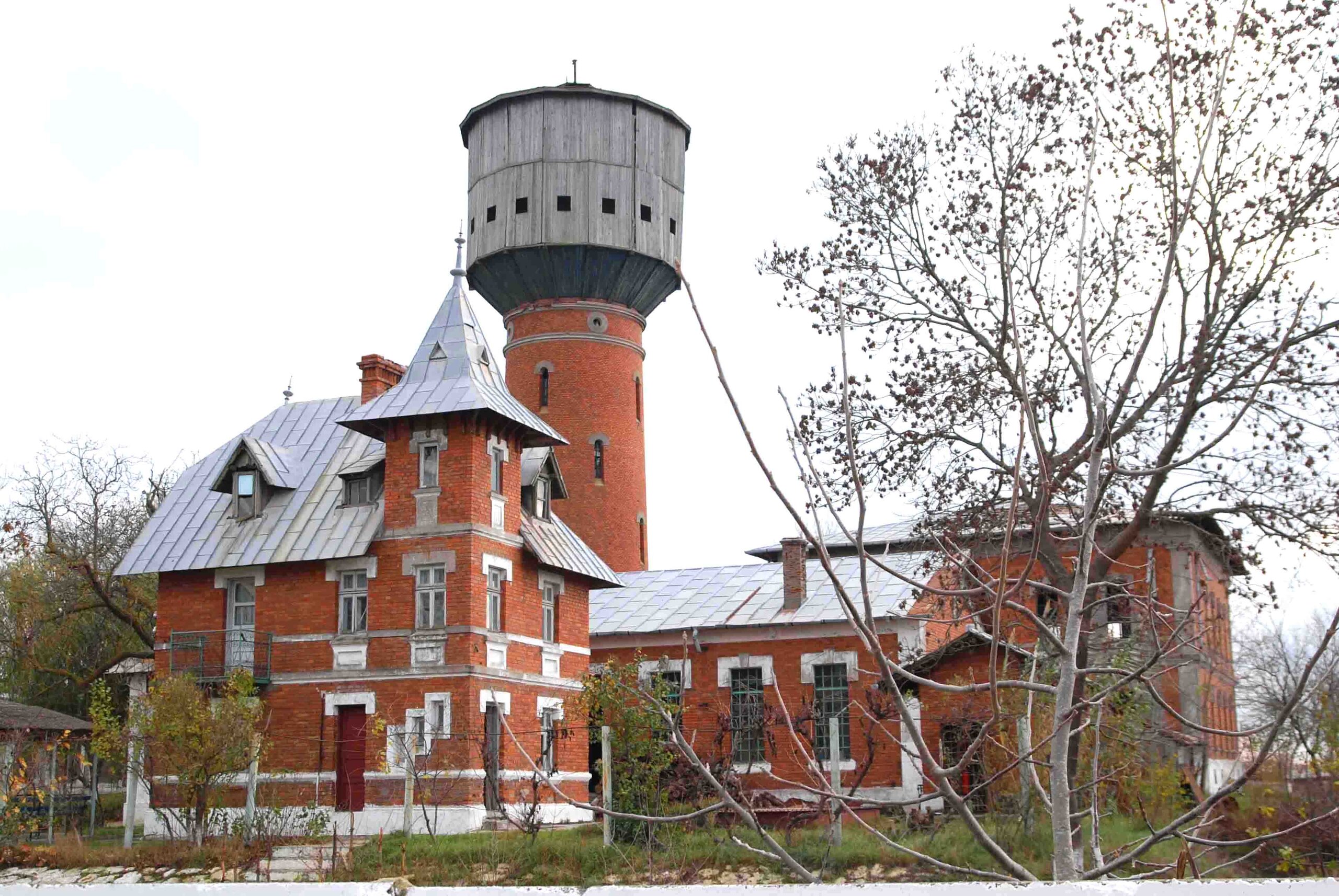
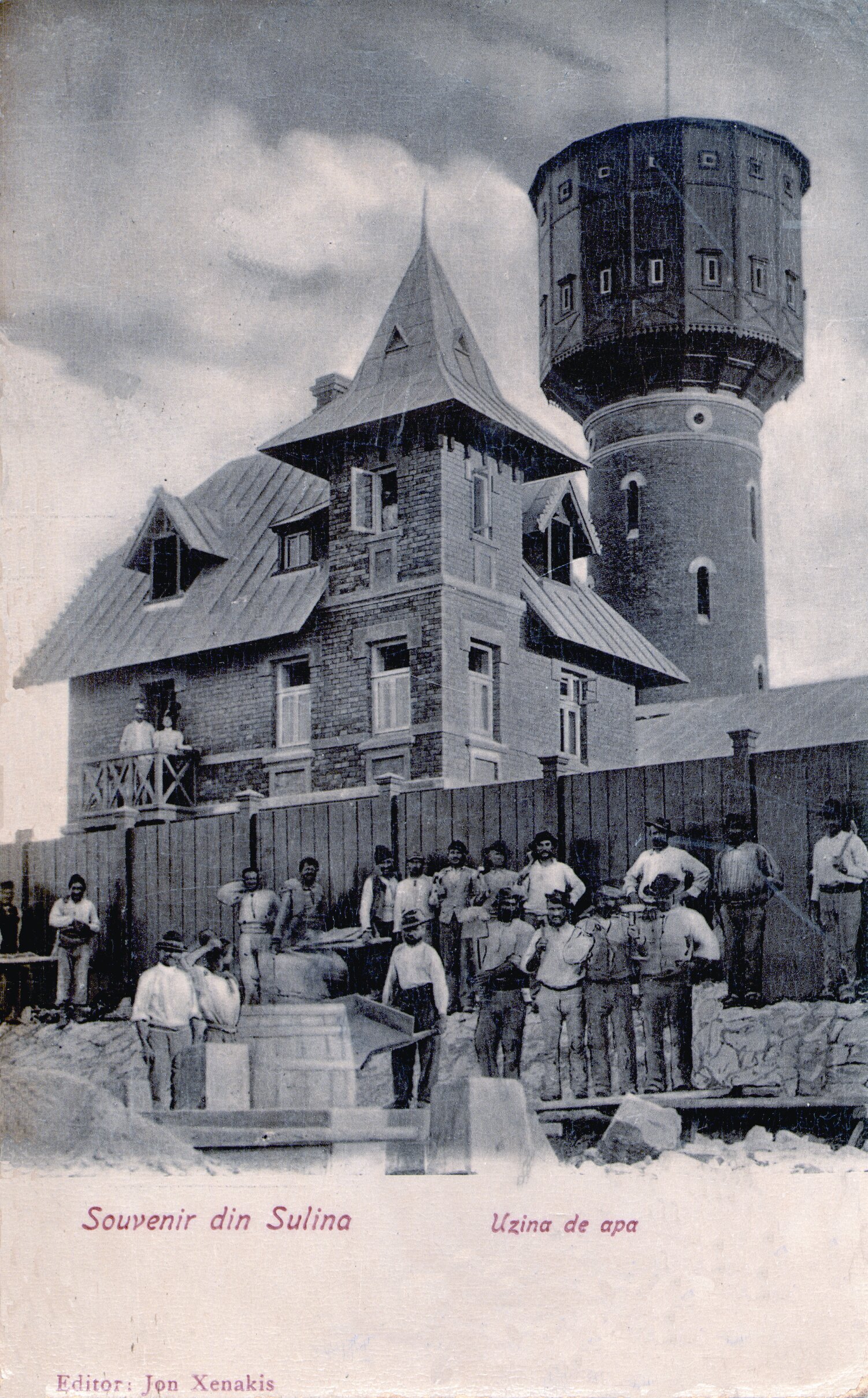
An important moment in the establishment of themodern town was the construction of the Waterworks and the town's water supply network, based on a Ministry of Public Works project signed by the architect Florian Gr. Pantelly9 and the engineer C. M. Vasilescu. The Waterworks was completed in 1903.
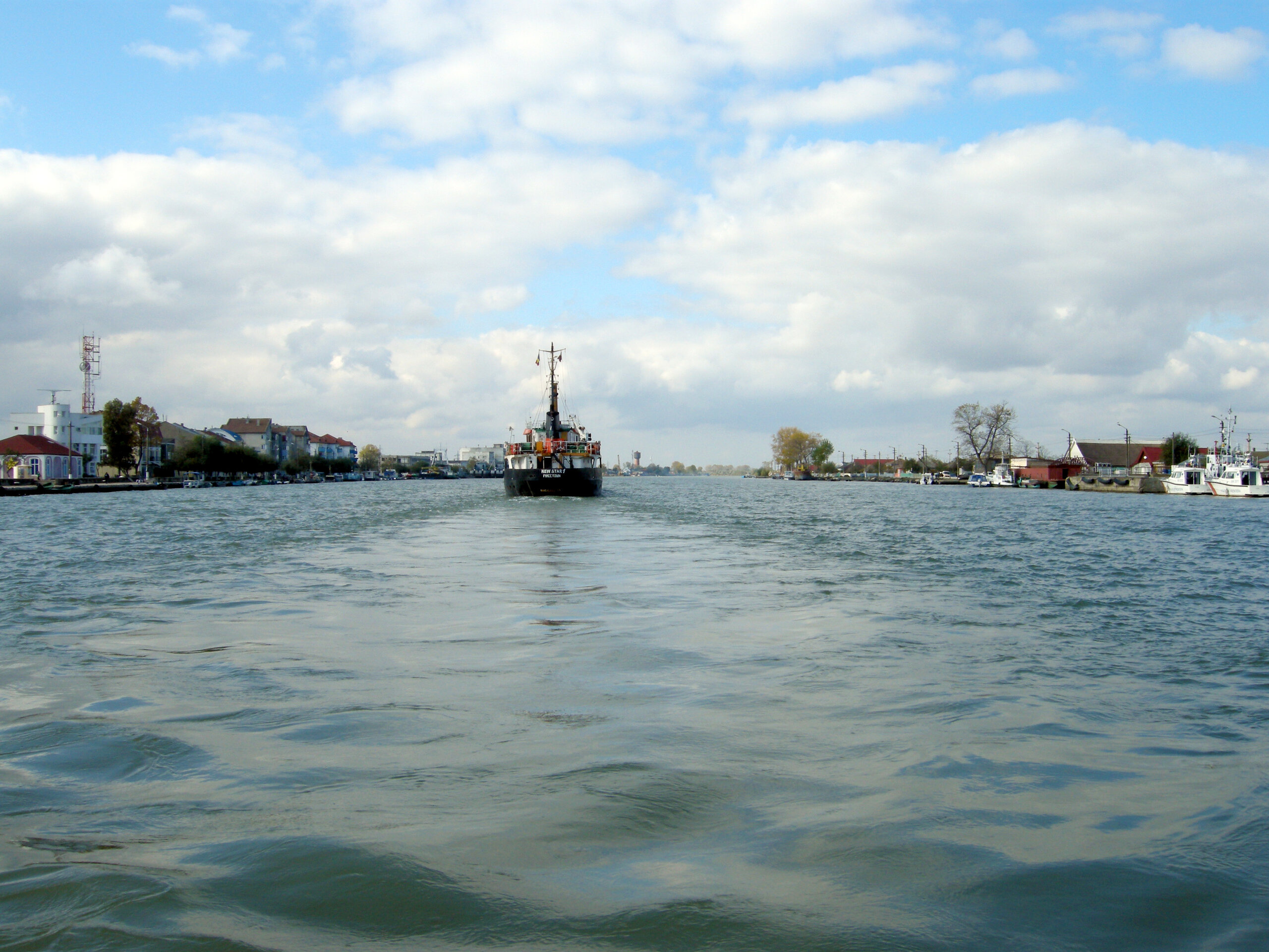
It was located on the right bank of the Danube, west of the city, more than a kilometer away from it (at that time), and consisted of the Water Tower, the Machine House, the Filter House, the former residence of the chief engineer and a sanitary annex. CED constantly contributed funds to the realization and later to the maintenance and extension of the drinking water supply system of Sulina and the Waterworks. The plant is still in operation today, expanding and modernizing, but retaining its historic core from 1903, representing a significant example of early 20th century industrial architecture. Located at the entrance to Sulina on the waterway, visible from the ship from a great distance, the Waterworks became an emblematic ensemble for the town.
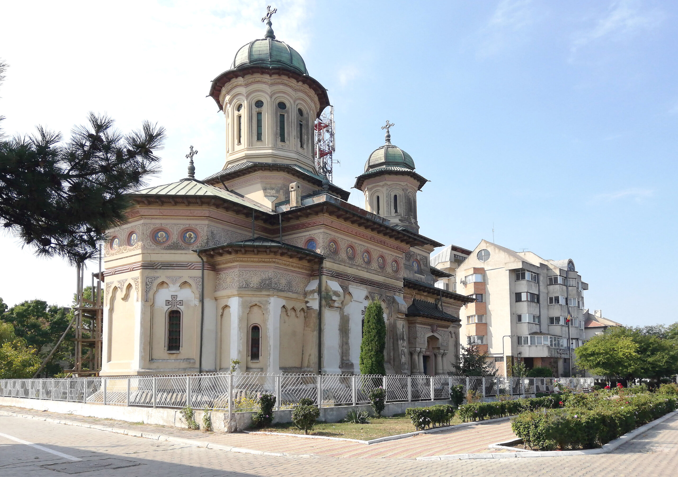
As early as 1878, the new authorities had decided to build a Romanian cathedral church dedicated to Saints Nicolae (patron saint of sailors and of all churches in Sulina) and Alexandru (on whose feast day, on August 30, 1877, the Grivița Redoubt was conquered). In the spring of 1899, the land on which the cathedral was to be built was purchased. The location was very well chosen: overlooking the Danube, on the quay, in the immediate vicinity of the Sulina administrative palace, which housed the town hall, the sub-prefecture, the court, the court of justice and the tax office, and the CED Palace. The cathedral was designed in neo-Romanesque style by the architect Nicolae C. Mihăescu10. Construction work began in 1910.
The year 1900 can be considered as the peak of Sulina's prosperity. The town was flourishing, even though the river trade was already being strongly competed by the railroad trade to the port of Constanta. In 1900, Sulina had a population of 5 611: 2 065 Greeks, 803 Romanians, 594 Russians, 404 Armenians, 268 Turks, 211 Austro-Hungarians, 173 Jews, 140 Kosovars and Montenegrins, 45 Italians, plus CED staff. It is the residence of the vice-consuls of Italy, England, Holland, Sweden, Norway and Austro-Hungary, and of the agencies of the trade houses of Brăila and Galati. Over 6,000 ships and steamships pass through Gura Sulina every year11.
During the First World War the town was deserted. Russian troops are stationed in Sulina, vandalizing the Armenian church and the Turkish buoy. The CED infectious diseases hospital is destroyed. After the war great efforts are made to return to a prosperous life. The CED rebuilds the Infectious Diseases Hospital, carries out extensive work to extend and strengthen the embankments, and opens the deep-sea canal, which allows access for cargo loading by large vessels. With funds received from the Romanian Government and the CED, the town's water supply system is rebuilt.
In 1932, the Romanian authorities revoked Sulina's porto-franco privilege, and in August 1938, following the Sinaia Agreement, the main tasks of the CED - technical works, pilotage, collection of navigation fees - were taken over by the Romanian state, through the newly-established Maritime Danube Directorate.
The Second World War brought great destruction to the city. In 1941 it was bombed. The Anglican church was destroyed and the Orthodox cathedral badly damaged. During the war, the CED Palace became the headquarters of the German military command, making Sulina a target. The bombing on August 25, 1944 was devastating, damaging over 60% of the city's built stock. Subsequent attempts to revive the town by transforming it into a tourist and spa resort, which began in the early 20th century, were severely distorted by the huge losses suffered during the Second World War. Immediately after the war, in the absence of international trade, the town was isolated and depopulated. In 1948, Sulina had 3 373 inhabitants.
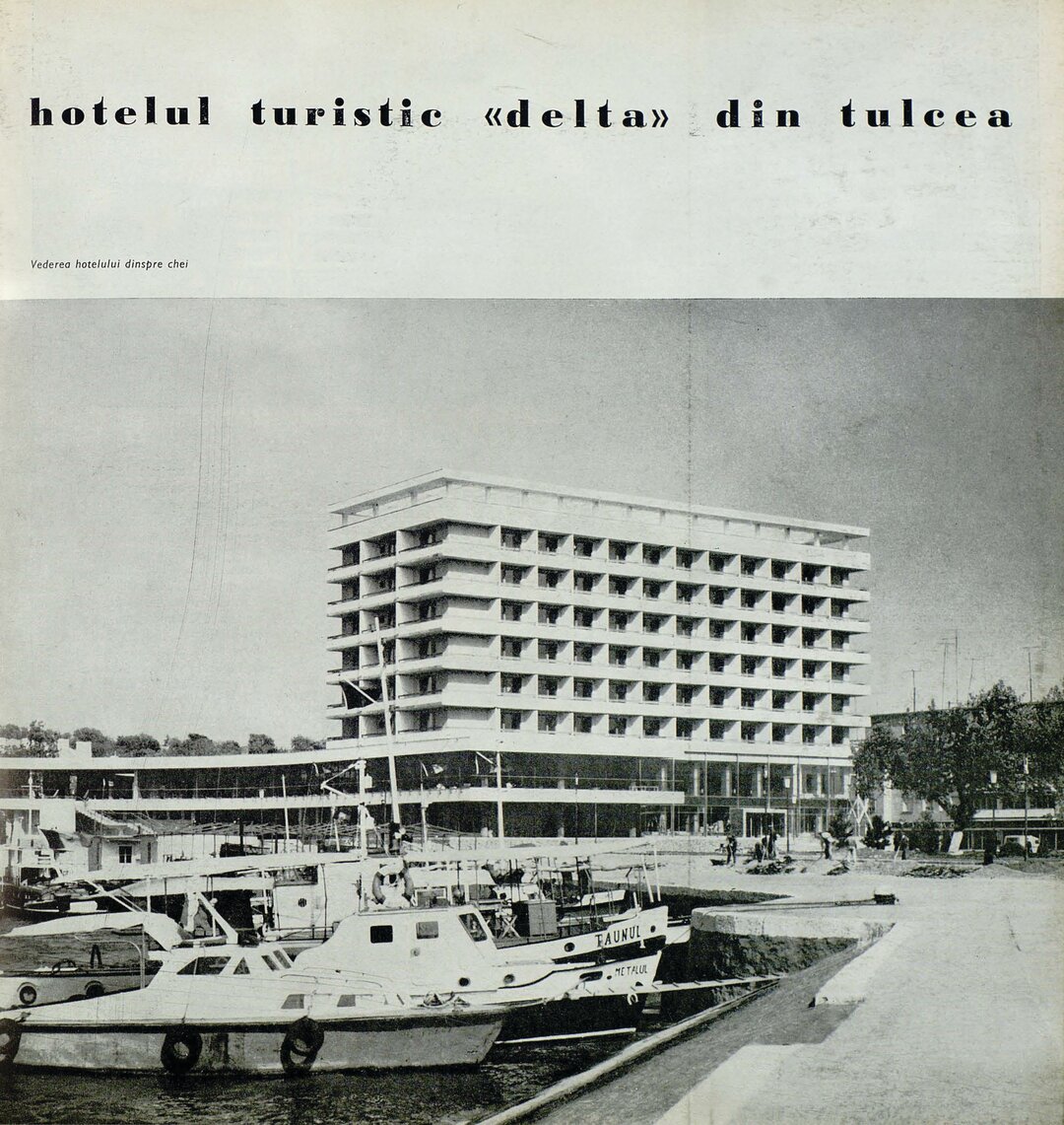
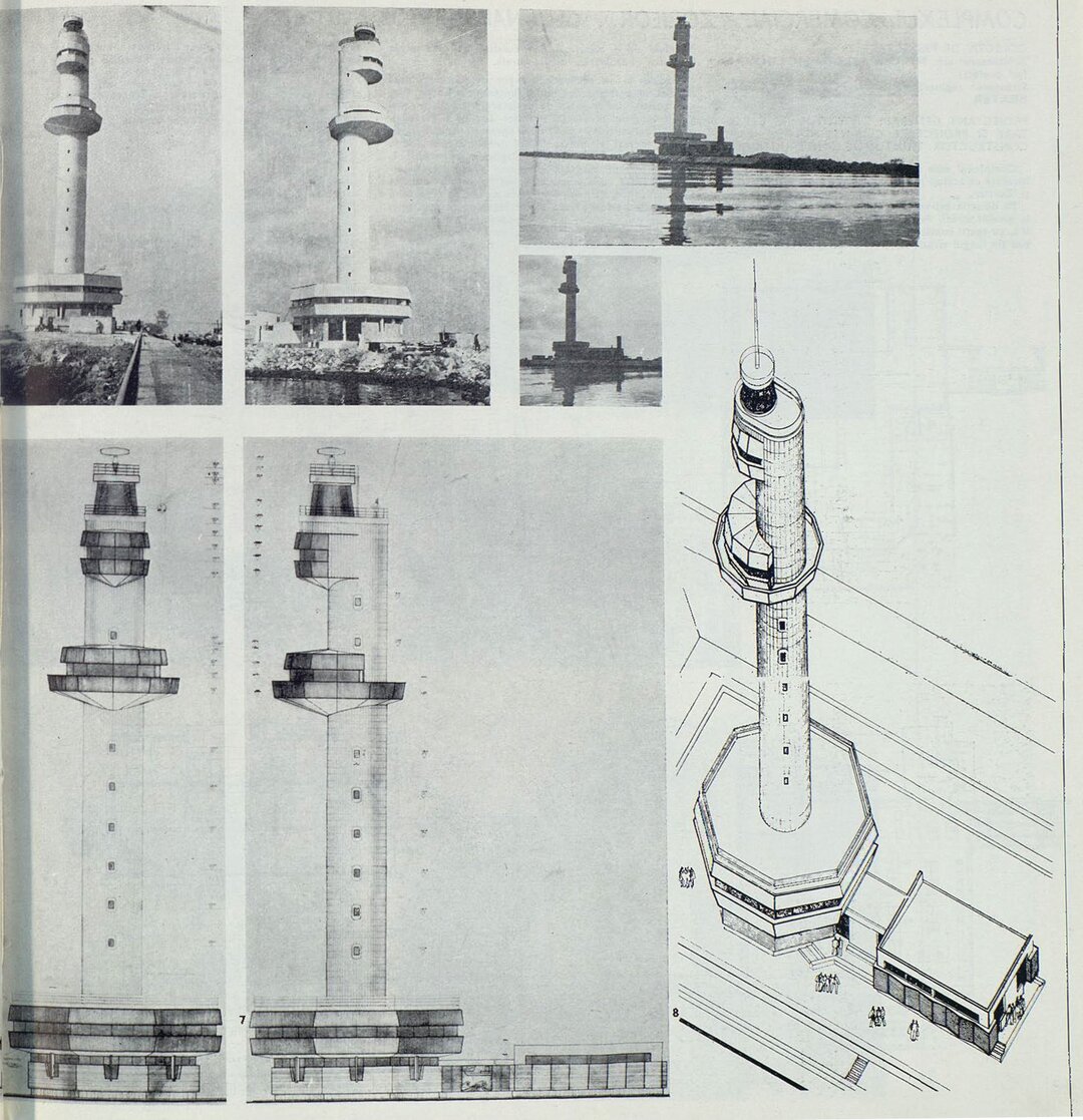
In the following decades, the town grew in terms of population, so that in 1989 Sulina had more than 5,000 inhabitants. The town is densifying, without increasing in surface area, filling the wounds caused by the bombing. The socialist policy of socio-economic development, insufficiently nuanced, aimed to counter the post-war decline and depopulation of Sulina. The following were built: the Lower Danube River Administration's ship repair workshop and offshore lighthouse (1954), the small and large port basins, the fish cannery, the cold store, a fishing gear repair workshop, a general store, a cinema (1957) and the Black Sea restaurant. In two phases, 1965 and 1970-1974, mainly on the land left vacant after the war bombings, denying the historical plot, ground-floor and 4-storey blocks were built, too high for the sandy soil on which they were located and into which they slowly sank. Between 1986 and 1989, a front of old buildings on the quayside on I Street is replaced by new 4-storey blocks.
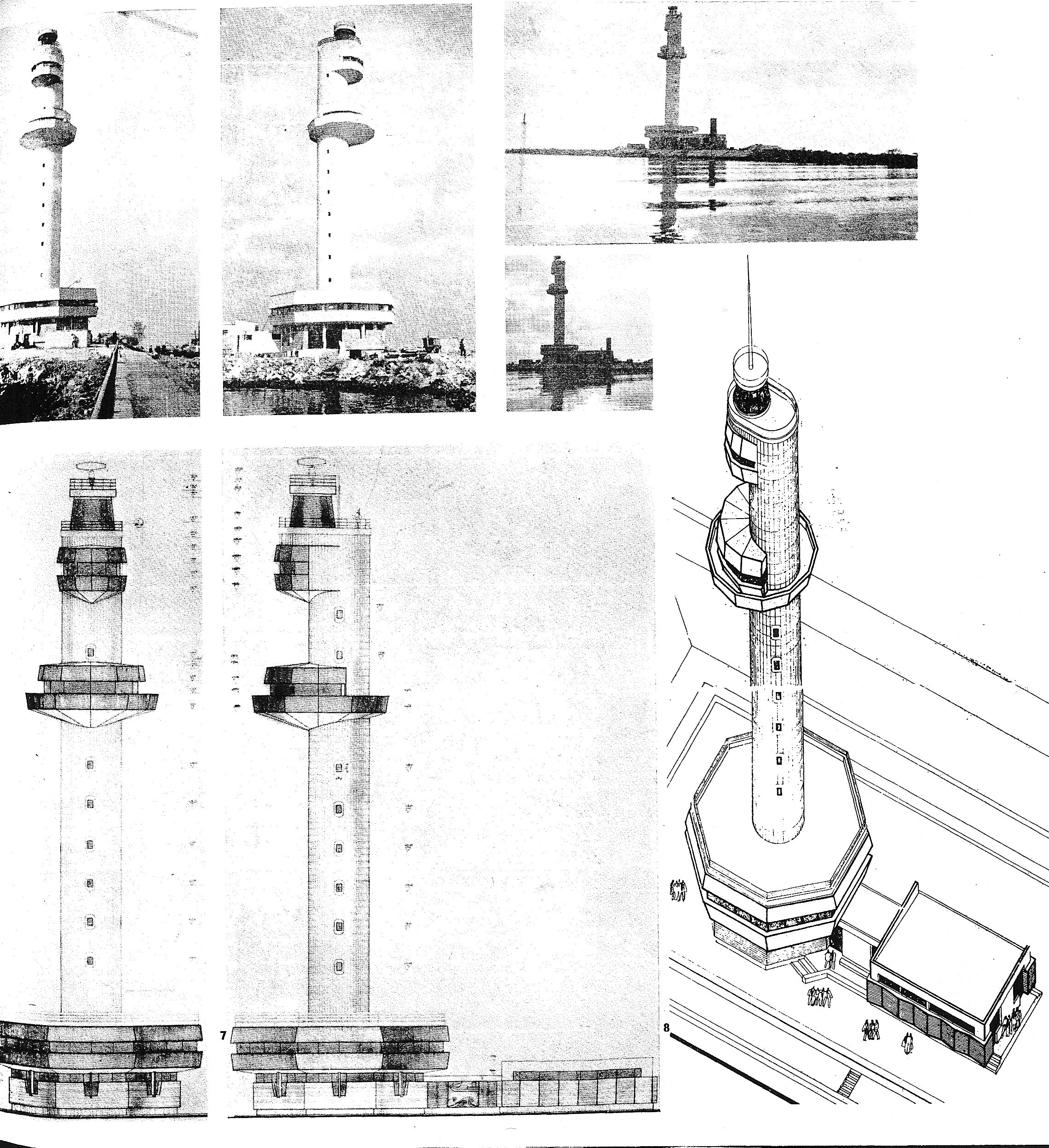
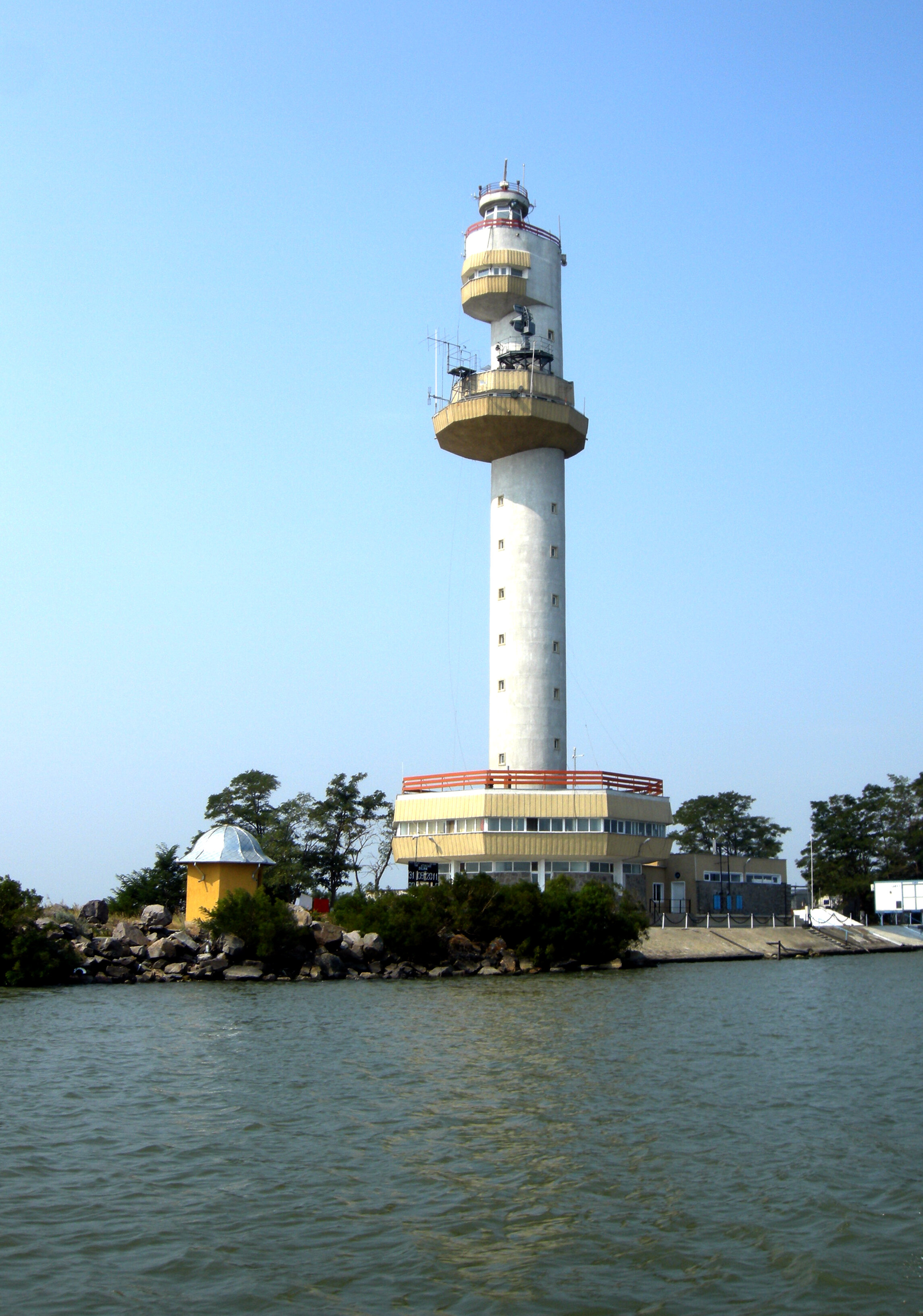
Two notable achievements are due to this period. The offshore lighthouse, built in the early 1980s by the Lower Danube River Administration, replacing the lighthouse erected in 1954, located 9 km offshore. It is designed by architect Ileana Luscov, the general designer being the Institute of Automotive, Naval and Air Transportation Projects - IPTANA - Construction Section. An architectural solution with aesthetic, plastic and dynamic qualities was sought. "The white, shining silhouette, the monumentality (...) creates a singular accent in the area where the Danube meets the Black Sea, constituting both a notable technical achievement and a point of tourist interest, personalizing the port area of Sulina."12
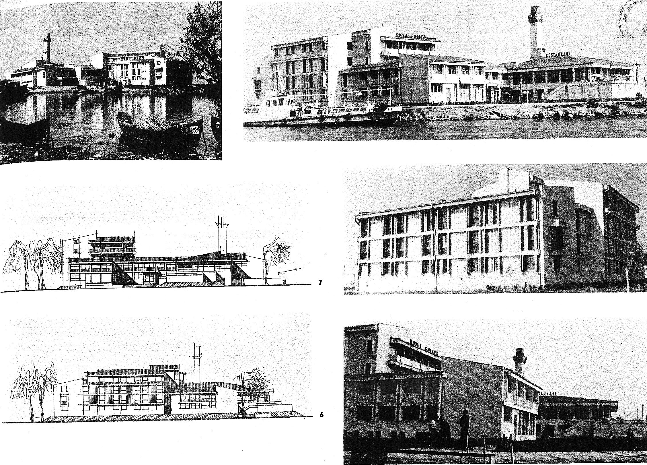
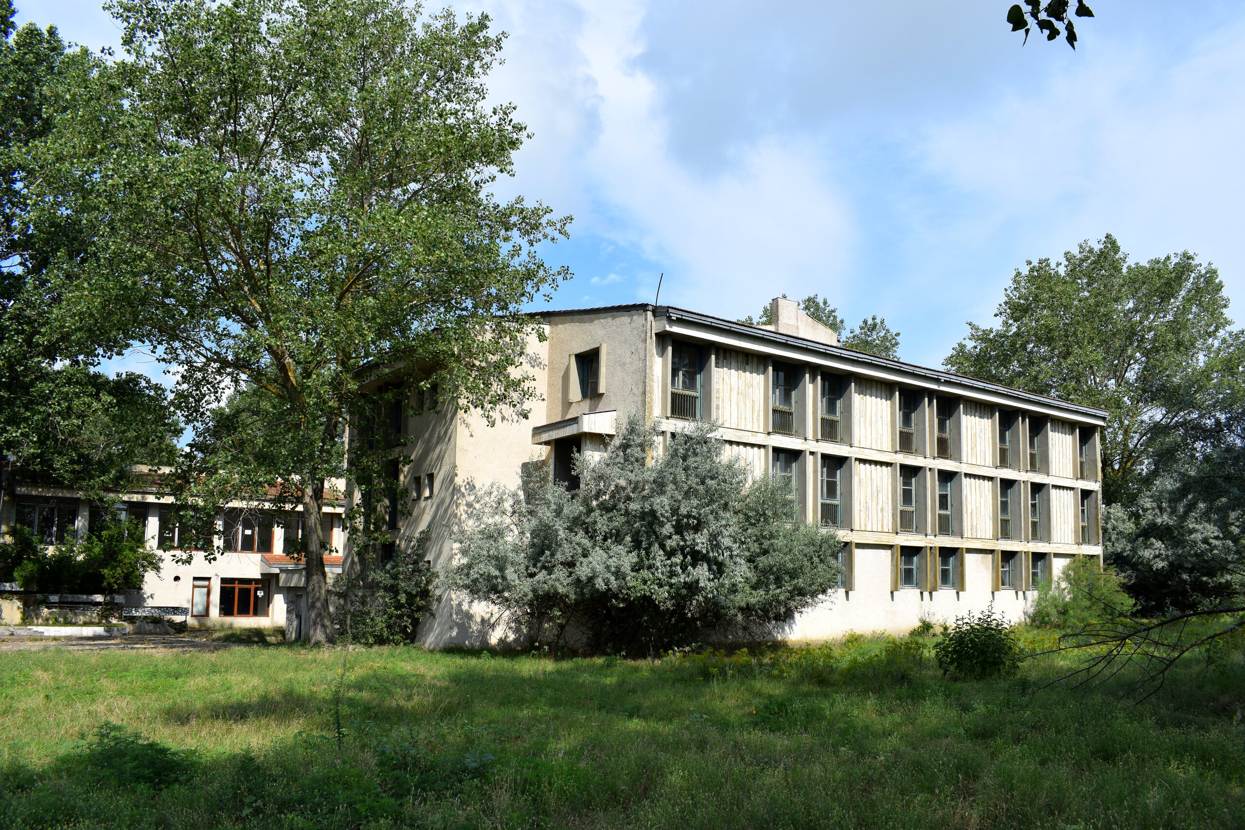
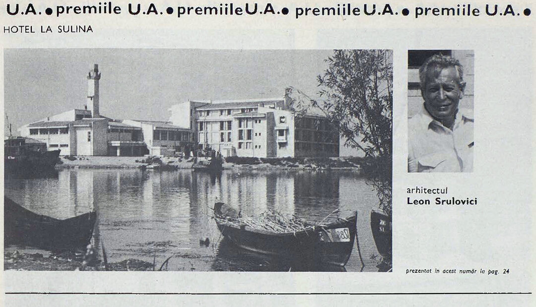
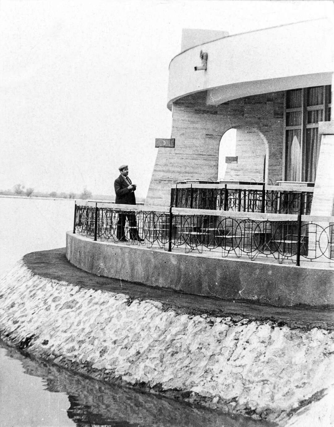
In 1985, the Union of Architects' Prize was awarded to the work "Hotel la Sulina", architect Leon Srulovici, general designer ISLGC Bucharest, known as the Youth Hotel, a marvelously integrated realization in the landscape, for which the designers extended eastwards the strip of land separating the Sulina Canal from the small basin, used for small boats, at the eastern end of the city. The exceptional location, which enhances and is emphasized by the architectural creation, is described by the architect as follows: "A promontory, surrounded on three sides by the water of the bay for the return of passenger ships arriving at the river station, by that of the Danube and by the shimmering harbor basin for pleasure craft"13.
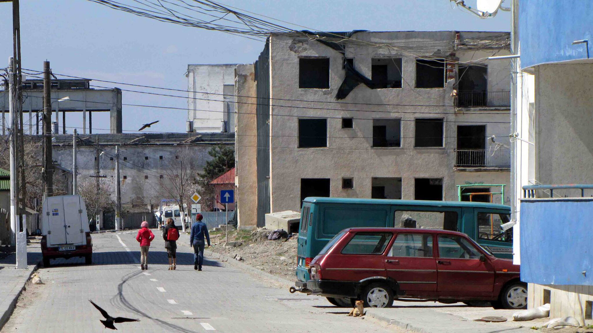
Since 1990 Sulina has been depopulated. While in 1992 there were 5,484 people living here, the 2011 census recorded 3,663 inhabitants, half the population of the town at the beginning of the 20th century. There is now a new confrontation with the abandonment of some public interest objectives, and implicitly with the physical abandonment of the buildings that enclose them. This situation is a serious problem which is causing a serious setback, both in terms of the general development of the settlement and in terms of its built heritage, including its extremely valuable historical heritage. The shipyard is gradually being closed down, the canning factory is being closed and many of the buildings erected during the socialist period are being demolished and abandoned, including the cinema built in 1957 and the Youth Hotel, which won the Union of Architects' Prize.
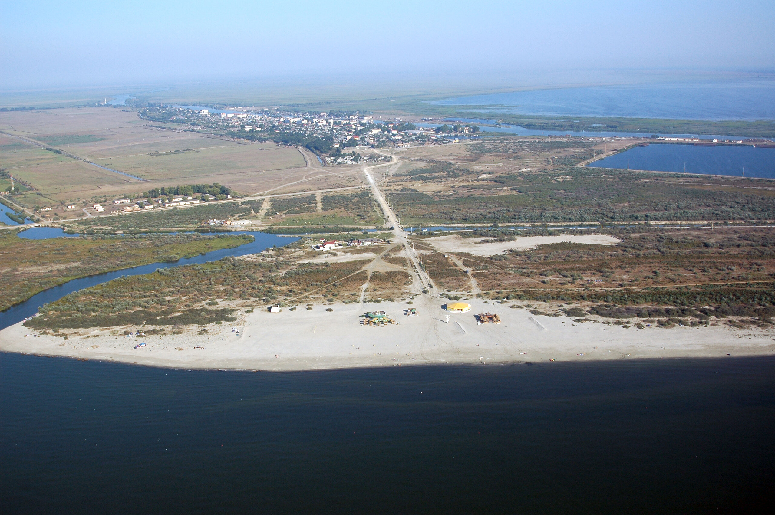
However, the city is expanding by subdividing and building on land to the east of the historic city, towards the sea, with many of the new buildings being built for tourism. It can be said that summer holiday tourism is today the main income-generating activity in Sulina.
Although the post-1990 period has brought a high recognition of the cultural and natural values of Sulina, through the promulgation of Law no. 345 of 6 July 2001 for the approval of Government Ordinance no. 125/2000 on the declaration of the city of Sulina, Tulcea County, and thesurroundingarea as an objective of national interest and the inclusion in the List of Historical Monuments of some sites, ensembles and historical monuments in the city, valuable historical buildings with complex cultural value, some classified as historical monuments, are abandoned or are in a very poor state of preservation. Among them: CED chief engineer's residence, CED workshops, the lighthouse on the CED south pier, the Camberi Hotel, the City Library. Some historical monuments have been restored: Parparia House, St. Nicholas Catholic Church, CED School, while others have been under construction for a long time: St. Nicholas and Alexander Orthodox Cathedral, CED Lighthouse, St. Nicholas Orthodox Church, St. Nicholas Greek Orthodox Church, and others are waiting for their turn: CED Cemetery, CED Palace, CED Villas, etc. The General Urban Plan of Sulina, approved in 2000 and extended in 2012, is currently being updated.
Sulina, where to?
NOTES
1 Georg Lauterer, Dutch navigator; led a commercial expedition on the Danube for the Austrian trading house Willeshofen in 1782; arrived in Sulina on August 7, 1782 and stayed until September 25.
2 Georg Lauterer, Description of the map of the Danube from Rusciuc to Sulina, made on the occasion of a shipment of goods for the House of Willeshofen, together with other accounts of this voyage (1782), in Călători străini despre Țările Române, vol. X, Part I, Ed. Academiei Române, Bucharest, 2000, pp. 329-330.
3 Romanian Geographical Society, The Great Geographical Dictionary of Romania, Vol. V, Bucharest, 1902, p. 63.
4 Ed. Engelhardt (1828-1916), French physician and diplomat, French consul in Galati, chief physician, then director of the Hospital Service in the CED (1857-1858), from 1864 - French commissioner in the CED.
5 Ed. Engelhardt, Etudes sur les embouchures du Danube, Galați, 1863, pp. 52-53.
6 Sir Charles Augustus Hartley (February 3, 1825 - February 20, 1915), English engineer, in construction and hydro-engineering for harbors and estuaries and in railway construction; chief engineer of the CED (1856-1872), then consulting engineer to the CED (1872-1902); member of the committee appointed by the US Congress to ensure navigability in the Mississippi Delta (1875); member of the International Technical Commission for the widening of the Suez Canal (1884); consultant for the development and modernization of the ports of Odessa, Trieste, Constanta, Burgas, Varna, Durban.
7 Eugène Leopold Claudi Claudi Magnussen (September 29, 1849 - July 8, 1919), Danish engineer; in 1875, on completing his studies, he accepted an invitation from the Dane Karl Henrich Leopold Kühl (1844-1906), then chief engineer of the CED, to join the CED's technical staff in Sulina (Kühl was Hartley's successor as head of the CED's Technical Service); from 1907 he succeeded Kühl, becoming chief engineer of CED, until his death in 1919; he is buried in the cemetery of Sulina.
8 Toader Popescu, The Romanian Railway Project, Simetria, Bucharest, 2014, p. 244.
9 Florian Gr. Pantelly (1858, Bucharest - 1935) Romanian architect and engineer; studied at the Institute of Mathematics in Zurich, then at the Polytechnic; studied architecture at the Academy of Fine Arts in Liege (1883-1891); architect at the Ministry of Public Works (1892-1898), at the Ministry of Domains (1889-1901), at the Ministry of the Interior, Sanitary Section (1907-1911, 1913-1918); architect at the Constanța Region (1918-1924); he is the author of the Sulina Waterworks and the drinking water collector with staff housing in Bucharest; he designed railway stations: Craiova - Calafat, Pitesti - Curtea de Argeș, Targoviste - Pucioasa, Galati - Barlad, Tg. Ocna - Palanca, Comănești.
10 Nicolae C. Mihăescu (March 3, 1863, Târgoviște - December 20, 1934, Bucharest) Romanian architect; studied at the School of Bridges and Roads in Bucharest and at the School of Fine Arts in Paris; architect, restorer and professor at the School of Architecture (1898-1934); main works: Palace of the Ministry of Cults and Arts, today the Ministry of Education and Research, Synodal Palace of Antim Monastery in Bucharest, Palace of the Society of Public Servants in Victoriei Square in Bucharest (now disappeared), Court and Commercial School in Targoviste, Court in Giurgiu, Cathedral in Drăgășani, Bradu - Boteanu Church in Bucharest.
11 Romanian Geographical Society, The Great Geographical Dictionary of Romania, Vol. V, Ed. SOCEC, Bucharest, 1902.
12 Arh. Ileana Luscov, Lighthouse at Sulina, Arhitectura magazine no. 2/1984, p. 14.
13 Arh. Leon Srulovici, Hotel la Sulina, Arhitectura magazine no. 1/1987, p. 24.
Bibliography
Bey, Voisin, Notice sur les travaux d'amelioration de l'Embouchure du Danube et Bras de Soulina 1857-1891, Paris, 1893
Bubulete, Doina, Filip, Anca, Studiu istoric general pentru fundamentarea reactualizăriiPUG orașului Sulina, 2012 (unpublished)
CED, Projets pour l'amelioration de la navigabilite de Bas-Danube, Leipzig, 1858
CED, Plans comparatifs de l'Embouchure et de differentes sections fluviales du Bras de Soulina, Litografia F. A. Brockhaus, Leipzig, 1867
CED, Memoire sur l'achevement des travaux d'amelioration executes aux Embouchures du Danube par la Commission Europeenne, Galați, 1867
CED, Memoire sur l'achevement des travaux d'amélioration executes aux Embouchures du Danube par la Commission Europeenne, Leipzig, 1873
CED, Cartes du Delta du Danube et plans comparatives de l'Embouchure et des sections fluviales du Bras de Soulina, Litografia F.A. Brockhaus, Leipzig, 1887
Constantinescu, Anghel, Monografia Sfintei Episcopii a "Dunărei de Jos", Ed. Atelierele SOCEC, Bucharest, 1906
Curelaru, Vicențiu, Biserici grecești din Dobrogea în care se sluvljește astăzi, Thesis, Bucharest, 1995
Engelhardt, Ed., Etudes sur les embouchures du Danube, Galați, 1862
Filip, Anca, Uzina de apă din Sulina, in Buletinul Comisiei Monumentelor Istorice, Nr. 1-2, București, 2010
Filip, Anca, Arhitectura biserericii - expresie a afirmării identității cultural-religioasă în comunitățile multietnice. Case study: Sulina, in vol. Monumentul XI, Lucrările Simpozionului Național "Monumentul - Tradiție și viitor", 11th Edition, Iași, 2010
Gusti, Dimitrie, coord. II, Imprimeria Națională, Bucharest, 1938
Hartley, Charles Augustus, Description of the Delta of the Danube and of the Works, Recently Executed, at the Sulina Mouth, London, 1862
Hartley, Charles Augustus, Description of the Delta of the Danube and of the Works, Recently Executed at the Sulina Mouth, London, 1874
Hartley, Charles William Stewart, A Biography of Charles Hartley, Civil Engineer (1825-1915), the Father of the Danube, Vol. I, Ed. Edwin Mellen, UK, 1989
Ionescu, M. D. cpt., Dobrogia on the threshold of the 20th century, Bucharest, 1904
Lahovari, George Ioan, coord, Marele dicționar geografic al României, Vol. V, Ed. SOCEC, Bucharest, 1902
Răducu, Nicolae, 1856-2006, 150 years since the establishment of the European Danube Commission, Europolis-Sulina Rescue Project, 2006
Rosetti, Carlo, Rey, M. Francis, La Comission Europeene du Danube et son oevre de 1856 a 1931, Imprimerie Nationale, Paris, 1931
Stanciu, Ștefan, România și Comisia Europeană a Dunării - diplomație, suveranitate, cooperare internațională, Ed. Pax Aura Mundi, Galați, 2002
Stanciu, Ștefan, Duță, Alexandru, Traites, conventions et autres documents concernant le regime de la navigation du Danube maritime, Ed. Partener, Galați, 2009
Sturdza, Dimitrie A., Însemnătatea lucrărilor Comisiune Europeane dela Gurile Dunării 1856 la 1912, Bucharest, Leipzig, Vienna, 1913
Țeposu, Emil, Pușcariu, Valeriu, România balneară și turistică, Ed. Cartea Românească, Bucharest, 1932