Landscape
Promises
Three USAMV landscape design projects
The three diploma projects of the students of the Landscape Design specialization at USAMV Bucharest illustrate the complexity of a field that combines urban design with ecology, architecture with spatial planning, engineering with art, urban with territory. Thus, two of them approach the urban space from different perspectives, while the third focuses on the anonymous landscape of a periphery dominated by an unpredictable nature.
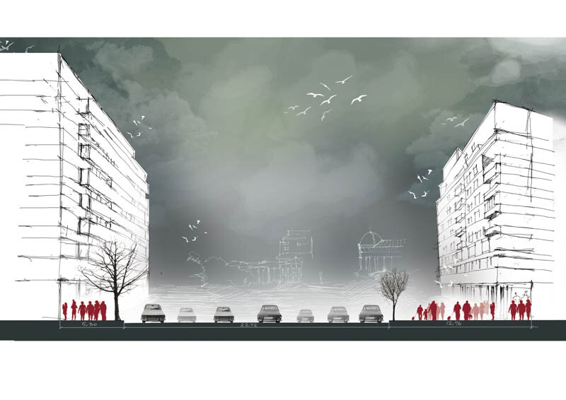
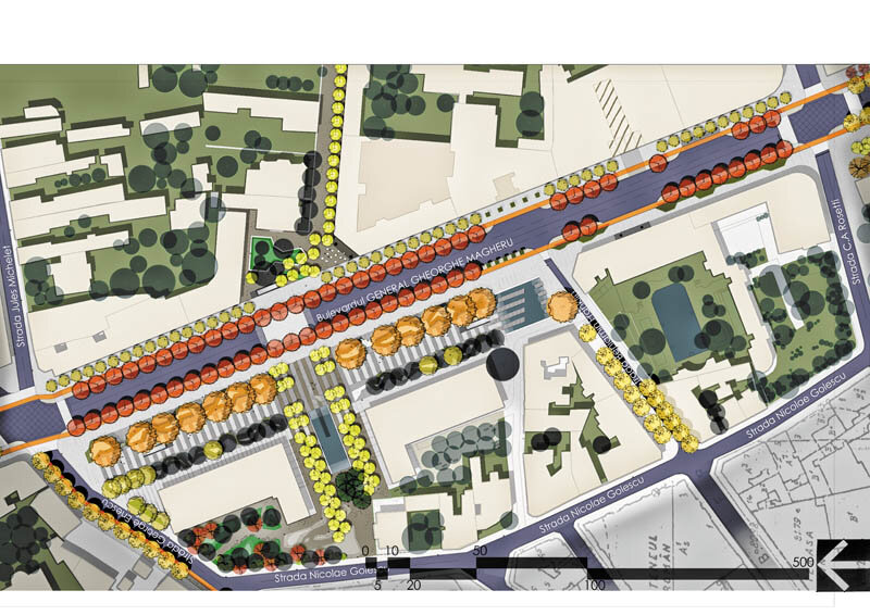
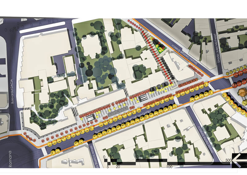
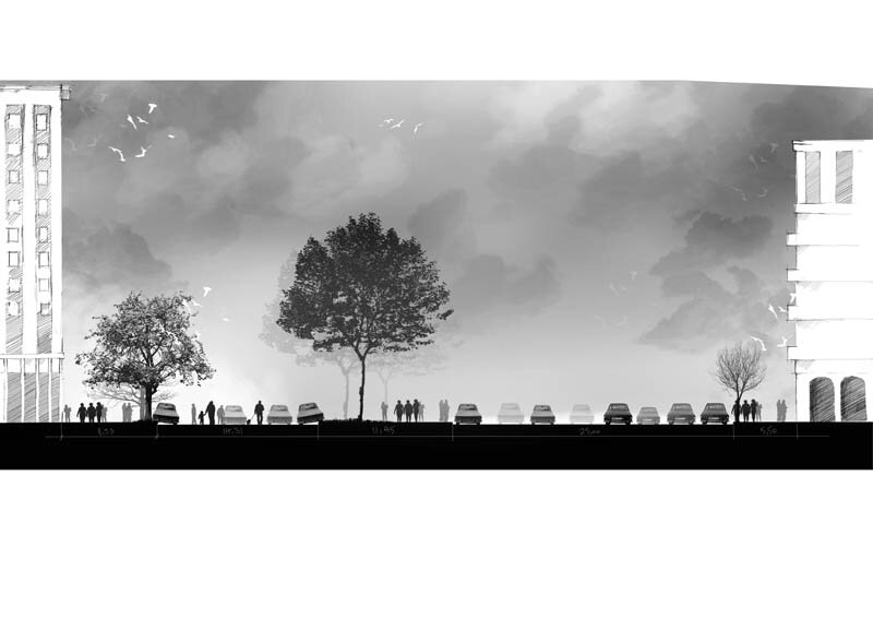
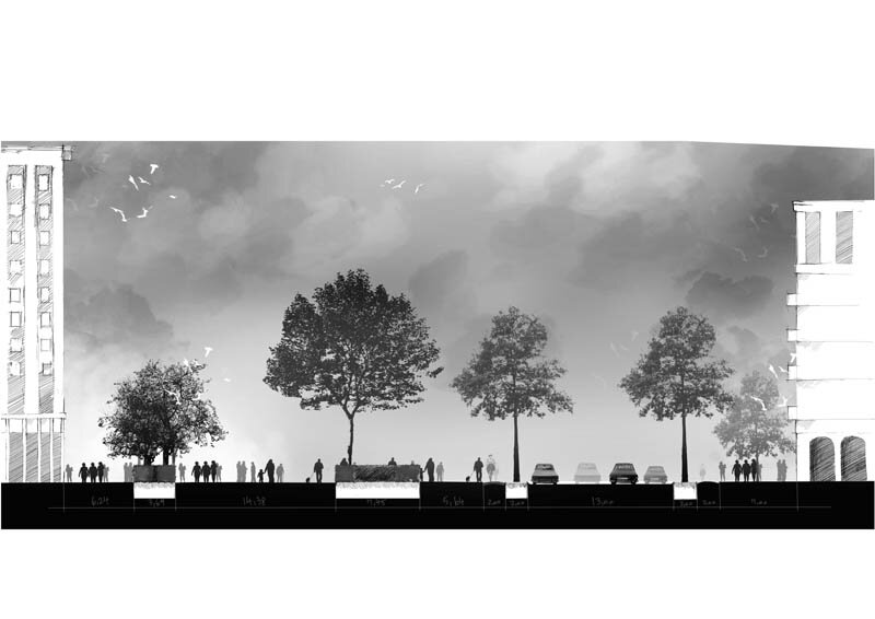
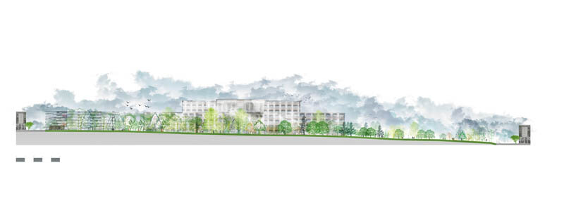
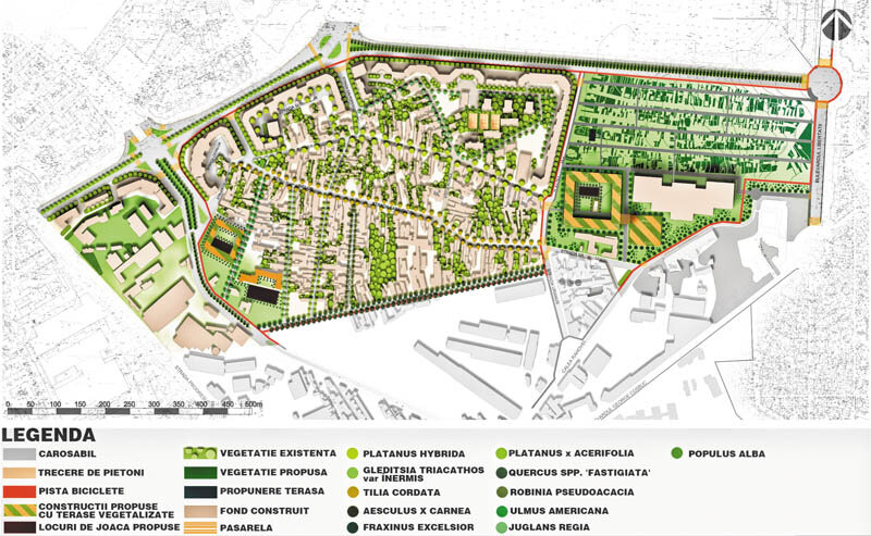
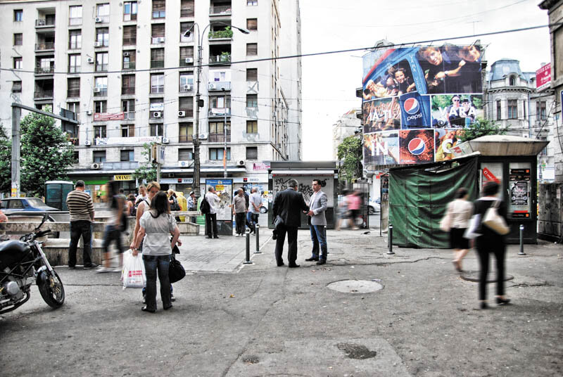
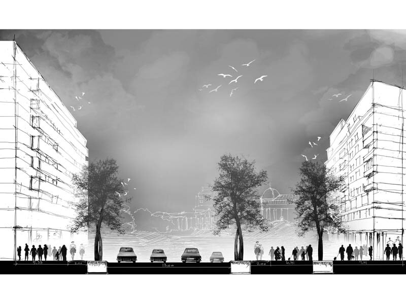
Oana Pîrvu's project initially started from the problem of redefining the north-south axis of Bucharest as an urban green axis. Analyses revealed a striking discrepancy between the degree of vegetalization of this axis and the intensity of social use of the space. Thus, the section between Roman Square and University Square, although it represents the central space of Bucharest, suffers in terms of quality and comfort. The presented project tackles in detail this linear center of the city, transforming it from a non-place of transit into a generous and offering space. The project concept is based on how people perceive urban space. Thus, the reconfiguration of the space is rethought as a succession of parallel planes addressing differentiated ways of perceiving space. The whole axis has been reconfigured in such a way as to discourage automobile traffic, all the more so as the breaking of the Buzești-Berzei axis is intended to take over the north-south axis (perhaps in this way the sacrifice of one of the most poetic slums of Bucharest can make sense in the eyes of the inhabitants). Along the axis, the different alignments of trees provide, in addition to shade and air, varying degrees of detail that cater to different planes and speeds of movement. Pavements and street furniture resize the space by emphasizing the vegetal and human spectacle, inviting to observe (and to be observed). Plant or mineral wallows, water surfaces (tangible, traversable, inviting), stabilized earth surfaces bring the forgotten landscapes of a garden city into the hurried life of the contemporary.

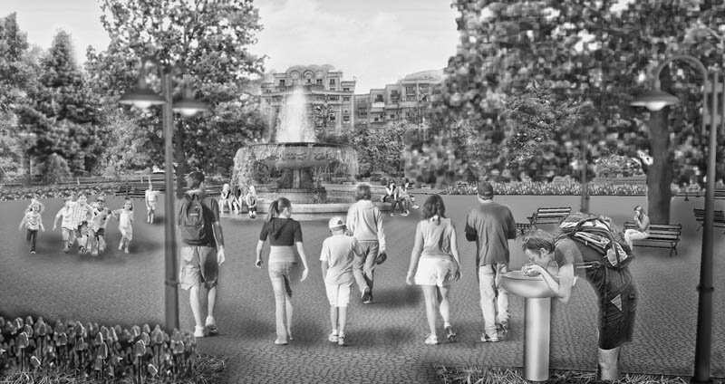
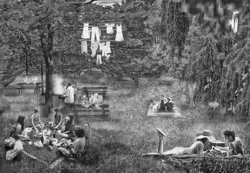
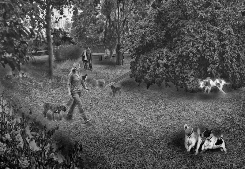
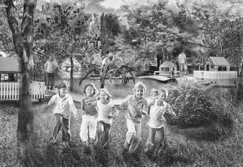
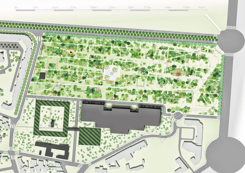
In the same sense of urban identity, Irina Spirea's project deals with the Rahova neighborhood, with the space in front of the Academy being "attacked" in the detailed design. The proposed intervention starts from the recovery of the urban memory, which will have effects both at the level of the urban landscape, as a physical expression of an urban reality, and at the level of the local community, as an instrument of reintegration and revalorization of the latter in the Bucharest society. The project aims at the reminemoration, through the landscape element, of a small part of the history of the Uranus neighborhood by erecting a park that has as its matrix the former plan of the area, a plan reconstituted in a vegetal scale based on the topographical survey of Bucharest in 1911. This "reconstitution" of the city will restore the space to its original proportions, its human scale, in contrast to the megalomania that replaced it, integrating the current uses of the space. By using materials and vegetation specific to the antedemolar period and by creating spaces that bring to the public's attention activities that nowadays seem to be a rarity in the urban landscape, the project aims to reconstruct a city normality, a naturalness of everyday life and its simple gestures. The whole project, a heterotopia of normality in an aberrant urban landscape, pays homage to the past, the present and the future as expressed by the gestures of people - well-known artists or anonymous city dwellers - and at the same time to the simplicity of gestures (whether vernacular or political) capable of responding to the present without forgetting the past and without ignoring the everyday that will always be present.
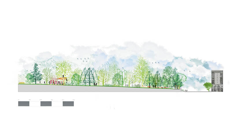
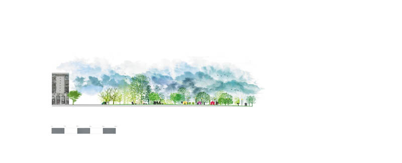
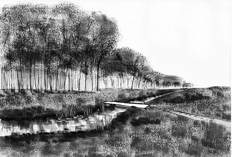
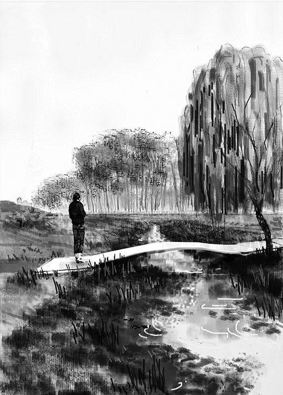
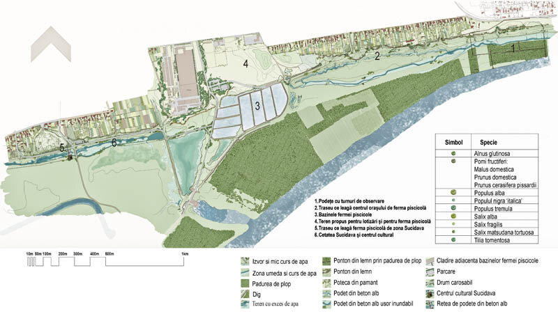
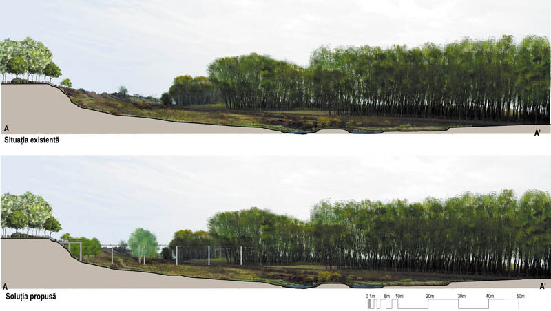
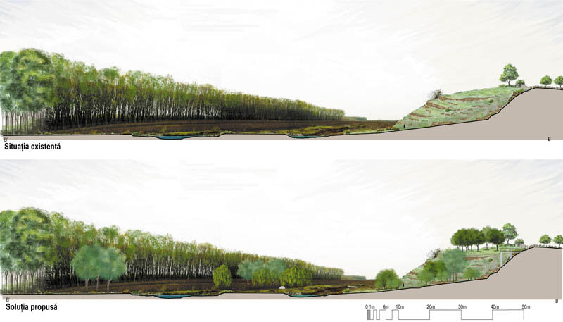
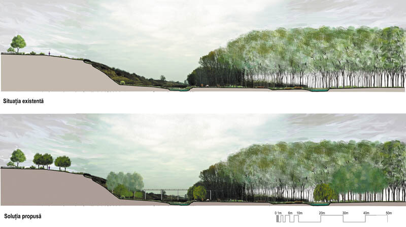
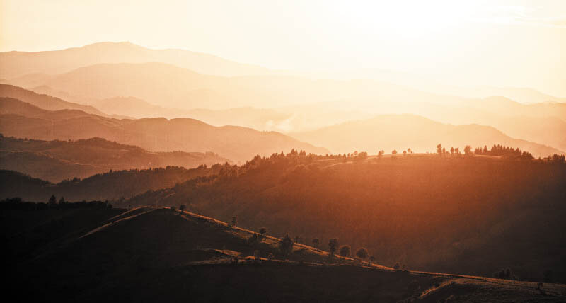
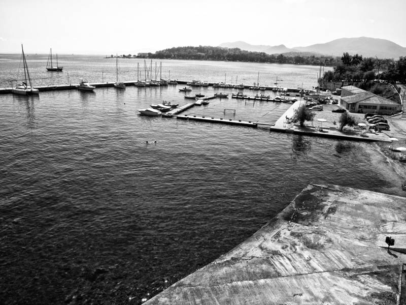
Another project that starts from the sensitive theme of the memory of place, but on a different scale, is that of Smaranda Comănescu, a project that tackles the Corabia waterfront. Over this stretch (3.3 km) the landscape varies discreetly but dramatically, the cliff can be divided into three sections: the floodable area, the breakwater and the water settling basins and the portion of the cliff adjacent to the Celei neighborhood.
The project proposes a route linking the city center to the Sucidava fortress, itself the remains of a long-gone settlement. The cliff path, accessible to both pedestrians and cyclists, will consist of dirt paths alternating with footbridges over the spring gullies.
The height at which the route is proposed has been chosen to be above flood levels, turning these periodic events into a spectacle of nature and emphasizing the dynamic aspect of a seemingly dormant landscape. Along the way, the trail often accompanies garden fences, giving the visitor the opportunity to pass almost from garden to garden. The trail follows the irregular relief of the cliff. From place to place, it moves away from the cliff, forming vantage points from which the flooded valley with its streams and peat bogs can be better seen. The trail changes in appearance and character as it moves from urban to more rural, from the broken lines of the footbridges offering a stroll through the crowns of trees, a unique perspective of a 'banal' landscape, to the sinuous lines of the wicker fences.
The three projects, apparently extremely different, have in common an approach to space that respects its memory and cultural landscape, an adaptation of solutions to complex social realities.
Cultural landscape threatened Roșia Montană
From the city to the edge
Landscape - a face of the world
Urban nature transition
Unloved Bucharest, landscape... or not... (?)
Landscape identification and assessment methodology
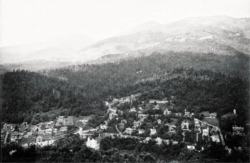
"Landscape as an archive": the history of the structuring of the Sinaia countryside
John Ruskin: landscape and democracy
Three landscape features in dialog with architecture
Building and deconstructing the local dimension
Cezar Lăzărescu, the story of an architect
Architect Dimitrie Ionescu-Berechet in Câmpulung
Entzauberung and re-Zauberung
Architecture as landscape
The holistic ambiguity of approaching the landscape
Creolizing the landscape
Dream dairy farm store
A Squared
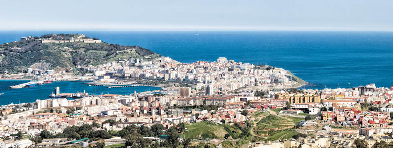
Fragments of Ceuta
Three USAMV landscape design projects