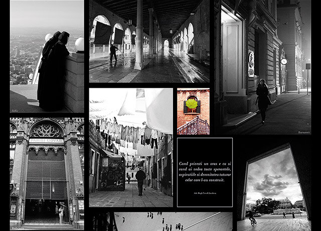
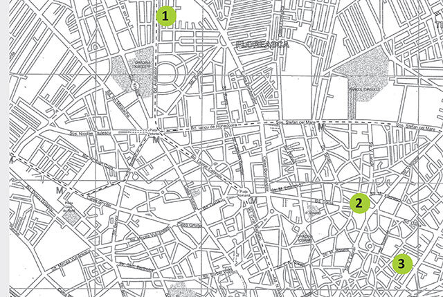
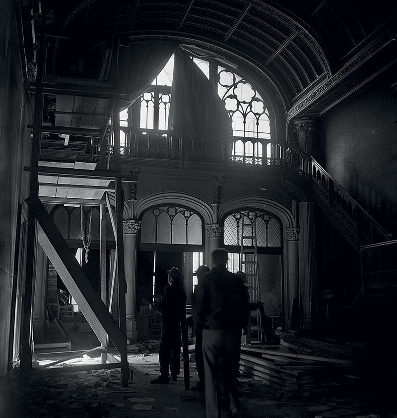
Bucharest Declaration of the Romanian Order of Architects

Allegory
as cultural recovery of lost history
| Allegory is a term with symbolic dimensions. It finds its place and expression in architecture in various ways. One of these is its relation to the history of a place. The following research presents the role of allegory as an emergent factor of memory and civilization. The approach is based on the historical and architectural record of a Greek settlement in Asia Minor1. |
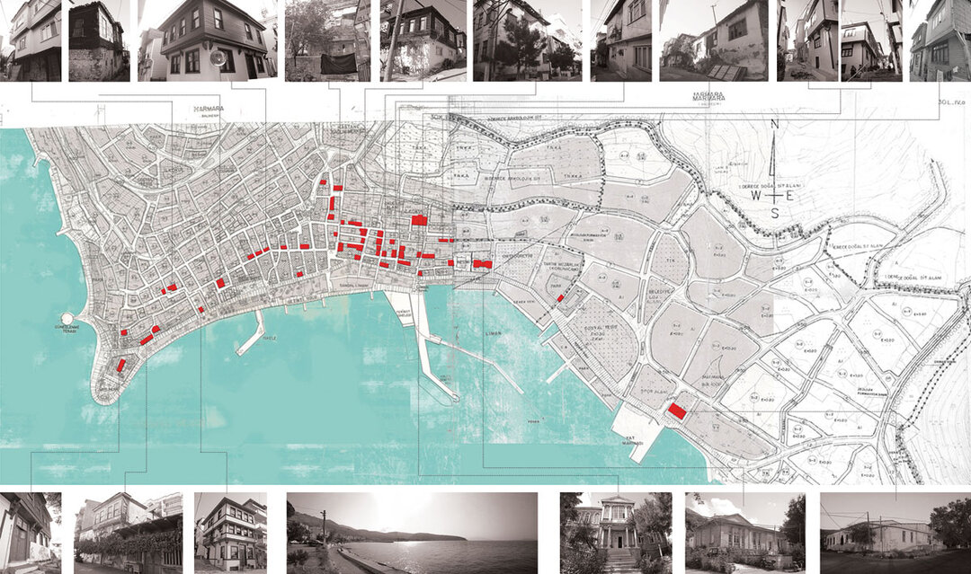
| As a case study a community in Marmara, the capital of the island of the same name, one of the distinct areas in Asia Minor of morphological interest both historically and architecturally. In the course of the investigation a question arose about how transformations resulted in the becoming of a meta topos, but also how it relates to the present and the past. Location and history of the settlement Marmaras is a coastal settlement, situated on sloping land with abundant vegetation, and is also the capital of the island of Marmaris. It lies on the south-western shore. It is the second-largest island in the Turkish region of Balikesir, the largest islands being Koutali and Afisia in the Sea of Marmara. It is made up of the communities of Marmara, Praștio, Afthoni, Klazaki and Galimi2. According to historical data, the population of the community at the beginning of the 20th century consisted of approximately 4,000 residents, of which 530 were Turks and Jews.3 The Greek residents of the community, during the first persecution, were deported to Kremasti. In the middle of 1919 they returned to the island and left again at the beginning of October in 19224, heading initially to Evia Limni, and from there, for the most part, to their present position in Neos Marmaras, Halkidiki. Residential records According to historical records, Turkish housing was concentrated in the center of the village on the north side, Jewish - to the east and Greek - to the west. Two Greek neighborhoods stood out: Taxiarchοn and Panagias. The market was not polarized in a single area, but took the form of shops scattered throughout the districts ("machalades")5. The streets were paved with stone6. In the center of the village there was one square, the Loggia, while another, called Taxiarchοn, was perimeter with numerous cafes. Two other squares supported social activities, here were the fountain and the Church of St. John (Agios Ioanis)7. In puls, there were the Kyriakideio Boys' School, donated by Nikolas Kyriakidis8 in 1919 and designed by the renowned Istanbul architect Karagiannakis Dimitrios Dimitrios, and the Pantelideio Girls' School, built in 1912 and donated by the Pantelis brothers9. The information gathered from local observations and studies reveals many Greek buildings, entire houses, some in good condition, some restored, many in average condition and many more in very poor condition, almost in ruins. However the historical and architectural elements are preserved and allow identification. Besides the houses, three public buildings stand out: two former schools and a partially preserved church. These are the Taxiarchon Church, the school (Kyriakideio) and the Kaimakami building (Pantelideio). In keeping with the existing topography, the buildings are extensive, following the morphology of the site with a continuous but punctuated building system. Monuments are also included in the built mass (Taxiarchon Church), while others are located in a prominent position (Kyriakideio School and Kaimakami Building). The street pattern follows a loose structure with the majority of the streets having their outlets in the coastal/shorefront. There are no delineated residential properties, most of which face the street and share open courtyard spaces. The architectural elements of the buildings in the village of Marmaras basically follow the traditional Balkan architecture as revealed by the field investigations. The ground floor is made of stone masonry or wooden structure, the floors - wooden, in response to the seismicity of the region10. The walls are made of bricks (sun-dried clay) and plastered with clay and lime. In addition, some of the planks ('sachnisia') protrude in cantilevers along the facade or in the shape of the letter 'L', and the roof has a wide eaves. Most of the houses are two-storey, but there are also three-storey houses consisting of ground floor, mezzanine and first floor with commercial and/or storage functions on the ground floor and mezzanine. The general organization of the rooms is as follows: (Fig. 1) the ground floor and the mezzanine have auxiliary and food rooms (kitchen and storage rooms), while the upper level has the living room and the relaxation and resting areas ('liakos' and bedrooms with sofas 'ontades'). Picture 1. General plan of Marmaras. Specifically, the "liakos" or "sofa" typologies that stand out in this settlement are internal, according to the researcher S. H. Eldem11, with various shapes: elongated or cross-shaped. All the above typological variations form the plan distribution (symmetrical or asymmetrical). The staircase is located in the central area of the ground floor, leading to the upper levels, from the closed spaces (kitchen, cellar) to the upper, open and more extroverted ones. The current situation in Marmaras is shown below with blocks following a rectangular format consistent with previous alignments. As can be seen from the photographs, all the buildings show evidence of damage, but some - such as public buildings and aristocratic residences - retain their former prestige and value. These buildings are classified with restoration legitimacy, while others, especially residential units, are restored under private initiative. |
| Read the full text in issue 1/2012 of Arhitectura magazine. |
| NOTES: 1Thepresentresearchis part of a study program being carried out in Asia Minor entitled Greek Cultural Communities and the Ekistic Heritage of Asia Minor (17th-20th centuries) under the scientific coordination of Dr. Eleni G. Gavra, Assistant Professor, University of Western Macedonia, Department of Balkan Studies, Florina, Greece, and Dr. Michailidis D. Iakovos, Assistant Professor, Artistotel University of Thessaloniki (AUTH), Department of History, Thessaloniki, Greece. The team includes the following researchers: Vasilis Dimitriadis, Historian, AUTH master student, Charalambos Minaoglou, Historian, PhD student University of Athens, Panos Zaxaros, Architect AUTH, Anastasia Bourlidou, Architect AUTH, Master in Landscape Architecture, AUTH, and Kleri Gkioufi, Architect AUTH, Master in Urban Design UTH. 2 Of these names, only the name Marmara is still used identically, while the locals use the unofficial name Palatia 3 Xenofanis, volume 3, Athens, 1905-1906, 190. The same magazine mentions that 650 houses were registered in the community, of which 500 belonged to Christians, 100 to Turks and 50 to Jews, according to Christos Zaxariadis, On the Community of Prokonnisos, Xenofanis, volume 1, Athens, 1896, p. 408 4 Antonis S. Marmarinos, From Propontis to the Aegean Waters. Neos Marmaras. Early Geri Geri Years, Thessaloniki, 1997, p. 34 5 Β 73, 42 (Center for Asia Minor Research Studies) 6 Β 73, 43 (Center for Asia Minor Research Studies) 7 Β 73, 44-45 (Center for Asia Minor Research Studies) 8 Kyriakidis invested 3,000 and donated 200 pounds annually for school expenses 9 Both buildings are saved in their original state. Kyriakideia school continues to function as it did in the beginning, while Pantelideia is now the Kaimakami office 10 Theodoros Iliadis, Prokonnisos, Palatia, Nea Palatia, Nea Palatia Community 2001, p. 131 11 S.H. Eldem, Türk Evi Osmanli Dönemi, Istanbul: TAÇ Vakfi, 1984, p. 23 |
|
Allegory is a term with symbolic dimensions. It finds place and expresses throughout architecture in various ways. One of them is its relation with the history of a place. The following research presents the role of allegory as an emerging factor of memory and civilization. It is approached through historical and architectural registration of a Greek settlement in the region of Asia Minor.1 |
| As a key study, there was chosen Marmara's community, the capital of the homonymous island, one of the distinctive Greek areas in Asia Minor with morphological interest on both historical and architectural level. During the investigation, a question was raised, regarding the way in which these transformations have resulted in the emergence of a meta topos, but also the extent that this meta topos is related to the past and the present. Location and history of the settlement Marmaras is a seaside settlement on inclined ground with abundant vegetation and also the capital of the Marmaris island, located on the southwest side. The island is the second largest one in Turkey's Balikesir region and the largest of the islands Koutali and Afisia, in the sea of Marmara. It consists of the communities of Marmara, Prastio, Afthoni, Klazaki and Galimi.2 As historical data indicates, the population of the community in the early 20th century, comprised of approximately 4,000 residents of whom 530 were Turks and Jews3. The Greek residents of the community during the first persecution were deported to Kremasti. They returned to the island in the middle of 1919 and left again in early October 19224 directed initially to Evia Limni and from there, in their majority, to their current position in Neos Marmaras, Chalkidiki. Housing registration According to historical references, the houses of the Turks were gathered at the center of the village on the north side of the Jews and east and west of the Greeks. Specifically, there were two Greek neighborhoods, Taxiarchοn and Panagias. The market was not concentrated on one area, but there were shops scattered in the neighborhoods ("machalades")5. The streets were stone-paved6. At the center of the village there was a square, Loggia, while another was Taxiarchοn, with lots of coffee shops surrounding it. Two other squares, where social activities took place, were located also, the fountain and Agios Ioanis.7 In addition, stood Kyriakideio males' school, donated by Nikolas Kyriakidis8 and Pantelideio females' school, donated by Pantelis' brothers9. Kyriakideio was designed in 1919 by the famous architect of Istanbul, Karagiannakis Dimitrios Dimitrios, as a donation of the Pantelis' ship-owners, built in the 1912. The information collected from local observation and investigation revealed many Greek buildings, houses in their entirety, some of which are in good condition or have been restored, many in moderate condition and even more in a bad state, almost in ruins. However, the main historical and architectural features remain so as for an indicative identification. Apart from the residences, three public buildings outstand: two former schools and a church that is partially preserved. It is the church of Taxiarchon, the school (Kyriakideia) and the Kaimakami's building (Pantelideia). According to the existing topography, the building blocks are large, following the morphology of the site with continuous, but spotted construction system. Moreover, the monuments are included in the building mass (Taxiarchon church), while some are located in a prominent position (Kaimakami's building, Kyriakideio school). The streets' layout follows a free grid with most routes ending in the coastal front. There are no enclosed house properties, and most are facing the street, with shared courtyard-open spaces. The architectural features of the buildings in Marmara's village comply, basically, with the standards of Traditional Balkan architecture, as it is clear from the field work. Specifically, the ground floor is stoned or wood structured and the floors are wooden, due to the seismicity of the region10. The filling of the construction is achieved with solid bricks (sun dried mad bricks) and coated with mud and lime. Moreover, there are projected parts on the floor ("sachnisia") alongside the facades or in L shape, and overhanging roof pattern. Most houses are two-storeyed, but there are also others three-storeyed consisting of ground floor, mid-floor and upper floor with commercial and/or storage usage on the ground and the mid-floor. The general organization of the rum house consists of the following pattern (image 1): the ground floor and/or intermediate spaces serve as auxiliary rooms, and catering (kitchen and storage areas), while in the upper floor or floors there are the living rooms and the space for relaxation ("liakos" and sofa-bedrooms or "ontades"). Image 1. General Plan of Marmaras. Specifically, the typology of "liakos" or "sofa" that is distinguished in this settlement is the one of the interior according to S.H. Eldem11, with variations of shapes: elongated shape, or cross-shaped. All the above typological variations shape the layout of the floor plan (symmetric or asymmetric). The staircase is located in the central part of the ground floor, leading to upper floors, from the enclosed spaces (kitchen, basement) to the opened and more extroverted ones upstairs. The current situation of Marmara's location is presented below, with the blocks following a rectangular layout, consistent with previous alignments. Regarding the buildings as seen from the photos, all showing evidence of damage, some of them retain their old prestige and value, such as public buildings and mansions. These buildings are known to be enlisted as restoration legitimacy, while some of them, especially housing units, are restored under private initiative. |
| Read the full text in the print magazine. |
| NOTES: 1Theresearch is part of a study program that takes place in Asia Minor, titled "Greek Communities Cultural and Ekistics Heritage in Asia Minor (17th- 20th centuries)", under the scientific supervision and coordination of: Dr Eleni G. Gavra, Assistant Professor, University of Western Macedonia, Department of Balkan Studies, Florina Greece and Dr Michailidis D. Iakovos, Assistant Professor, Aristotle University of Thessaloniki (AUTH), History Department, Thessaloniki, Greece. The team comprises also of the researchers: Vasilis Dimitriadis, Historian, master candidate AUTH, Charalambos Minaoglou, Historian, PhD candidate Athens University, Panos Zaxaros, Architect AUTH, Anastasia Bourlidou, Architect AUTH, Master in Landscape Architecture AUTH and Kleri Gkioufi, Architect AUTH, Master in Urban Planning UTH. 2 From these namings only the one of Marmara is still used as it was, whereas locals use unofficially the name Palatia. 3 Xenofanis, volume 3, Athens, 1905-1906, 190. In the same magazine it is reported that the community listed 650 houses, from those 500 belonged to Christians, 100 to Turks and 50 to Jews, relevant Christos Zaxariadis, ΄ About Community of Prokonnisos΄, Xenofanis, volume 1, Athens, 1896, p. 408. 4 Antonis S. Marmarinos, ΄From Propontis to Aegean waters. Neos Marmaras. The first difficult years΄, Thessaloniki, 1997, p. 34. 5 Β 73, 42 (Center for the Minor Asia Research Studies). 6 Β 73, 43 (Center for the Minor Asia Research Studies). 7 Β 73, 44-45 (Center for the Minor Asia Research Studies). 8 Kyriakidis spent 3,000 pounds and offered 200 pounds annually for the expenses of the school. 9 Both of the buildings are still saved as they were. Kyriakideia school continue to operate as before, while Pantelideia is Kaimakami's office. 10 Theodoros Iliadis, ΄Prokonnisos, Palatia, Nea Palatia΄, Nea Palatia Community 2001, p. 131. 11 S.H. Eldem, Türk Evi Osmanli Dönemi, Istanbul: TAÇ Vakfi, 1984, p. 23. |