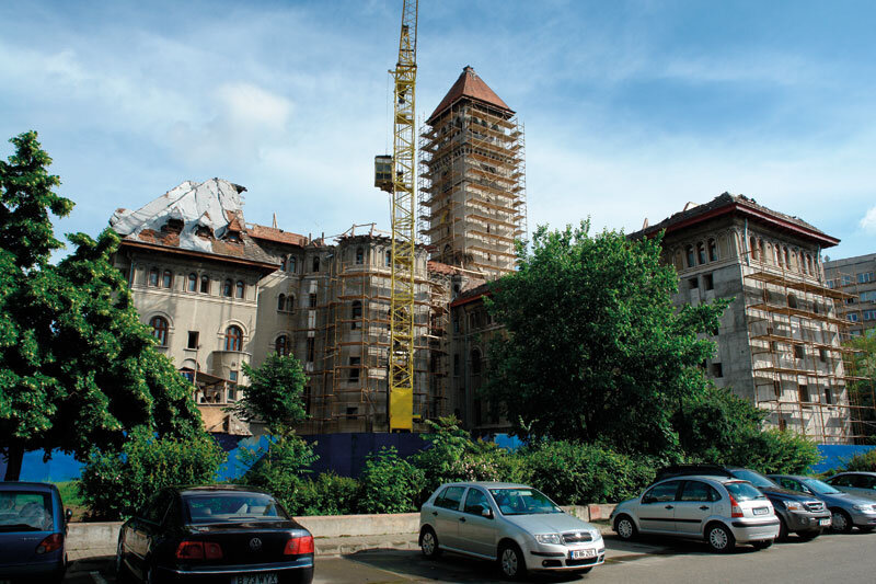
stardust


For a few years now, north-south traffic in the northern part of Bucharest has been very heavy and very difficult. The overpasses between Otopeni and Băneasa were built and the situation has been remedied on the DN1 on this stretch. Traffic is still very difficult on the streets and boulevards that open towards Bucharest after Băneasa Airport. The major points of conflict are in particular in Piața Presei Libere, Piața Charles de Gaulle, on the DN1 extension and at the intersections with perpendicular arteries, on the Aerogării-Aviator Șebanescu-Barbu Văcărescu.
Recent studies, analyses and forecasts (Master Plan for Bucharest: traffic study - Eng. Suciu - see poz. 1, 1a; Metroul 2011 traffic study - see poz. 2, 2a; AECOM Thompson-Reuters estimate - see poz. 3; 2011 population census; Bucu-rești green cadastral survey) outlines the situation on the ground as being due to the urban development of a territory north of the Colentina lakes sally, in a south-north axis.
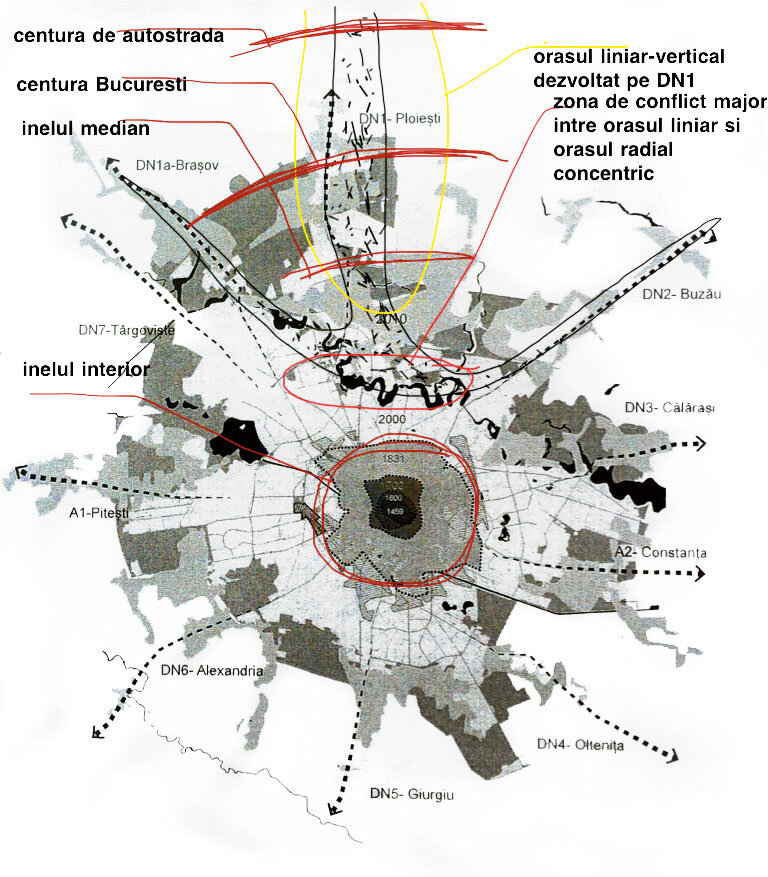
Projected since the 1970s (see the course on Urban Structures by Prof. Alexandru Sandu at the UAU "Ion Mincu"), the continuum of urban interest along the national road between Bucharest and Ploiești - two poles of urban concentration on a national scale - has materialized in a "linear city" on a vertical S-N axis, between Piața Unirii-Palatul Parlamentului (the southernmost pole of Bucharest) and kilometre 36 on the DN1 - the northernmost access to the Snagov residential and leisure area.
After 1990, almost 100,000 people (see the 2011 census, with population differences over the last 20 years in Bucharest and neighboring communes north of the capital) moved their residence to the northern area (Chitila, Mogoșoaia, Buftea, Corbeanca, Pipera, Tunari, Otopeni, the shores of Lake Snagov). In addition, there are serious concentrations of jobs and services along the DN1, Otopeni and Băneasa airports, the Băneasa hypermarket. Today, all these functions, interests and real estate developments mean that many people - especially in the mornings and evenings - travel along the DN1 - mainly in the morning and evening - between work and home or for the services offered along the way, and only 20% are in transit (including the new Bucharest-Ploiești highway will redistribute all of this existing flow). Thus, a nearly 40-kilometer-long boulevard has emerged that concentrates and will continue to concentrate traffic. As I was saying, this "boulevard" has three poles: the first, to the south - Unirii Square and, in particular, the Parliament Palace and the ministries (many political and administrative people live in the north - Snagov, plus the connection with the rest of the country to the north, to which will soon be added the interest generated by the Cathedral of the Salvation of the Nation); another to the north, the Snagov area, and a median one - in the middle of the "boulevard" - namely, in the area of the Băneasa hypermarket.
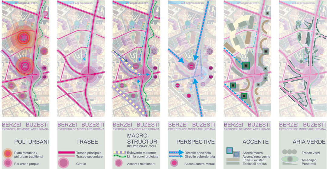
The 40 km "boulevard" with all that we have seen it develop - I did not use the term "boulevard" in a pejorative sense, but precisely to emphasize the sense of concentration of urban interests - enters and linearly punctures an urban structure, organically developed, radially-concentric, with rings and a network of streets gravitating around the center - Roman Square - Univer-sity Square - Unirii Square - producing major disruptions, especially in terms of traffic.
Faced with such a challenge, which has been recognized and known for years, there have also been concerns and proposals for solutions at a global level for years (PUG Bucharest 2000, the JICA study - with Japanese assistance, the Bucharest Circulation Master Plan and, most recently, the Bucharest 2035 Strategic Concept).
The local and punctual resolution of solutions in strategies - in plans - becomes a real challenge when it has to be applied on the ground, in reality. Delaying their realization will further deepen this dysfunction of the "linear-vertical city" implanted in the "round city". For an architect it is a social command.
In this sense, I reiterate what I have already said in order to understand the urban context of Bucharest:
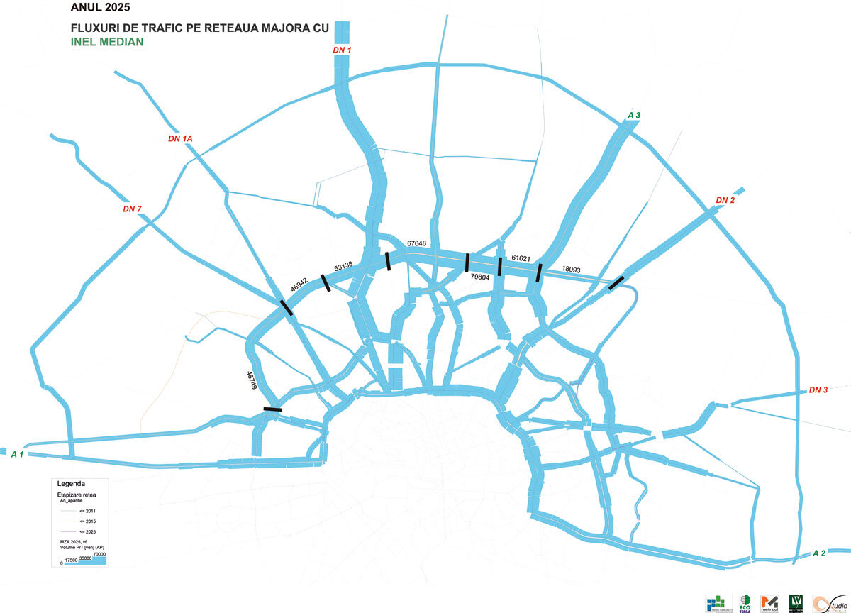
1. On the long term (10-20 years): the motorway belt that, about 30 km from the center, will link the current and future highways and will redistribute access at the level of "city quarters" (east, west, north, south).
2. In the medium term (4-5 years): the median ring that will border, on either side, in the northern area, the Bucharest-Constanta railroad and together with the existing beltway will redistribute traffic to adjacent areas.
3. In the short term (1-2 years): overpasses and underpasses that will cross the neuralgic points, especially in the perimeter markets area (Piața Presei Libere, Piața Charles de Gaulle, Pasajul Pipera) and will fluidize the current polluting parking at the entrances to the traffic light roundabouts. Moreover, these squares will be resolved at the level of intermodal poles, facilitating convenient transfer both for means of transport (parking for private cars and transfer to the metro or other public transport) and for pedestrians.
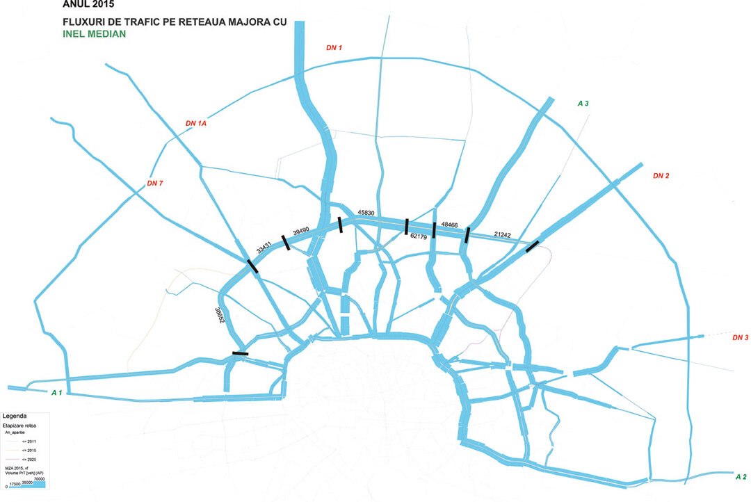
I was creating a plastic image, in which the mass of interests and movements from the north to Bucharest would be like a river that gathers tributaries throughout, increasingly abundant and discharging through a delta into the city - the organic network of streets - but deposits silt and plant debris blocking the entrances to the delta. The collected mass looks like a natural impounding dam. No doubt it must be dissipated. In the medium and long term, upstream diversion canals are being built; in the short term, when time is short, holes are being drilled in the dam. Today, because of the accumulations, we are in the situation that in the main distribution markets - Free Press Square, Charles de Gaulle Square - we should realize such overflow valves (see picture 4).
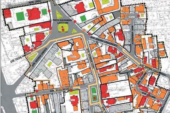
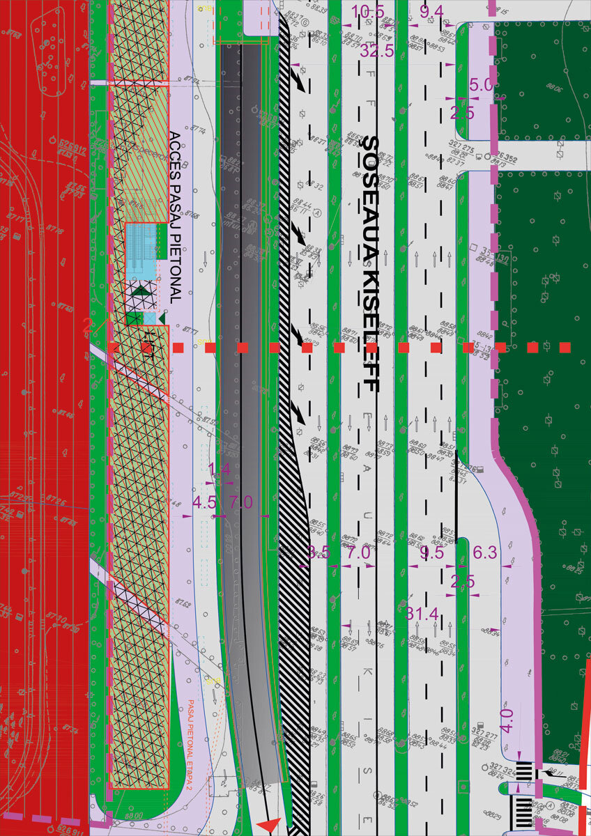
I. Being part of the connection system between the linear city and the organic concentric city, the Free Press Square is the first place where an intermodal node can be realized. It is a turntable that distributes to the northwest on Bdul Tipografiei, to the southwest on Bdul Mărăști -Expoziției and to the south on Bdul Kiseleff. It is difficult to operate, creating permanent parking and pollution. A road underpass is proposed (see photo 5) in the direction from Băneasa which, under the square, branches off and has exits on Bdul Expoziției and Bdul Kiseleff. Also underground, from the underpass, there are accesses to the underground parking lots in front of the Free Press House, the Exhibition enclosure, under the City Gate complex, and the area of the end of the tram line. The future metro line to the airport will also run in this area. The properly sized underground car parks would function as transfer zones: you park your personal car and take the metro, tram or bus. All these transfer points are connected by a network of pedestrian over- and underpasses. From the point of view of protecting the trees and the image of the boulevard, the interventions for the car ramps are made with the preservation of the bordering alignment trees and without changing the prospect (see poz. 6).
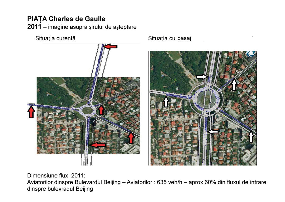
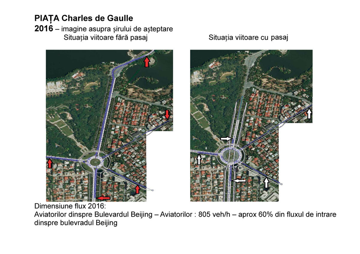
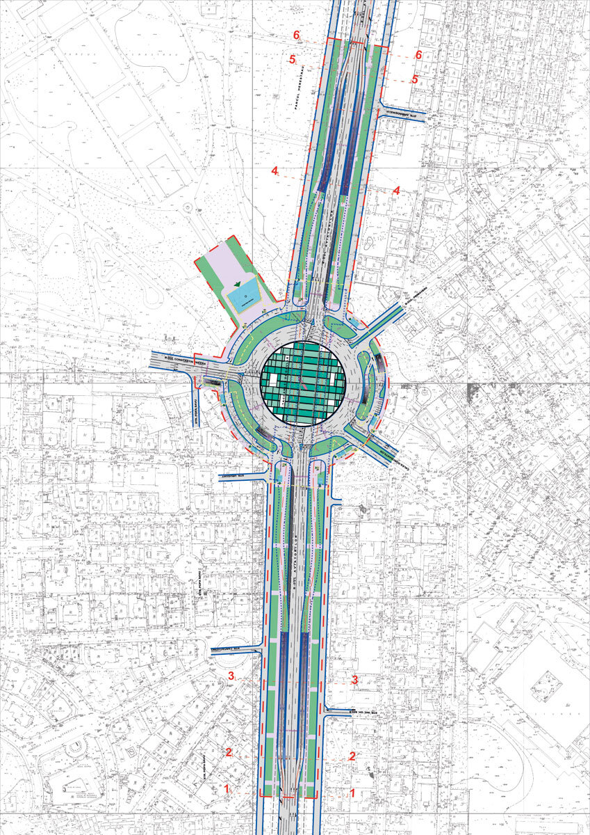
II. Charles de Gaulle Square would be the second turntable in the succession of intermodal nodes distributing south of the future median ring. Thus, it would take in two major flows from the north (Bdul Prezan and Bdul Aviatorilor, from the lakes), one from the south, via Victoriei Square, and the other from the east, via Calea Dorobanților. A very heavily used node (see Fig. 2), it can be decongested by an underpass only in the south-north direction along Aviatorilor Boulevard (see Fig. 7), parallel to the metro box that crosses the square on the south-north axis. The metro station under the square will be amplified to the scale of a major pedestrian slab connected to all pedestrian accesses around the square and, in addition, will be opened to the Herăstrău Park through a vomitorium-am-phitheater. Under the pedestrian slab, two levels of car parking lots can be created, which will unblock the overcrowded street parking lots adjacent to the square and can be used as transfer places from the personal car parked on the premises to public transport, as in the case of the Free Press Square.
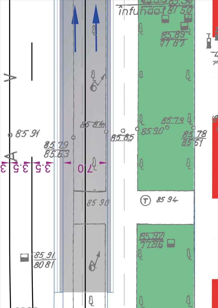
Interventions on the alignment trees by creating ramps along Aviatorilor Boulevard involve the relocation of 18 trees per direction. The acceptance of the compromise may be in favor of reducing pollution by shortening the stopping time at traffic lights, given that, in terms of green space, we are in a heavily planted area, and the recent green cadastre recently carried out for Bucharest shows that we have good coverage. From the point of view of the image of the boulevard, among the five variants of positioning the ramps (from the collateral alleys; in the middle of the boulevard - parallel ramps; in the middle of the boulevard - offset axial ramps; in the middle of the collateral green space), the lateral access variant was chosen, from the immediate vicinity of the existing roadway, given the existence of four rows of trees in the alignment that overlap the view when crossing the boulevard (see poz. 8). Managing the future of a city is a process of permanent negotiation between the practical and the beautiful, between needs and desires, between heritage and intervention, between function and pleasure, between public and private interest, between frustrations and achievements.