FânFest Conferences

manifestos for bucharest
- the first workshop of urban scenarios for bucharest
|
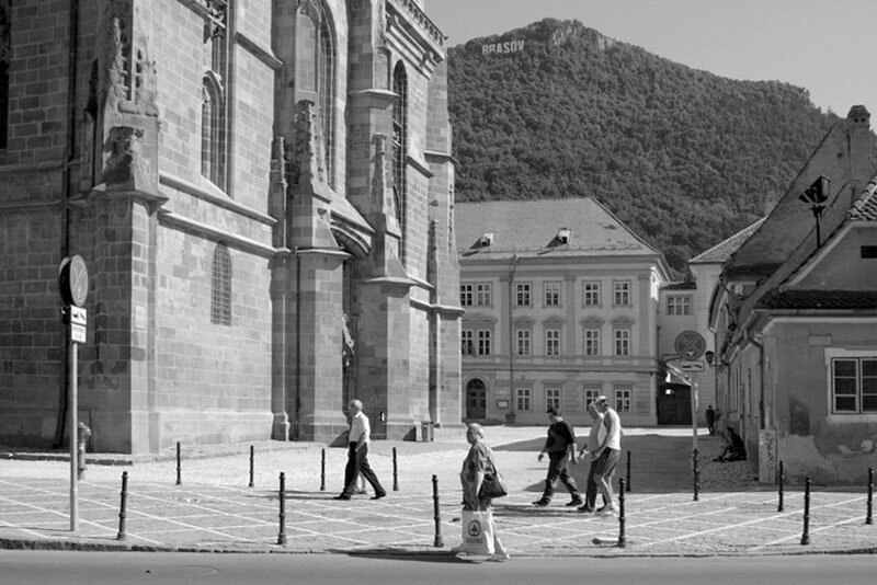
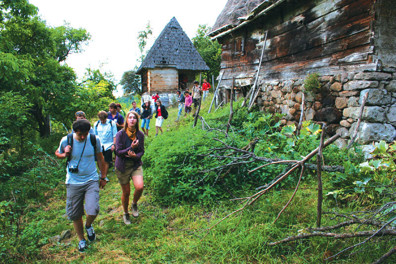
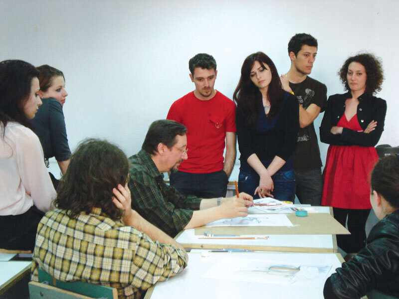
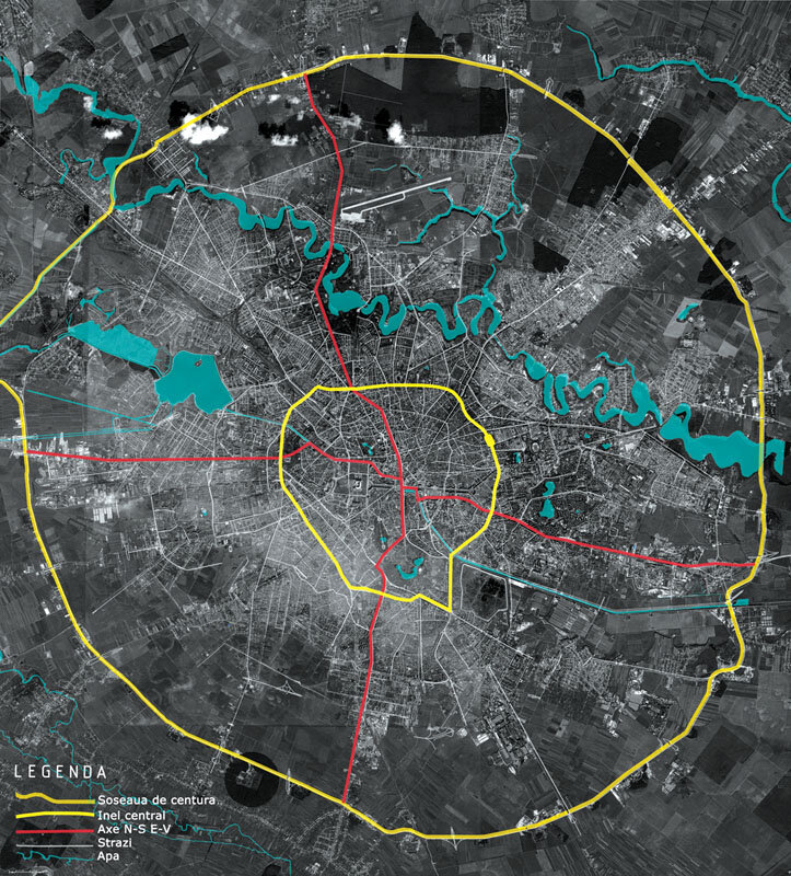
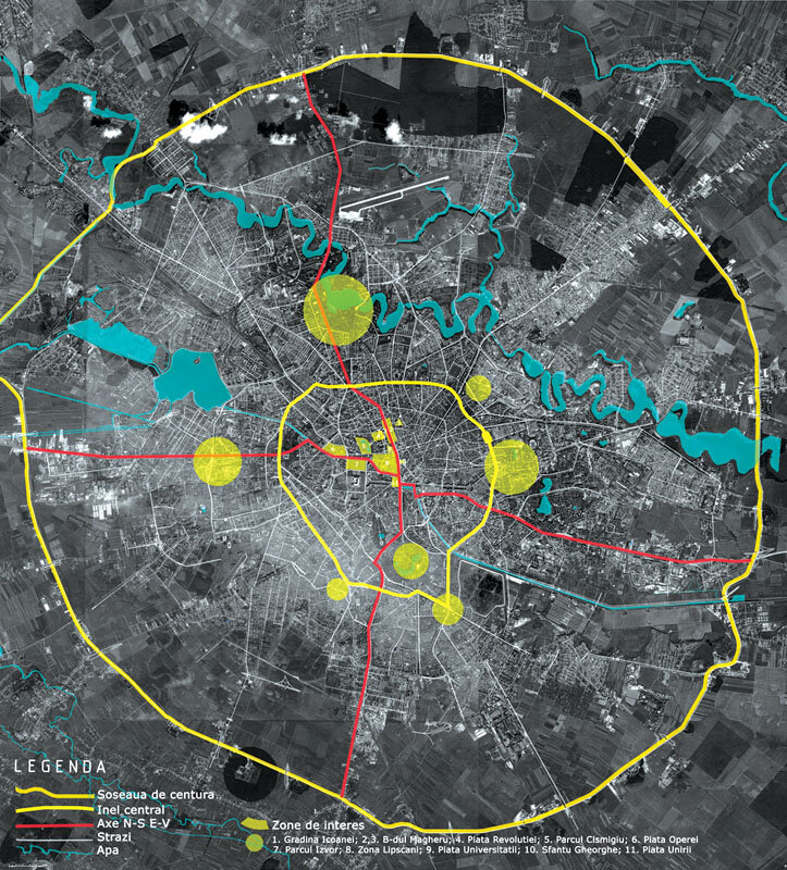
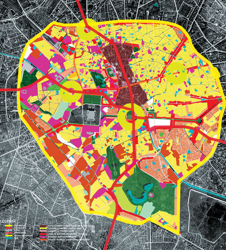
What is Bucharest like? How would I like Bucharest to be? What can I do to make it what I want it to be? These are questions that are constantly preoccupying us and, to find the answers, we have organized this intensive workshop. We are interested both in Bucharest's current problems and its qualities. That's why we set out to find solutions based on what Bucharest has to offer, transforming problems into advantages and starting points towards a sustainable, feasible and identifiable development for the city and its users. We looked at Bucharest through the eyes of 13 student architects, with an average age of 24. Their age is important because they represent the new generation of users, with the critical spirit and enthusiasm needed to improve the status quo. Out of these 13, 5 are from Bucharest, the rest have been living and knowing it for 5 years, since the beginning of their university studies. Our approach started with a few key words describing the problems faced by Bucharest is currently facing: green area | living | living | water | walking | walking | boundaries | screening | street | objects | parking | cathedral | deindustrialization | center | topography | fields | square | culture | neighborhood | mobility | We worked in five teams, each choosing and interpreting one of the keywords in their own way. The tutors did not intervene to impose any guidelines in this research, the prioritization of the different keywords was at the students' choice. Concrete identification of the problem expressed by the keyword, reading the city in the light of the chosen keyword, proposing an intervention strategy on an urban scale; choosing a place to illustrate the strategy through a project on an architectural scale, and drawing up the manifesto. We considered the production of a manifesto to be of paramount importance; on the one hand because it gives a decisive character to the proposal, and on the other hand to attract the attention of the public, the users of the city. The works presented in this article are part of a traveling exhibition open to the general public. The aim is to involve as many of the city's users as possible in the process of developing the capital and to show them the possibilities for improving the quality of their urban life. The five resulting projects, although different in scale of intervention, provide the city with an alternative basis for a Masterplan. MOBILITY proposes an adaptive structure whose location at key points would solve both the traffic problem and the problem of uncontrolled densification of built space. Small PUBLIC PLACES in areas of high residential density give the possibility to solve the problems of interstitial areas and involve users in the maintenance of the public spaces thus obtained. THE STALLS sound an alarm signal on the privatization of public space and propose the rehabilitation and inclusion in the circuit not only of abandoned houses and courtyards in the historic center, but also the use of the entire lot built on the upper basement and ground floor levels. The limitations, even if utopian in their solution, offer an argument for the intensification of cultural actions, supported either by the administration or by private agents or non-governmental organizations. The APA proposes an important change at the level of private automobile traffic, but offers enormous advantages for the urban life and identity of Bucharest. University "Spiru Haret" | Bucharest Maria Duda | Dragoș Dordea | Gabriele Guastella |
| How is Bucharest?How would I like Bucharest to be? What could I do to make it become so? These are themes constantly on our mind and in order to give them the right answer we put up this workshop. We are interested in both Bucharest's current problems and in its qualities. That is why we approached the search for solutions starting from what Bucharest offers us, turning its problems into advantages and departure points towards a sustainable, feasible and characteristic development for both the city and its users. We looked at Bucharest through the eyes of 13 students in architecture, of an average age of 24. Their age is important as they represent the new generation of urban users, endowed with the necessary critical eye and enthusiasm to better the current state of things. Out of these 13, 5 are Bucharest born and bred, while the rest have been living here for the past 5 years, ever since their academic education started. Our approach started from a few key-words that describe the issues that Bucharest is currently confronted with: green areas|living|water|promenade| limits | screening | streets | objects | parking | cathedral | deindustrialization | deindustrialization | centre | topography | fields| plazas | culture | quarter |mobility| We worked in five teams, each having chosen and interpreted in their own manner one of the key-words. The tutors did not intervene in order to impose a certain direction in this research; the priority given to the different key-words being left to the choice of the participants. The workshop developed in five phases: coming up with a concrete interpretation of the issue expressed by the key-word; reading of the city according to the chosen word; proposing a strategy on city-scale intervention; picking a site to illustrate the strategy through a project on architectural scale; making the manifesto. We considered the making of a manifesto to have paramount importance; on one hand because a manifesto gives a decisive character to the proposal, on the other hand it draws the public's, the city users' attention. The works presented in this article are part of an itinerant exhibition, open to the public. The goal is to make as many city users as possible part of Bucharest's development process, and present them with means and ideas which might improve the quality of their urban life. The fice resulting projects, even if differing in scale and size, offer an alternative basis for a city Masterplan. MOBILITY proposes an adapting structure, which, placed in the right spots, would solve issues both of traffic and of uncontrolled densification of built space. The smaller PLAZAS sited in residential areas of high density would allow solving the issue of interstitial spaces and also involve the users in the maintenance of their new public areas. STREETS let out an alarm call regarding privatizing public space. They propose to rehabilitate and encompass in the public circuit not only the derelict buildings and abandoned courtyards of the historical center, but also integrate and open up its upper floors, expanding thus the walking experience to vertical dimensions as well. LIMITS, even though utopian in their solution, offer a strong argument for intensifying cultural actions, whether supported by the administration or by private entities or ong-s-s. Finally, WATER proposes an important change private-traffic-wise but gives back huge advantages upgrading Bucharest's urban life and identity. In the follwoing pages you will be presented with three of the five projects: MOBILITY, LIMITS and WATER. |
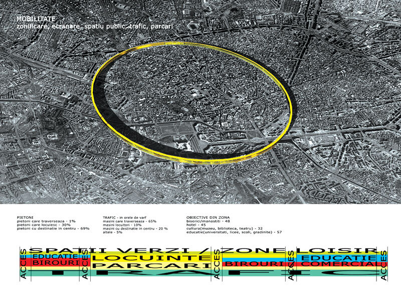
MOBILITY | Zoning | Screening | Public Space | Traffic | Traffic | Parking
MOBILITY | Zoning | Screening | Public space | Traffic | Parking
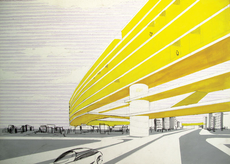
| THE RING - SUSPENDED CITY |
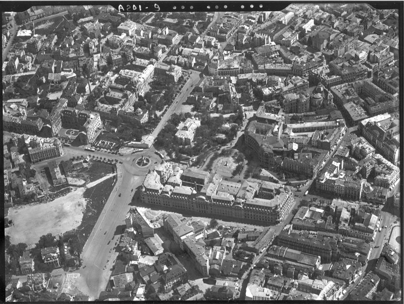
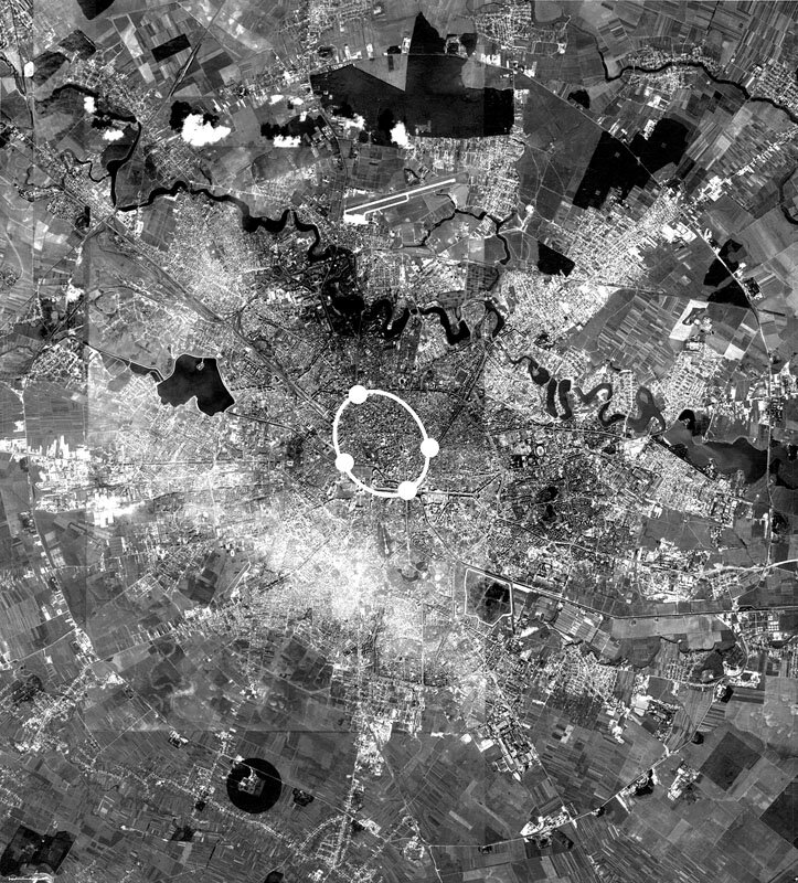
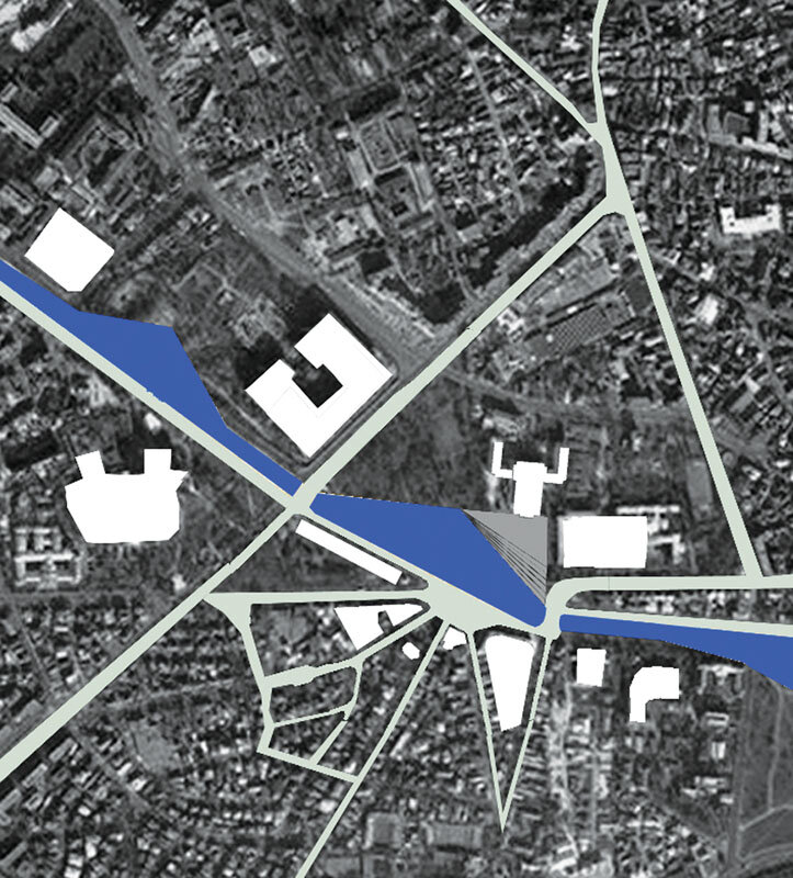
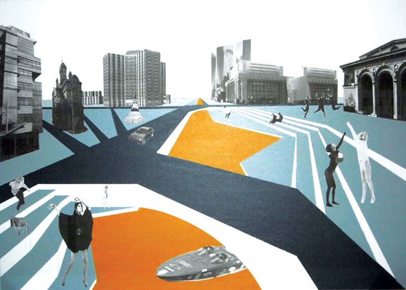
| Addressing the issue of users' ability to move was considered from both the pedestrian and the driver's perspective, with a focus on their interaction in reaching their destinations. After marking the major radial and axial streets, both congested areas and their adjacent points of attraction were determined according to their own experience. The study then focused on the city center, looking at public spaces, squares and parks, and how they are connected, visually and in terms of accessibility. It turned out that the current ubiquity of cars makes it difficult, if not impossible, to create a route linking attractive spaces. The main observation is that the center's through traffic prevails over destination traffic, resulting in congestion. The points considered critical are the squares of Unirii, Eroilor, Victoriei, Kogălniceanu.Making a functional analysis of the center, it was noted both a fragmentation by areas of interest, which intensifies traffic, and an abusive aesthetic and functional densification of the urban fabric. The proposal is a suspended ring city, with main access points in problematic squares; on the one hand it would solve transit traffic by taking it from ground level, but also the problem of zoning and constructive development: functions complementary to those at ground level are accommodated at the upper levels. The ring is in symbiosis with the existing center, which it frees from disharmony, restoring its attractiveness and comfort. Tudor Pavelescu | Alexandra Popescu | Cătălin Iacob |
| THE RING - FLOATING CITY |
| The approach combined the views of both pedestrians and drivers on mobility - the emphasis was put on their interaction while trying to reach their destinations within the city. The study debuted with identifying the main roads and their relative attraction poles, focusing afterwards on the city center. Attractive public spaces such as plazas and parcs are hardly connectable in one continuous path, both visually and access-wise, mainly because of the ubiquitous presence of cars. The main observation was that inside the centre, transit traffic prevailed on destination one, leading to congestion. Critical points are: Unirii, Eroilor, Victoriei and Kogălniceanu squares.The functional analysis showed accentuated zoning, which intensifies traffic, and also hectic densification of built fabric. The proposal is a suspended ring-city, with acces points in the problematic squares; it solves both transit traffic, lifting it from ground level and also offers the alternative of developing the city vertically. Top levels host functions missing on the ground, the ring being in full symbiosis with the existing center. Freed of surplus traffic and construction, the center regains its attraction and comfort. |
LIMITE | Zonificare | Fizicitate | Frontiere sociale
LIMITS | Zoning | Zoning | Physicality | Social boundaries
| CULTURAL BOULEVARD |
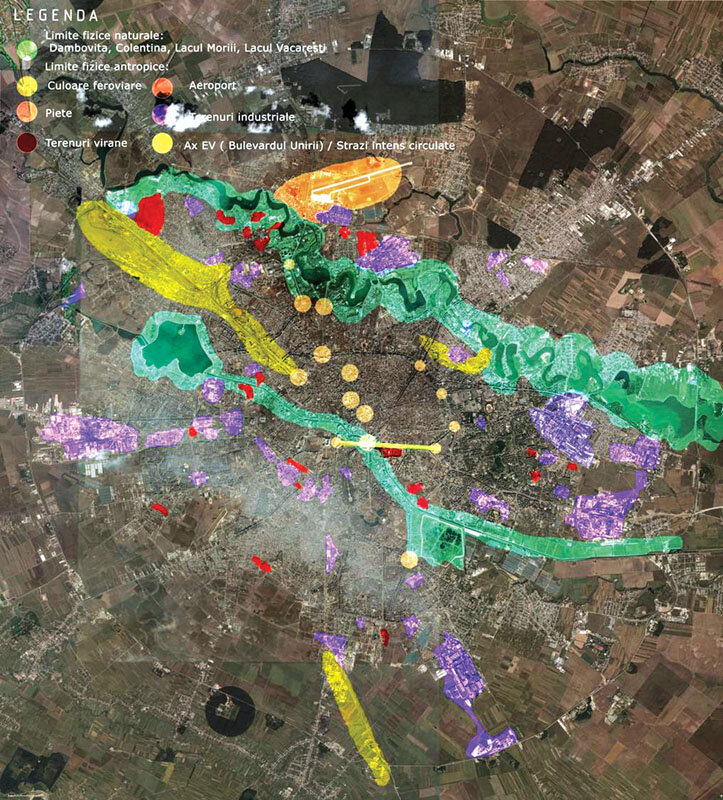
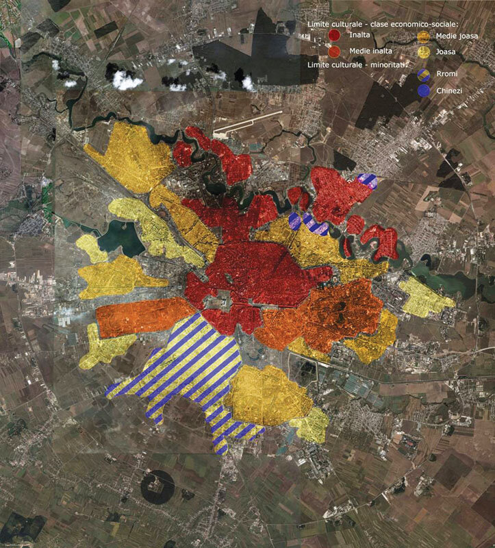
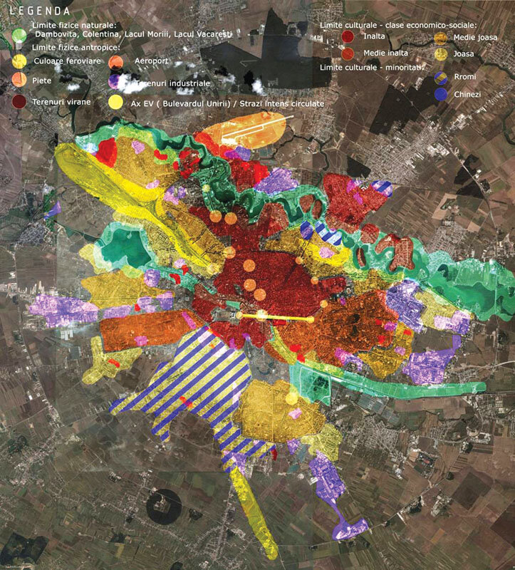
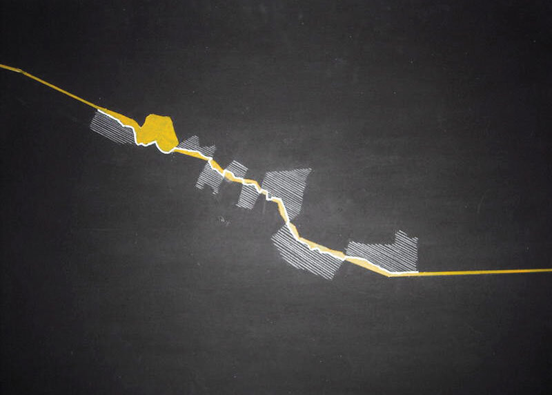
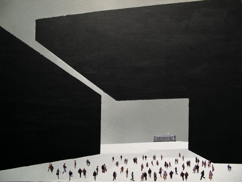
| We started with the analysis and mapping of LIMITS in a physical, concrete and figurative sense. The physical, natural and man-made boundaries, such as the lakes in the north, the wastelands and industrial lands, the railroad corridors, are boundaries in terms of accessibility and use; the cultural boundaries, in turn divided into economic-social (reflecting the standard of living) and ethnic (minorities such as Roma, Chinese), were considered in terms of accessibility, topography and history. The overlapping of the two categories of boundaries led to the conclusion that the current division of Bucharest into social classes expresses the way the city is developing, first - along the Dambovite, a natural element, then in the north - along the lakes: Bucharest is developing between two clear boundaries. The idea of the project is to create a third boundary that will generate the development of the city in the south-west: a cultural boulevard with monumental, iconographic aesthetics, a route of public, educational and recreational spaces for both locals and non-locals, regenerating the area and bringing it to a new status: an identity element of the city. The trail passes through the heart of the problem area to allow for a two-way crossing and development. The dialog of scale with the People's House allows it to be integrated into the city's scale. Oana Țențu | Cristina Sternatis | Olimpiu Răileanu |
| THE CULTURAL BOULEVARD |
| The process started with analyzing and mapping LIMITS, according to both concrete and figurative meaning. Physical limits, natural or anthropic, such as the northern lakes, the brown fields, the railway tracks, are accessibility and use boundaries; culturallimits, such as social-economic ones (standard of living), ethnical ones (gipsy and chinese minorities) are defined by accessibility, topography and history. Overlapping the two categories led to the conclusion that Bucharest developed inside two limits: the river and the northern lakes. The idea behind the project is to create a third limit in order to boost the development of the city on the west-south axis: a cultural boulevard with a monumental, iconic aesthetics; a trail of public, educational and recreational spaces, destined to both local users and visitors from all over the city. Thus, the area would be recovered and brought to a new, enhanced status: identitary element of the city. The boulevard passes through the heart of the problematic zone, enabling its being crossed through and developed in both directions. The scale dialog with the House of the People allows the latter to be integrated in the cityscape. |
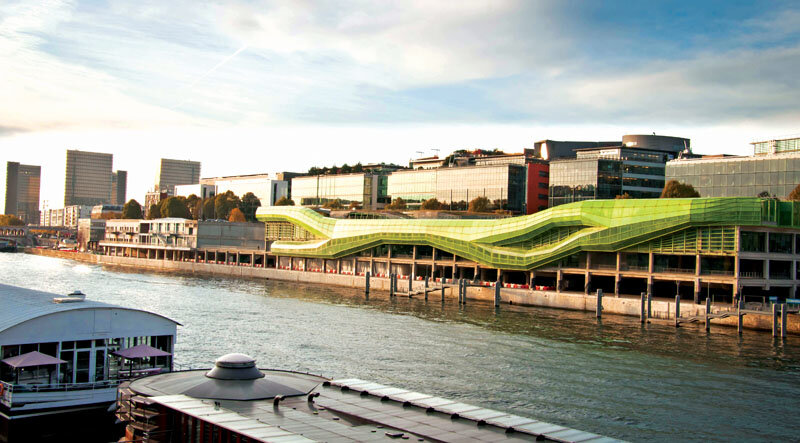
APA | Infrastructure | Integration | Connection
WATER | Infrastructure | Integration | Connection
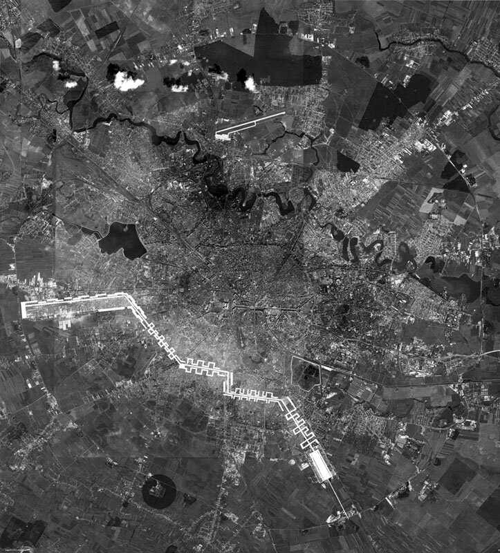
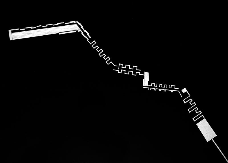
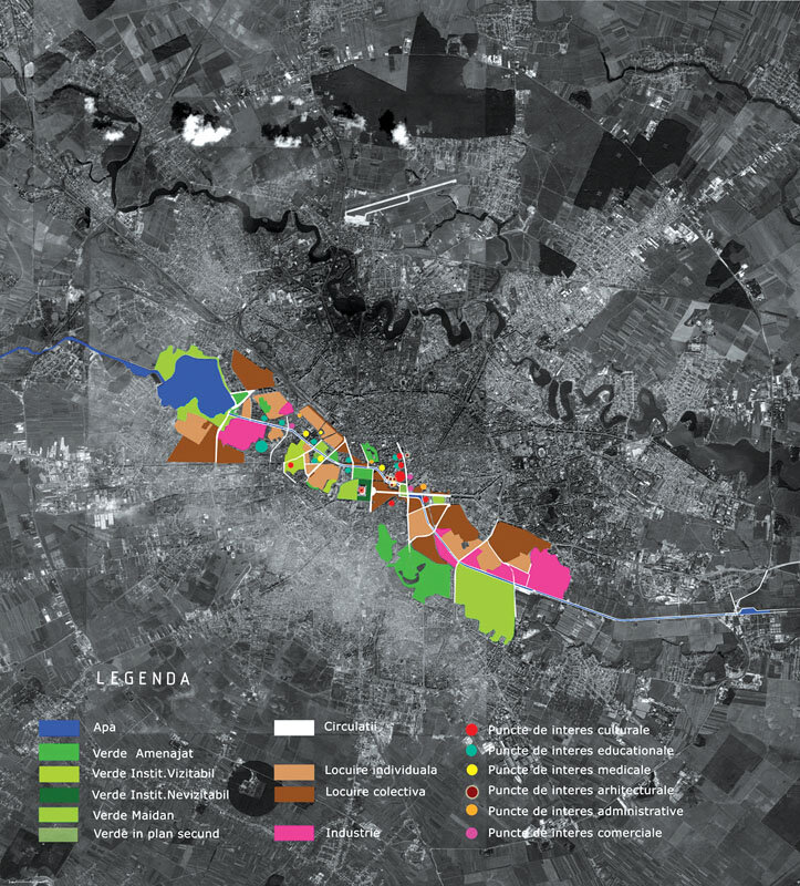
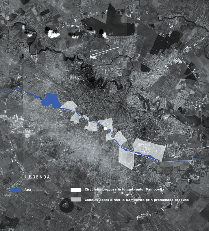
| DÂMBOVIȚA RIVER |
| The choice of the keyword was motivated by the curious and shocking isolation, shielding, denial of the Dâmbovița river from the image and life of the city.Following the functional analysis of its banks, as well as the insufficient connections between them, an idea was born, as radical as it is radical, as strategic from the point of view of urban sustainability: the division of the river banks according to traffic. One bank would become pedestrianized and open to the water, allowing users to take advantage of its presence, while the other bank would take over private car traffic.The traffic allocation is made according to the functions accommodated along the river: areas of public, cultural, residential and park interest would be served only by public transport, while the corresponding banks would be topographically remodeled in a free, organic way, allowing the public to come into direct contact with the river. Other functions will be served by personal traffic, and the relationship with the river will be a more distant, protected one. Following the existing functions, the pedestrian and the trafficked bank will alternate, zigzagging along the Dâmbovië river, but both will allow the river to be integrated into the urban context and into the everyday life of the users. The manifesto is proposed for Opera Square. Magda Băescu | Ionuț Turcu |
| THE DÂMBOVIȚA RIVER |
| The choice of the keyword is motivated by the curious inconspicuousness of the river inside the city. After carrying out an analysis of functions along its banks and their scarce connection to the water front, a quite radical and strategical idea sprung out: dividing the banks according to traffic use. One bank would become pedestrian and open towards the river, allowing users to benefit from its presence, while the other bank would take in all private car traffic. The division follows the functions along the river: areas of public interest, cultural zones and residential neighborhoods would be served only by public transportation and their banks would be topographically remodelled in an organic, free way, enabling the public to come into direct contact with the river. The other functions would benefit private car traffic and a more remote approach to the river side. The banks thus alternate in their use, but both integrate the river in the urban scape and users' daily life. The manifesto focuses on the Opera Plaza. |