1.075 km

© Martina Peneva
Historically, rivers have been developed for different purposes: in large waters, for flood protection by dyking; in medium waters, to achieve stable conditions, e.g. by course straightening and bank erosion protection; in small waters, to facilitate navigation, e.g. by dredging. All these anthropogenic pressures have led to significant modification of watercourses. Changes in hydromorphology (runoff with silt, bed shape, size and substrate type) and water quality (temperature, turbidity, nitrogen, phosphorus) have an impact on invertebrates. Invertebrates are the food for fish and birds, which in turn feed mammals. The whole altered food chain impacts society by reducing the benefits that rivers can provide as a resource or recreation service. Changes in physical (hydromorphological) conditions behave like a domino effect, so it is important to be aware of them.
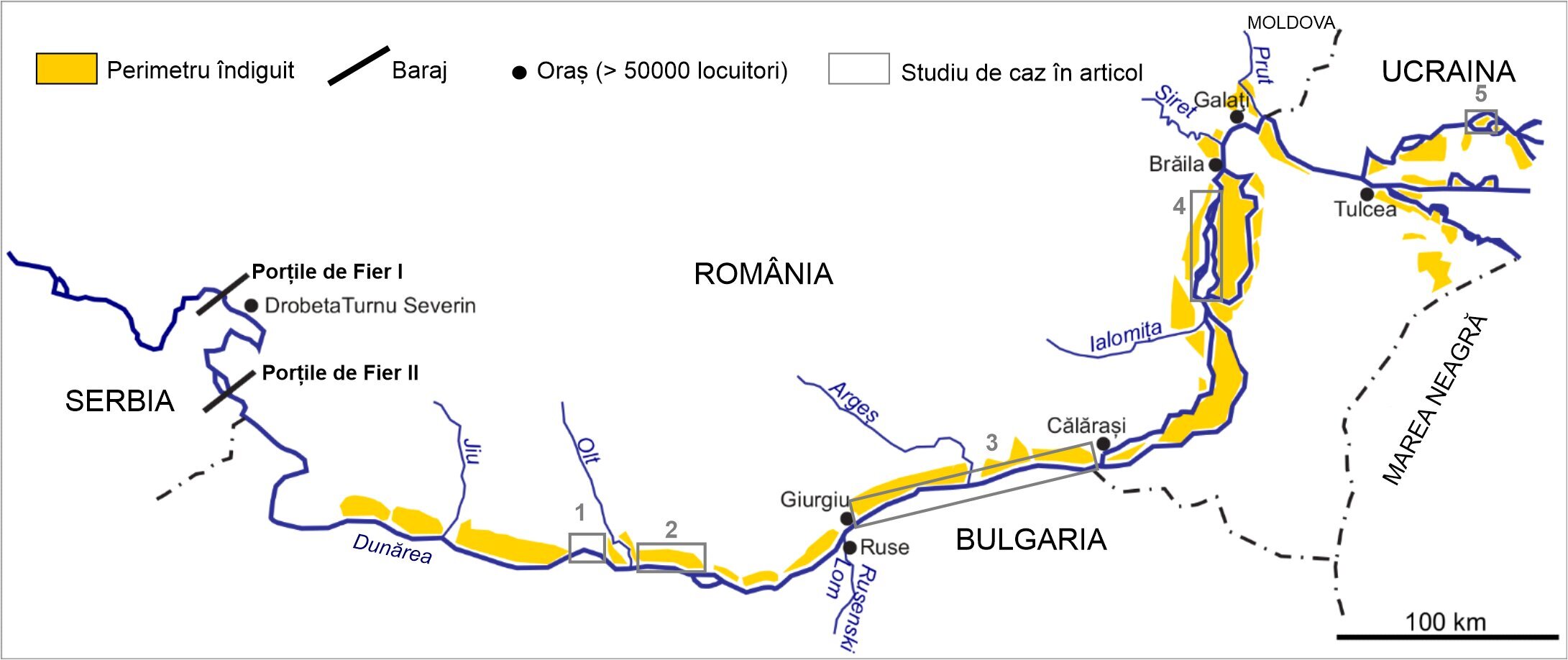
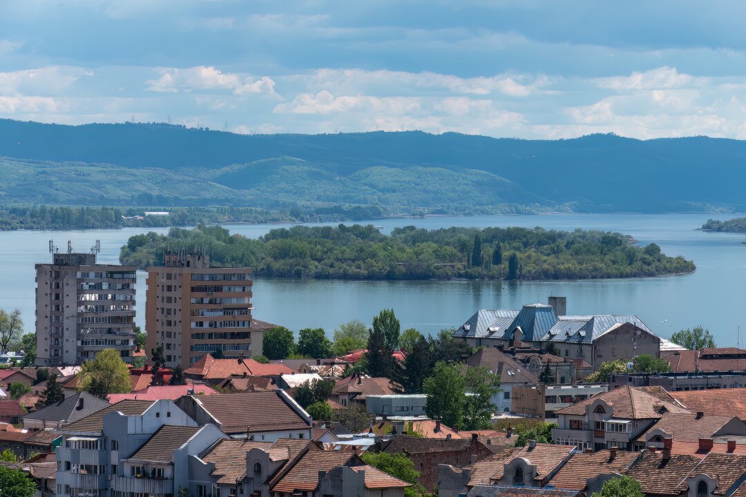
The Danube River is modified by man. On its more than 2,800 km journey between the Black Forest Mountains and the Black Sea, the Danube gathers its tributaries in a catchment area of 817,000km2. It is a medium-sized river with a flow at the entrance to the Danube Delta of about 6,500m3/s. It is considered the most international river basin in the world and one of the most transformed by man. The Danube catchment area overlaps the territory of 19 geographically central European countries (80.5 million inhabitants in total). The largest part in terms of surface area (30%) and population (22%) belongs to Romania. The Danube proper crosses 10 states and four capitals (Vienna, Bratislava, Budapest and Belgrade), three of which have more than 1 million inhabitants. The Upper Danube (Germany, Austria, Slovakia) and Middle Danube (Hungary, Croatia, Serbia) have more important improvements than the Lower Danube (Romania, Ukraine, Serbia, Bulgaria).
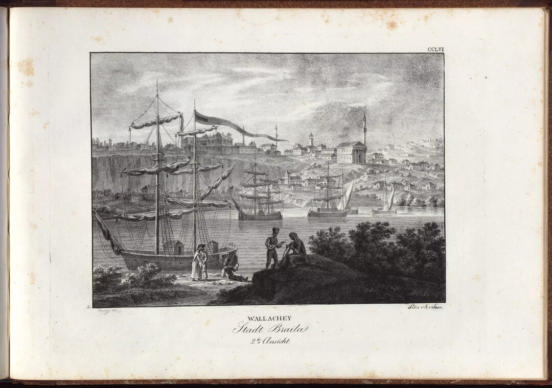
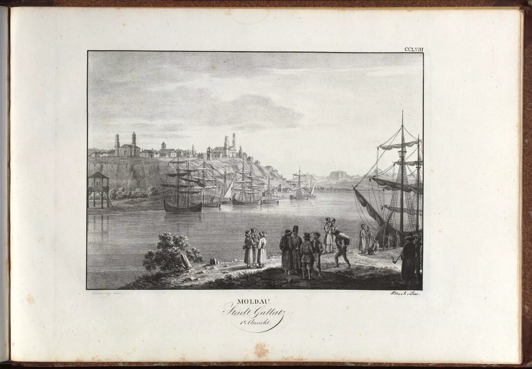
In the case of the Romanian Danube, the main developments are shown in Figure 1. On the Romanian territory, the Danube meadow has been leveled. The ditching started in the first part of the 20th century with the aim of economic exploitation and reduction of water risks (Antipa, 1910). In the 1930's. In the 1930's. 7% of the Romanian Danube Danube meadow was ditched. By the 1970s, the moored area had increased to 75%, natural willow forests had been locally replaced by poplar forests and other developments implemented in order to protect the banks from erosion (quotes from Ioana-Toroimac, 2014). Two dams were built on the Lower Danube at Iron Gates I (1964-1972) and II (1977-1986).
The following paragraphs present some aspects related to the hydromorphologic transformations undergone by the Danube River under anthropogenic impact during the last centuries. The Danube's minor floodplain and the river's outflow have experienced the effects of human pressure. In the context of increasing global emphasis on the natural environment and its value, the last paragraph questions the prospect of restoring the Lower Danube to conditions closer to historical ones.
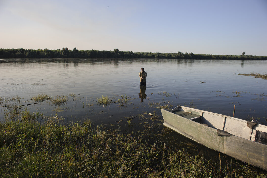
Under natural conditions, the Danube formed from upstream to downstream a succession of riverbed types - with more or fewer branches, more or less sinuous, depending on the materials they cross (erosion-resistant or not), the slope and the amount of silt water transported. But the Danube's riverbed has changed as a result of human intervention over the past centuries. The Upper Danube at Vienna formed a multi-branched riverbed, which was lost as a result of flood protection, navigation, harbor construction and city development. Today, the Strauss Blue Danube is canalized and its former branches are "dead", with no connection to the main branch. The Middle Danube south of Budapest formed a meandering riverbed. It has been straightened mainly for navigation, losing its former sinuosity. The Lower Danube in southern Romania is the one that has preserved most of its natural characteristics. The Lower Danube is characterized by the formation of small islands between several branches. On the borders of the great empires, perhaps due to a lack of interest in development, the Lower Danube and its delta have not been as strongly modified by man.
Danube islands are formed where there are favorable conditions for the deposition of silt transported by the river, i.e., where the current velocity decreases. They generally have an elongated shape, which is characteristic of the dominant erosion processes. They are generally covered with vegetation. They migrate downstream or laterally and may merge together. In addition to islands, non-vegetated and therefore spatially dynamic alluvial shoals can also form in the Danube. These contribute essentially to the formation and evolution of the islands themselves.
One of the most studied stretches of the Danube is the one between Giurgiu (Romania)/Ruse (Bulgaria) and Calarasi (Romania)/Silistra (Bulgaria), as it is the most dynamic and has aroused scientific interest. According to the study conducted by Grecu et al. (2022), in 1856, 51 islands with a total area of 47.7km2 were counted, 79% of which were covered with vegetation (forest, grassland) and the remaining 11% without vegetation. In 2019, 49 islands were quantified with a total area of 53.7km2 of which 91% with forest vegetation and 9% without forest vegetation. Hypothetically, each island had an average area increasing from 0.9km2 to 1km2. According to the same study, the large islands expanded and became vegetated, while the small islands probably disappeared by merging with the large ones. The banks of the Danube were generally slightly eroded during this period. Material from erosion probably contributes to the continued island formation.
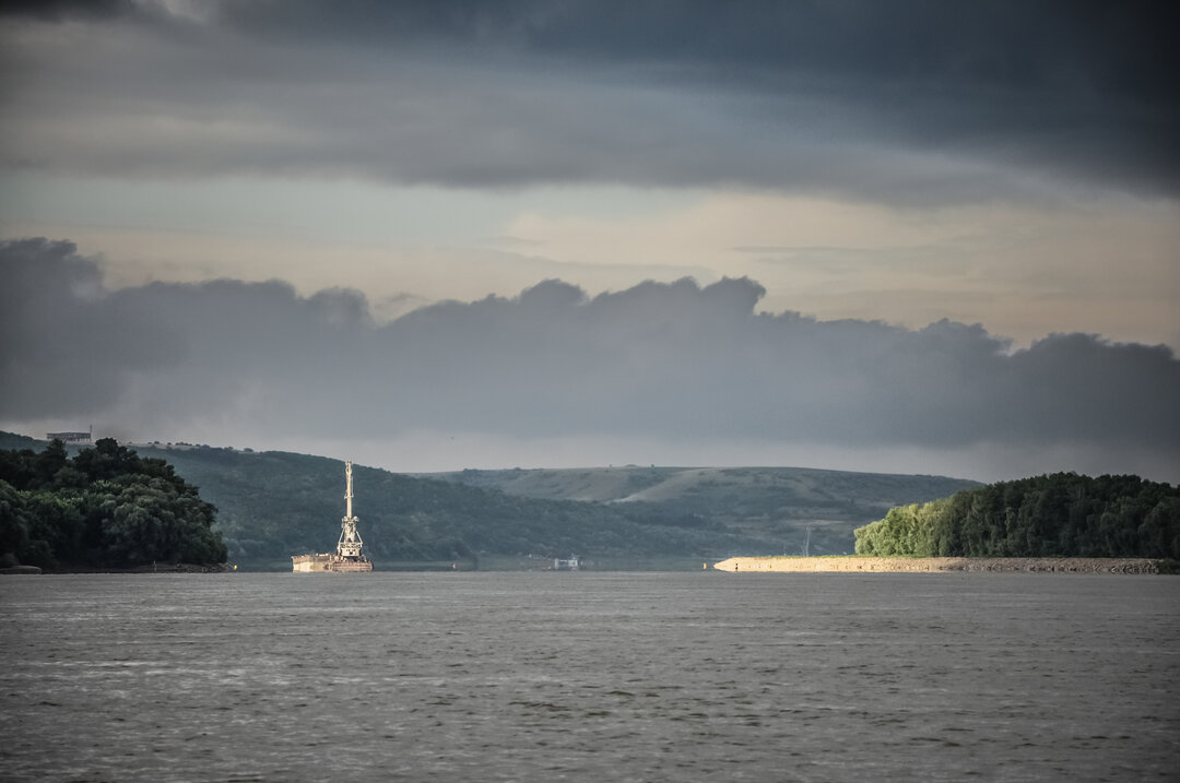
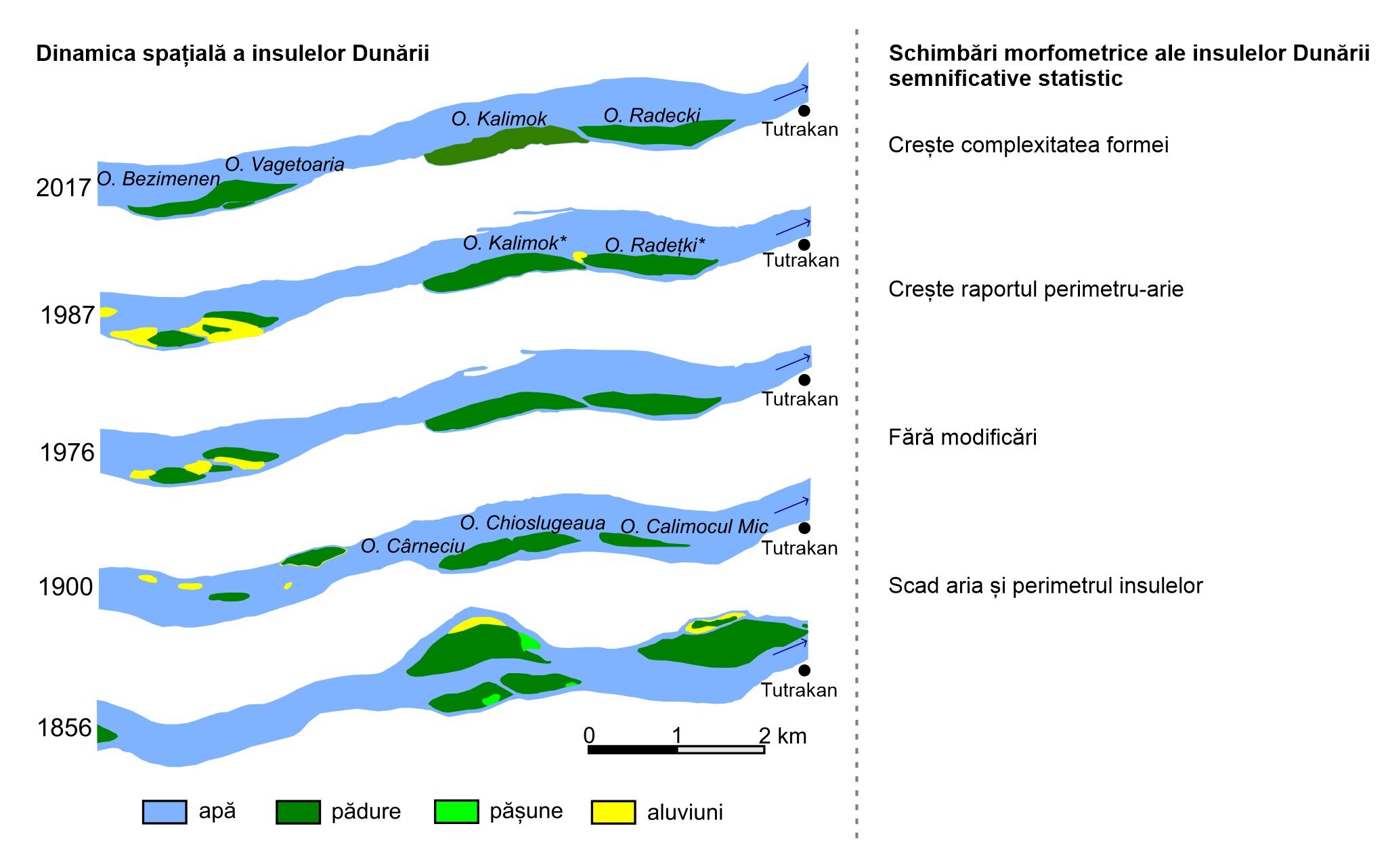
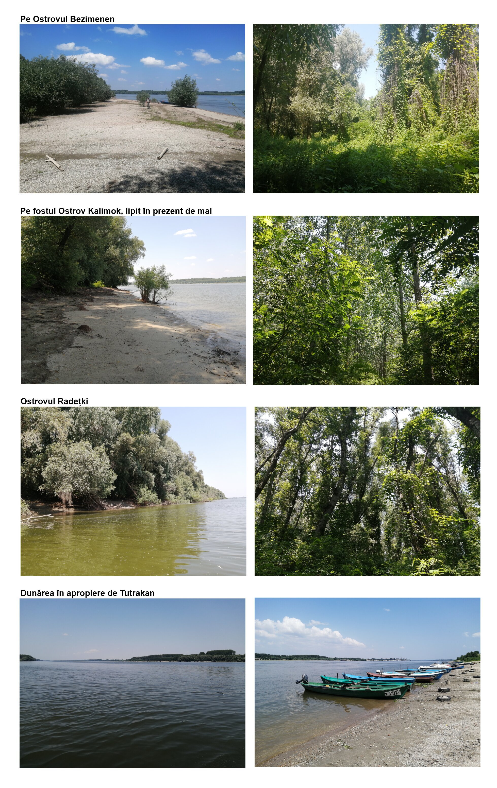
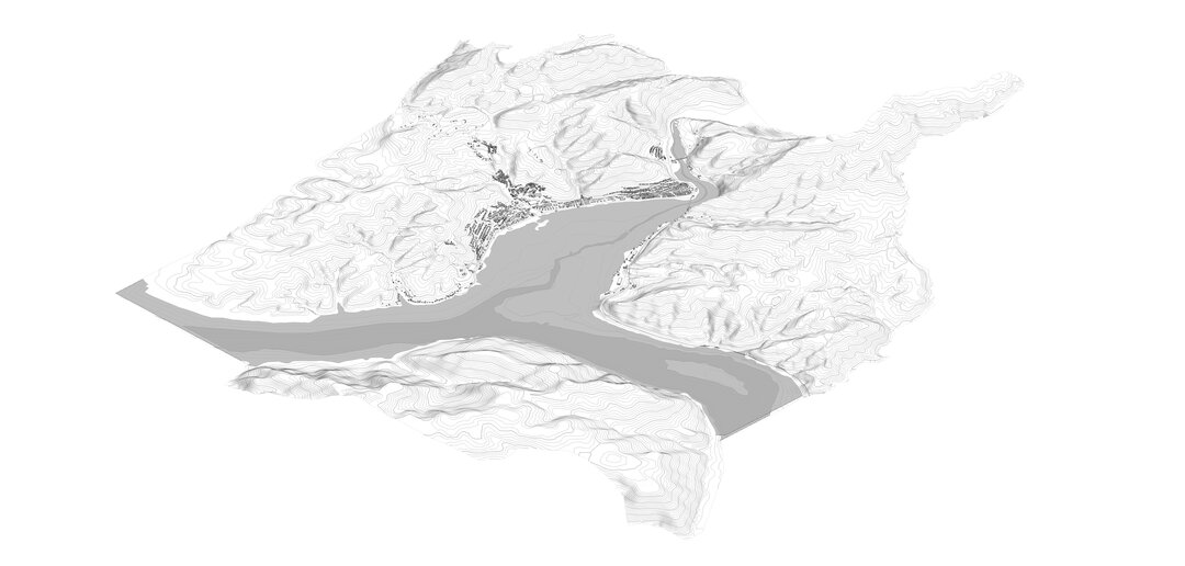
Figure 2 focuses on the islands of the Danube upstream of Tutrakan (in Bulgaria, at the confluence of the Arges and the Danube). The analysis of several maps and satellite images from 1856-2017 shows a complex evolution. From a statistical point of view, the islands became more fragmented between 1856 and 1900, which may be a consequence of the intense functioning of the hydrosystem under the impact of floods characterized by high water volume and rapid runoff. Moreover, the last decade of the 19th century was characterized by major floods (Gâștescu and Țuchiu, 2016). After 1976, the perimeter-water ratio increases, suggesting the elongation of these islands under the impact of fluvial erosion and probably against the background of the construction of the Iron Gates I dam. After 1987, the complexity of the shape increases suggesting the search for a new balance between erosion and accumulation processes. Figure 3 captures some images along this sector.
Apart from this in-plane dynamics, the Lower Danube was characterized by a slight degradation compared to the Upper and Middle Danube and an average lowering of the bed bed by about 3 m (WRI et al., 2020). In places, the bed bed has lowered by 9-10 m. The degradation has been attributed to sand extraction from the Lesser Danube bed for economic purposes. Degradation has the effect of breaking up the banks of the river, which are generally made up of gravels and sands.
This dynamic of the Danube bed can have an impact on society. Silt deposits can block harbors and impede navigation. Erosion can destroy reindeer used as beaches by locals. Island migration can pose border problems. For example, Dorondel et al. (2019) showed how islands in the vicinity of Zimnicea (today's harbor area) played a major role in local history in the 19th century. Despite the risk to society, the dynamics of riverbeds are difficult to model and predict because of the many factors that can influence them and especially hydrological variability. In the absence of planning, development projects need to take into account this unstable characteristic of riverbeds.
The Danube River has a hydrological regime characterized by high spring floods due to spring thaw and snow melt in the catchment and low autumn floods due to lack of precipitation after the warm summer months, when water resources are lost through evaporation and evapo-transpiration. Under natural conditions, flooding should occur in spring almost every year. But anthropogenic changes have changed this periodicity.
Pavla Pekarova and co-workers (2016, 2019) wrote that the Danube peak flow started to occur in April instead of May which can be speculated as an effect of climate change and faster snowmelt earlier in the year. They also observed that the Danube has fewer low-magnitude floods (low flow and theoretically more frequent) now than in the past, but more high-magnitude floods (high flow and theoretically less frequent). This is probably due to the management of the dams built on the Danube to retain large volumes of water. However the dams have to protect themselves by discharging huge amounts of water when necessary, which can occasionally lead to major floods. But these observations are only hypotheses, and are very difficult to prove by rigorous scientific methods as there are many factors influencing the Danube's runoff.
For example, between April and May 2006, the Danube recorded historic flows at some hydrometric stations in Romania, i.e. the highest recorded during the period when the measurements were taken. This resulted in the flooding of some localities, mainly in the counties of Dolj, Giurgiu and Călărași, causing damage. The dykes were submerged or collapsed, but in some cases breaches were created to evacuate the water in the meadow in order to reduce the downstream risk for certain socio-economic objectives. The Danube also flooded in central Europe during the same period. This has led to unprecedented policy (regulatory) measures in the field of flood risk management, both at European and national level, with the aim of identifying and characterizing flood-prone areas of rivers.
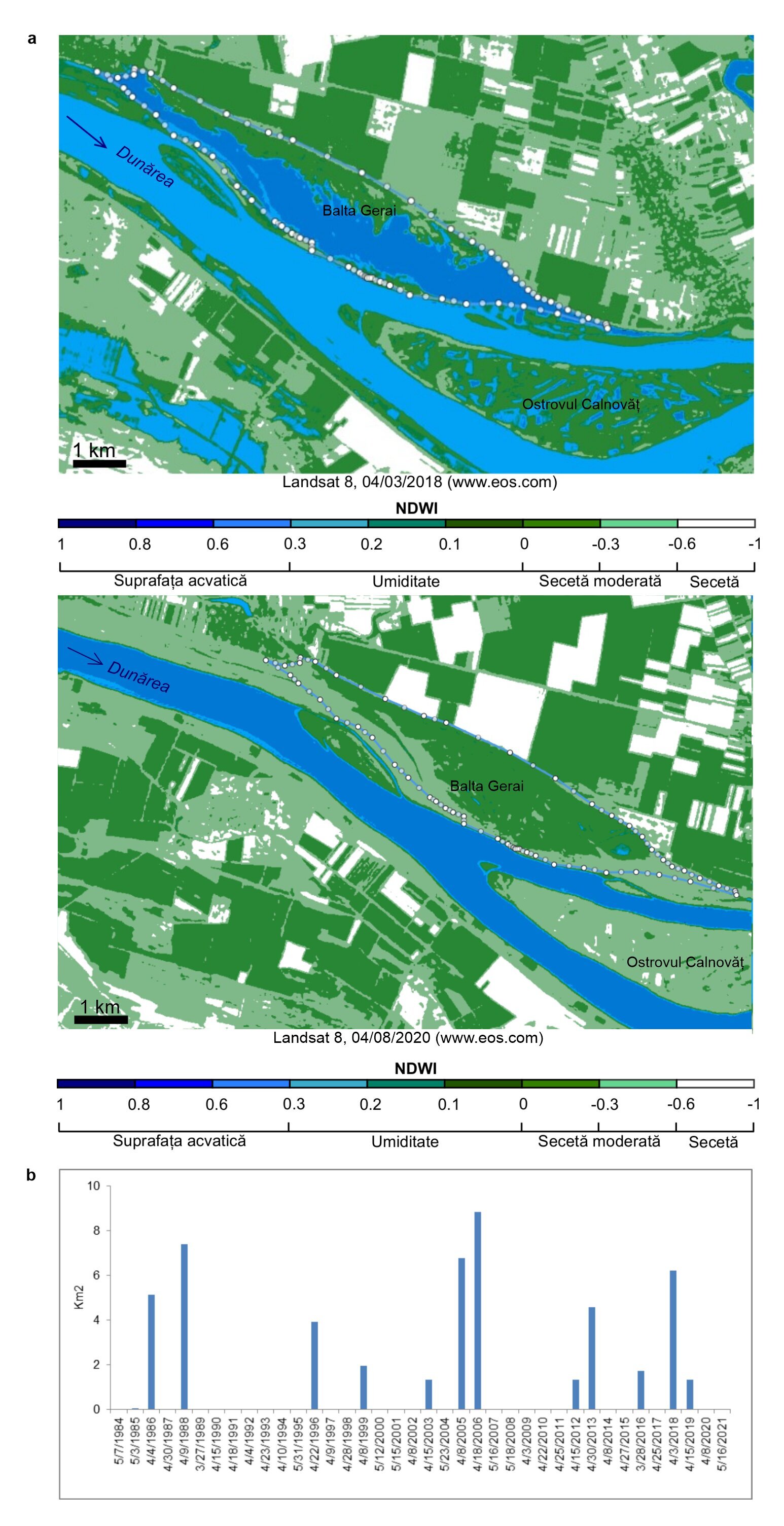
Figure 4 shows the temporality of flooding on the Danube, more specifically the frequency of flooding in Balta Gerai upstream of the confluence of the Olt and the Danube. It can be seen that the area flooded in the spring of 2006 was the largest in the analyzed period. Altogether, 12 spring floods in the last 37 years (1984-2021) have been identified on the basis of satellite images. The area is not indistinct, which confirms the result of the previous paragraph regarding the decrease in the frequency of flooding on the Danube.
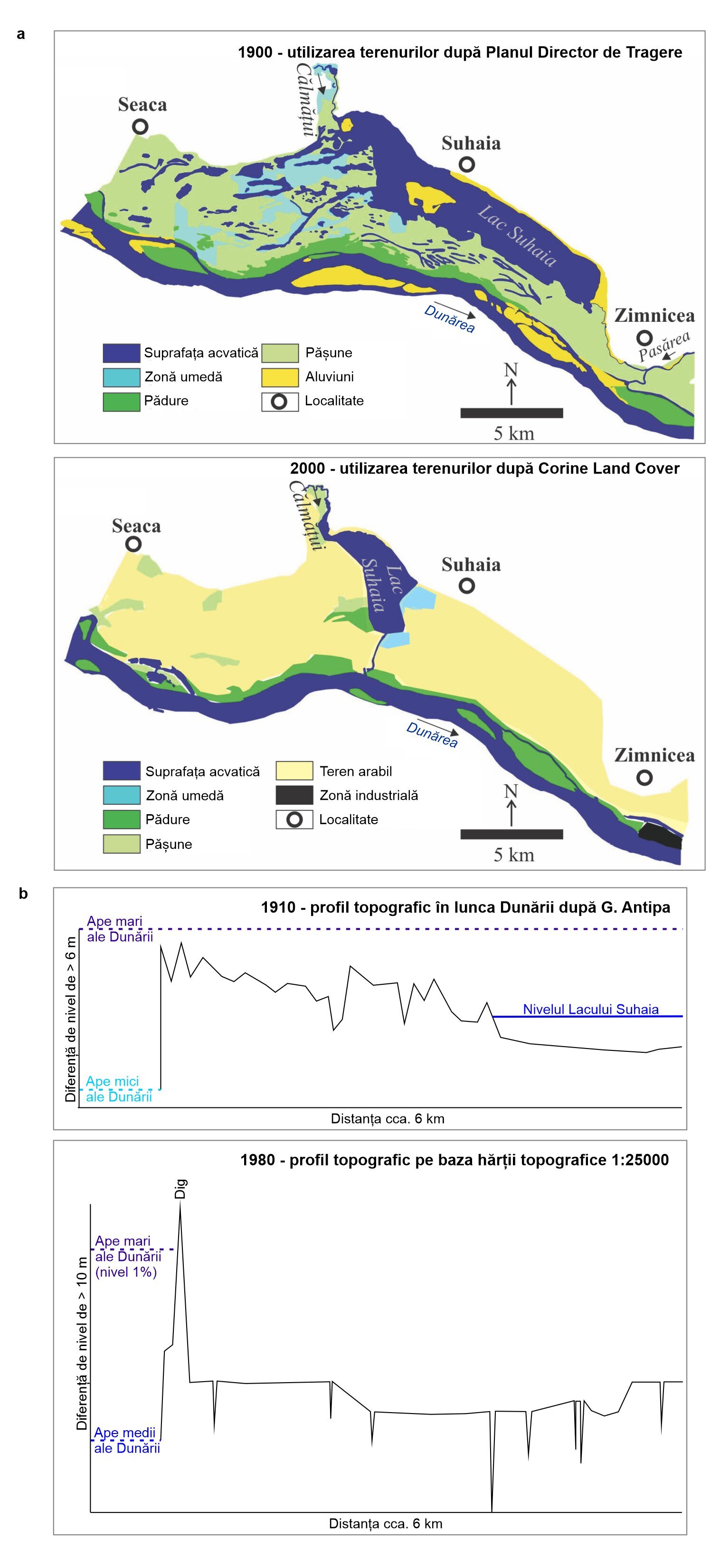
Figure 5 is demonstrative for the spatiality of Danube flooding. Figure 5 shows the Danube floodplain under natural and man-modified conditions in the area of Lake Suhaia, upstream of the town of Zimnicea. The profile from 1910 was published by Grigore Antipa and shows that the annual high waters covered the entire Danube meadow. The 1980 topographic profile shows a 5 m high dike separating the minor from the major Danube bed. The dike prevents the level of the Danube with a statistical return time of once every 100 years from flooding in the Danube meadow. The dike in the area of Lake Suhaia was not submerged in the 2006 spring flood. Moreover, Lake Suhaia was drained by a lot of canals (up to 5 m deep) intended to lower the groundwater level in the area. This has led to a decrease of more than 80% of the aquatic and wetland surface area in the corresponding diked enclosure of Lake Suhaia (Ioana-Toroimac, 2014).
A part of the scientific community and civil society have advocated the re-flooding of the Danube Danube floodplain (Constantinescu et al., 2015). The idea has been partly opposed as the Danube has more polluted waters nowadays than in the past, which would lead to soil pollution with other possible consequences (Vișinescu and Bularda, 2008). The Romanian state funded a project proposing to abandon the dikes on 15% of the Danube riverbed, where the current topography would allow the Danube to re-inundate (Nicherșu et al., 2022). The project has not yet been implemented, but is still under discussion and pilot areas for testing hydraulic scenarios for reflooding have been proposed within the Interreg Danube Floodplain project. A few other independent restoration projects have been implemented along the Lower Danube (in Romania and Bulgaria) and its delta with predominantly ecological purpose and moderate hydromorphological effectiveness (e.g., Ioana-Toroimac et al., 2022).
Two case studies are demonstrative for the low restoration effectiveness of the Lower Danube. In the case of the Babina Ostrov on the Chilia Arm in the Danube Delta, the dikes were opened (in 1994) so that the agricultural polder returned to a flooded state, closer to the natural one. However, the river deposited silt and blocked the openings especially after the 2006 Danube flood, which led to the restriction of the water surface and reduced the effectiveness of the restoration works over time (Ioana-Toroimac et al., 2022). In the case of the Small Island of Braila, restoration was necessary on a clogged channel. Overall, the Small Island of Braila has remained one of the few areas in quasi-natural conditions, without major anthropogenic interventions at local scale. But Ioana-Toroimac et al. (2022) showed that the wet area of the Small Island of Brăilei is decreasing while the dry area is increasing (period 1984-2020). These trends are probably due to a combination of factors such as the degradation of the Danube riverbed and climate change (e.g., increasing air temperature at meteorological stations along the Danube in Romania, according to Constantin et al., 2022). This drying trend of the Danube wetlands may foreshadow a reduced effectiveness of possible actions to restore the Lower Danube wetland paradise of more than a century ago.
Restoration of wetland ecosystems in the Danube meadow, however, comes from an unexpected context. Clius et al. (2022) quantified the land use of the Danube meadow and its delta through Geographic Information Systems. Between 1990-2018, wetland area increased by almost 5%, while aquatic area, forested area, agricultural area and artificial area decreased. The authors conclude on the rewilding of brownfield areas and suggest that flooding increases the potential for these areas to return to a condition closer to their historical state.
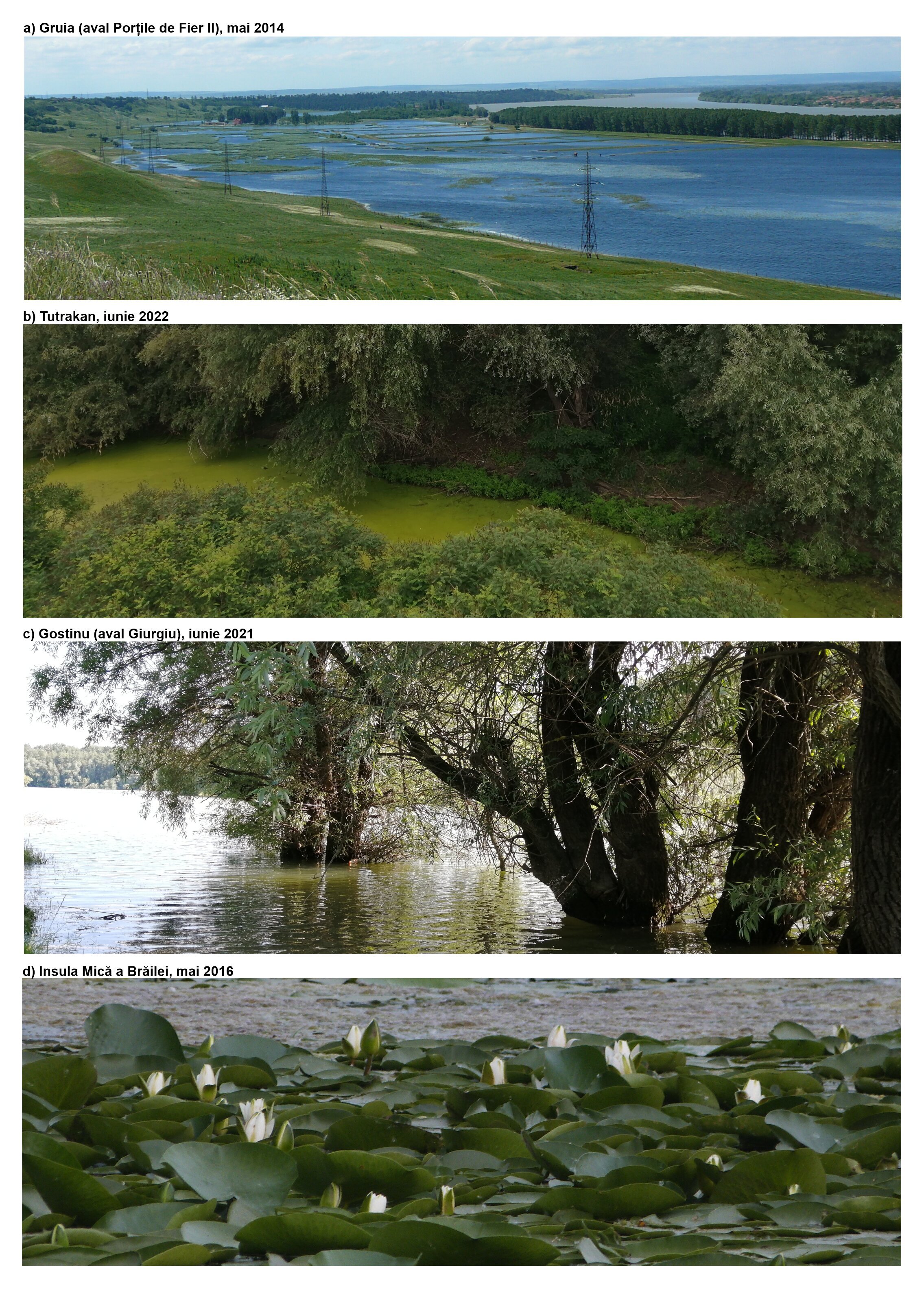
To visualize the above information, Figure 6 contains images of shallow wetland areas on the Danube. Figure 6a shows the transformed Danube meadow - abandoned fish ponds beginning to be overgrown with vegetation. Photo 6b shows a clogged arm of the Danube between an island and the shore. Photo 6c shows an artificial channel at the end of which is a station pumping water for irrigation. Photo 6d is demonstrative of the typical ecosystem of the Small Island of Braila under quasi-natural conditions.
Conclusions on the anthropogenic impact on the hydromorphology of the Lower Danube can be grouped as follows. Modifications in the minor riverbed are less important than those in the major riverbed (meadow). The changes in the minor riverbed are given by the general context of the catchment, whereas the changes in the meadow were given by local scale interventions. Although variations in river runoff have remained important, flooding of the Danube today is less frequent than in the past due to the degradation of the minor riverbed, dams and protection works such as dykes. These changes appear to be irreversible, hydromorphological restoration is difficult to imagine, and a wetland in quasi-natural conditions, such as the Small Island of Braila, has shown a drying trend over the last four decades. Given that active restoration seems difficult to achieve, the prospect of passive restoration of the Danube wetlands by abandoning previous developments is opening up. In the context in which in the field of water and environment naturalness is generally advocated, society should find and capitalize on those services provided by rivers focused precisely on the spatio-temporal dynamics or instability of the river environment.
Part of the information in this material represents partial results obtained within the research projects PN-III-P4-ID-PCE-2020-1238 State, communities and nature in theLowerDanube area: a history of theDanubeislands(1830-2020) and PN-III-P1-1.1-TE-2021-0600 Methodology for assessing the effectiveness of hydromorphological restoration of rivers in Romania, funded by the Ministry of Research, Innovation and Digitalization, CNCS - UEFISCDI, within the PNCDI III.
Antipa, G., 1910. The Danube floodplain: its present state and the means to develop it. 2nd ed. Editura Autograf MJM, Craiova.
Clius, M., Mustățea, M., Chendeș, V., Niță, MR. (2022) Land Management Practices Favoring Environmental Conservation in the Danube Lower Valley (Romania). In: Negm, A., Zaharia, L., Ioana-Toroimac, G. (eds) The Lower Danube River. Earth and Environmental Sciences Library. Springer, Cham. pp. 481-501.
Constantin, D.M., Onțel I., Tișcovschi, A.A., Irimescu, A., Grigore, E., Ilea, R.G., Dîrloman, G. (2022). Observed Changes in the Temperature and Precipitati,on Regime Along the Lower Danube River. In: Negm, A., Zaharia, L., Ioana-Toroimac, G. (eds) The Lower Danube River. Earth and Environmental Sciences Library. Springer, Cham. pp. 273-297.
Constantinescu, S., Achim, D., Rus, I., Giosan, L., 2015. Embanking the Lower Danube: from natural to engineered floodplains and back. In: Hudson, P.F., Middelkoop, H. (eds) Geomorphic approaches to integrate floodplain management of lowland fluvial systems in North America and Europe. Springer, New York. pp. 265-288.
Dorondel, Ș., Șerban, S., Cain, D., 2019. The Play of Islands: Emerging Borders and Danube Dynamics in Modern Southeast Europe (1830-1900). Environment and History 25(4):521-547.
Gâștescu, P., Țuchiu, E., 2012. The Danube River in the Pontic sector - hydrological regime. In: Gâștescu, P., Lewis, W., Brețcan, P., Water resources and wetlands. Conference Proceedings, September 14-16, 2012, Tulcea - Romania, pp. 13-26.
Grecu, F., Ioana-Toroimac G., Osaci-Costache G., Zaharia L., Cocos O., Hachemi K., Sălăjan L., 2022. Dynamics of Islands and Danube River Channel Along Vedea-Călărași Sector (1856-2019): Hydrogeomorphological Approach. In: Negm, A., Zaharia, L., Ioana-Toroimac, G. (eds) The Lower Danube River. Earth and Environmental Sciences Library. Springer, Cham. pp. 43-67.
Ioana-Toroimac, G., 2014. Protection and restoration of the Danube floodplain (Romania): from the state of the art to the case of Lake Suhaia. Sustainable development and territories 5(3):1-16.
Ioana-Toroimac, G., Zaharia, L., Moroșanu, G.A., Grecu, F., Hachemi, K., 2022. Assessment of Restoration Effects in Riparian Wetlands using Satellite Imagery. Case Study on the Lower Danube River. Wetlands 42:30.
Nichersu, I., Nichersu, I., Constantinescu, A., Nichersu, A. (2022). A Transdisciplinary Approach Using Danube River Multi-connectivity in Wetland Management. In: Negm, A., Zaharia, L., Ioana-Toroimac, G. (eds) The Lower Danube River. Earth and Environmental Sciences Library. Springer, Cham.
Pekarova, P., Pramuk, B., Halmova, D., Miklanek, P., Prohaska, S., Pekar, J., 2016. Identification of long-term high-flow regime changes in selected stations along the Danube River. Journal of Hydrology and Hydromechanics 64(4):393-403.
Pekarova, P., Pramuk, B., Halmova, D., Miklanek, P., Prohaska, S., Pekar, J., 2016. Identification of long-term high-flow regime changes in selected stations along the Danube River. Journal of Hydrology and Hydromechanics 64(4):393-403.
Știucă, R., Nichersu, I., Tudor, M., 2007, The Danube Delta and Wetlands projects in Romania. In Final Wetlands Workshop of the UNDP/GEF Danube Regional Project April 18-20, 2007, Tulcea, Romania.
Vishinescu, I., Bularda, M., 2008. Severe changes in the hydrological regime of the Danube River and their impact on agriculture in the Danube meadows. Analele INCDA Fundulea LXXVI:101-112.
WRI & project partners, 2020a. Long-term morphological development of the Danube in relation to the sediment balance, https://www.interreg-danube.eu/danubesediment


-topaz-denoise-enhance-sharpen--15883-m.jpg)