1.075 km
© Adrian Rădulescu
As the archiving of documents has often suffered in the culture of Romanian officials/people, I think it is time to present two documents found in two photo albums: the 1964 Timișoara Systematization Sketch and the Orșova Systematization Sketch from the same period. I do not know where the archives of the (state) Institute of Projects, which from 1957 to 1968 was called DSAPCB, and then, until after 1995, IPROTIM, are today, when it disappeared, probably in 2010. I note this major shortcoming especially since around 1985, when I worked as an architect in IPROTIM, I had the surprise to watch the moving of the archive from an old building to the ground floor of the institution (a new 5-story building was built), when a number of archived documents were burned. It was in vain that some of the members of the Urban Planning staff protested. The institutions of force did not allow the fire in the courtyard of the institution to come near. As if some of them knew something.
Back to ORȘOVA.
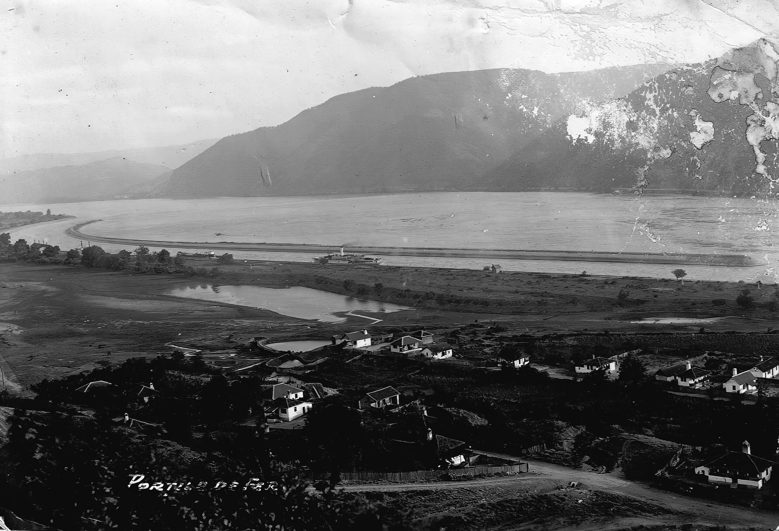
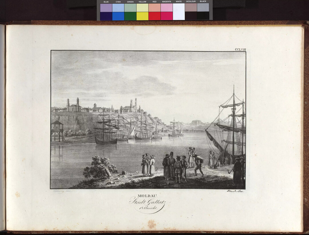
A lot can be written about the destiny of Orșova. The reason for this is the numerous geopolitical changes that have lasted more than 2,000 years and, above all, its special geostrategic position. We begin our brief presentation of its development with the information that in 193, "the town was raised to the rank of municipality. Following the battle of Posada in 1330, which constified the exit of Wallachia from the Hungarian crown, Orșova was proclaimed "Royal Fortress" by Louis the Great. In 1408, Pippo Spano, the banul of Severin, fortified Orșova as Ottoman pressure grew stronger. After the Battle of Mohacs (1526), Orșova was conquered by the Turks from the Hungarian Kingdom. In 1664, the town became part of the Timișoara paszalship. Before 1700, Orșova and Ada-Kaleh were continually disputed by the two major empires, being conquered by the Habsburgs and the Turks. In 1717, Orșova was recaptured by the Habsburgs. 1737 was the year in which Orșova came under Ottoman rule, on condition that the Cerna canal was built. Orșova was a fishing village near Jupalnic, which played an important role in controlling the Cerna valley. In 1791 the town came under Habsburg administration. After 1829 (Peace of Adrianopole), the locality played a major economic role through the trade relations of the Romanian Country, which found a favorable opening for its export products to the Habsburg Empire, an important role played following the completion of the Orșova-Caransebeș road, as well as the one on the Romanian side of the river. The Austrian Shipping Company (DDSG) was established here, but transportation on the Danube in the vicinity of the Cazanelor was still difficult. After 1873, Orșova came under Hungarian administration. In 1878, the Timișoara-Orșova railroad, part of the Budapest-Bucharest rail link, was completed. In 1896, in the presence of Emperor Franz Josef and King Alexander of Serbia, the navigation canal on the Serbian side of the Danube is inaugurated at Porțile de Fier-Sip (Fig. 1) and a ship repair yard is set up in Orșova.
In 1918 the administration of the Kingdom of Romania was established here and thus, together with the county of Caras-Severin, Orșova became part of the Romanian Banat area.
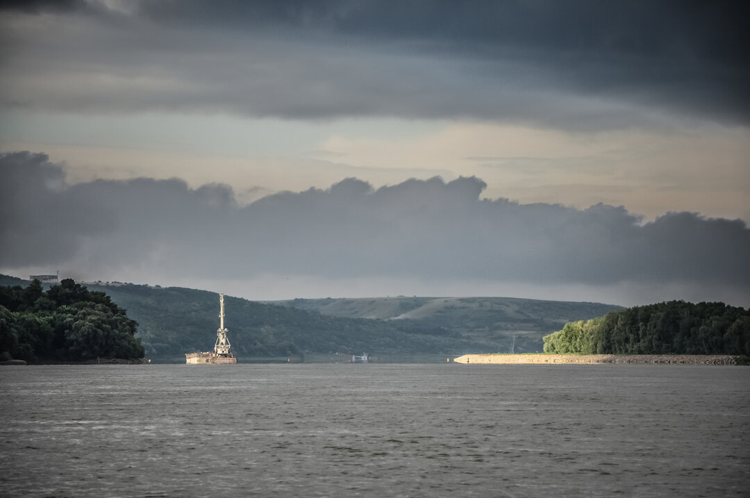
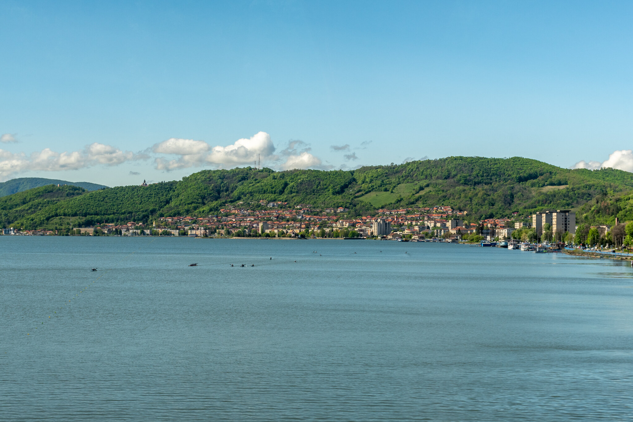
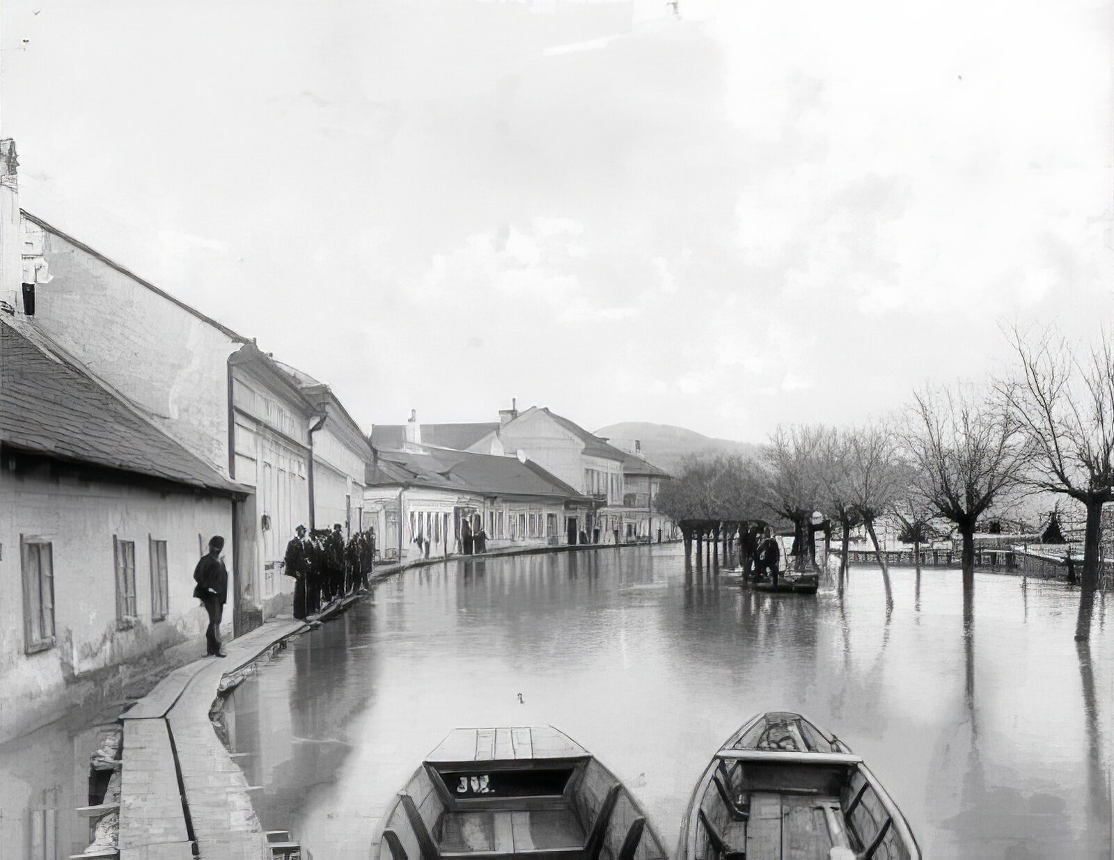
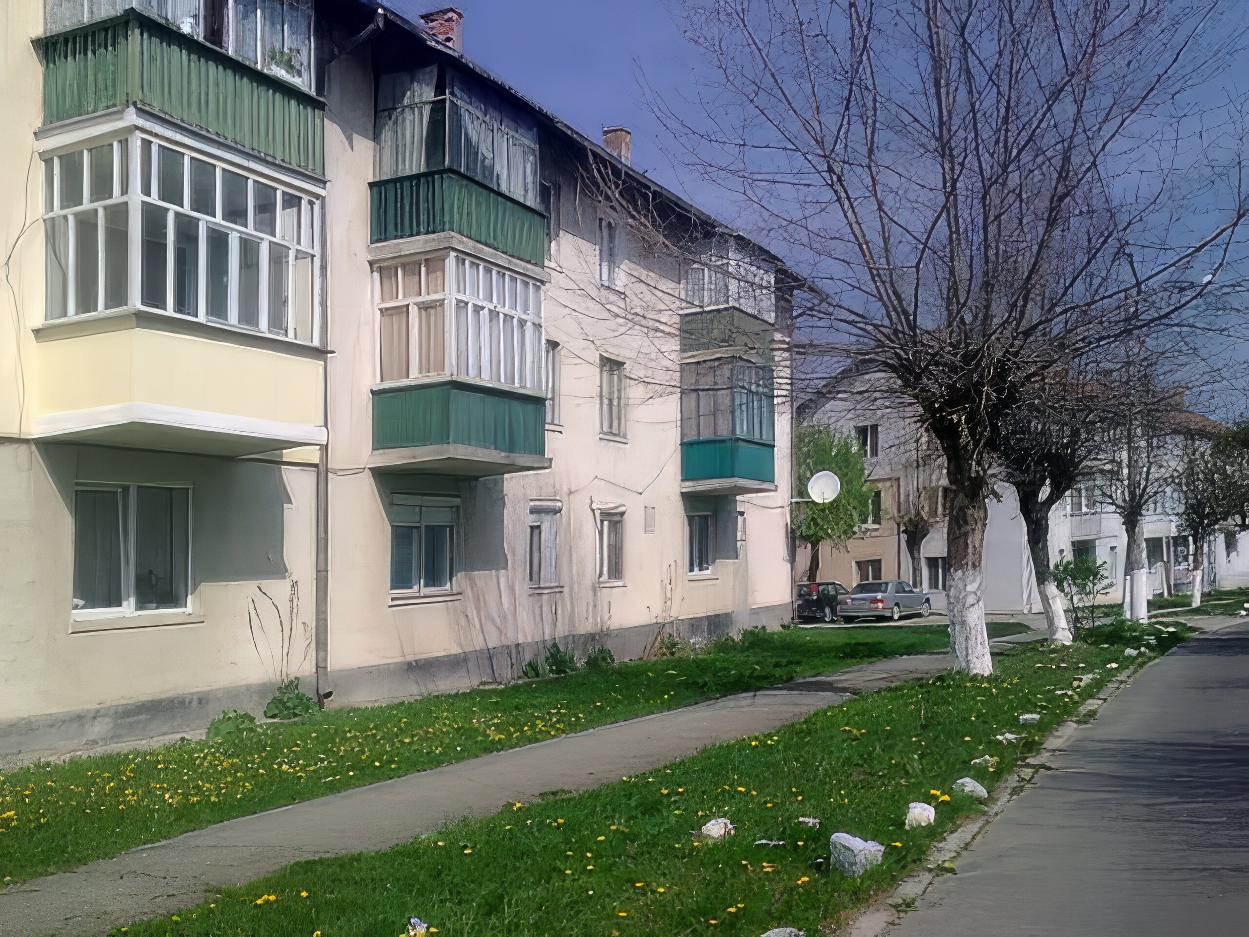
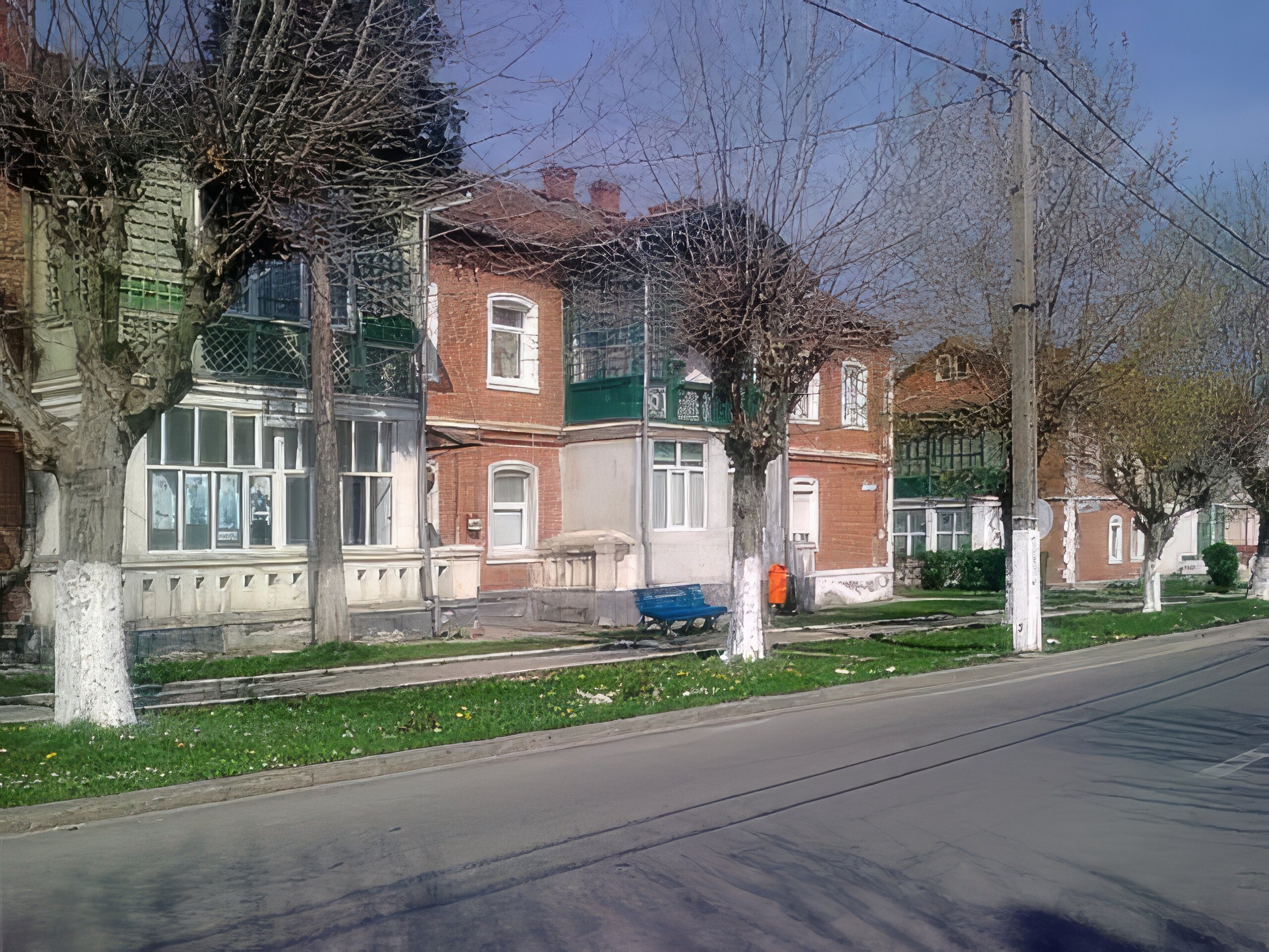
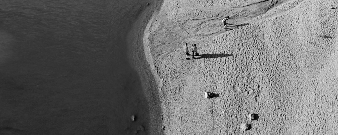
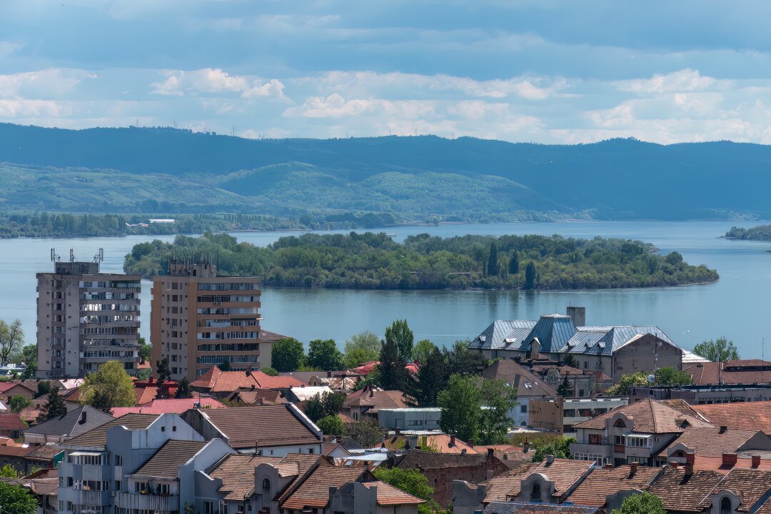
Orșova seems a town like many others, but it had the great advantage of being located/controlled on the river bank (fig. 2a), even though floods were frequent in the city (fig. 2b).
Geopolitical disputes did not end in 1918. After the USSR's victory in 1945 (as part of the victors) ideological struggles between Soviet/Romanian and Yugoslav leaders arose around 1950. For this reason, the district capital in that part of the Banat region was located in Mehadia. These ideological struggles were the reason invoked by the political leadership in our country for one of the most terrible mass deportations (one night in June 1951) of the population in the modern history of Romania (around 40,000 inhabitants) from a radius of approx. 50 km around the border with Tito's Yugoslavia. It was only after 1954 that the district was relocated to Orșova. As after any ideological dispute, the friendship between the leaders of our countries resumed, especially since the USSR wanted at all costs to pan-Slavize our region up to the Adriatic Sea and Bulgaria, with the intention of turning the two countries, Romania and Bulgaria, into Soviet republics. Part of this geostrategy were also two important economic investments in our country: The Galati Steelworks (in collaboration with the USSR) and the Iron Gates Hydro-technical Dam (in collaboration with the SFRY Yugoslavia).
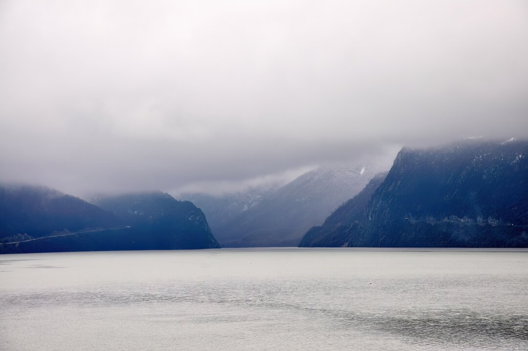
This was, in brief, the context in which the Iron Gates Hydro-technical Dam was born (Fig. 3), with its major effects on the town of Orșova and the island of Ada Kaleh. The study was carried out by dozens of Research and Design Institutes from the USSR, with Romanian sub-projects.
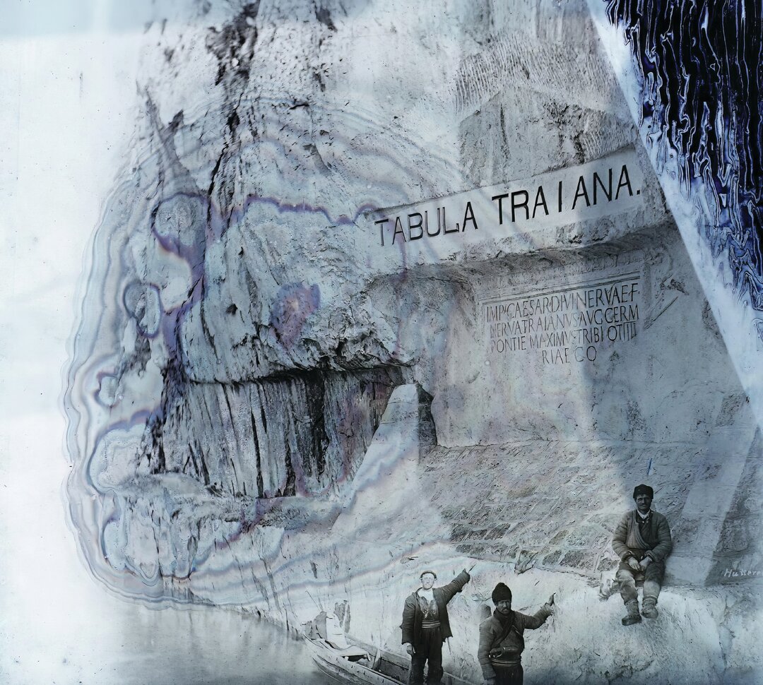
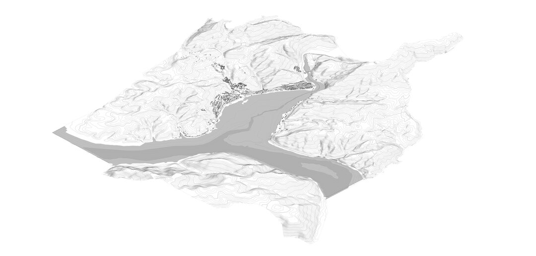
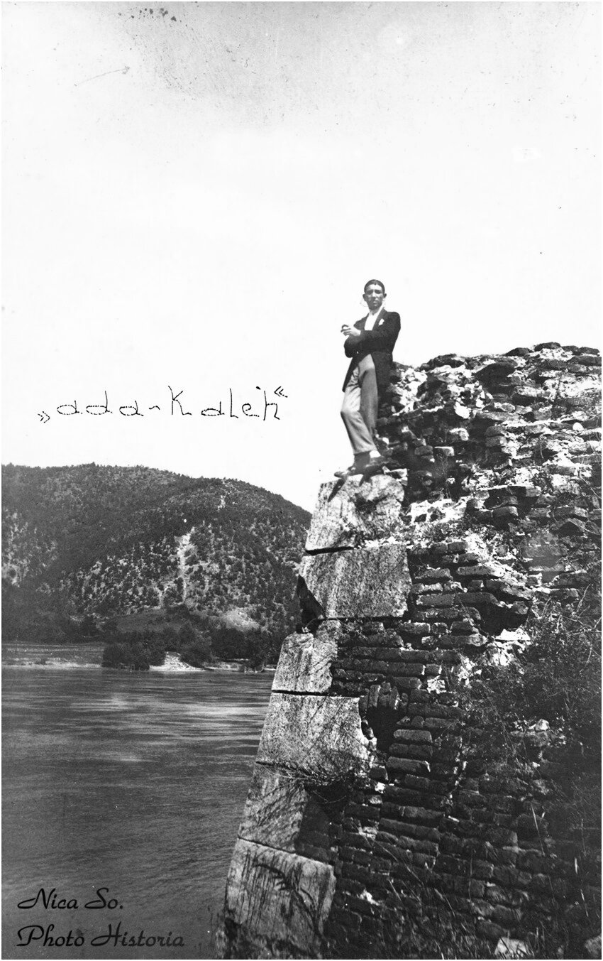
A brief analysis of the contents of Figure 3 shows that the Romanian bank, especially the old town of Orșova (in the lower left stamp), the Danube bank was the most affected up to Berzeasca by the reservoir of the Iron Gates hydroelectric power station and it implied the disappearance or relocation of some settlements. Tufari, Coramnic and Jupalnic also disappeared when the Cerna valley was flooded by the waters of the Iron Gates hydropower plant. The island of Ada Kaleh disappeared and so the hundreds of years old Turkish population had the choice between moving to Turkey, to Turnu Severin or to Orșova. Part of the population displaced to Turkey returned to Turnu Severin within a few years
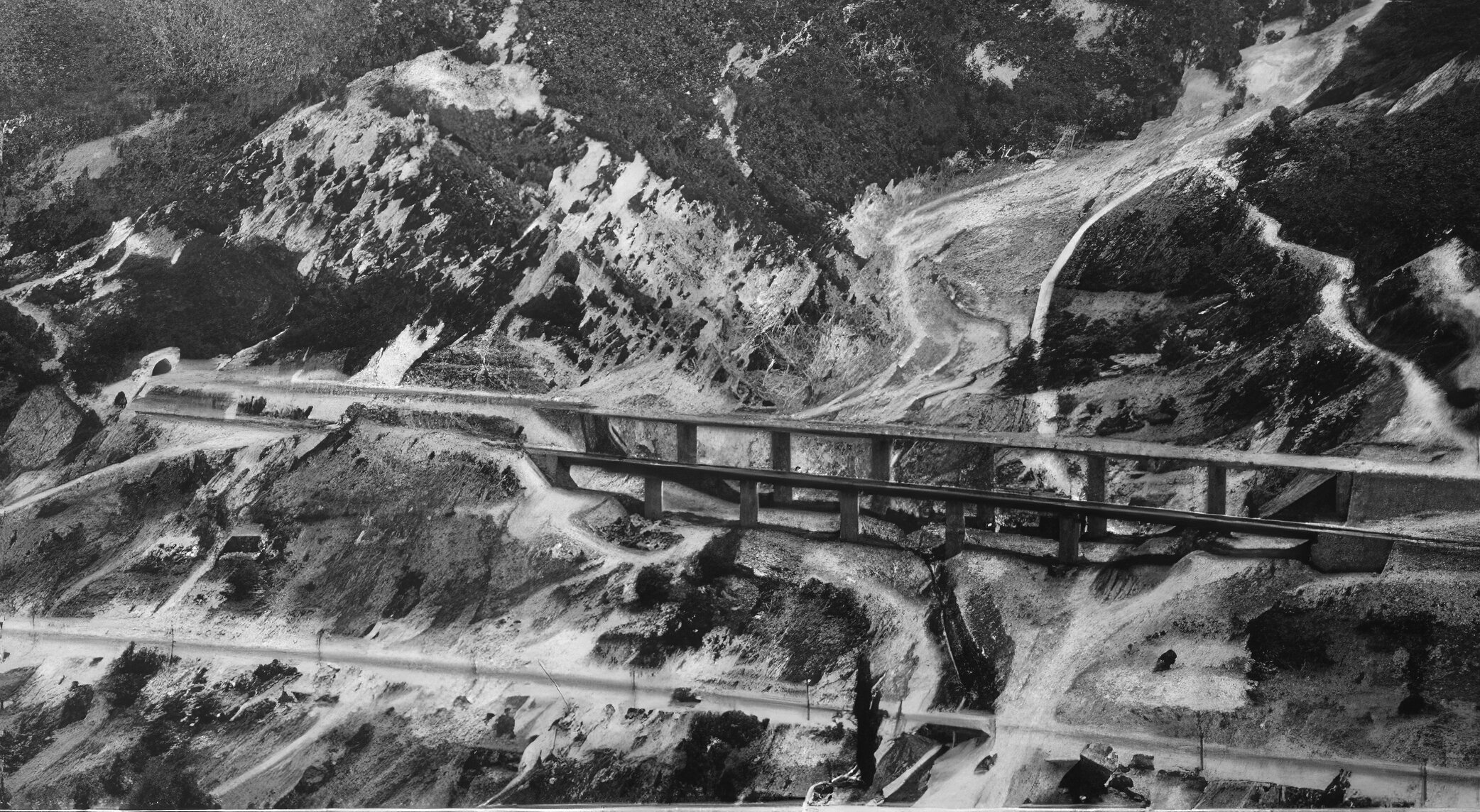
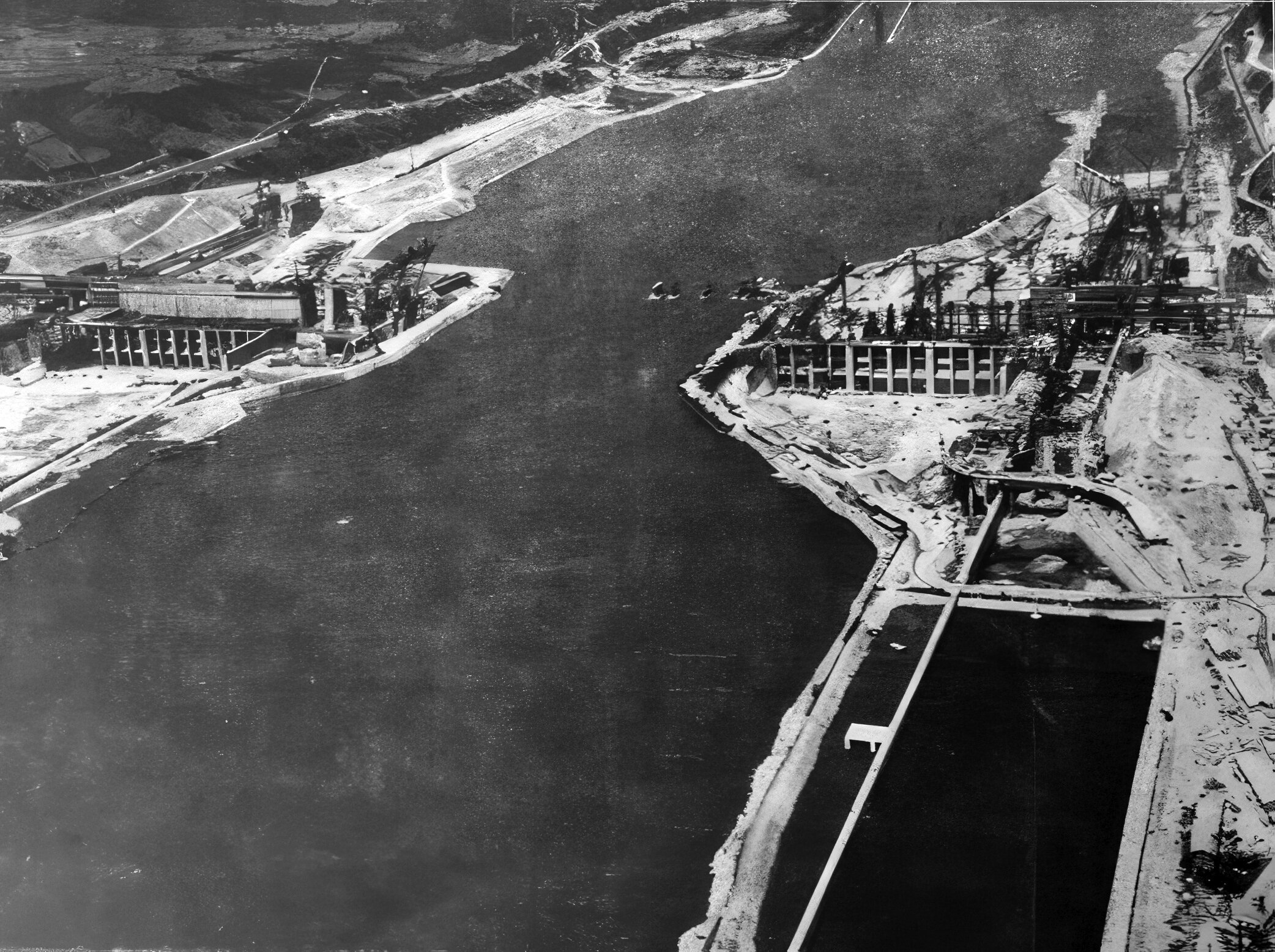
In fig. 4a shows the extent of the collateral investments on the Romanian side, including viaducts for the railroad and road, which today form the European/ global geostrategic mobility corridor Via Carpathia. Figure 4b also shows a stage of the construction of the Iron Gates dam before the closure of the old Danube, which led to the resettlement of the population in the area between 1966 and 1974 to new sites.
The geopolitical epic of Orșovei did not end there. In February 1968, Romania's political leadership abolished the Regions (including the Autonomous Regions, in a bid to get rid of the last remnants of USSR control) and switched to the county-based administrative reform on which Romania is still based today. Orșova (with the entire Danube Clisura up to almost Berzeasca) passed from Banatul Montan (part of the Banat Region) to Mehedinți County.
And so we finally arrived at our theme: the RECOVERY OF ROMANIAN ARCHIVES, which also contain the Systematization Outline of the resettlement of the town of ORȘOVA from 1966-1974.
In 1960, the DSAPCB (Institute of Systematization, Architecture, Design, Constructions Banat) based in Timișoara was given the task of designing the relocation of Orșova, which was to be flooded. The project was coordinated through the Systematization Workshop until 1966.
If in 1962 the Systematization Workshop had only 11 people (with a head of the Design Workshop: arch. Ionescu Natalia / arh. designer: arh. Grumeza Silvia, arh. Nidermaer Paul, arh. Carp Octavian/ draughtsman Mărcuș Georgeta), as a result of professional necessity it increased in 1971 to 26 people (with head of the design workshop: arch. Ionescu Natalia;/ arh. designer: arh. Voștinaru Liviu, arh. Grumeza Silvia, arh. Carp Octavian;/ designer: eng. Flondor Sanda, Mayer Ervin, Mărcuș Georgeta, carh. Balaban Armand, Planner: Kiraly Cornelia). Note the presence of economists in an urban planning collective. We have only mentioned those who worked directly in the systematization workshop, but it should be recalled that the topo; geo; roads, building, electrical, etc. workshops supported the interdisciplinary systematization activity (today called territorial and urban planning) of the area. To simplify the story, I'll use excerpts from a 2020 post.
"From the archives of the time, I had access only to an album with photographs of the plans delivered by the Directorate of Systematization and Architecture Design and Construction Design Banat (DSAPCB) in Timisoara,documentationnecessary for the construction of the Hydropower Complex at Iron Gates, a study entitled: COMPARATIVE STUDY OF THE ENLARGEMENT OF THE LOCALITY OF ORȘOVA, PROJECT D.S.A.A.P.P.C. BANAT, no. 9331-32, with 11 copied plates/photos as follows: The Location in the Banat Region; Systematization Proposals stage 1970 for the Iron Gates Hydropower System Area; Existing Situation of the Iron Gates Localities; 4 variants with the Analysis of the lands proposed as possible for the relocation of Orșova, which was to be covered by the dam waters and with 6 variants with Informative Systematization Details for the 4 location variants".
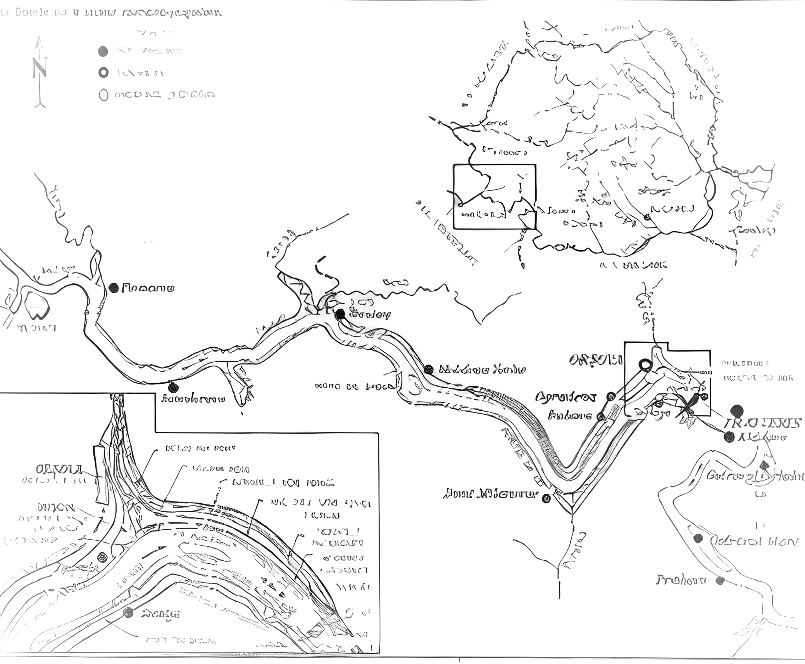
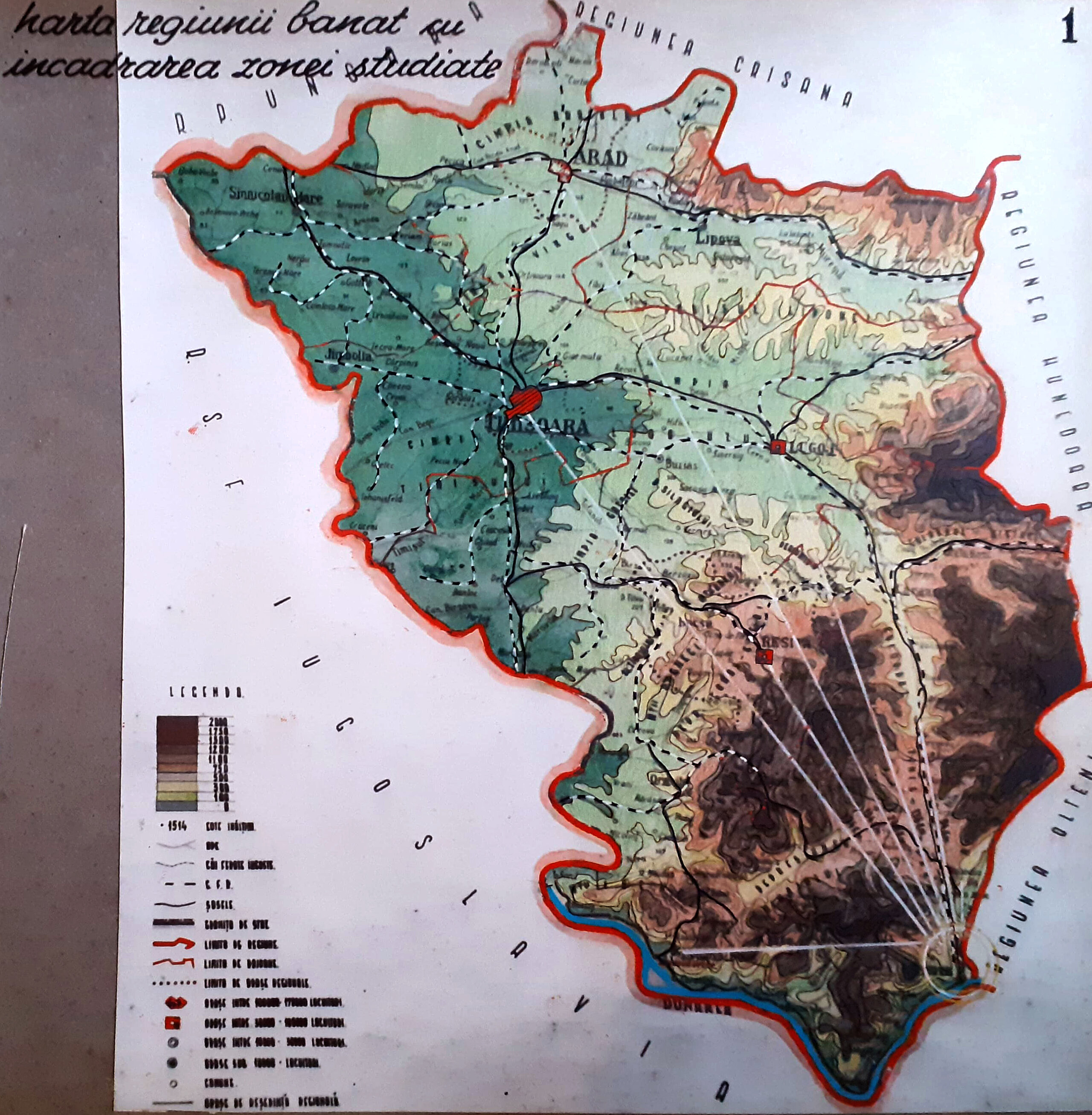
Let's start the analysis on the uncovered photos/plans: the study started with the analysis of the regional context of Banat (Fig. 5) and the impact of the Iron Gates dam on Arad, Timișoara, Lugoj, Reșița and Moldova Nouă. The analysis of the effect of the relocation of the locality was included in the written part, which was extensive, especially as the mobility network (especially the road network) was particularly backward at that time.
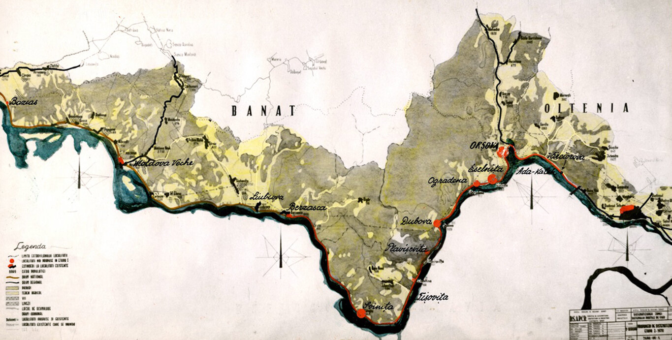
This was followed by the study/analysis of the area of the Romanian territory (Fig. 6) with effects on the localities Moldova Noua, Berzeasca, Svinița, (Planișevița) Dubova, (Ogradeva) Eșalnița, Orșova, including the island Ada Kaleh (the localities in brackets were not found on the map today).
At this phase, an important role was played by historians and archaeologists who were given the opportunity to study the remains of the Danube Clis route, the Romanian side.
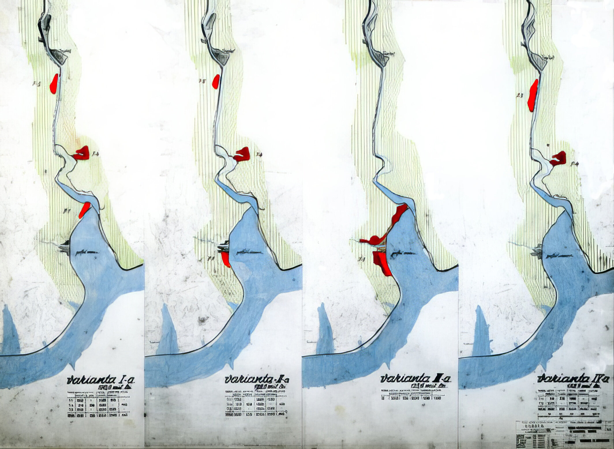
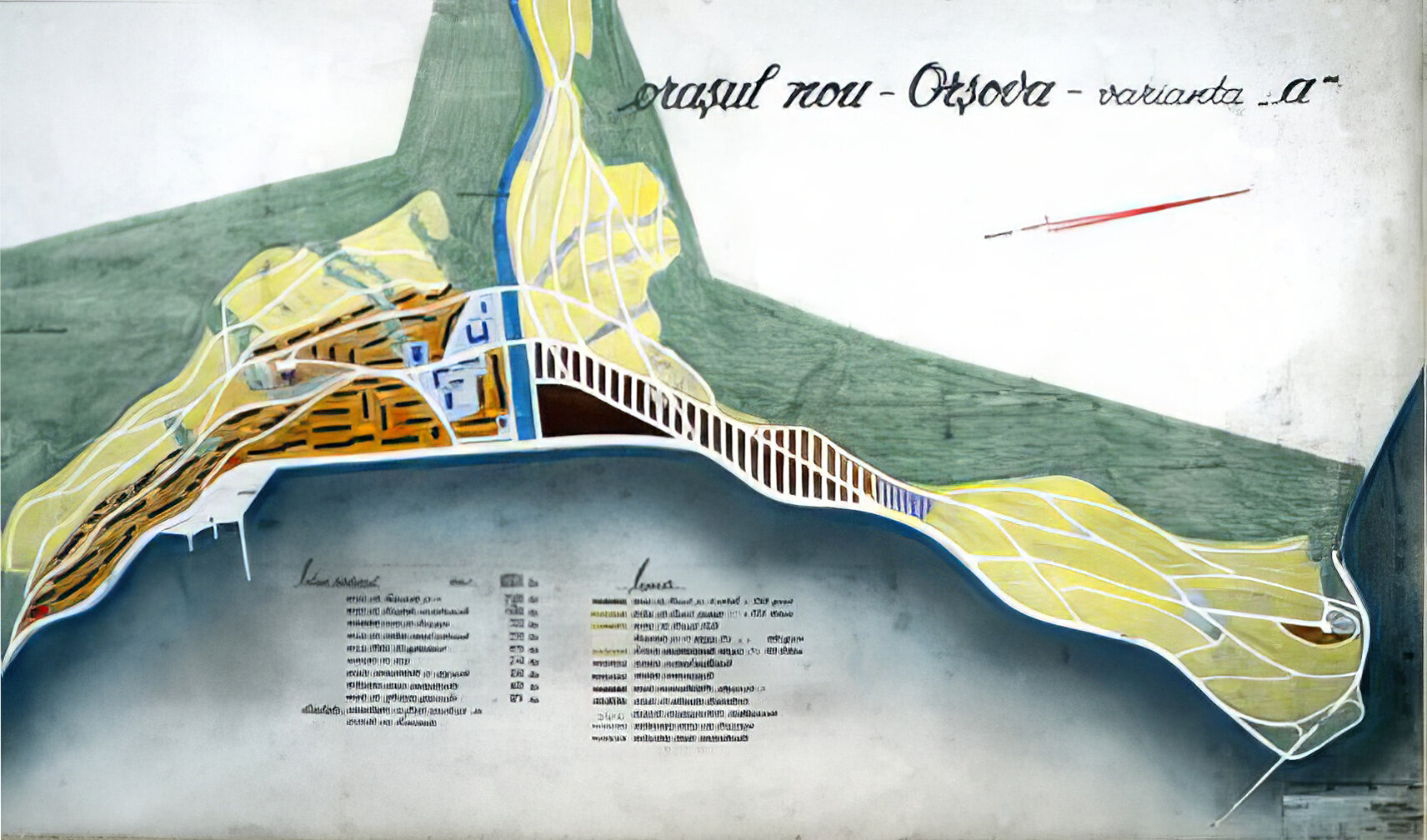
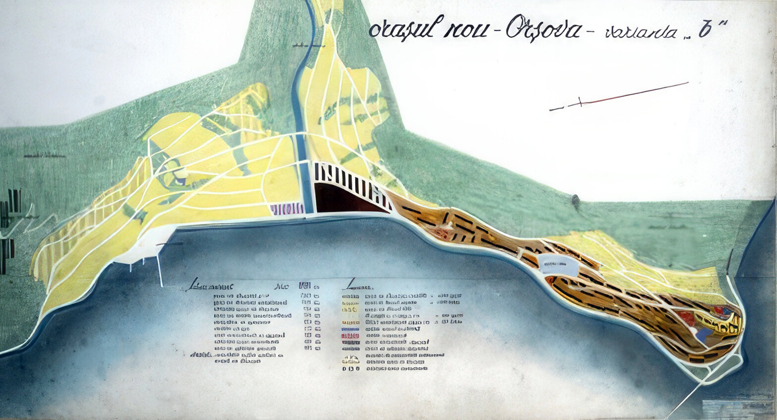
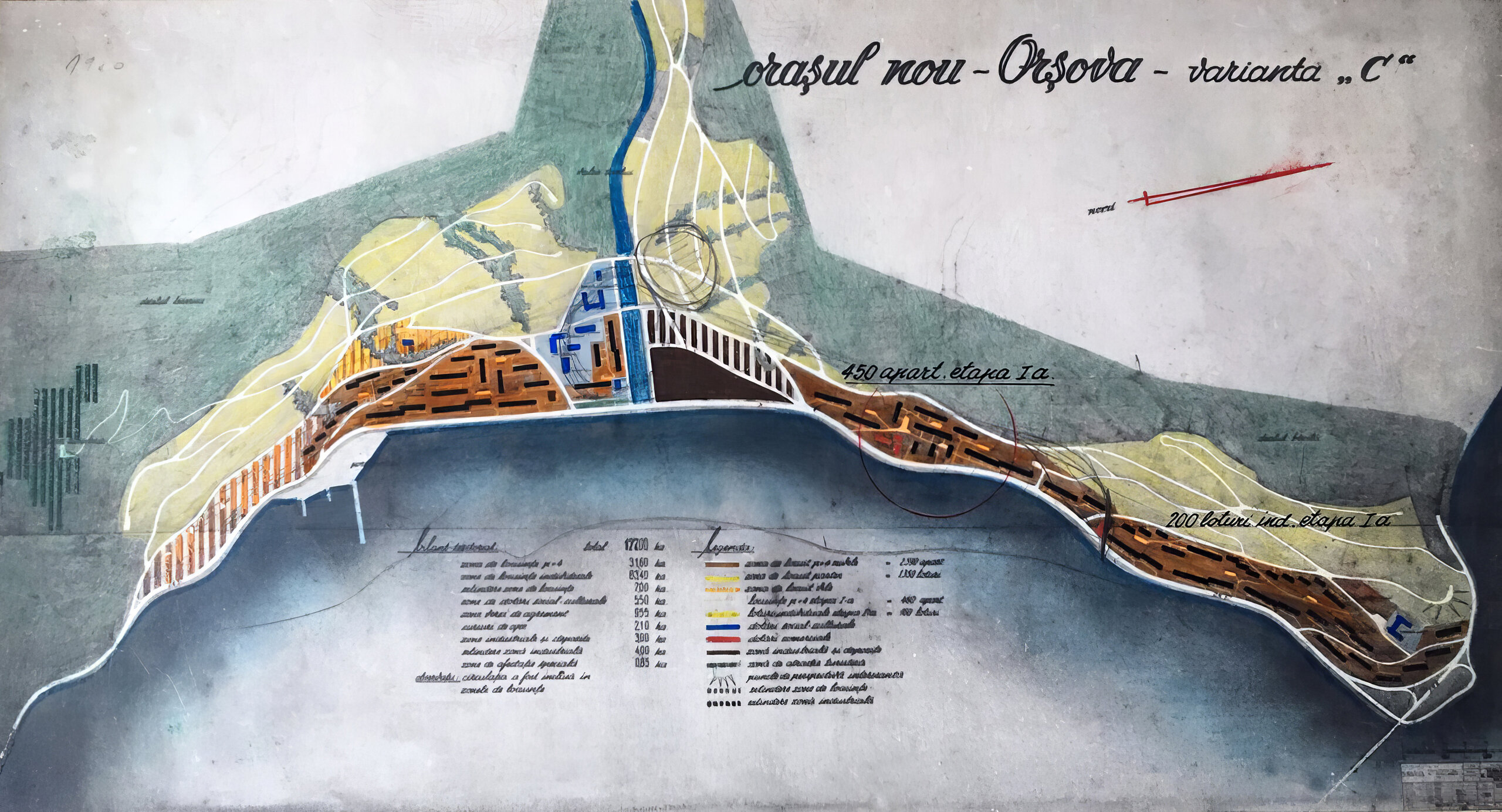
In order to discuss the 4 variants I used part of the mentioned post: "The comparative analysis of the 4 variants of the land (fig. 7) was made from the ideological (today it is called Political Correctness, PC for short), economic, social, cultural, ecological point of view, and it is described in the written part".
"Variant I proposed the realization of three new distinct communities/nuclei, with two communities in the Cerna valley, one of them on a meadow on the left bank of the Cerna river course and another on the right bank of the Cerna before the localities of Topleț and Barza and a distinct nucleus at the confluence of the Danube and the Cerna river.
Variant II differed from the first one only by moving the core on the Danube around the point of contact between the stream flowing down from the hillside and a small existing community.
Variant III (the one that was adopted/realized) proposed the extension of the small community on either side of it with a town consisting of blocks (upstream on the Danube from the existing nucleus) and individual buildings (downstream on the Danube from the existing nucleus)".
Variant IV proposed two sub-variants with collective housing in blocks of which one on a meadow on the right side of the Cerna river course before the localities of Topleț and Orșova (see fig. 10 - Systematization Detail of sub-variant 1 and sub-variant 2) and a site for a "Garden City" implant on a land crossed by valleys on the left side of the Cerna river (fig. 8).
"At the governmental level it was decided to choose variant III, with a unique settlement on the banks of the Danube bay that emerged after the construction of the dam.
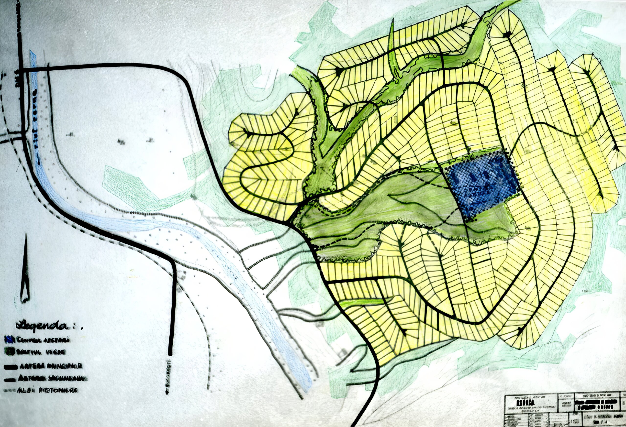
What interests us in this post is variant IV (T4), rejected by the way, with a new community with individual lots for the residential area proposed on the meadow on the left side of the course of the Cerna River, in an area of 6,300 ha ( fig. 8)."
"I have chosen this plan (8a) to note the protection/non-construction of the valleys (ravines) in the ISD, which are still preserved on the site today. It is also a forward-thinking concept for our times, when the New Green Deal concept was requested (but not accepted by the local authorities) . The proposal was characterized by lots for individual housing, motivating the cultural/social element of the transmutation of the population of the future 4 flooded localities - Coramnic, Tufări, Jupalnic and Orșova - with traditional housing. This typology of housing was complemented by the use of cul-de-sacs, typical operations of British "garden city" towns from the beginning of the 20th century to the present day, and by a large community center (marked in blue). For the Romanian People's Republic, proposing to move the 'new working class' into blocks of flats alone was an act of great courage at the time (1964). Obviously this type of housing in separate communities was not approved".
An example realized in Romania in the 1950s of the last century of a "garden city" implanted in Victoria City, Brasov County (fig.9) was designed by a USSR Design Institute.
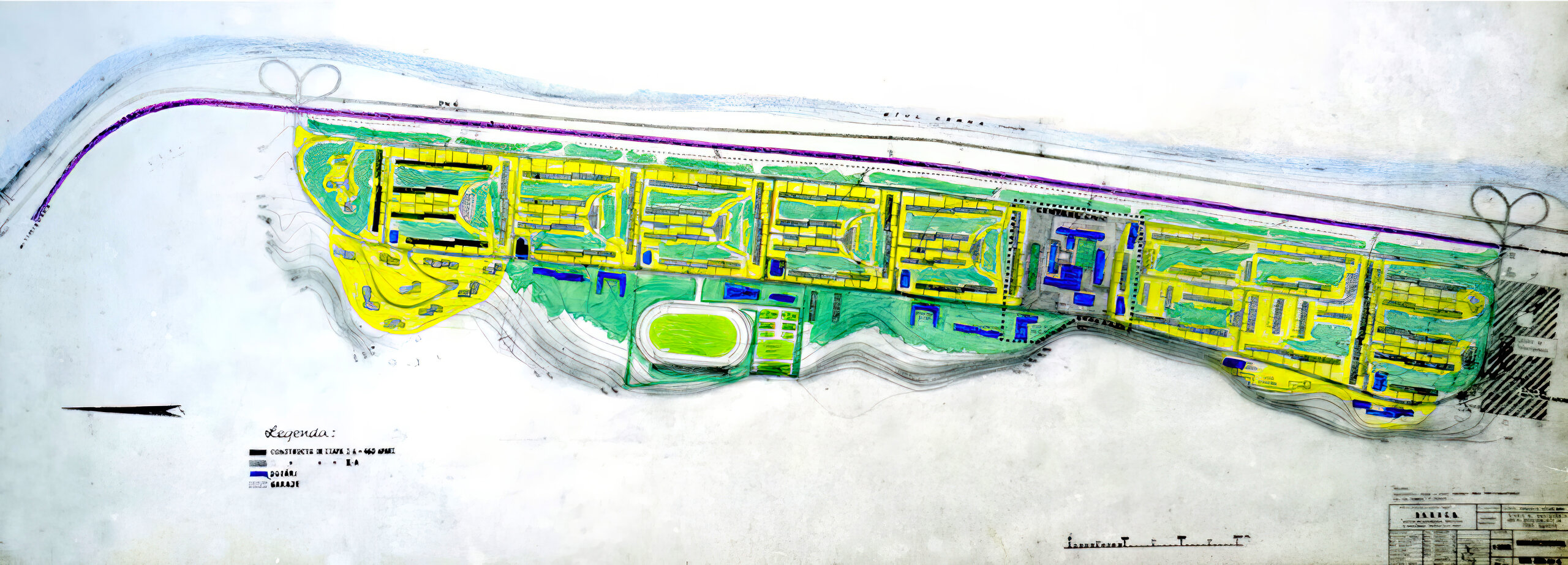
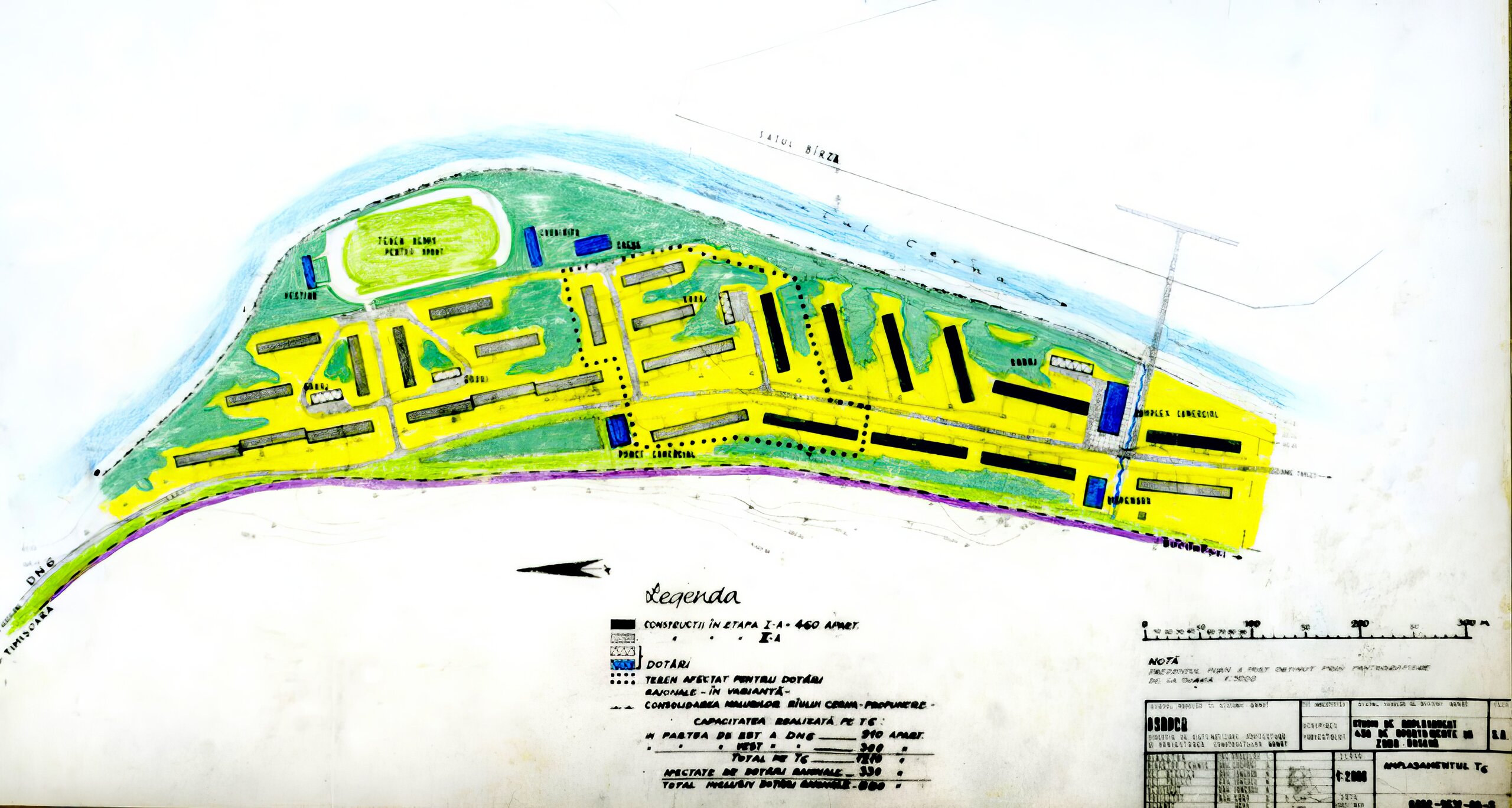
Two sub-variants of Variant IV (Fig. 10) of moving Orșova along the Cerna River between Topleț and Barza into residential areas of 5-storey blocks of flats were also detailed "Informatively"
The two sub-variants in Fig. 10 located on flat agricultural land keep the route of the existing railroad and road. Both sub-variants follow the principles of the socialist type of urbanism practiced in Romania between 1960-1975, with spaces for sports and educational facilities according to the norms of the time. Sub-variant 10a, located closer to Topleț, is based on the principle of enclosed enclosures of blocks with facilities grouped in one area, and sub-variant 10b, located closer to the current location of Orșovei, is based on the principle of lamellae of blocks with green spaces between them (distances between blocks 60 m, L=3H) with related facilities distributed everywhere. The first sub-variant has the advantage of easy pedestrian access to the hillside/mountain, and the second one has the advantage of easy pedestrian access to the water (Cerna river). Both variants were abandoned, the new location on the Danube at the confluence with the Cerna River (variant C) being chosen for both geostrategic (control of the Danube) and economic (shipyard) reasons.
"But it was worth the effort because variant C, the one that has been approved/realized (fig. 11c) is a reasonable compromise, having downstream/right downstream also an area with 200 lots with individual housing (for the displaced population), in addition to the 450 apartments in blocks on the left of the picture".
The displaced residents in the 200 plots for individual housing received in addition to a very small plot of land a number of bricks (I suspect from demolitions).
What remains of these studies? What was accomplished before and after the relocation?
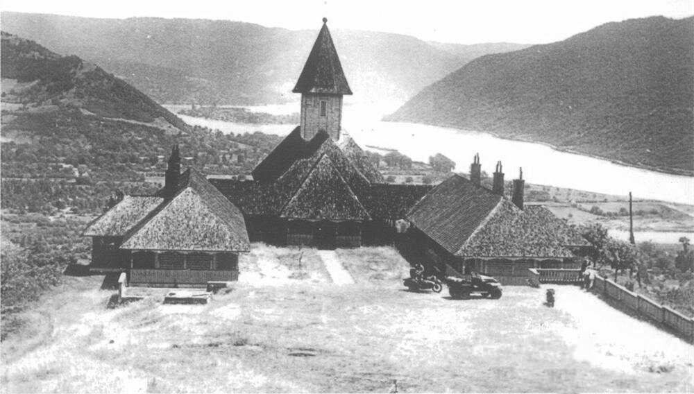
The town is decrepit after 1990, like most small/medium sized towns born in the 1960-1989 era. Their chance is tourism because any visitor today can access two MARKING ARCHITECTURAL SIGNS of the place, visited by thousands of tourists:
It is located on the crest of the Moșului Hill, founded (1936-1939) by the great inter-war journalist Pamfil Șeicaru in memory of the battles he fought during the First World War. The monastery complex was converted into accommodation and restaurant in the period following the geopolitical changes after 1945. After 1990, the religious foundation was taken over by the Metropolitan of Oltenia and became a place of worship. It occupies an important visual point in the Danube gorge (fig.12).
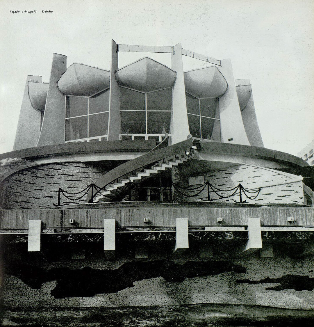
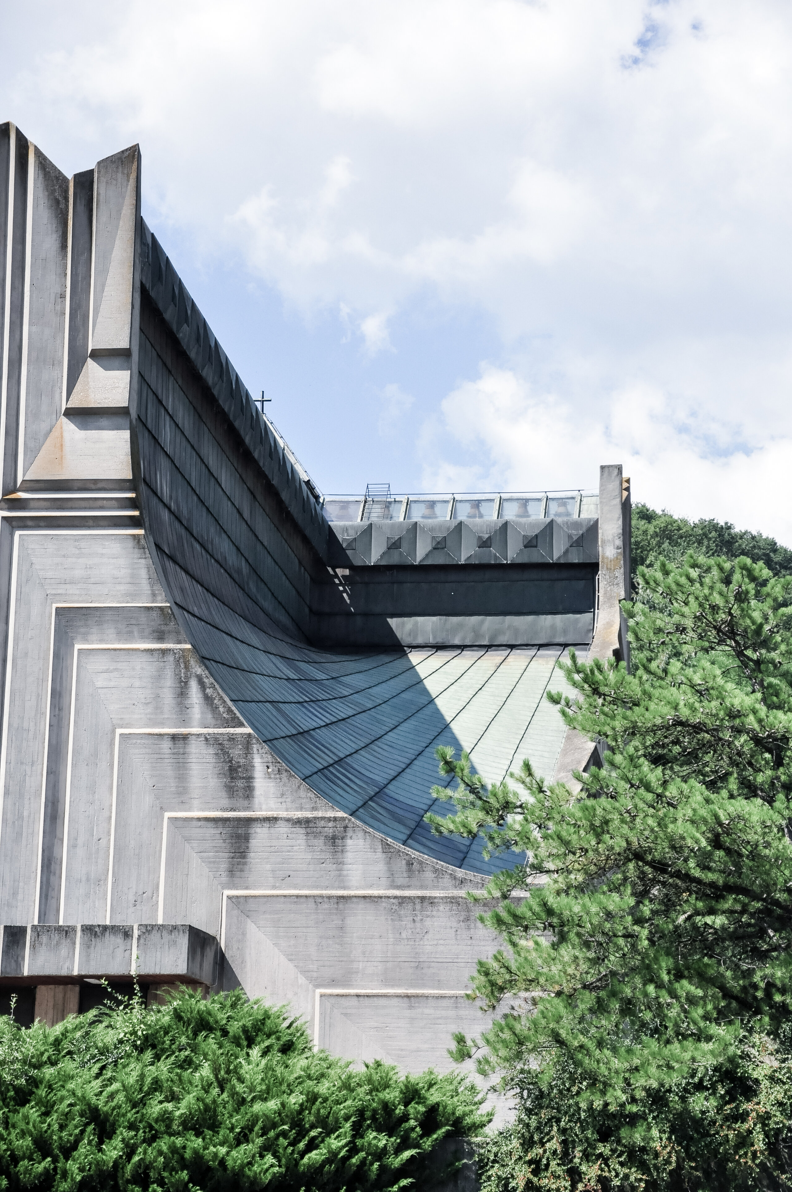
The Roman-Catholic Church, built between 1972-1976, is located in the geometric center of the new settlement at the confluence of the new course of the Danube and a stream/river flowing down from the hills.
"What I noticed, on closer examination of this photo/plan (fig. 11c) ..., were the two "guguloaie" (pencil scribbles) drawn on it. Possibly the operation of drawing the site of a new investment was done in great haste/secrecy in a DSPAPCB office around 1971, with very few people present. What international acts were signed at that time, what internal decisions were taken in Bucharest or Timișoara, at the DSAPCB, we can only speculate.
What do they suspect behind this discovery? I think that the reason was that on a site (the one in front of the stream flowing into the reservoir that had already been built), between 1972-1976, the Roman-Catholic Church (the only Catholic church built during the communist regime in Romania) was built, designed by Hans Fackelmann, an edifice that, together with the one built by Nicolae Porumbescu in Satu Mare, are emblematic of modernist/brutalist architecture in communist Romania. I have an unforgettable memory from 1976, of a train journey with MASTER Hans Fackelmann in the restaurant car (in order to be able to tell/describe as many details as possible about the masterpiece that I was to see at the end of the Timișoara-Orșova road) and a visit as a site attendant next to the MAN Hans".
Because we have offered these two achievements for reflection, because we kept mentioning at the beginning of our post the importance of the geopolitical situation at a particular moment, we must mention, in the second case, the attempt of the People's Republic of Romania in the early 1960s to resume economic exchanges and in 1968 to establish diplomatic relations with the Federal Republic of Germany. The effect was the subsequent location/realization of the Roman Catholic Church in the central area of Orșovei.
Let's not forget that the science of building "the city" is the art of using all the favorable geopolitical situations of the moment for the good of the community, after having a SYSTEMISING SCHEME/PATJ/PUG approved on POSSIBLE SCENARIOS, for CLARIFICATION OF OPTIONS (notions in the current European language), then calling on architects who know the measure of a job well done.
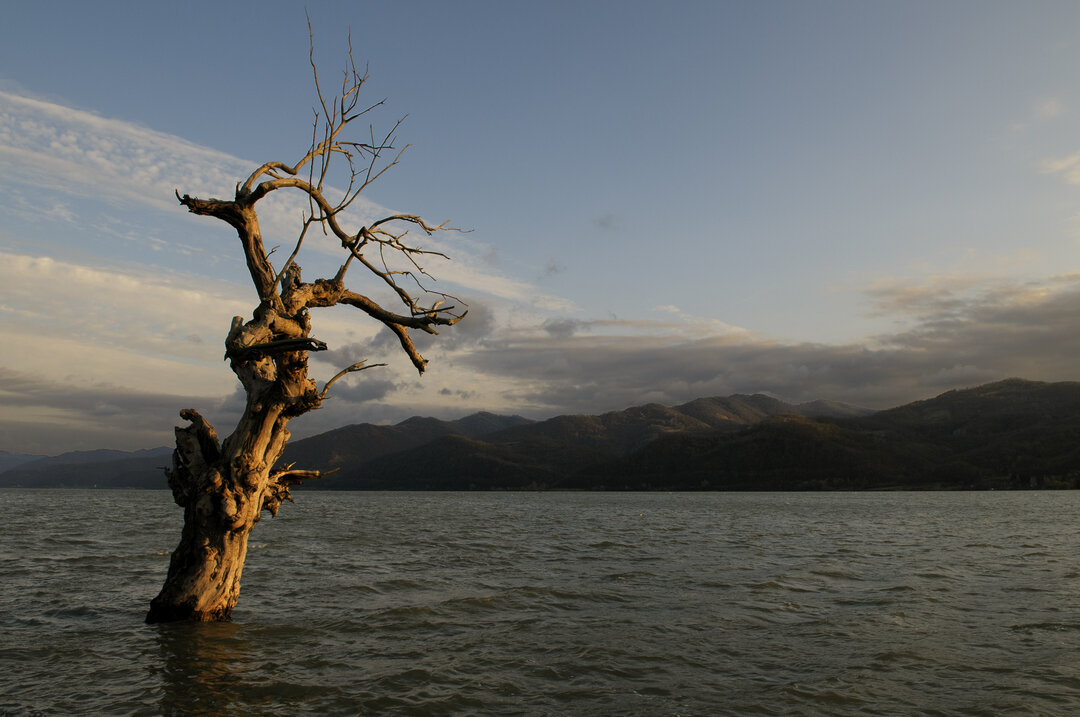
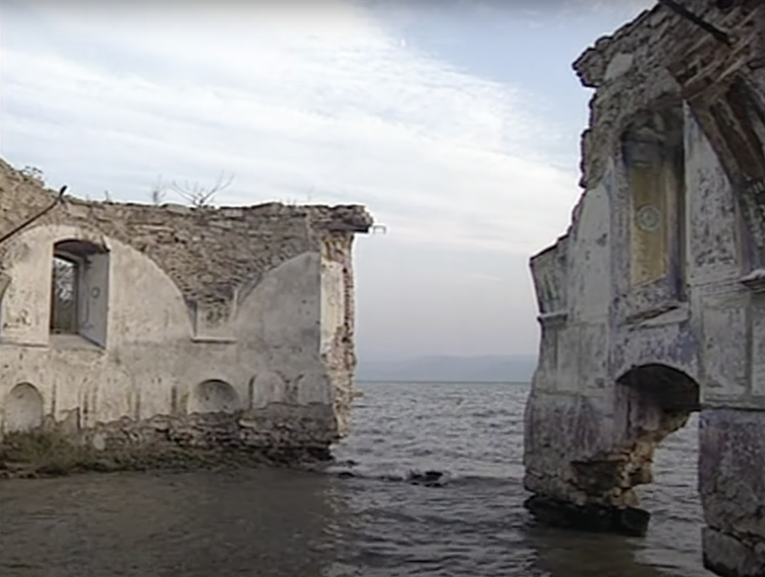
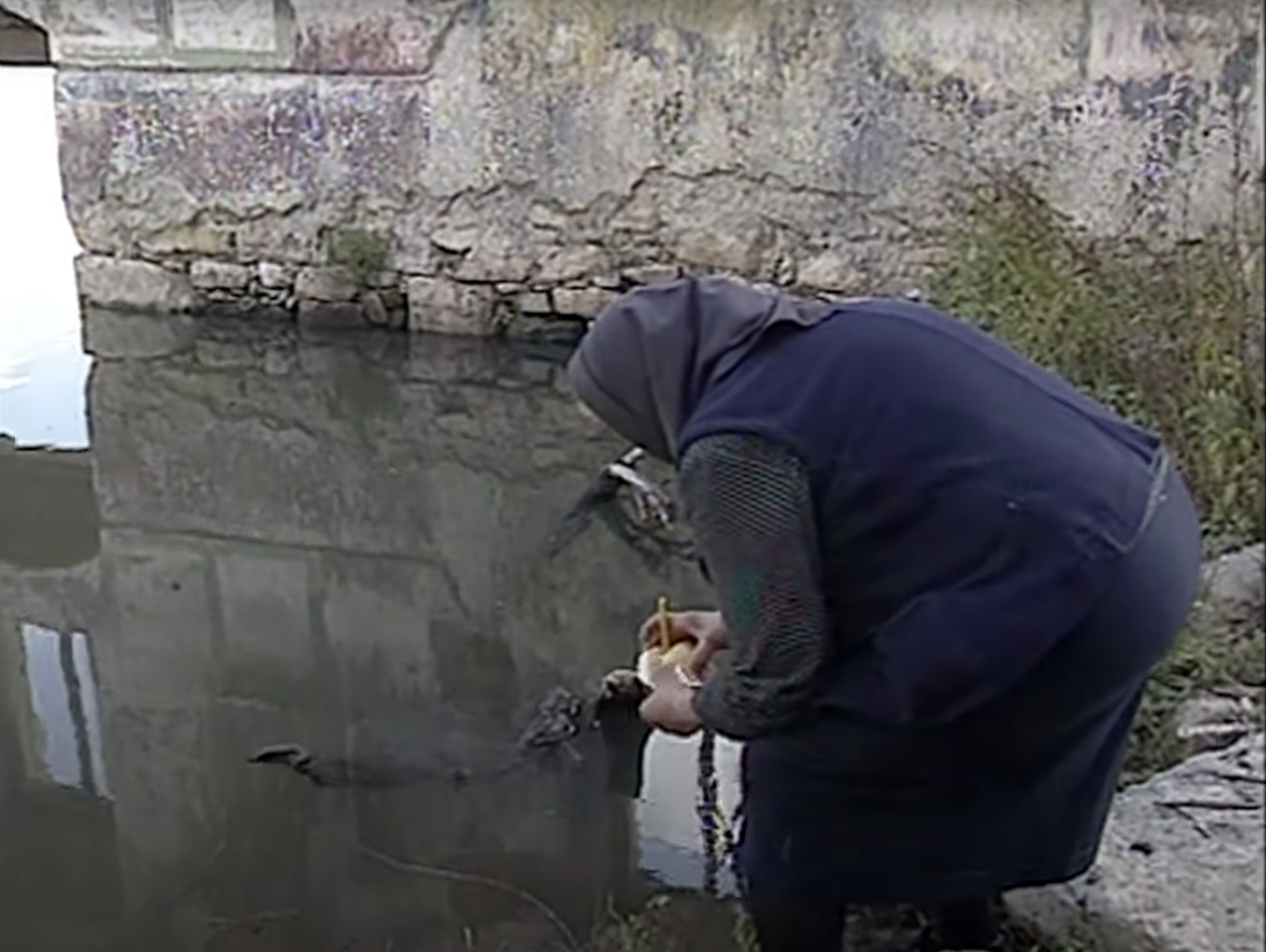
Our intention in 2021 was to understand in a rational, dry way, the process of a dramatic action of strategic urban planning, from a period dominated by the era of forced industrialization in Romania in the 1960s and 1970s, lagging behind what happened in the early capitalist period in Western Europe. It remains the duty of today's younger generation to empathically analyze the dramas left in the souls of people displaced by the momentum of the era. Over time, these traumas have metamorphosed into legends that still haunt the forcibly abandoned places. A case in point is the church in the village of Svinița on the Romanian side of the Danube. The old village, inhabited by ethnic Orthodox Serbs, had the misfortune of being located below the level of the new reservoir, which is why it was relocated to a higher elevation on a nearby hill. Despite the attempts of the officials to erase all traces of the old village, although the dam water has gradually covered everything, the walls of the old church are still standing (see Fig. 14a).
These walls, still standing in the water, mark the souls of the locals as an everlasting reminder of their existence in the area. Today, 60 years after the dam was built, they come down from the hill where the village was relocated to perform their ancient rituals within the walls of the church in the water (see Fig. 14b): "Let Maika Kalea's alms be given to this church and let all the bad things go to the Danube", says a peasant woman in the film during this ritual. To realize the meaning of this postscript, it is worth watching a documentary film (only 15 minutes long) made by Vasile Bogdan in 1998, on Romanian Television, Timisoara Studio, from which I have captured the images in fig. 14 (accessing the website: YouTube- Vasile Bogdan director).
It is a lesson that we should learn today, in order not to repeat the mistakes of the past, because: "PEOPLE ARE MORE IMPORTANT THAN BUILDINGS and LOCAL COMMUNITIES ARE MORE IMPORTANT THAN CITIES".
- Radu Radoslav, 2020, - IT'S NOT IMPORTANT HOW MUCH YOU GET, BUT HOW MUCH YOU SPEND | Radul's Blog (wordpress.com), vol. IV, RADU'S BLOG - A TIMIȘOREAN URBANIST'S DIARY IN THE TIME OF PANDEMIC, 2020.03.07.- 2021.03.20., Ed. Cosmopolitanart Timișoara, ISBN 978-606-988-062-3, pp. 218-2021.
- Radu Radoslav, 2020, 2020.09 - O CAMPANIE ELECTORAL FĂ FĂ O DEZBATERE REALĂ | Radul's Blog (wordpress.com), vol. IV, Radul's Blog (wordpress.com), vol. IV, RADU'S BLOG - JURNAL OF A TIMIȘOREAN URBANIST IN TIMES OF PANDEMIC, 2020.03.07.- 2021.03.20., Ed. Cosmopolitanart Timișoara, ISBN 978-606-988-062-3, pp. 153-154, 2021.


-topaz-denoise-enhance-sharpen--15883-m.jpg)