1.075 km
The town has a not very distant history, being mentioned for the first time as Lichirești, a settlement already established in 1600 (Tudor, 2008), but the area is known among specialists for the ancient sites of the Hamangia, Boian and Gumelnița civilizations. With the right of the Ștafetari horsemen to settle on the Lichireștilor estate, the locality began to be known as Călărași (Tudor, 2008), and over time it consolidated this name, as it is still known today.
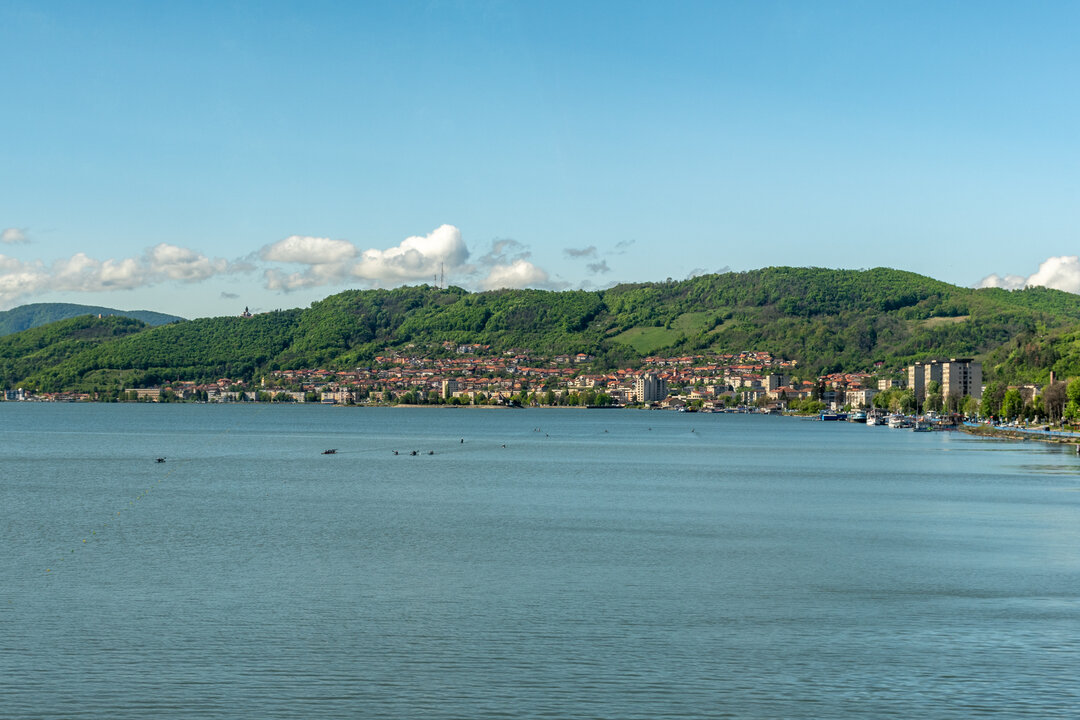
At present, many of the cities on the Danube are shrinking, a fact that is visible and quantifiable on all levels of analysis: from the social to the economic, with traces in the geometrically constructed and also in the perceived space. Of course, there is also a nuance given by the label of provincial towns, with a quiet atmosphere, generous public green spaces, low urban density, and Calarasi is not excluded from this description.
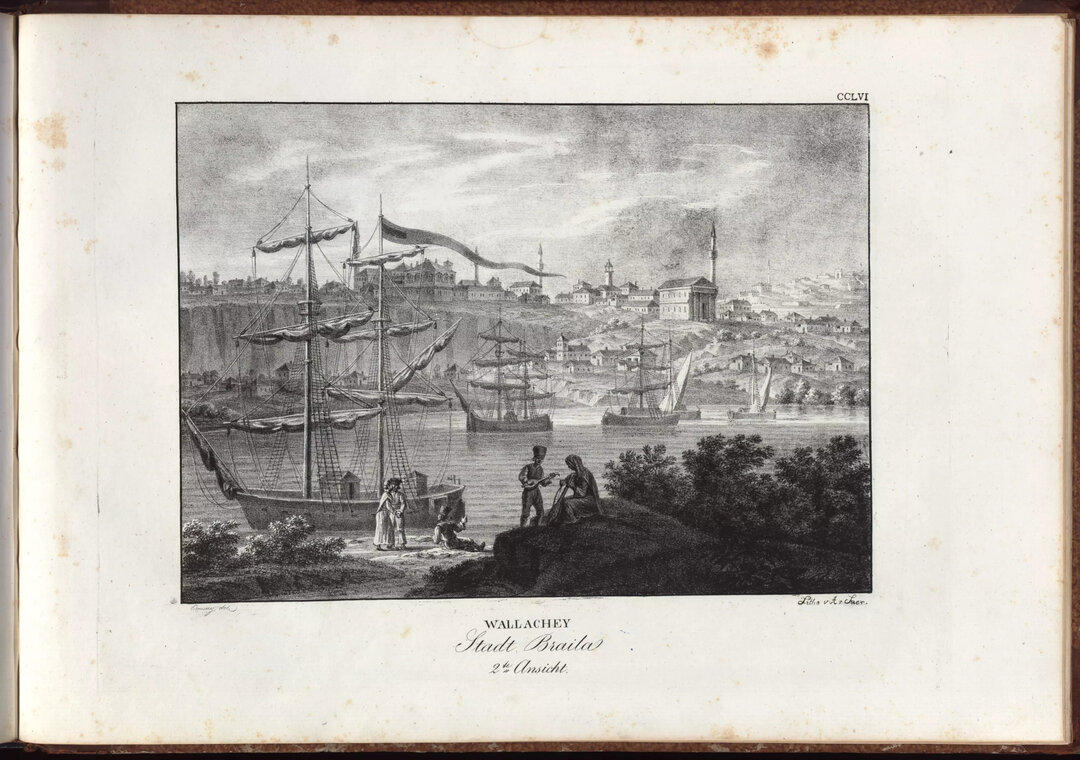
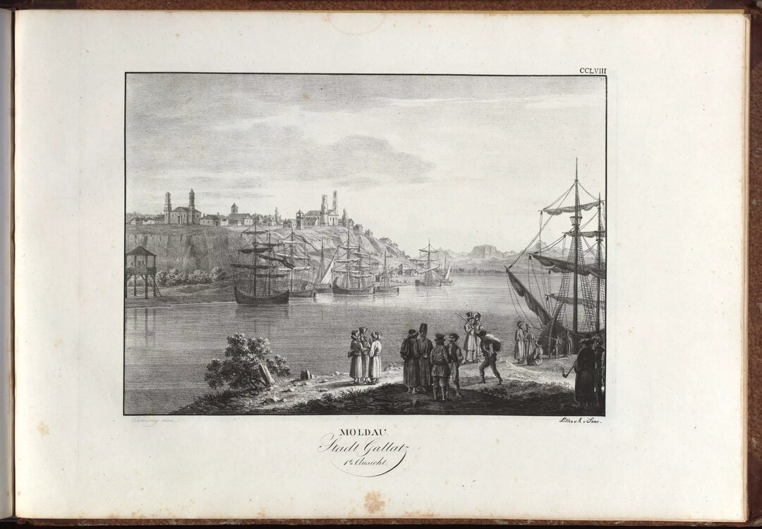
The town developed in the wake of the Russo-Turkish war, the moment being marked by the year 1833, when it became a military outpost in front of Silistria, then still under Turkish occupation. Although the motivation for the development of the two localities does not have happy origins, their destiny is to evolve together, sometimes as adversaries, sometimes as twinned localities. From this period onwards, under administrative and military impetus, the locality underwent an accelerated development, marked by competition with its sister across the Danube. Another important moment was the acquisition of the status of free city in 1852, when, for a short period, it changed its name to Știrbeiu1 (Tudor, 2008).
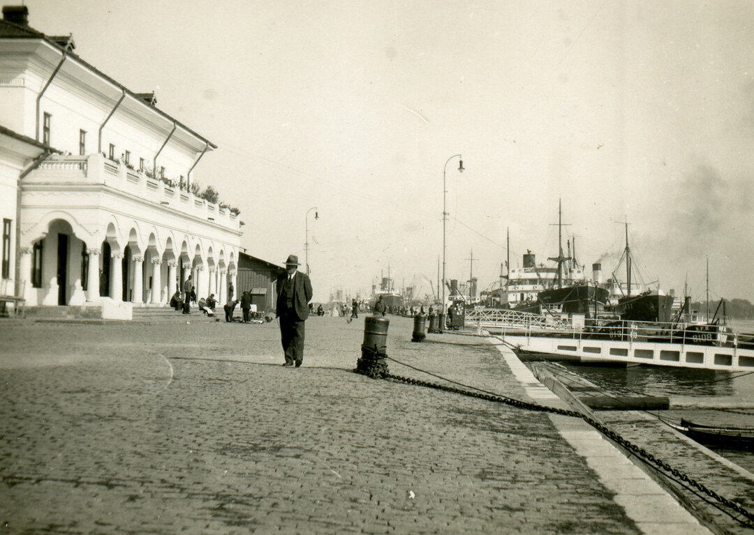
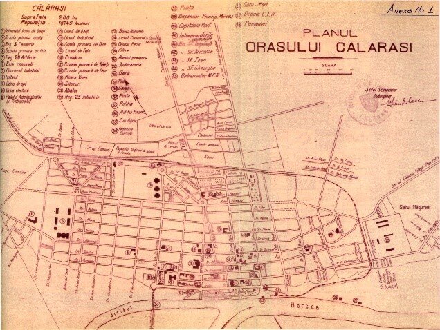
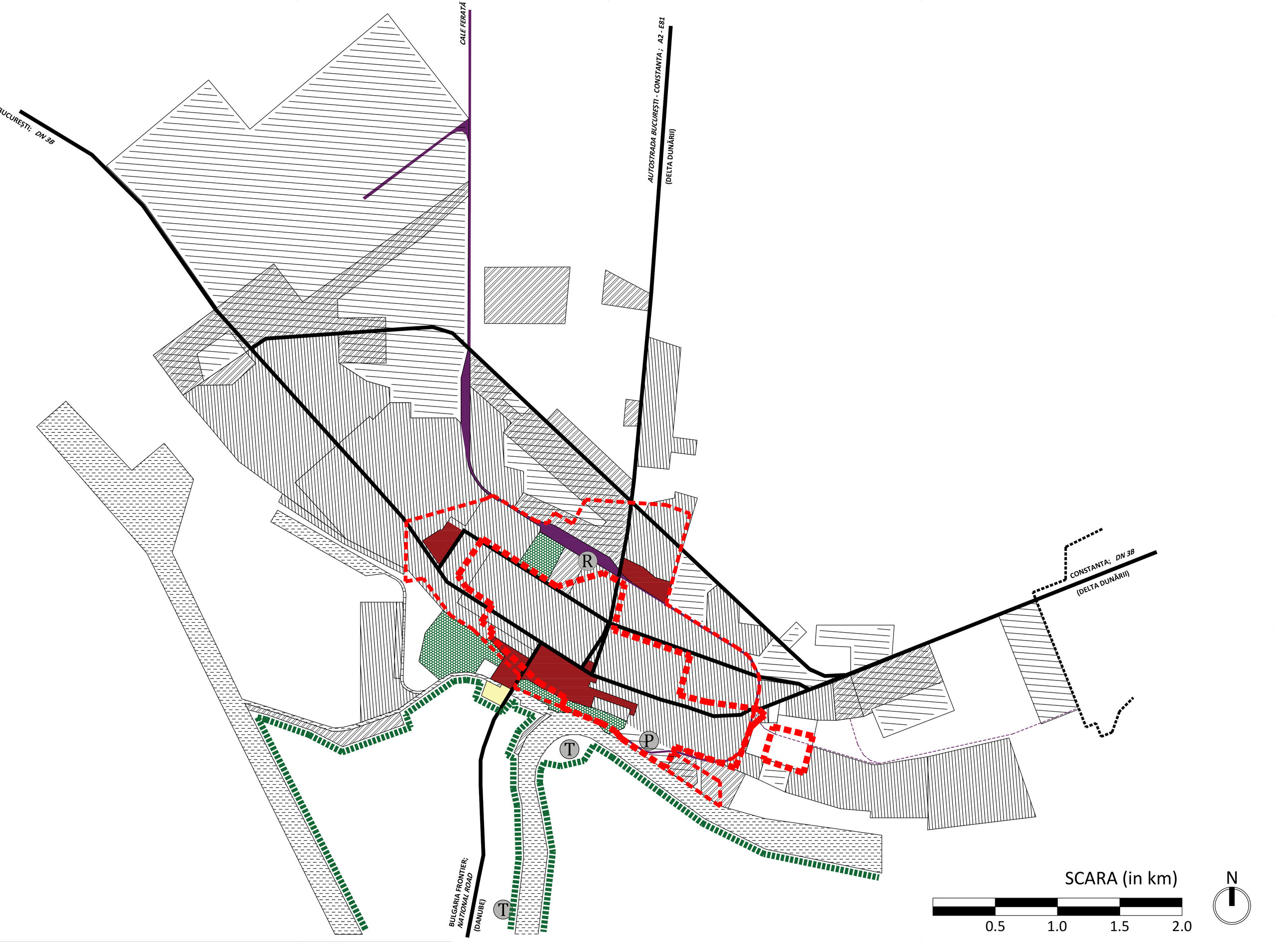
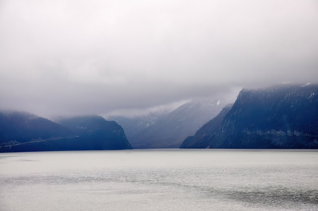
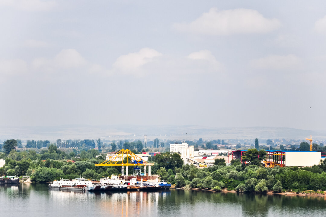
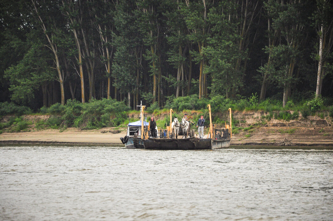
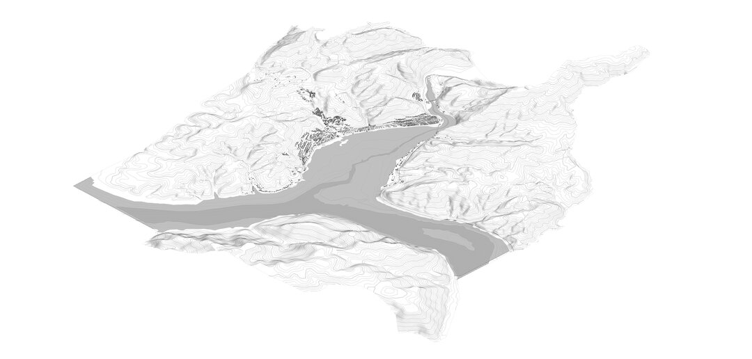
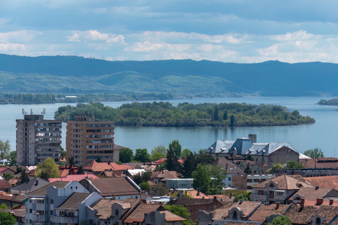
The development of the town remains, however, naturally closely linked to the Danube through the Borcea Arm. Here, near the water, are located the main administrative and social-cultural buildings and also near the water are the economic functions, based (almost) exclusively on trade. The quays of the harbor have been developed on the shore, and since 1886 they have been connected with the rest of the country by railroad - an important prerequisite for the development and affirmation of the city as a regional commercial point. Goods, mainly grain and timber, are exported through the industrial port to upstream European countries: Austria and Germany. Next to the industrial port, the civil port was developed, the two having representative administrative buildings bearing the signature of Eng. Anghel Saligny2 (Tudor, 2008): the harbor master's office, today in an advanced state of decay, and the river station, currently undergoing interventions that have changed its original image and functionality.
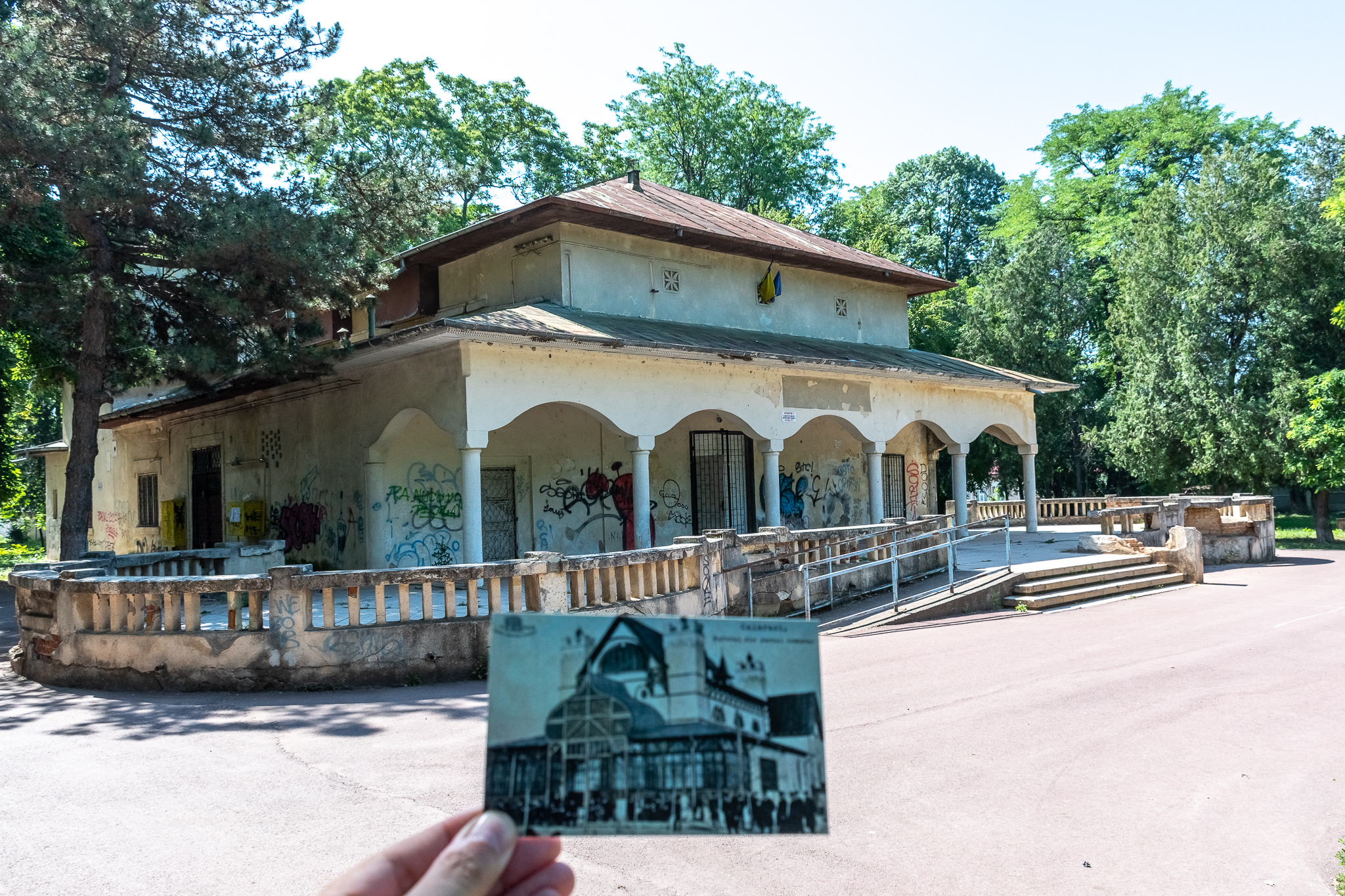
In the first years of the 20th century, the Central Park was laid out on the waterfront and, within it, the Communal Theater, also known as the Buffet of the Communal Park or the Communal Casino. The theater was complemented by a music pavilion, which has now disappeared. Through these developments, the town consolidated its status as an economic, social and cultural center developed from the 19th century onwards, being in a relationship of dependence with the water.
The town, through its layout and functions, is oriented towards the banks of the Borcei.
The inter-war period continued the development of the town through the expansion of the administration with new housing plots, social-cultural and educational buildings and the strengthening of the economy through the establishment of the grain exchange.
Unusually, for a short period of time (1936-1940), associated with Cadrilater, a civil airport was set up in Călărași for the Bucharest-Călărași-Bazargic/Balcic route. Although the airport was located to the north, opposite the Danube, its existence certifies, once again, the important position of the city within the regional system, acquired as a city on the Danube.
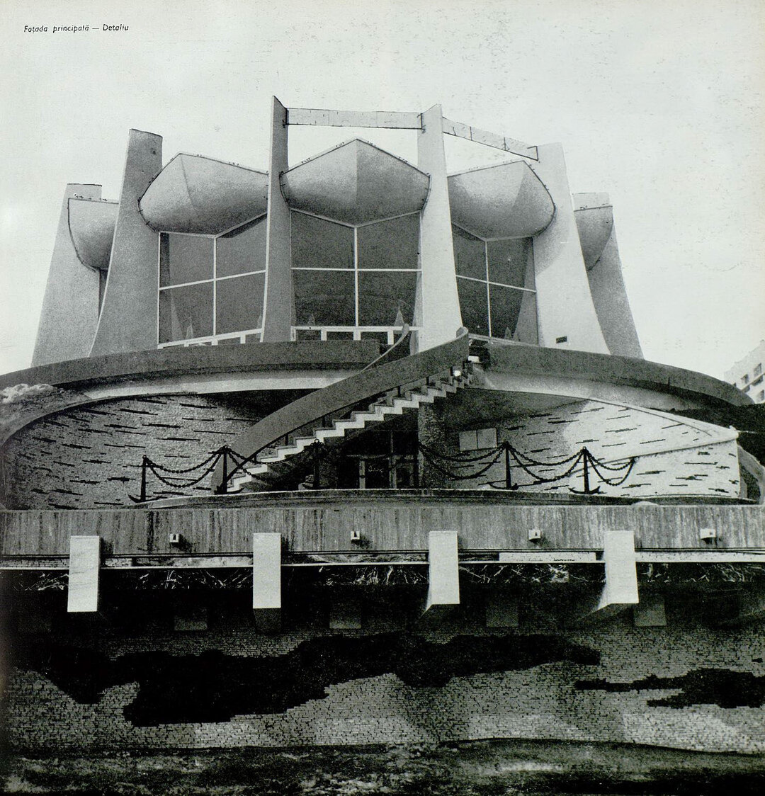
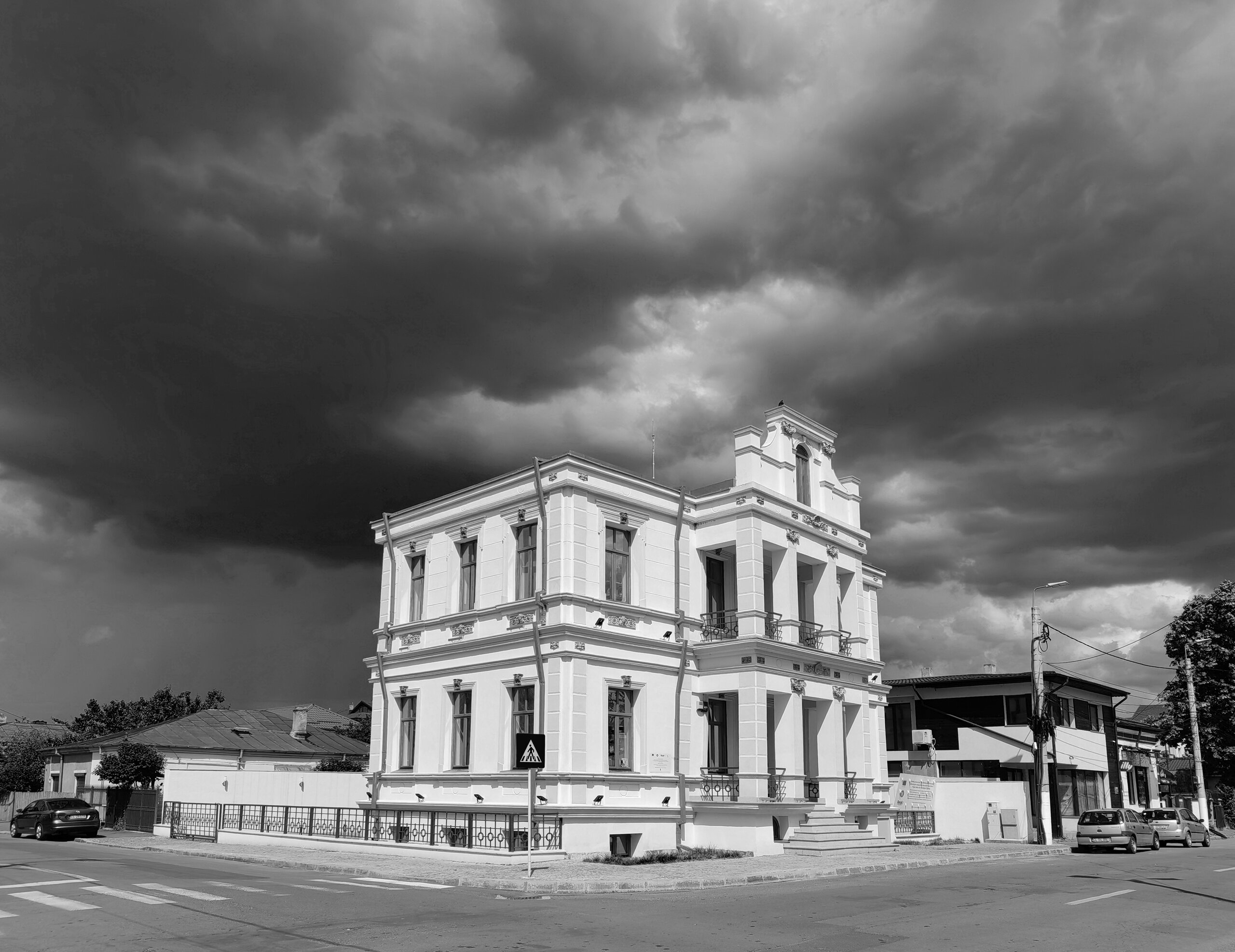
The years of communist development after the Second World War marked here, as in other cities, the construction of a new city center - a symbol of a new era and detachment from the past - but the intervention is not completely foreign to the evolution in relation to water. The new civic center was developed as a continuation of the existing central nucleus, represented by the Administrative Palace, the Court, the Court of Justice, the City Hospital and several other facilities, by inserting a new administrative building in front of the old one. Between the old building and the new one is configured the civic square, an important component of the system of central public spaces designed at the time, and from here a pedestrian axis is opened towards the town square. The intervention preserves the representative buildings of the old center.
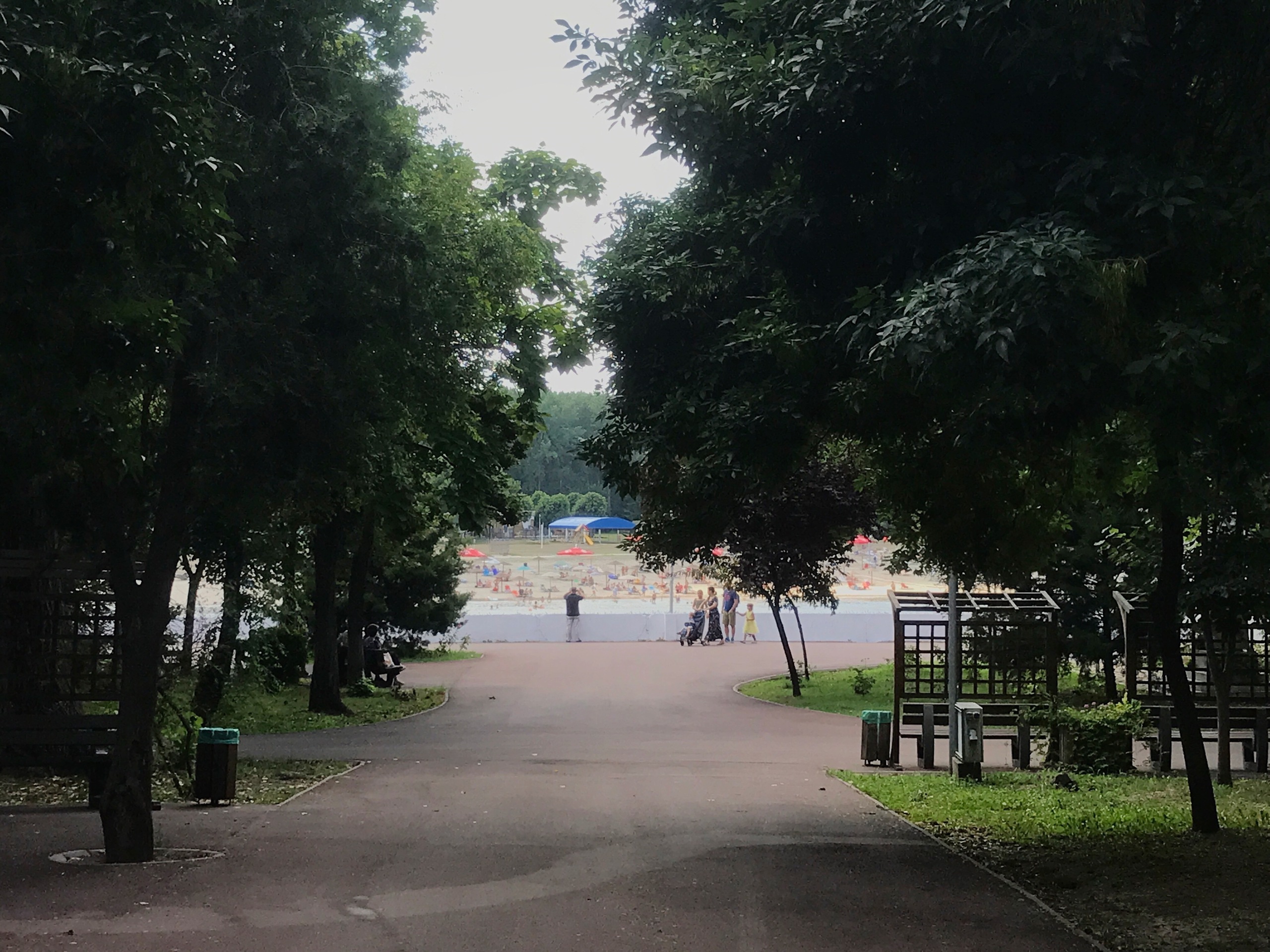
The newly developed axis is oriented parallel to the water, and the relationship with it and the communal park located along the bank is filtered through a series of buildings, the parapet having administrative, social-cultural, commercial and service and housing functions. Without detailing the architectural aesthetics, the intervention does not cancel in an urbanistic sense the historical tendency of orientation of the city and has the effect of amplifying the existing central area, correctly related to the scale of the planned development. The area in the immediate vicinity of the Borcea Inlet is complemented with new public functions: the recreational area of the park is enlarged by appreciable areas, complemented by the zoo, and the summer theater is set up in the area between the square and the port. The space occupied by these public functions is flanked to the east by the industrial port and to the west by new industrial investments.
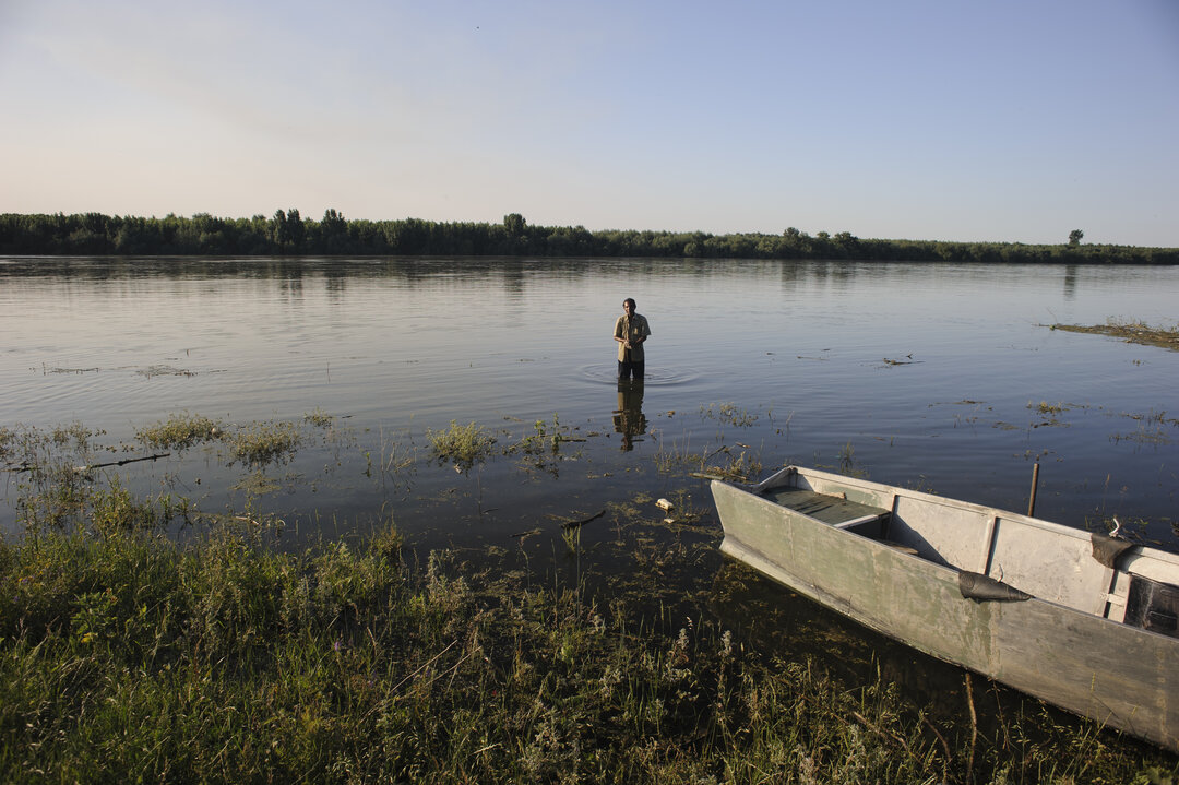
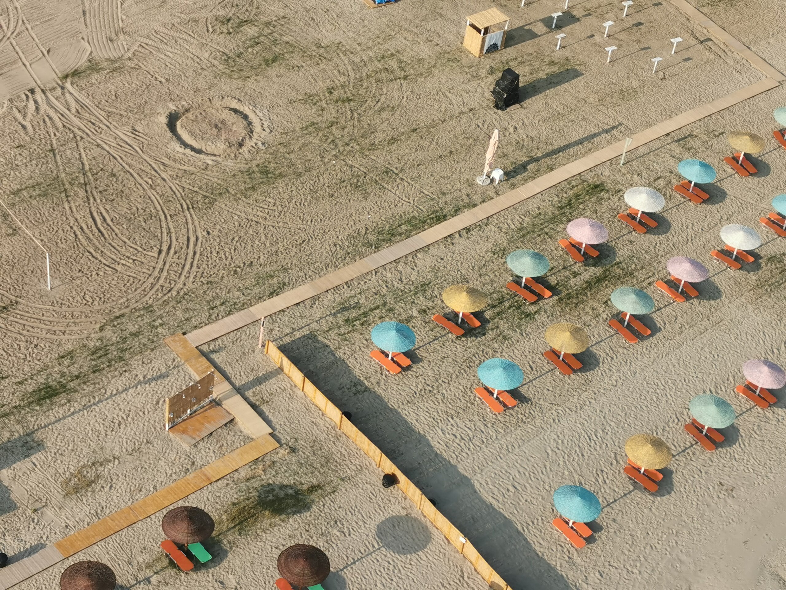
On the other side of the Borcea Arm is the city beach. Through this functional extension, the water is transformed from a separating element into a connecting element, integrated into the city. Water sustains and unifies the two complementary functions, being a determining element of their existence; it has an active role through its social - urban use, beyond visual aesthetics and economic importance. The beach is linked to the park by regular boat trips.
Although it does not belong to the category of public spaces classically defined in the urban morphology, it is worth mentioning the construction of the "Siderca" steelworks - an economic and structural objective on the scale of the region, a landmark of gigantic communist investments. By its scale and functionality, the investment has shaped an area of about 650 ha and, although it was not located on the Danube, it was connected to the Danube by a navigable canal with an industrial port, emphasizing the economic importance of the presence of the Danube.
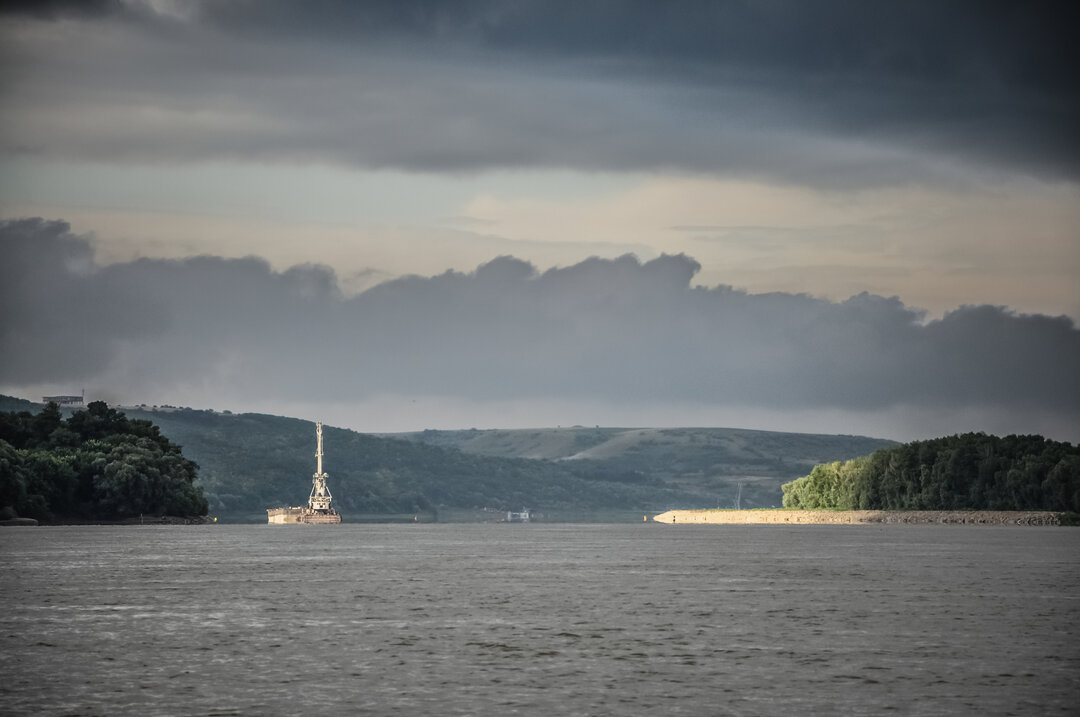
Against the background of the political, social and economic changes after 1989, a significant area of the city, especially that belonging to the communist development, was affected by abandonment and restriction of the built environment until its complete disappearance. Industry, which was the economic engine of the city, was restructured and the city, conceived as a pole of regional development3, lost almost all of its steel industry. The city's old port drastically reduced its activity and declined from its position as a regional commercial port. It, like most buildings in the economic sector, was abandoned and entered a phase of decay. The steelworks was closed, abandoned and eventually, except for a few units, demolished. In its aftermath on the territory, the traces of the related realized objectives remain: the lake of the newly created industrial harbor, the concrete ruins of the unfinished harbor and the navigable canal. Although abandoned and in a state of decay, these remaining investments represent assets that can be recovered and reintegrated into a new economy.
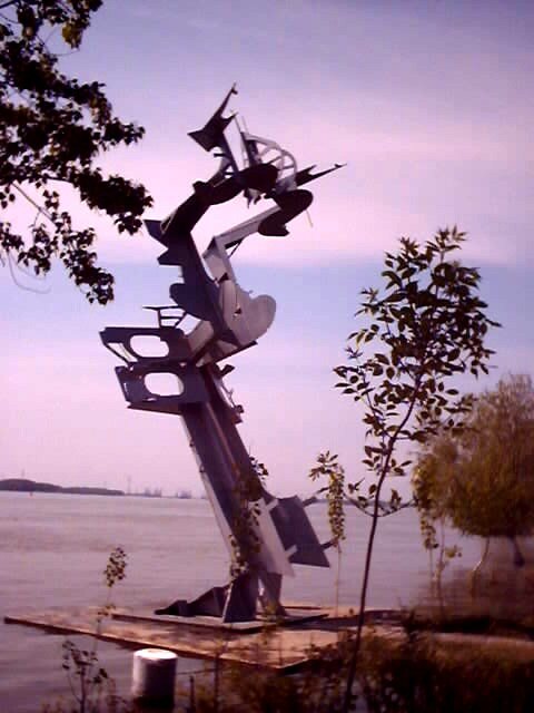
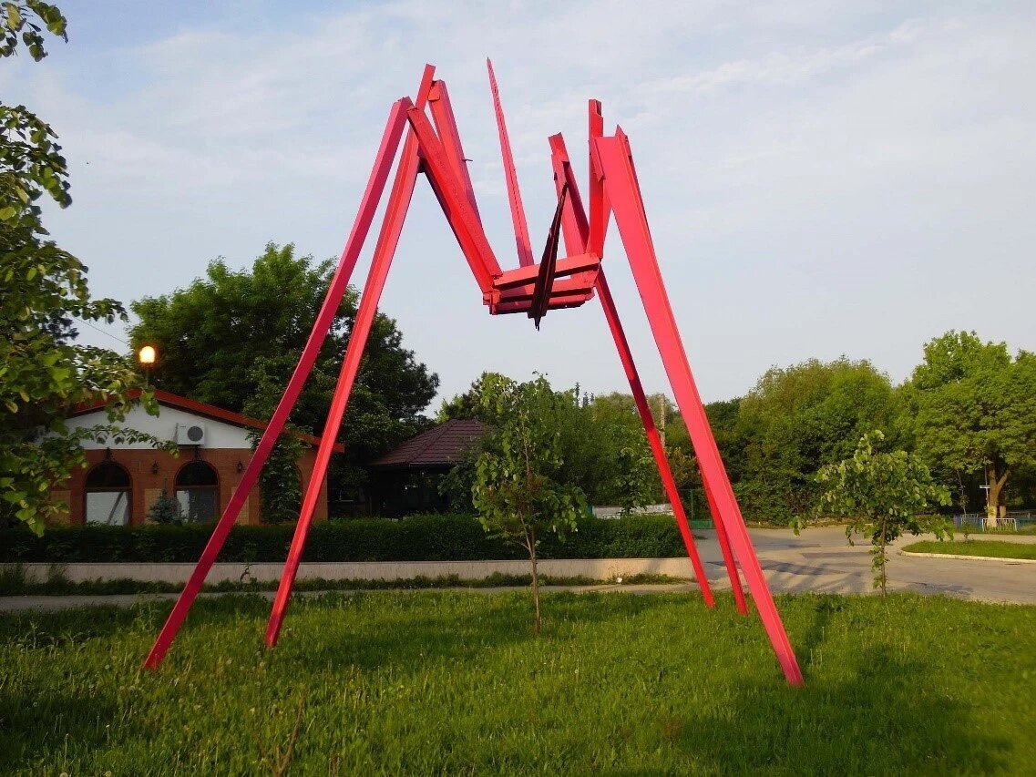
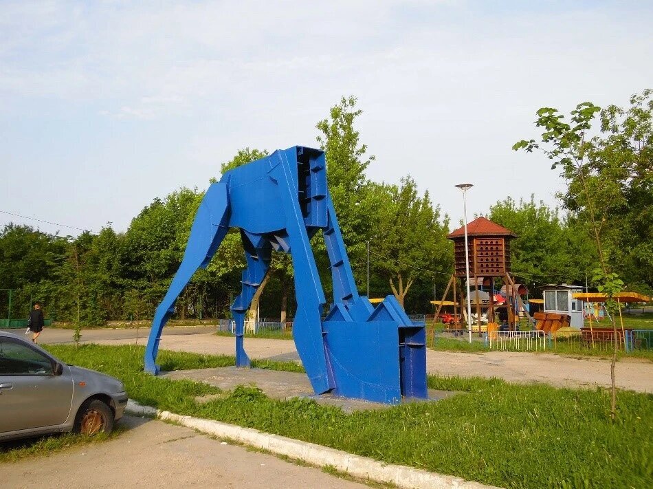
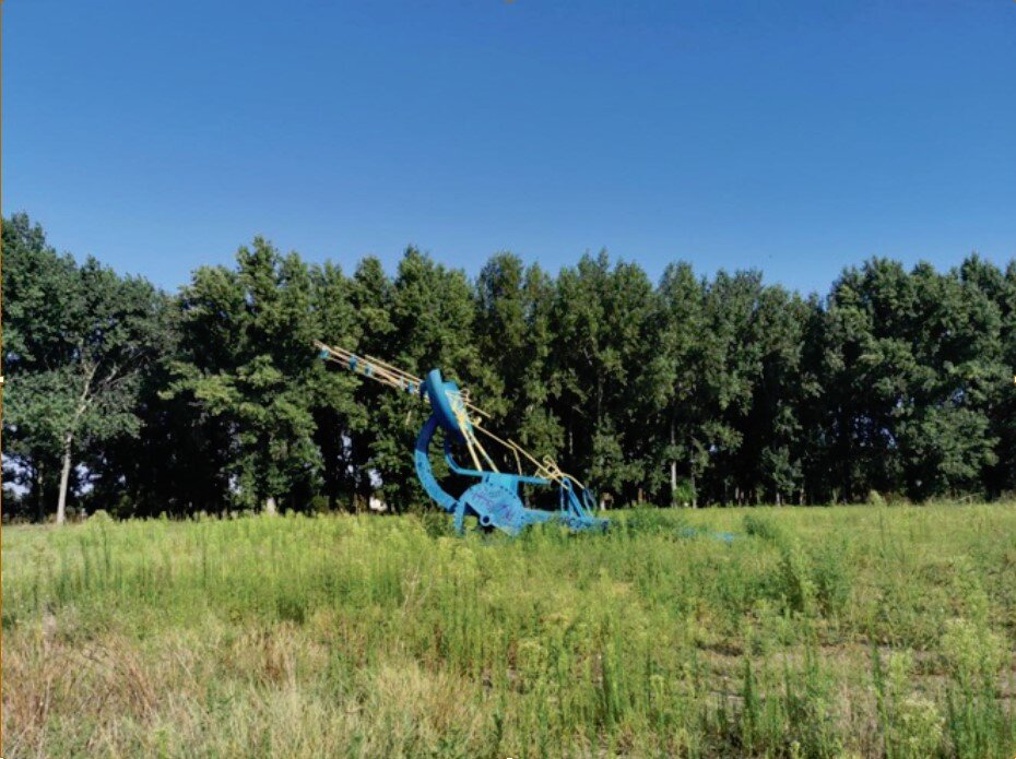
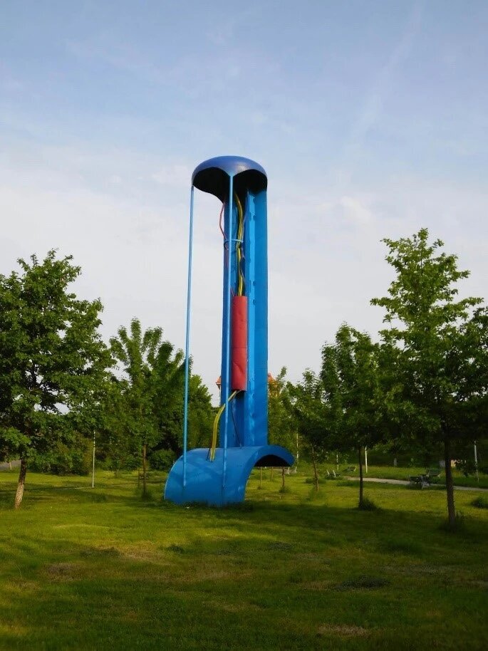
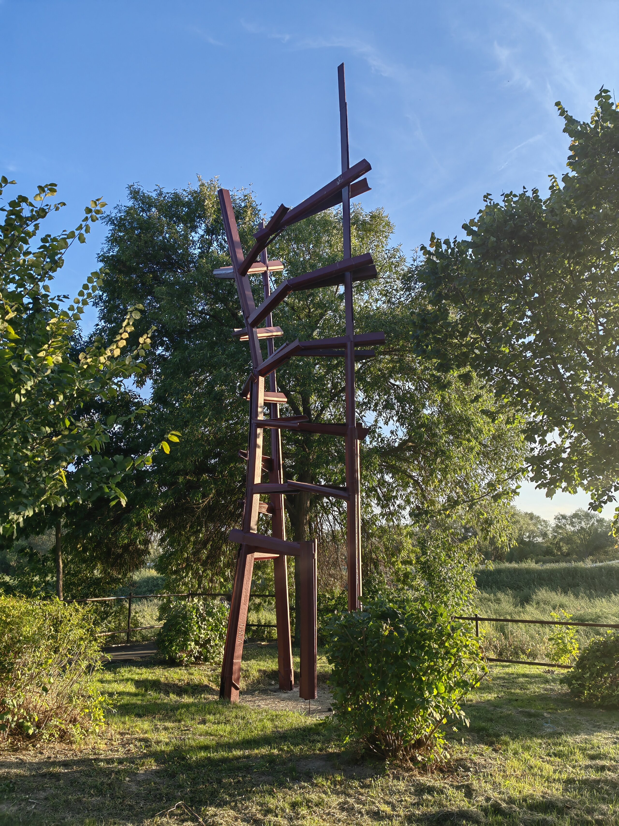
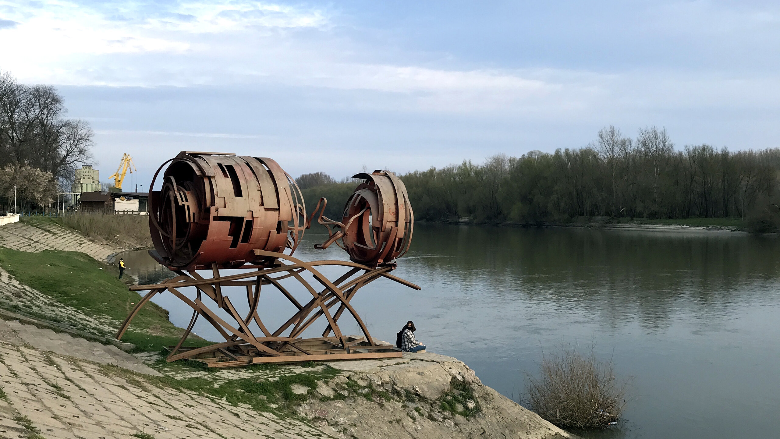
As a reminder of the manufacturing industry, Călărași is home to eight metal sculptures, works of monumental art and public monuments resulting from metal sculpture camps (1998, 1999) and scattered in the city's public spaces.
The changes also mean a rescaling of economic activities: several new industrial units are set up, continuing the industrial orientation of the communist period.
With its location on the Danube arm and in the vicinity of Bucharest, and with a particularly attractive natural setting, the city seems to be naturally oriented towards diversifying its economic profile, but above all by promoting cultural, leisure and ecotourism.
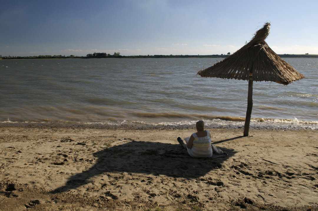
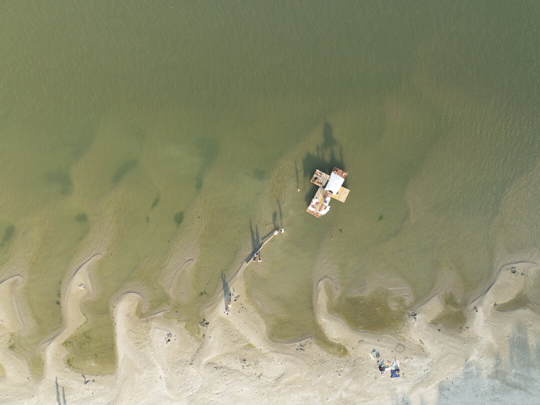
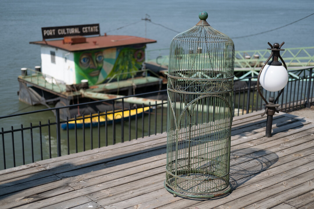
Music festivals take place here, some of which go beyond local cultural boundaries and have become landmarks along the Danube, such as the '3 Smoked Olives' electronic music festival. The recreation and leisure function is supported by the existence of sandy beaches with complementary services, accessible from the road leading to the border crossing point to Silistra.
There is a related infrastructure for tourism and the town has a valuable concentration of green spaces in the southern part - Central Park, Dumbrava Park and Zoo, vegetation massifs, nurseries, located along the Danube arm. In the vicinity there is the special protection area "Iezeru-Călărași", Natura 2000 site, with an area of 2.877 ha. To this can be added the former facilities (canal, lake) related to the Siderca industrial platform, unutilized land resources that can be exploited to complete the city's green spaces system so that tourism can become a growth engine.
The integration into the European Union offers the opportunity for new projects, which can be developed on the basis of existing values, which are recognized and embraced by the local community. One direction of European development can be found in the New European Bauhaus initiative which calls to "imagine and build together a sustainable and inclusive future", referring to "places, practices and experiences".
In the last four years, students from the UAUIM Faculty of Urbanism have been involved in three research projects funded by European grants: DANUrB and DANUrB+ through the INTERREG- DANUBE program and DANUBIAN_SMCs through the ERASMUS+ program.
These projects dedicated to the Danube have meant the participation of the UAUIM in large international consortia of universities from all over the region (Vienna, Budapest, Bratislava, Belgrade, NoviSad), together with research centers, NGOs and municipalities of small and medium-sized Danube cities as associated strategic partners, which also represent the territories analyzed through case studies, where the focus of attention was particularly concentrated. For UAUIM, the pilot cities in which students developed detailed analysis and concrete proposals during the design workshops, under the guidance of the teaching staff and in connection with local actors in these cities, were Giurgiu (2017-2019) and Călărași (2020-2022).
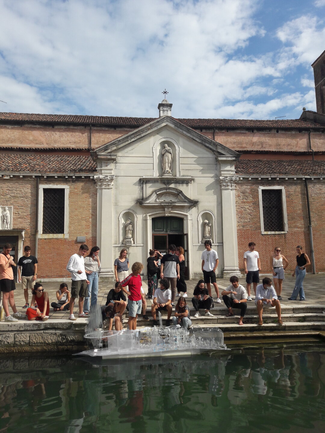
In the 2021 workshop of the ERASMUS+ DANUBIAN_SMCs project students experimented and mapped a number of Danube cities in Austria, Slovakia, Hungary, Serbia and Romania, having previously provided with documentation and explanatory lectures of the international online course conducted by the project partner TU Wien - "Simlab", on modern spatial data technologies, focusing on two aspects:walkability andbikeability. The students of the Faculty of Urbanism of UAUIM identified relevant places in Călărași city, generated digital markers and routes with smartphones and then integrated them into interactive maps, generating a project blog,
useful for disseminating the results of their field research to locals and other stakeholders. The method of collecting, accumulating and visualizing data using geo-location applications and by creating the blog proved to be innovative in the process of understanding the needs of the Danube cities, assessing and visualizing important aspects of urban life, and the process can be replicated on a larger scale.
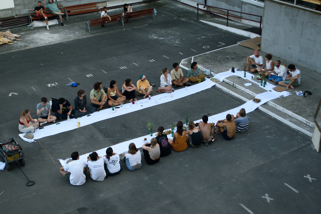
Another international meeting coordinated by the UAUIM Faculty of Urbanism offered students from the seven countries involved in the DANUBIAN_SMCs project the opportunity to use the interactive maps produced in the framework of the 2021 blog and to realize a step forward in city planning through a gradual and nuanced process of co-planning and co-designing with the local community, in the spirit of inclusive city development. This meeting took place in Călărași in June 2022 and was conducted as a Living Lab4, contributing new insights and creative insights and customized knowledge and data gained by the students on spatial and social inclusion/exclusion, peripheral areas and green areas of the city. The outcomes of this activity were prepared to provide support in the development of small and medium-sized Danube cities and to engage stakeholders in a real debate about inclusive development. The activity took place in both a formal and informal educational setting, involving students, experts, residents, administration representatives and other local stakeholders, and led to the acquisition of new knowledge and skills for interdisciplinary interaction. The students, through their proposals for valorization realized in the projects, contributed with information for the realization of a tourist route for the Pocket Guide application, one of the outcomes of the DANUrB+ project, a complementary project and in synergy with ERASMUS+ DANUBIAN_SMCs.
During the project period, the second year students of the Master's program "Landscape and Territory" (2019-2021), as well as the fourth year students of the Landscape Design and Planning Section of the Faculty of Urbanism, UAUIM, have also been working on the planning of Călărași in the regional context of the Danube, in different courses and design workshops.
The aim of these disciplines was to explore and re-evaluate the built and natural heritage and to promote the revitalization / redefinition of sustainable tourism in the city and the Lower Danube region. Their analysis focused on public spaces, parks, urban parks, gardens and squares, roads and riverside areas that could provide access to the city's attractions and along which other public amenities could be developed for the benefit of the local community and tourists. The students proposed spatial systems, shaping possible tourist routes within the city, taking into account the requirements of the residents, designing continuous green urban corridors, revitalizing and landscaping pedestrian-friendly public spaces and shaping them environmentally through contemporary architecture, landscaping and design. Special attention in their proposals has been paid to the access points into the city, the area around the railway station and, last but not least, the green area related to the Borcea Canal and the Danube connecting territory. The latter has been conceived as a series of continuous, coherently designed gardens and public landscaped spaces - a green axis of Călărași - incorporating the existing parks and extending this ensemble with new landscaping for recreation, walking, sports and cultural activities.
Disclaimer: The DANUBIAN_SMCs project was (partially) funded by the ERASMUS+ grant program of the European Union under grant no. 2019-1-RO01-KA203-063878.The content of this material is the sole responsibility of the authors, and theNational AgencyANPCDEFP and the European Commission are not responsible for any use that may be made oftheinformationcontained therein.
1 From prince Barbu Stirbei, who facilitated the city's disrobing and liberation
2 The same architectural typology is to be found in Giurgiu, the plans also signed by Eng. Anghel Saligny.
3 Since 1981 it has been the capital of Călărași County.
4 https://www.ltu.se/cms_fs/1.101555!/file/LivingLabs/LivingLabsMethodologyBook_web.pdf.
Țiripan, Nicolae, coord. (2010) Monografia Municipiului Călărași, 3rd edition, Ed. Pământul, Călărași
Revistă culturală a Bărăganului, 4 (2006), p. 20-21
Tudor, Constantin (2008), Istoria orașului Călărași, 2nd edition, Ed. Agora, Călărași
Hărmănescu, M., Manea, S. (2022) In Djukić, A., Kadar, B. Stan, A., Antonić, B. (Eds.) 2022. D+ Atlas: Atlas of Hidden Urban Values along the Danube, Belgrad University
Stan, A., Hărmănescu, M (2021). Abandoned lands in small and medium sized cities situated on Southern and Lower Danube's urban fronts, as opportunity to enhance the river urban green infrastructure (UGI) in Urban Services to Ecosystems: Green Infrastructure Benefits from the Landscape to the Urban Scale, Catalano, C., Andreucci, M.B., Guarino, R., Bretzel, F., Leone, M., Pasta, S. (Eds.), Springer: Nature.
ErasmusPlus (2019) Creative Danube: innovative teaching for inclusive development in small and medium-sized danubian cities https://ec.europa.eu/programmes/erasmus-plus/projects/eplus-project-details/#project/2019-1-RO01-KA203-063878 / https://danubian-smcs.uauim.ro
Joklová, V., Djukic, A., Hărmănescu, M., Janková, N. (2019). 3.3. Conceptual approaches to environmental quality and liveability in smaller cities. in Benko Melinda, Gregor Pavel, Lubica Vitkova , eds. (2019). Book on the Unexplored Cultural Heritage in Communities by the Danube, "Nakladatelství Gasset", Prague
Hărmănescu, M., Stan, A. Manea S.V. eds. (2023). Methodological guidelines and new theoretical and practical theoretical and practical methods of interdisciplinary teaching for assessing small and medium sized cities on Danube, Ed. Ion Mincu, Bucharest.
Benko M. ed. (2022). report of data collection of good practices and teaching/learning cross border cooperation on Danube SMCs, for transferring research and innovation in continuing education, Ed. Ion Mincu, Bucharest


-topaz-denoise-enhance-sharpen--15883-m.jpg)